235 résultats
19731602050041West of England Press 1973. Hardcover. Like New. Facsimile of the 1520 edition. Burgundy cloth with crimson spine label. 46 cm. Hardcover. No dust jacket. Good binding and cover. Spine cocked. Includes maps and original Latin text as well as essays on the history of the work. Clean unmarked pages. This is an over sized or heavy book that requires additional postage for international delivery outside the US. West of England Press hardcover
62444Venice 1596. FIRST EDITION THUS. Original engraved map of the Arabian Peninsula 16 x 21.5 cm. overall with Latin text to verso. Embellished with sea monster to lower right corner. An excellent copy. This early map engraving is from Claudius Ptolemaeus Ptolemy and Giovanni Antonio Magini's Geographiae universae tum veteris tum novae absolutissimum opus duobus voluminibus distinctum. The work was published in Venice by S. Galignani de Karera's Heirs in 1596. This is the first Magini edition. "The copperplate maps prepared for this edition and engraved by Girolamo Porro are on a smaller scale and somewhat better executed than those in the editions of 1562" Phillips. [Venice, 1596]. unknown
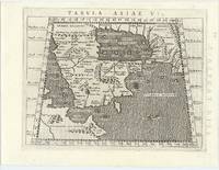
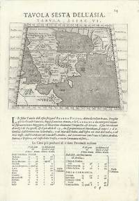
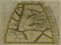
63967Venice 1596. Original engraved map of the Arabian Peninsula 12.5 x 17.5 cm on single leaf 29 x 20.5 cm with Italian text beneath. Verso printed with a map of Central Asia 'Tavola Settima Dell'Asia. Tabula Asiae VII' 12.5 x 17.5 cm. A very good example. This early map engraving is from Claudius Ptolemaeus Ptolemy and Giovanni Antonio Magini's Geographiae universae tum veteris tum novae absolutissimum opus duobus voluminibus distinctum. The work was published in Venice by S. Galignani de Karera's Heirs in 1596. This is the first Magini edition. "The copperplate maps prepared for this edition and engraved by Girolamo Porro are on a smaller scale and somewhat better executed than those in the editions of 1562" Phillips. [Venice, 1596]. unknown
1985204502Franklin Center Pennsylvania: Franklin Library 1985. First Edition; First Printing. Hardcover. Near Fine Leather Bound. Printed on archival paper with gilded edges. The endsheets are of moire fabric with a silk ribbon page marker. Smyth sewing and concealed muslin joints to ensure the highest quality binding. This book is in full leather with hubbed spines.; Great Books of the Western World. Franklin Library hardcover
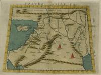
1574M7274Venice: Ruscelli c. 1574. Very Good;. Notes: Italian text on verso.<br>Girolamo Ruscelli 1518–1566 was an Italian mathematician and cartographer active in Venice during the early 16th century. Ruscelli is best known for his important revision of Ptolemy's Geographia published posthumously in 1574. Size : 192x266 mm 7.56x10.47 Inches Coloring: Hand Colored Category: Maps Asia Middle East Holy Land & Palestine;Maps Asia Middle East Jordan Syria Lebanon;Maps Asia Near East Turkey; Ruscelli unknown
1985332694Pennsylvania: Franklin Library 1985. First Edition; First Printing. Hardcover. Near Fine Leather Bound. Printed on archival paper with gilded edges. The endsheets are of moire fabric with a silk ribbon page marker. Smyth sewing and concealed muslin joints to ensure the highest quality binding. This book is in full leather with hubbed spines.; The Great Books of the Western World. Franklin Library hardcover
1574M7264Venice: Ruscelli c. 1574. Very Good;. Notes: Italian text on verso.<br>Girolamo Ruscelli 1518–1566 was an Italian mathematician and cartographer active in Venice during the early 16th century. Ruscelli is best known for his important revision of Ptolemy's Geographia published posthumously in 1574. Size : 190x265 mm 7.48x10.43 Inches Coloring: Hand Colored Category: Maps Russia; Maps Europe Ukraine; Maps Europe Poland Lithuania; Ruscelli unknown
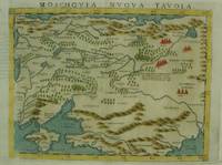
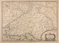
1574M7269Venice: Ruscelli c. 1574. Very Good;. Notes: An early and fine map of European Russia beautifully hand coloured. <br>Italian text on verso.<br>Girolamo Ruscelli 1518–1566 was an Italian mathematician and cartographer active in Venice during the early 16th century. Ruscelli is best known for his important revision of Ptolemy's Geographia published posthumously in 1574. Size : 190x260 mm 7.48x10.24 Inches Coloring: Hand Colored Category: Maps Europe Ukraine; Maps Russia; Ruscelli unknown
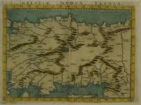
1574M7280Venice: Ruscelli c. 1574. Very Good;. Notes: Italian text on verso.<br>Girolamo Ruscelli 1518–1566 was an Italian mathematician and cartographer active in Venice during the early 16th century. Ruscelli is best known for his important revision of Ptolemy's Geographia published posthumously in 1574. Size : 189x260 mm 7.44x10.24 Inches Coloring: Hand Colored Category: Maps Asia Near East Turkey; Ruscelli unknown
1574M7277Venice: Ruscelli c. 1574. Very Good;. Notes: Italian text on verso.<br>Girolamo Ruscelli 1518–1566 was an Italian mathematician and cartographer active in Venice during the early 16th century. Ruscelli is best known for his important revision of Ptolemy's Geographia published posthumously in 1574. Size : 190x260 mm 7.48x10.24 Inches Coloring: Hand Colored Category: Maps Asia Central Tibet & Himalayas; Maps Asia Far East China; Ruscelli unknown
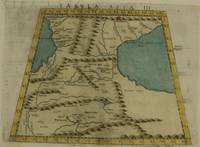
1574M7273Venice: Ruscelli c. 1574. Very Good;. Notes: Italian text on verso.<br>Girolamo Ruscelli 1518–1566 was an Italian mathematician and cartographer active in Venice during the early 16th century. Ruscelli is best known for his important revision of Ptolemy's Geographia published posthumously in 1574. Size : 192x264 mm 7.56x10.39 Inches Coloring: Hand Colored Category: Maps Asia Middle East Caucasus.; Ruscelli unknown
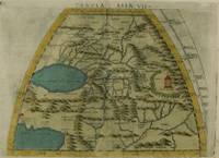
1574M7276Venice: Ruscelli c. 1574. Very Good;. Notes: Italian text on verso.<br>Girolamo Ruscelli 1518–1566 was an Italian mathematician and cartographer active in Venice during the early 16th century. Ruscelli is best known for his important revision of Ptolemy's Geographia published posthumously in 1574. Size : 191x266 mm 7.52x10.47 Inches Coloring: Hand Colored Category: Maps Asia Central Turkmenistan Uzbekistan Tajikistan Kyrgyzstan Kazakhstan; Maps Asia Central Afghanistan Pakistan; Maps Asia Central India & Sri Lanka / Ceylon; Ruscelli unknown
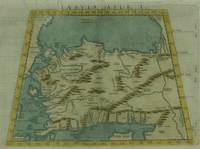
1574M7271Venice: Ruscelli c. 1574. Very Good;. Notes: Italian text on verso.<br>Girolamo Ruscelli 1518–1566 was an Italian mathematician and cartographer active in Venice during the early 16th century. Ruscelli is best known for his important revision of Ptolemy's Geographia published posthumously in 1574. Size : 190x266 mm 7.48x10.47 Inches Coloring: Hand Colored Category: Maps Asia Near East Turkey; Ruscelli unknown
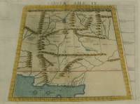
1574M7278Venice: Ruscelli c. 1574. Very Good;. Notes: Italian text on verso.<br>Girolamo Ruscelli 1518–1566 was an Italian mathematician and cartographer active in Venice during the early 16th century. Ruscelli is best known for his important revision of Ptolemy's Geographia published posthumously in 1574. Size : 188x264 mm 7.40x10.39 Inches Coloring: Hand Colored Category: Maps Asia Central Afghanistan Pakistan; Ruscelli unknown
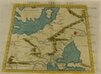
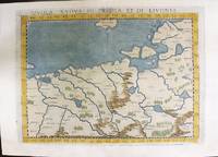
1574M11141Venice: Ruscelli c. 1574. Very Good. Notes: Italian text on verso.<br>Map of Prussia Poland Lithuania part of of Estonia and the Baltic Region.<br>Girolamo Ruscelli 1518–1566 was an Italian mathematician and cartographer active in Venice during the early 16th century. Ruscelli is best known for his important revision of Ptolemy's Geographia published posthumously in 1574. Size : 190x263 mm 7.48x10.35 Inches Coloring: Hand Colored Category: Maps Europe Poland Lithuania; Ruscelli unknown
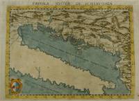
1574M7268Venice: Ruscelli c. 1574. Very Good;. Notes: Italian text on verso.<br>Girolamo Ruscelli 1518–1566 was an Italian mathematician and cartographer active in Venice during the early 16th century. Ruscelli is best known for his important revision of Ptolemy's Geographia published posthumously in 1574. Size : 190x261 mm 7.48x10.28 Inches Coloring: Hand Colored Category: Maps Europe Balkans; Ruscelli unknown
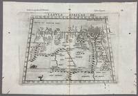
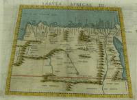
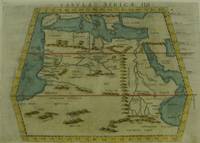
1574005867Venice: Vincenzo Valgrisi 1574. 1574 Edition. Engraving on Copper. Very Good. Double-page copperplate engraved map with letterpress text. Image: 26 x 19 cm. Sheet: 34 x 24 cm. A highly decorative and historically significant 16th-century map of North and Northeast Africa derived from Ptolemy’s 2nd-century geography. The map was published in the 1574 edition of Geographia edited by Girolamo Ruscelli and printed in Venice by Vincenzo Valgrisi. This is “Tabula Africae III†the third of Ptolemy’s Africa maps focusing on: Libya Egypt Cyrenaica Thebes and parts of Arabia Prominent classical sites including: Alexandria Cyrene Memphis Thebes Ptolemais Ammonis templum Mountain chains rivers and desert regions in stylized Renaissance form The map features Latin titling and classical toponyms while the verso contains the original Italian commentary explaining the geography cities and coordinates. CONDITION: Very good. Strong impression with clear platemark. Central fold as issued. Mild age toning and minor wear to margins. Backed at top center. Verso complete with full letterpress text Tavola Terza d’Africa Antica. Note: only this 1574 edition contains Vincenzo Valgrisi's elaborate printer's emblem showing: A lion leaping or attacking a smaller animal often interpreted as a fox and a large bird resembling an ostrich standing nearby. Vincenzo Valgrisi unknown
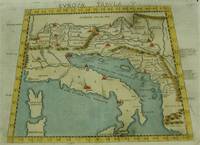
1574M7262Venice: Ruscelli c. 1574. Very Good;. Notes: Italian text on verso.<br>An early map of Italy the Adriatic Sea. Croatia Dalmatia Slovenia and Serbia beautifully hand coloured. <br>Girolamo Ruscelli 1518–1566 was an Italian mathematician and cartographer active in Venice during the early 16th century. Ruscelli is best known for his important revision of Ptolemy's Geographia published posthumously in 1574. Size : 186x266 mm 7.32x10.47 Inches Coloring: Hand Colored Category: Maps Europe Italy; Maps Europe Balkans; Ruscelli unknown
1730332605Amsterdam: R. & W. Wetstein William Smith 1730. unbound. Map. Copper plate engraving. Image measures 13.25" x 18".<br/> <br/> Printed circa 1730 this map of the Indian subcontinent was based on Ptolemy's 2nd century map and refined by Mercator beginning in the 16th century. This 1730 edition features graticule lines and a cartouche with a cherub. Covering an area from the Himalayan Mountains south to the Indian Ocean the map names many cities and topographical features. The map is in good condition wear to edges small tear to top of original center fold line. <br> <br> Gerard Mercator 1512-1594 was an accomplished mathematician cartographer globe maker and engraver best known for the Mercator Projection. Incorporating the newly accepted fact that the world is round Mercator was able to render longitude lines consistently straight on a chart. Although this requires some distortion it was of great use for navigators; furthermore it has since become historically important as it is still the most commonly used projection today.<br/> <br/> R. & W. Wetstein, William Smith unknown
1915181190Munich: J.B. Obernetter 1915. Hardcover. VG- covers have heavy wear but pages of text and illustrations are clean and clear. Front cover is unnattached and heavy chipping to spine. Tan boards with brown lettering 2 preliminary leaves 180 pp many uncut bw illustrations and diagrams. Text is in Portuguese. Title translates to: "Treaty of the sphera with Theorica of the sun and the moon and the first book of Geographia by Claudio Ptolomeo." History of Portuguese nautical science at the time of the great discoveries. J.B. Obernetter hardcover
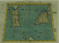
1574M7263Venice: Ruscelli c. 1574. Very Good;. Notes: Italian text on verso.<br>Early map of Sicily Malta and Sardinia beautifully hand coloured. <br>Girolamo Ruscelli 1518–1566 was an Italian mathematician and cartographer active in Venice during the early 16th century. Ruscelli is best known for his important revision of Ptolemy's Geographia published posthumously in 1574. Size : 190x265 mm 7.48x10.43 Inches Coloring: Hand Colored Category: Maps Mediterranean Islands; Ruscelli unknown
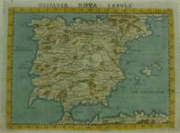
1561M7270Venice: Ruscelli c. 1561. Very Good;. Notes: Italian text on verso.<br>An early map of the Iberian Peninsula including Spain and Portugal beautifully hand coloured. <br>Girolamo Ruscelli 1518–1566 was an Italian mathematician and cartographer active in Venice during the early 16th century. Ruscelli is best known for his important revision of Ptolemy's Geographia published posthumously in 1574. Size : 195x265 mm 7.68x10.43 Inches Coloring: Hand Colored Category: Maps Europe Spain;Maps Europe Portugal; Ruscelli unknown
1574M7260Venice: Ruscelli c. 1574. Very Good;. Notes: Italian text on verso.<br>Girolamo Ruscelli 1518–1566 was an Italian mathematician and cartographer active in Venice during the early 16th century. Ruscelli is best known for his important revision of Ptolemy's Geographia published posthumously in 1574. Size : 189x261 mm 7.44x10.28 Inches Coloring: Hand Colored Category: Maps Africa North Egypt;Maps Africa North; Ruscelli unknown
1561M7261Venice: Ruscelli 1561. Very Good;. Notes: Italian text on verso.<br>Girolamo Ruscelli 1518–1566 was an Italian mathematician and cartographer active in Venice during the early 16th century. Ruscelli is best known for his important revision of Ptolemy's Geographia published posthumously in 1574. Size : 188x165 mm 7.40x6.50 Inches Coloring: Hand Colored Category: Maps Africa North; Ruscelli unknown