48 résultats
1564265015Venice: Giordano Ziletti 1564. hardcover. very good. 3 parts in 1. Each part has a separate title page with large printer's device. Part 2: Espositioni et Introduttioni Universali di Girolamo Ruscelli sopra tutta la Geografia di Tolomeo. Part 3: Discorso Universale di M. Gioseppe Moleto mathematico. Illustrated with 63 of 64 fine double-leaf copper engraved maps including the rare "World in Hemispheres". Additional large in-text engravings and decorative initials throughout. 8 358 110 204 48 index 47 pages. Short thick 4to bound in old calf with gilt devices on covers neatly re-cased binding well-rubbed but very sound; very clean copy virtually free of foxing; one map ink stained; lacks the final world map "Carta Marina" a.e.g. Venetia: Appresso Giordano Ziletti 1564. Text in Italian. Bookplate of Otto Orren Fisher pasted on inside cover. Manuscript note in ink on title page reads: Ex Libris Stephan Tiapas.<br/> <br/> Second edition of Ruscelli's Italian translation very similar to the edition of 1561 and containing the same series of maps. The double- page maps are partly based on those of Jacopo Gastaldi in the edition of 1548 but on a larger scale. According to Nordenskiold two important innovations were introduced by the 1561 edition into cartographical literature. One: the division of the Map of the World in two hemispheres. Two: The re-issue of the Zeno Map of the Arctic Regions which had appeared first 3 years before. "If the remarkable map in this little work had not received extensive circulation under the sanction of Ptolemy's name it would probably have been forgotten. During nearly a whole century it exercised an influence on the mapping of the northern countries to which there are few parallels in the history of cartography".<br> <br> Girolamo Ruscelli c. 1504-1566 was a Venetian editor whose maps are primarily based on those by Jacopo Gastaldi 1548 but with many of his own additions and reproduced on a larger scale. Ruscelli introduces several important innovations in this volume through his 37 "modern" maps which cover Europe Africa Asia and the New World. Ruscelli includes a double hemisphere world map which was the first of its kind to be used in an atlas and "Carta Marina Nuova Tavola" a rare sea chart of the world. He includes a revised version of the Zeno map of the Arctic first published in 1558. The Zeno map describes the purported journey of the author's ancestors in the 1390s to Greenland Iceland the mythical islands of Frisland and Icaria and what is now thought to be Newfoundland and Labrador. While Zeno shows Greenland connected to Norway Ruscelli has updated the map by eliminating this land bridge. Despite its inaccuracies and inclusion of mythical lands the Zeno map persisted as the prevailing map of the Arctic and Greenland for many years. Six other New World maps include the South American continent Brazil Central America and the Baja Peninsula the eastern coast of North America Cuba and Hispaniola. Claudius Ptolemy 90-168 CE was a Roman geographer and mathematician living in Egypt who compiled his knowledge and theories about the world's geography into one seminal work. Although his maps did not survive his mathematical projections and location coordinates did. During the Renaissance revival of Greek and Roman works "Geographia" was rediscovered by monks and based upon Ptolemy's detailed instructions the maps were recreated. The first printed edition of "Geographia" with maps was published in Bologna in 1477. A rare and exciting edition for any collector. Sabin 66504<br/> <br/> Giordano Ziletti unknown
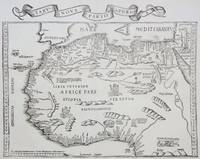
1535M6976Lyons: Melchior & Gaspar Trechsel c. 1535. Very Good;. Notes: No text on verso.<br><br>This is based on Waldseemuller's map Norwich 286 with borders and ornaments by Holbein and Graf. The reissued map includes six kings seated on their thrones a rhinoceros a cyclops and two oxen. <br><br>"As northern Africa was better known than southern Africa at that period it has more geographical information in the interior. Various kingdoms are described with a multitude of coastal names and as with the southern part . these are placed within the coastline. The Mediterranean and Red Seas are prominently featured as well as a number of islands on the northwest coast -- Madeira the Canaries etc. -- which at that time were already well known to the Portuguese in their initial efforts to discover a route to the Indies." Norwich Size : 320x400 mm 12.60x15.75 Inches Coloring: Black & White Reference: Norwich 286 Category: Maps Africa North; Melchior & Gaspar Trechsel unknown
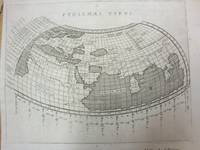
1597M7073Venice 1597. Very Good; a tear in the lower margin not effecting the map. Notes: Ptolemaic map following the classical format. The Indian Ocean is landlocked with a continuous coastline joining Africa to South East Asia. Toprobana present day Sri Lanka is a very large island in the Indian Ocean and the Indian sub-continent is completely missing although the Ganges river is shown. The Mediterranean is well depicted but greatly exaggerated in length. In Africa the Nile is shown originating in mountains below the Equator. Finely engraved in the Italian style with a stippled sea by Girolamo Porro. The map is on a full sheet of Italian text. Italian text on verso. Size : 138x178 mm 5.43x7.01 Inches Coloring: Black & White Reference: Shirley #193. Category: Maps World; unknown
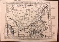
1513M8825Strasburg: Martin Waldseemuller c. 1513. Excellent. Notes: StolenA fine and strong impression of this rare map of Eastern Europe from the 1513 edition of Waldseemüller's modern atlas Geographia.<br><br>The verso is blank. The watermark is similar to fleur de lis sitting on a multi headed star.<br><br>Large Ptolemaic map depicting Europe and Balkan from the Adriatic Sea to the Black Sea.<br><br>The Atlas ' GEOGRAPHIE OPUS NOVISSIMA TRADUCTIONE E GRECORUM ARCHETYPIS ' one of the most important edition of Ptolemy Atlases.was published by Johannes Schott in Strasburg 1513.<br> Size : 434x618 mm 17.09x24.33 Inches Coloring: Black & White Category: Maps Europe Greece Macedonia; Maps Europe Balkans; Maps Europe Romania; Maps Europe Hungary; Martin Waldseemuller unknown
1574M7264Venice: Ruscelli c. 1574. Very Good;. Notes: Italian text on verso.<br>Girolamo Ruscelli 1518–1566 was an Italian mathematician and cartographer active in Venice during the early 16th century. Ruscelli is best known for his important revision of Ptolemy's Geographia published posthumously in 1574. Size : 190x265 mm 7.48x10.43 Inches Coloring: Hand Colored Category: Maps Russia; Maps Europe Ukraine; Maps Europe Poland Lithuania; Ruscelli unknown
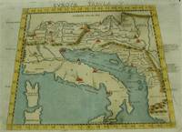
1574M7262Venice: Ruscelli c. 1574. Very Good;. Notes: Italian text on verso.<br>An early map of Italy the Adriatic Sea. Croatia Dalmatia Slovenia and Serbia beautifully hand coloured. <br>Girolamo Ruscelli 1518–1566 was an Italian mathematician and cartographer active in Venice during the early 16th century. Ruscelli is best known for his important revision of Ptolemy's Geographia published posthumously in 1574. Size : 186x266 mm 7.32x10.47 Inches Coloring: Hand Colored Category: Maps Europe Italy; Maps Europe Balkans; Ruscelli unknown
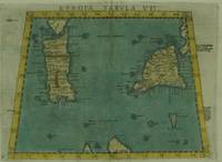
1574M7263Venice: Ruscelli c. 1574. Very Good;. Notes: Italian text on verso.<br>Early map of Sicily Malta and Sardinia beautifully hand coloured. <br>Girolamo Ruscelli 1518–1566 was an Italian mathematician and cartographer active in Venice during the early 16th century. Ruscelli is best known for his important revision of Ptolemy's Geographia published posthumously in 1574. Size : 190x265 mm 7.48x10.43 Inches Coloring: Hand Colored Category: Maps Mediterranean Islands; Ruscelli unknown
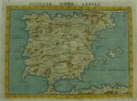
1561M7270Venice: Ruscelli c. 1561. Very Good;. Notes: Italian text on verso.<br>An early map of the Iberian Peninsula including Spain and Portugal beautifully hand coloured. <br>Girolamo Ruscelli 1518–1566 was an Italian mathematician and cartographer active in Venice during the early 16th century. Ruscelli is best known for his important revision of Ptolemy's Geographia published posthumously in 1574. Size : 195x265 mm 7.68x10.43 Inches Coloring: Hand Colored Category: Maps Europe Spain;Maps Europe Portugal; Ruscelli unknown
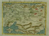
1574M7269Venice: Ruscelli c. 1574. Very Good;. Notes: An early and fine map of European Russia beautifully hand coloured. <br>Italian text on verso.<br>Girolamo Ruscelli 1518–1566 was an Italian mathematician and cartographer active in Venice during the early 16th century. Ruscelli is best known for his important revision of Ptolemy's Geographia published posthumously in 1574. Size : 190x260 mm 7.48x10.24 Inches Coloring: Hand Colored Category: Maps Europe Ukraine; Maps Russia; Ruscelli unknown
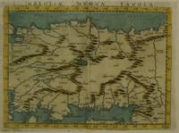
1574M7280Venice: Ruscelli c. 1574. Very Good;. Notes: Italian text on verso.<br>Girolamo Ruscelli 1518–1566 was an Italian mathematician and cartographer active in Venice during the early 16th century. Ruscelli is best known for his important revision of Ptolemy's Geographia published posthumously in 1574. Size : 189x260 mm 7.44x10.24 Inches Coloring: Hand Colored Category: Maps Asia Near East Turkey; Ruscelli unknown
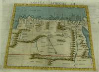
1574M7260Venice: Ruscelli c. 1574. Very Good;. Notes: Italian text on verso.<br>Girolamo Ruscelli 1518–1566 was an Italian mathematician and cartographer active in Venice during the early 16th century. Ruscelli is best known for his important revision of Ptolemy's Geographia published posthumously in 1574. Size : 189x261 mm 7.44x10.28 Inches Coloring: Hand Colored Category: Maps Africa North Egypt;Maps Africa North; Ruscelli unknown
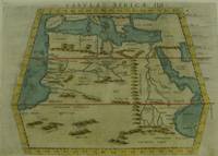
1561M7261Venice: Ruscelli 1561. Very Good;. Notes: Italian text on verso.<br>Girolamo Ruscelli 1518–1566 was an Italian mathematician and cartographer active in Venice during the early 16th century. Ruscelli is best known for his important revision of Ptolemy's Geographia published posthumously in 1574. Size : 188x165 mm 7.40x6.50 Inches Coloring: Hand Colored Category: Maps Africa North; Ruscelli unknown
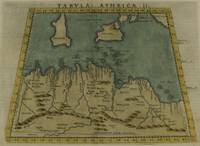
1574M7259Venice: Ruscelli c. 1574. Very Good;. Notes: Italian text on verso.<br>Girolamo Ruscelli 1518–1566 was an Italian mathematician and cartographer active in Venice during the early 16th century. Ruscelli is best known for his important revision of Ptolemy's Geographia published posthumously in 1574. Size : 190x253 mm 7.48x9.96 Inches Coloring: Hand Colored Category: Maps Africa North; Maps Mediterranean Islands; Ruscelli unknown
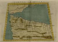
1574M7258Venice: Ruscelli c. 1574. Very Good;. Notes: Italian text on verso.<br>Girolamo Ruscelli 1518–1566 was an Italian mathematician and cartographer active in Venice during the early 16th century. Ruscelli is best known for his important revision of Ptolemy's Geographia published posthumously in 1574. Size : 187x262 mm 7.36x10.31 Inches Coloring: Hand Colored Category: Maps Africa North; Ruscelli unknown
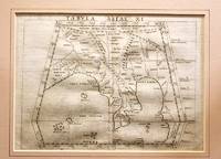
1561M11293Venice 1561. Very Good. Notes: Detailed and early map of Southeast Asia and the Malay Peninsula.<br>The map shows Ptolemy's idea of a landlocked Indian Ocean. <br>Girolamo Ruscelli 1518–1566 was an Italian mathematician and cartographer active in Venice during the early 16th century. Ruscelli is best known for his important revision of Ptolemy's Geographia published posthumously in 1574. Size : 173x232 mm 6.81x9.13 Inches Coloring: Black & White Category: Maps Asia South East Malaysia & Singapore; Maps Asia Central India & Sri Lanka / Ceylon; unknown
1574M7277Venice: Ruscelli c. 1574. Very Good;. Notes: Italian text on verso.<br>Girolamo Ruscelli 1518–1566 was an Italian mathematician and cartographer active in Venice during the early 16th century. Ruscelli is best known for his important revision of Ptolemy's Geographia published posthumously in 1574. Size : 190x260 mm 7.48x10.24 Inches Coloring: Hand Colored Category: Maps Asia Central Tibet & Himalayas; Maps Asia Far East China; Ruscelli unknown
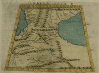
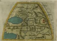
1574M7273Venice: Ruscelli c. 1574. Very Good;. Notes: Italian text on verso.<br>Girolamo Ruscelli 1518–1566 was an Italian mathematician and cartographer active in Venice during the early 16th century. Ruscelli is best known for his important revision of Ptolemy's Geographia published posthumously in 1574. Size : 192x264 mm 7.56x10.39 Inches Coloring: Hand Colored Category: Maps Asia Middle East Caucasus.; Ruscelli unknown
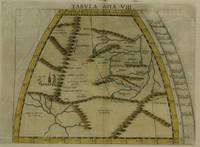
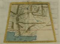
1574M7276Venice: Ruscelli c. 1574. Very Good;. Notes: Italian text on verso.<br>Girolamo Ruscelli 1518–1566 was an Italian mathematician and cartographer active in Venice during the early 16th century. Ruscelli is best known for his important revision of Ptolemy's Geographia published posthumously in 1574. Size : 191x266 mm 7.52x10.47 Inches Coloring: Hand Colored Category: Maps Asia Central Turkmenistan Uzbekistan Tajikistan Kyrgyzstan Kazakhstan; Maps Asia Central Afghanistan Pakistan; Maps Asia Central India & Sri Lanka / Ceylon; Ruscelli unknown
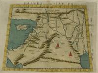
1574M7274Venice: Ruscelli c. 1574. Very Good;. Notes: Italian text on verso.<br>Girolamo Ruscelli 1518–1566 was an Italian mathematician and cartographer active in Venice during the early 16th century. Ruscelli is best known for his important revision of Ptolemy's Geographia published posthumously in 1574. Size : 192x266 mm 7.56x10.47 Inches Coloring: Hand Colored Category: Maps Asia Middle East Holy Land & Palestine;Maps Asia Middle East Jordan Syria Lebanon;Maps Asia Near East Turkey; Ruscelli unknown
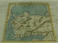
1574M7271Venice: Ruscelli c. 1574. Very Good;. Notes: Italian text on verso.<br>Girolamo Ruscelli 1518–1566 was an Italian mathematician and cartographer active in Venice during the early 16th century. Ruscelli is best known for his important revision of Ptolemy's Geographia published posthumously in 1574. Size : 190x266 mm 7.48x10.47 Inches Coloring: Hand Colored Category: Maps Asia Near East Turkey; Ruscelli unknown
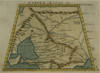
1574M7272Venice: Ruscelli c. 1574. Very Good;. Notes: Italian text on verso.<br>Map of the ancient region of Asiatic Sarmatia.<br>Girolamo Ruscelli 1518–1566 was an Italian mathematician and cartographer active in Venice during the early 16th century. He was also an alchemist writing pseudonymously as Alessio Piemontese.<br>Claudius Ptolemy better known mononymously as Ptolemy was a Greco-Roman mathematician astronomer astrologer geographer and music theorist who wrote about a dozen scientific treatises three of which were important to later Byzantine Islamic and Western European science. Size : 188x262 mm 7.40x10.31 Inches Coloring: Hand Colored Category: Maps Russia; Ruscelli unknown
1574M7278Venice: Ruscelli c. 1574. Very Good;. Notes: Italian text on verso.<br>Girolamo Ruscelli 1518–1566 was an Italian mathematician and cartographer active in Venice during the early 16th century. Ruscelli is best known for his important revision of Ptolemy's Geographia published posthumously in 1574. Size : 188x264 mm 7.40x10.39 Inches Coloring: Hand Colored Category: Maps Asia Central Afghanistan Pakistan; Ruscelli unknown