Neele, Samuel John [Ptolemy]Biblio.com

235 résultats
179440805London: Printed for A. Strahan and T. Cadell Edinburgh E. Balfour 1794. A very good copy small marginal tear just touching a blank section of map. 31 x 52 cm. Removed from: Robertson William Historical Disquisition concerning the knowledge which the ancients had of India. [Printed for A. Strahan and T. Cadell] [Edinburgh] [E. Balfour] unknown
1584Map1002Cologne: Goldefridi Kempensis 1584. 2nd Edition . No Binding. Fine. Folio. AN ORIGINAL MAP. Original hand colouring. 47x40cms Folding double page.PLEASE EMAIL FOR PHOTOS. <br/> <br/> Goldefridi Kempensis unknown
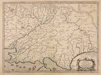
1730332605Amsterdam: R. & W. Wetstein William Smith 1730. unbound. Map. Copper plate engraving. Image measures 13.25" x 18".<br/> <br/> Printed circa 1730 this map of the Indian subcontinent was based on Ptolemy's 2nd century map and refined by Mercator beginning in the 16th century. This 1730 edition features graticule lines and a cartouche with a cherub. Covering an area from the Himalayan Mountains south to the Indian Ocean the map names many cities and topographical features. The map is in good condition wear to edges small tear to top of original center fold line. <br> <br> Gerard Mercator 1512-1594 was an accomplished mathematician cartographer globe maker and engraver best known for the Mercator Projection. Incorporating the newly accepted fact that the world is round Mercator was able to render longitude lines consistently straight on a chart. Although this requires some distortion it was of great use for navigators; furthermore it has since become historically important as it is still the most commonly used projection today.<br/> <br/> R. & W. Wetstein, William Smith unknown
20082-0789315912Universe Pub 2008. Hardcover. New. 304 pages. 14.00x9.00x1.25 inches. Universe Pub hardcover
2024__0903696746Hurtwood Pr Ltd 2024. Hardcover. New. 208 pages. 11.50x9.25x9.09 inches. Hurtwood Pr Ltd hardcover
0903696746.Ghardcover. Good. Access codes and supplements are not guaranteed with used items. May be an ex-library book. hardcover
46530570-nnew. unknown
46530570like new. unknown
56560946-75University of Pennsylvania Press. Used - Very Good. Former library copy. Pages intact with possible writing/highlighting. Binding strong with minor wear. Dust jackets/supplements may not be included. Includes library markings. Stock photo provided. Product includes identifying sticker. Better World Books: Buy Books. Do Good. University of Pennsylvania Press unknown
1997SONG0812233700University of Pennsylvania Press 1997-01-29. hardcover. Used: Good. 6.75x1.25x9.75. Buy with confidence. Excellent Customer Service & Return policy. University of Pennsylvania Press hardcover
1997DADAX0812233700University of Pennsylvania Press 1997-01-29. hardcover. New. 6.75x1.25x9.75. Buy with confidence. Excellent Customer Service & Return policy. University of Pennsylvania Press hardcover
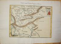
1541M7225Lyon: Michael Servetus c. 1541. Very good minor wormholing on upper margin. Notes: StolenThe only text on verso is the number "33". The publisher Michael Villanovus or Servetus was tried by Calvin for heresy and burned at the stake with several of his books. Size : 307x363 mm 12.09x14.29 Inches Coloring: Hand Colored Category: Maps Europe Poland Lithuania; Maps Europe Hungary; Maps Europe Romania; Maps Europe Ukraine; Maps Europe Czech Republic Slovakia; Michael Servetus unknown
658618765Rowman & Littlefield Publishers Incorporated . Papeback. New. Rowman & Littlefield Publishers, Incorporated unknown
116647741X.Gpaperback. Good. Access codes and supplements are not guaranteed with used items. May be an ex-library book. paperback
1120199433.Gpaperback. Good. Access codes and supplements are not guaranteed with used items. May be an ex-library book. paperback
200690171Museum. New. 2006. Paperback. 0954904141 . FREE UPGRADE to Courier/Priority Shipping Upon Request - IN STOCK AND IMMEDIATELY AVAILABLE FOR SHIPMENT - Flawless copy brand new pristine never opened -- 72 pp. ; 70 illus. -- with a bonus offer-- . Museum paperback
2017131308Ann Arbor MI: William L. Clements Library 2017. hardcover dust jacket. 8.75 x 11 inches. hardcover dust jacket. 230 pages. "A handsome and well-illustrated book on a worthwhile subject at a reasonable price. Graffagnino Austin Ptolemy and Dunnigan shed light on sixteen fascinating figures whose contribution to our understanding of American History is inestimable and often underrated. I have a hard time finding fault with The Pioneer Americanists except to wish it were twice as long."<BR> <br /> - William Butts Manuscripts<BR> <br /> <BR> <br /> The Pioneer Americanists is a captivating look at the lives and careers of eight generations of outstanding Americanists prior to 1900. Here are autobiographical and contemporary biographical sketches of White Kennett Isaiah Thomas James Lenox Joseph Sabin John Carter Brown Lyman Copeland Draper George Brinley Jr. and the other noteworthy specialists who created and nurtured the Americana field from the late seventeenth through the nineteenth centuries. Illustrations from the remarkable collections of the William L. Clements Library and other leading institutional archives complement the texts to provide a panoramic window on the early story of Americana appreciation collecting and description. Anyone with a professional or avocational interest in antiquarian Americana will find The Pioneer Americanists a fascinating treasury of information enlightenment and inspiration. William L. Clements Library unknown
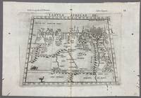
1574005867Venice: Vincenzo Valgrisi 1574. 1574 Edition. Engraving on Copper. Very Good. Double-page copperplate engraved map with letterpress text. Image: 26 x 19 cm. Sheet: 34 x 24 cm. A highly decorative and historically significant 16th-century map of North and Northeast Africa derived from Ptolemy’s 2nd-century geography. The map was published in the 1574 edition of Geographia edited by Girolamo Ruscelli and printed in Venice by Vincenzo Valgrisi. This is “Tabula Africae III†the third of Ptolemy’s Africa maps focusing on: Libya Egypt Cyrenaica Thebes and parts of Arabia Prominent classical sites including: Alexandria Cyrene Memphis Thebes Ptolemais Ammonis templum Mountain chains rivers and desert regions in stylized Renaissance form The map features Latin titling and classical toponyms while the verso contains the original Italian commentary explaining the geography cities and coordinates. CONDITION: Very good. Strong impression with clear platemark. Central fold as issued. Mild age toning and minor wear to margins. Backed at top center. Verso complete with full letterpress text Tavola Terza d’Africa Antica. Note: only this 1574 edition contains Vincenzo Valgrisi's elaborate printer's emblem showing: A lion leaping or attacking a smaller animal often interpreted as a fox and a large bird resembling an ostrich standing nearby. Vincenzo Valgrisi unknown
154115881Vienna 1541. Very good condition. The second map to show just southern Africa; it is based on the Waldseemuller modern map of southern Africa and derived from Ptolemy. Decoratively illustrated with African kings serpents an elephant and a Christian soldier riding a sea monster towards Madagascar. Three large rivers arise from a mountain range labeled 'Fontes Nili' source of the Nile other mountain ranges and coastal towns named in Latin or Portuguese. With the figure of the King of Portugal riding a sea monster towards Madagascar. <br /> <br /> Based on the slightly larger map from 1513 published in "Ptolemy's Geographia". The atlas was reprinted in 1520 1522 1525 1535 and 1541. This wood block was cut in 1525 for the publisher J.Grünninger. This being the variant of 1541 now without the banner title but title in letter type and blank verso.<br /> <br /> From the last edition of Ptolemy's "Geography" with maps by Laurens Fries and the text edited by Michael Servetus. Servetus was accused of heresy and burnt at the stake. Calvin ordered that copies of the book should be burnt with him although this copy seems to have eluded the flames. <br /> <br /> Wood block map with early hand color. Blank on the verso with the number 39 at the lower right corner. Image size: 16 7/8 x 13". Paper size: 21 1/4 x 15". Strengthened on the verso very faint browning at middle of center fold otherwise very good. Betz p. 55-56. Tooley "Map Collectors' Circle No. 30 Printed Maps of the Continent of Africa Part II" p. 61-62. Karrow "Mapmakers of the Sixteenth Century" unknown
174209570London: Printed for John and Paul Knapton at the Crown 1742 Book. Good. Hardcover. in the original full leather with five raised bands modestly worn both hinges cracked but holding no significant foxing all folding maps present and untorn very little wear inside. Printed for John and Paul Knapton at the Crown hardcover
2008ABE-1712239321266Dorling Kindersley 2008 Superb copy of a stunning book. Award winning architect and historian Ptolemy Dean has packed so much into this heavy and large sized book. Clean and tight no owner marks looks new and unread. 1st Edition. Hardcover. As New. Dorling Kindersley hardcover
2008TH241351Dorling Kindersley London 2008. 1st Edition. HARDCOVER. 1st printing. Tall large 4to. in colour printed boards 224pp illustrated in colour throughout __CONDITION : A well preserved AS NEW unmarked copy. . . . . . . . . . . . . . To see more of our Art Monographs etc type DbbARTIST in the Keywords search box __We always ship in PROTECTIVE CARD PARCELS Dorling Kindersley, London hardcover
2008042267London: Dorling Kindersley 2008. 1st Edition. Hardcover. As New/No Dust Jacket. quarto. 1st printing. An unread book in an as new condition. Dorling Kindersley hardcover
19993973784Ashgate 1999. This is an ex-library book and may have the usual library/used-book markings inside.This book has hardback covers. In good all round condition. No dust jacket. Please note the Image in this listing is a stock photo and may not match the covers of the actual item1200grams ISBN:1840142936 Ashgate hardcover