SANSON, NicolasBiblio.com

442 résultats
170054022Nicolas Bion: L'Usage des Globes. Amsterdam: Francois Halma. 1700. Attractive map of north eastern Africa including Egypt and northern Libya. Much of the charm of early maps of Africa lies in how they show the interior of the continent which was not explored until the 19th century. Maps by Sanson in original colour are rare. Nicolas Sanson was founder of the French school of mapmakers at a time when the leadership in European cartography passed from the Low Countries to France. This map was published in Brion's treatise on globes. Nicolas Brion was a famous French mathematical and scientific instrument maker. Copper engraving. Very good condition. Darkened edges to margins. Faint inkstamp on right margin not affecting map. Original colour. Size: 27 x 17 cm. 10½ x 6½ inches. unknown
41445142-nnew. unknown
41445142like new. unknown
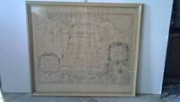
6m5023H. Jaillot Paris 1696. Grenzkolorierte Kupferkarte gerahmt ca. 56 : 65 cm gebräunt. unknown
2004H-405-5902004. Paperback. Good. Former library book. Different cover. Different publisher. Ammareal gives back up to 15% of this item's net price to charity organizations. paperback
2005H-405-5922005. Paperback. Good. Former library book. Different cover. Different publisher. Ammareal gives back up to 15% of this item's net price to charity organizations. paperback
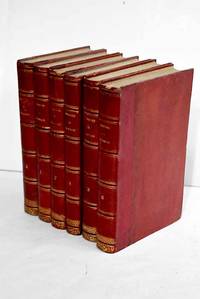
18633586263Paris.: Dupray de la Maherie. 1863. Hardcover. Cubierta deslucida. oxido leve . Good. 20 cm. 6 v. Encuadernación en tapa dura artesanal hol. Idioma frances. Sept generations d'executeurs 1688-1847 . Cubierta deslucida. oxido leve . hsitoria Dupray de la Maherie. hardcover
2005X-343-635STE ECRIVAINS 2005. Paperback. Good. Former library book. Different cover. Ammareal gives back up to 15% of this item's net price to charity organizations. STE ECRIVAINS paperback
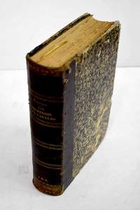
18633691903Madrid.: Manini Hermanos. 1863. Hardcover. Encuadernacion muy deteriorada . Good. 24 cm. 863 p. 27 h. de lám. il. Encuadernación en tapa dura artesanal. Traducción española por D. Juan de Sala . Encuadernacion muy deteriorada . Manini Hermanos. hardcover
90475PARIS Chez l’Auteur 1654. Title cartouche to lower right corner. Blank on verso. In good condition. Some light tanning on edges with a few faint foxing marks. With original outline hand colouring. Engraved Size 17.5 x 23 inches Nicolas Sanson 1600-1667 sometimes called Nicolas Sanson d'Abbeville or Sanson d'Abbeville was the most important French cartographer of the 17th century. Tooley called Sanson "the founder of the French school of cartography." He began making maps in the late 1620s and in the 1630s he was working with Melchior Tavernier. Later Sanson worked in concert with the print publisher Pierre Mariette with whom he published his great atlas: Cartes générales de toutes les parties du monde 1658. After Sanson's death in 1667 his son Guillaume carried on the business in partnership with Alexis Hubert Jaillot. Guillaume established himself as a very important French mapmaker in his own right. PARIS Chez l’Auteur 1654. unknown
2011SONG0197264832British Academy 2011-11-07. 1. hardcover. Used: Good. 9.20x1.30x6.20. Buy with confidence. Excellent Customer Service & Return policy. British Academy hardcover
3136661Manini Hnos. Hardcover. Lomo rozado. Good. 22 cm. 860 p. Encuadernación en tapa dura artesanal. Con láminas . Lomo rozado. Literatura.82 82 Manini Hnos. hardcover
90474PARIS Chez l’Auteur 1654. Title cartouche to lower right corner. Blank on verso. In good condition. Some light tanning on edges with a few faint foxing marks. A few small nicks lower margin edge. With original outline hand colouring. Engraved Size 17.5 x 23 inches Nicolas Sanson 1600-1667 sometimes called Nicolas Sanson d'Abbeville or Sanson d'Abbeville was the most important French cartographer of the 17th century. Tooley called Sanson "the founder of the French school of cartography." He began making maps in the late 1620s and in the 1630s he was working with Melchior Tavernier. Later Sanson worked in concert with the print publisher Pierre Mariette with whom he published his great atlas: Cartes générales de toutes les parties du monde 1658. After Sanson's death in 1667 his son Guillaume carried on the business in partnership with Alexis Hubert Jaillot. Guillaume established himself as a very important French mapmaker in his own right. PARIS Chez l’Auteur 1654. unknown
2026x-0197609945Oxford University Press Inc 2026. Hardcover. New. 232 pages. 6.51x0.84x9.51 inches. Oxford University Press Inc hardcover
3838178408.Gpaperback. Good. Access codes and supplements are not guaranteed with used items. May be an ex-library book. paperback
0190310847.Gpaperback. Good. Access codes and supplements are not guaranteed with used items. May be an ex-library book. paperback
36637Milano: Rizzoli 1974. First edition primo edizione hardback. Folio 41cm x 35cm 164pp. Colour frontispiece 44 colour plates tavole 132 text figures. Original green cloth dustwrapper green cloth slipcase. The book is in excellent condition; the dustwrapper is very good short closed tear to the front panel some light fraying of the extremities; the slipcase is good to very good some rubbing. A magnificent production with the text pages printed on hand-made paper and the plates printed on cardstock. Text in Italian. Milano: Rizzoli, 1974. hardcover
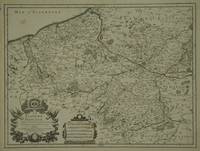
30600Paris: Jaillot. 1689. 43.1 x 57 cm. Original outline colour. Single page folio map of southern Flanders and Artois. Blank on verso. Small tear without loss at upper edge just touching image. Small section of upper margin missing though not affecting map. Small brown spot to centre of lower edge. Paris: Jaillot. 1689 unknown
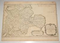
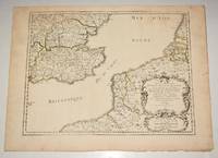
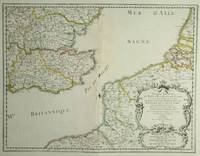
28812Paris: Sanson. 1654. 36.6 x 48 cm. Original outline colour. Double page map of the south east England shown with the adjacent coastline of France and Belgium. Title cartouche to lower right corner. Blank on verso. Wear to centrefold with some loss Paris: (Sanson). 1654 unknown
170058299Description de tout l'Univers 1700 published by F.Halma Amsterdam. Nicolas Sanson was founder of the French school of mapmakers at a time when the leadership in European cartography passed from the Low Countries to France. Copper engraving. Fine condition. Original colour with gold leaf highlights. Size: 17 x 18.5 cm. unknown
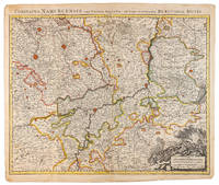
1710009138Amsterdam: Pierre Mortier 1710 Cooper engraving 50.5 x 60.5 cm on paper measuring 54.0 x 63.0 cm with original color in outline minor spotting and creasing remnants of centerfold paper slightly frayed at edges. A good copy of an uncommon map of the province of Namur a region of the Spanish Netherlands published in Amsterdam by Pierre Mortier to illustrate events of the War of the Spanish Succession. Pierre Mortier unknown
6131577927.Gpaperback. Good. Access codes and supplements are not guaranteed with used items. May be an ex-library book. paperback
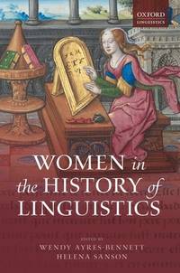
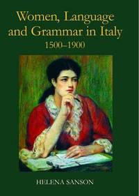
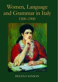
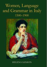
A9780197264836Hardback. New. In the sixteenth century Italian was a literary language not accessible to the less educated among them women who would instead speak a local dialect. Little attention has been paid to women's linguistic education but this study shows the vital role they played in developing Italian as a true mother tongue. hardcover
1954mon0000050986London 1954-01-01. Hardcover. Very Good. 2.5980 cent in x 18.3860 cent in x 13.1900 cent in. Complete with dust wrapper. Rare. London hardcover
ria9780197264836_inpHardcover. New. New Book; Fast Shipping from UK; Not signed; Not First Edition; In the sixteenth century Italian was a literary language not accessible to the less educated among them women who would instead speak a local dialect. Little attention has been paid to women's linguistic education but this study show hardcover