169 résultats
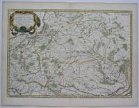
169616269Paris: Alexis Hubert Jaillot 1696. Copper-engraved map with full original colour and gold embellishment in excellent condition. A stunning map of Normandy by Alexis Jaillot an exceptional example with gilt embellishments.<br/> <br/> One of the most important figures in French cartography Nicolas Sanson initiated the great school of French geographers. Born in Abbeville in 1600 Sanson established his first printing house in Paris in 1638. He soon became geographer to the king establishing himself as one of the most influential cartographers on the Continent. He was succeeded by his sons Adrien and Guillaume and by his son-in-law Pierre Duval who continued to publish a wealth of maps using Sanson's name. At the close of the seventeenth century Sanson's plates were purchased by the influential cartographer Alexis Hubert Jaillot who continued to publish his maps and atlases under Sanson's title. This stunning map of Normandy is based on Sanson's map published in 1650 but was redrawn and enlarged by Jaillot. It shows the provinces of Normandy as well as the northern tip of Brittany and part of the English Channel. Both Jersey and Guernsey are included as is Mont St. Michel off the coast of St. Malo. In keeping with all of Sanson's and Jaillot's superb maps forests rivers and towns are meticulously identified and named. The map includes an ornate cartouche in the upper section as well as a scale and key.<br/> <br/> Tooley Maps & Map-Makers pp. 40-41. Alexis Hubert Jaillot unknown
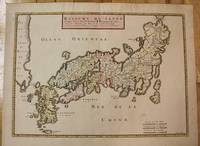
1656M8114Paris c.1656. Very Good. Size : 375x521 mm 14.76x20.51 Inches Coloring: Original Hand Coloring Category: Maps Asia Far East Japan & Korea; unknown
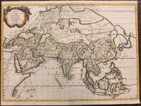
1667M8921Paris: Pierre Mariette 1667. Very Good. Notes: An important map of Asia by Nicolas Sanson showing the boundaries of the major historic civilizations of this continent. Examples include Assyria Syria Asia Minor Armenia Arabia Felix Libya Sarmatia Thracia Graecia Persia India China Ethiopia Scythia and Gangem. <br><br>Sanson 1600–1667 was a French cartographer termed by some as the "father of French cartography." His works are known for their incorporation of the most up to date information of the time and their clean modern style. Size : 402x470 mm 15.83x18.50 Inches Coloring: Original Hand Coloring Category: Maps Asia Continent; Pierre Mariette unknown
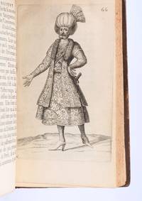
169490853Paris: Veuve de Jacques LangloisVeuve de R. ChevillonJacques Langlois 1694. Fine. Veuve de Jacques Langlois Veuve de R. Chevillon Jacques Langlois Paris 1694 9.5 x 16.5 cm Relié Rare illustrated first edition with 5 copper-engraved plates hors-texte including 2 folding plates cf. Barbier II 302. Schwab 517. Hage Chahine 4320. Wilson 200. Absent from Blackmer and Atabey. Our copy lacks the two dedication leaves to Rouillié often missing with repairs to the joints and one corner and a manuscript ex-libris on the title-page. Contemporary full mottled fawn calf spine with five raised bands gilt and decorated with gilt compartments and floral tools tan calf title-label gilt fillets to the edges partly faded speckled edges. Sanson a zealous apostolic missionary tireless traveller and accomplished diplomat arrived in Persia in 1683 learning Armenian Turkish and Persian while travelling through the kingdom in order to ""consoler les chrétiens qui y habitent"". He took an interest in everything ""murs situation antiquités"" of the regions he crossed and eventually gained access to the Palace ""qui ne sont accordées qu'aux grands seigneurs de Perse"" attending all audiences and taking part in every banquet.</p><p>He spent three years close to Soliman before returning to France bringing Louis XIV a personal message from the ""roi"" of Persia. Provenance: copy from the library of the literary critic Émile Faguet 18471916 with his vignette bookplate pasted to the inside board. Veuve de Jacques LangloisVeuve de R. ChevillonJacques Langlois hardcover
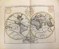
1696M10191Amsterdam: Covens & Mortier c.1696. Very Good. Size : 393x540 mm 15.47x21.26 Inches Coloring: Original Hand Coloring Category: Maps World; Covens & Mortier unknown
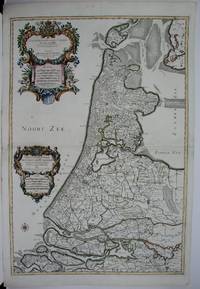
1674M1744Paris: Jaillot Hubert 1674. Very Good to Excellent. Size : 572x840 mm 22.5x33 Inches Coloring: Original Outline Coloring Category: ; Maps Europe Benelux Jaillot, Hubert unknown
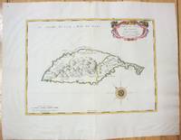
1658M7057Paris 1658. Very Good;. Notes: An early map of the Island of St. Christopher that includes a decorative compass rose in sea area and an ornamental title cartouche in top right decorated with scrolls ribbons and fruit. This is the first printed map of St. Kitts published in "Cartes Generales De Toutes Les Parties Du Monde."<br>With wide margins. Size : 314x429 mm 12.36x16.89 Inches Coloring: Original Outline Coloring cartouche and compass hand coloured Category: Maps West Indies Other Islands; unknown
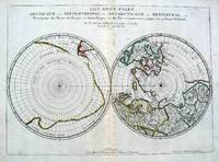
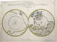
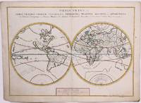
16575033Paris 1657. Par N. Sanson d'Abbeville Geographe ordre du Roy. Spence 3017 lists a slightly different title but undoubtedly the same map. 53x38 cms. Period outline color central fold very good condition. A double hemisphere map to the North and South poles. The North pole is connected to Greenland and Spitzbergen but there is little other detailed coastline in the polar area. Europe Russia and Canada are delineated. The South pole is based on the great unknown Southland of Magellan. The tip of S. America is shown and a large land mass which encompasses the whole of the hemisphere but nothing else. unknown
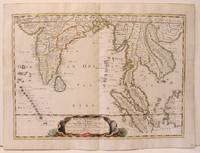
1654M2656Paris 1654. Excellent. Size : 385x530 mm 15.125x20.875 Inches Coloring: Original Hand Coloring Reference: Nebenzahl 3.9C Category: Maps Asia South East; Maps Asia Central India & Sri Lanka / Ceylon; unknown
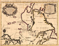
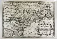
169317230Paris: Hubert Jaillot. 1693. Other. In excellent condition. Minor offsetting of the old outline colors to the paper. 465 by 610mm 18 by 24 inches. 465 by 610mm 18 by 24 inches. Copper Engraving color by Jaillot Alexis-Hubert & Sanson N published 1693 by Hubert Jaillot Paris. Image size: 465 by 610mm 18 by 24 inches. By Jaillot after Sanson a landmark of late 17th-century French cartography of North America. Alexis-Hubert Jaillot c.16321712 was one of the most important French cartographers and map publishers of the late 17th century. He collaborated with the pioneering geographer Nicolas Sanson 16001667 and his sons to produce finely engraved large-format maps of the world's regions publishing in Paris from 1670 onwards. Jaillot's maps are distinguished by their impressive scale rich baroque cartouches and the high quality of their engraving. His map of Canada and New France 1693 is a landmark document of 17th-century French geographical knowledge of North America reflecting decades of French colonial exploration and mission activity in the St. Lawrence and Great Lakes regions.Large and decorative map of Canada by the French cartographer Nicolaus Sanson and Hubert Jaillot. Published in the 'Atlas Noveau.' this atlas was a masterpiece in the French cartography in the 17th century. The atlas was specially designed for Louis XIV and due of the very large size of the plates most maps were printed from two plates it took Hubert Jaillot over 12 years to complete the 'Atlas Noveau.'. Canada is very detailled shown on the map as well Labrador Terra Neuf & Nouvelle France are shown in engraved territory borders. The map is rich in detail with many cities and place names rivers lakes mountains bays etc. In excellent condition. Minor offsetting of the old outline colors to the paper. Hubert Jaillot. unknown
1655M5101Paris 1655. Excellent. Size : 395x560 mm 15.5x22 Inches Coloring: Original Outline Coloring Category: ; Maps Europe Poland Lithuania unknown
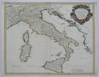
1665M5118Paris 1665. Very Good central fold reinfrced. Notes: There is a water mark on the right hand portion of the map. Size : 435x540 mm 17.125x21.25 Inches Coloring: Original Outline Coloring Category: ; Maps Europe Italy unknown
1666M1204Paris: Mariette Pierre 1666. Very Good. Size : 410x555 mm 16.125x21.875 Inches Coloring: Hand Colored Reference: Mojski Piotr Maria "Cartographia Rappersviliana Polonorum" page 388 number 32; Category: ; Maps Europe Poland Lithuania Mariette, Pierre unknown
1657M954Paris 1657. Very Good; some occasional mild browning. Notes: 17th century French map of Arctic and Antarctic regions. It was published in Cartes générales de toutes les parties du monde. <br><br>Nicolas Sanson 1600–1667 was a renowned French cartographer termed by some as the "father of French cartography." His works are known for their incorporation of the most up to date information of the time and their clean modern style. Size : 390x537 mm 15.375x21.125 Inches Coloring: Hand Colored in outline Category: ; Maps Polar Arctic Regions; Maps Polar Antarctic Regions unknown
1657M8883Paris 1657 . Very Good. Notes: A handsome 17th century map of the known world typifying Sanson's scientific style of cartography. Embodying the most up to date information of the period Sanson's map depicts California as an island with Antarctica and Australia still largely unknown. A land bridge connects Asia to North America and touches Japan. A very accurate map for the period. Nicolas Sanson 1600–1667 was a French cartographer termed by some the creator of French geography in which he's been called the "father of French cartography." <br><br><br> Size : 380x537 mm 14.96x21.14 Inches Coloring: Original Hand Coloring Reference: Shirley R.W. World 400; Pastoureau M. Sanson V A 98. Category: Maps World; unknown
1700M11077Paris 1700. Excellent. Notes: Second state. Published in Description De Tout L'Universe-Halma.<br>An excellent example of Nicolas Sanson's map of Canada and the Great Lakes Lake Superior and Lake Michigan Lac du Puans are shown open-ended.<br>Engraved in the bottom-right corner outside the neat-line is "A.d.Winter Schulp". Additions include a latitude and longitude grid; mountains and trees filling in the blank areas east of James Bay and in northern Labrador; and the three latitude and longitude values that were previously missing in three of the corners on the border. Size : 207x308 mm 8.15x12.13 Inches Coloring: Black & White Reference: Burden #575; Kershaw #137 Plate 85 Category: Maps Canada East; Maps North America Great Lakes; unknown
1665M589Paris: Mariette Pierre 1665. Excellent. Size : 410x560 mm 16.125x22 Inches Coloring: Hand Colored Reference: Mojski Piotr Maria "Cartographia Rappersviliana Polonorum" page 387 number 31; Category: ; Maps Europe Poland Lithuania Mariette, Pierre unknown
165556109Paris. 1655. Attractive map of Morocco and parts of Algeria. Maps by Sanson in original colour are rare. Nicolas Sanson was founder of the French school of mapmakers at a time when the leadership in European cartography passed from the Low Countries to France. Copper engraving. Very good condition. Some light browning to the centre fold. Attractive water mark. Original colour. Size: 53 x 40 cm. 21 x 15½ inches unknown
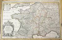
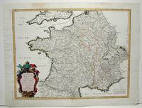
1690M10380Paris: H. Jaillot c.1690. Very Good backed on acid free tissue paper for long term preservation. Notes: Large and detailed map of France with a large decorative cartouche in the lower left two sheets joined. Size : 565x896 mm 22.24x35.28 Inches Coloring: Original Outline Coloring Category: Maps Europe France; H. Jaillot unknown
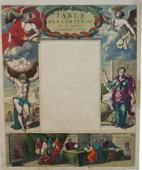
1650M2494Paris 1650. Very Good; light age toning; some browning on lower half of the map. Size : 547x433 mm 21.5x17 Inches Coloring: Original Hand Coloring Category: ; Maps Misc Curiosities Title Pages Games etc. unknown
1665M1736Paris: Mariette Pierre 1665. Excellent; some light browning on upper margin. Size : 410x535 mm 16.125x21 Inches Coloring: Original Hand Coloring Category: ; Maps Europe France Mariette, Pierre unknown
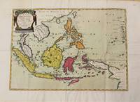
1654M10780Paris 1654. Very Good. Notes: Detailed map of Southeast Asia by Nicholas Sanson 1600-1667 renowned French cartographer. Size : 402x560 mm 15.83x22.05 Inches Coloring: Original Hand Coloring Category: Maps Asia South East Indonesia & Papua New Guinea; Maps Asia South East Thailand Laos Vietnam Cambodia & Burma / Myanmar; Maps Asia South East Philippines; unknown
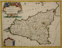
1692M7516Paris: Hubert Jaillot c. 1692. Very Good. Notes: Title cartouche in upper left features Sicilian coat of arms winged angels and merpeople while the scale in the lower left is held on each side by allegorical figures of labour and harvest. Mount Etna is represented pictorially. Size : 418x530 mm 16.46x20.87 Inches Coloring: Hand Colored in Outline Category: Maps Mediterranean Islands; Hubert Jaillot unknown