946 résultats
18364318FB1836. Paris J.-B. Baillière 1836. 8°. 1 Tafel fehlend 352 S. Moderne Steifbroschur mit aufgezogenem Originaltitel Titel gebräunt. Durchgehend leicht fleckig. Sonst in schöner Erhaltung. unknown
2011G0197264832I4N00British Academy 2011. Hardcover. Very Good. May have limited writing in cover pages. Pages are unmarked. ~ ThriftBooks: Read More Spend Less.Dust jacket quality is not guaranteed. British Academy hardcover
194338552D. Appleton -Century. Good with no dust jacket. 1943. Revised Edition. Hardcover. Spine is straight binding is tight name sticker inside the book reading pages have some underlining some wear. Map is in very good condition and comes with the book.; 9x6x1.5; 554 pages . D. Appleton -Century hardcover
174518854Amsterdam Chatelain 1745 une carte ancienne gravée sur cuivre (Copper etching) en noir . Format : 17 x 19,5 cm, Échelle au1:200,000,000ème, pli central vertical normal venant d'un atla ( vertical centerfold), avec note dans la marge en haut à droite : Tome VIII Page 87, pour "l'introduction à l'histoire générale et politique de l'univers, Ou l'on voit l'Origine, les Révolutions, l'Etat présent, & les Intérêts des Souverains" ; Commencée par Mr. le Baron de Pufendorff ; complétée et continuée jusqu'à 1745 par Mr. Bruzen de la Martinière, 8 volumes in-12, 1745 à Amsterdam chez Zacharie Chatelain Editeur,
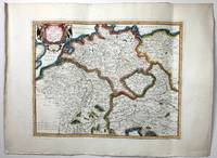
1662280971662 une carte ancienne gravée sur cuivre (Copper etching) en noir . Format : 46,5 x 58 cm, par Nicolas SANSON carthographe, 1662 [s.n.] Editeur,
1926R300296450Spes. 1926. In-12. Relié demi-cuir. Etat d'usage, Couv. convenable, Dos satisfaisant, Papier jauni. Environ 200 pages par volume. Plats jaspés. Dos cuir à titre, année et motifs dorés.. . . . Classification Dewey : 248-Vie chrétienne et méditations
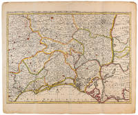
1710009141Amsterdam: Pierre Mortier 1710 Cooper engraving 44.5 x 59.5 cm on paper measuring 54.0 x 64.0 cm with original color in outline minor spotting and creasing remnants of centerfold. A good copy of a map of south-central France the Cévennes Vivarais Occitania published in Amsterdam by Pierre Mortier to illustrate events of the War of the Spanish Succession. Pierre Mortier unknown
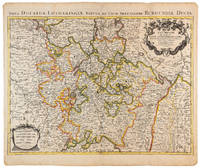
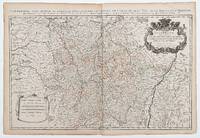
1710009140Amsterdam: Pierre Mortier 1710 Cooper engraving 46.5 x 61.5 cm on paper measuring 54.0 x 64.5 cm with original color in outline minor spotting and creasing remnants of centerfold. A good copy of a map of the Duchy of Lorraine and surrounding territories published in Amsterdam by Pierre Mortier to illustrate events of the War of the Spanish Succession. Pierre Mortier unknown
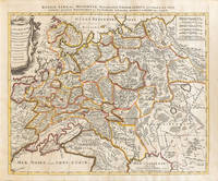
1710009147Amsterdam: Petrus Schenck 1710 Cooper engraving 46.5 x 58.0 cm on paper measuring 51.0 x 63.5 cm with original outline coloring flattened expertly restored and backed with archival tissue paper. The Latin title in the top border reads: "Russiae Albae sive Moscoviae delineatio Geographica accurata et nova…". A good copy of a Moscovie map published in Amsterdam by Petrus Schenck. Petrus Schenck unknown
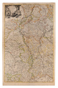
1710009148Amsterdam: Pierre Mortier 1710 Cooper engraving on two joined sheets measuring 59.5 x 95.5 cm with original outline coloring expertly cleaned and flattened. A good copy of a map of western Germany published in Amsterdam by Pierre Mortier to illustrate events of the War of the Spanish Succession. The first state with "2. Carte de la Meuse" added in manuscript. Pierre Mortier unknown
14357382like new. unknown
16411809140021Paris : Tavernier et a present Pierre Mariette 1641. First Edition. Maps. Good. 53 x 40 cm. Original engraved double page map of France. In gilt and black frame under glass. Some browning. Scale: 1:3000000. Paris : Tavernier, et a present Pierre Mariette unknown
18335778GB1833. Dritte Ausgabe. 5 Bde. Paris J.-B. Baillière 1833. XI 731 S. mit 1 gefalteten Tabelle - 2 Bl. 672 S. - 2 Bl. 621 S. - 2 Bl. 715 S. - 2 Bl. 832 S. Halblederbände der Zeit mit goldgeprägtem Rückentitel stärker berieben vorderes Außengelenk bei Bd. 1 angeplatzt. Schnitt staubig Vorsätze etwas leimschattig. Durchgehend mäßig stockfleckig mit stellenweise stärker braunfleckigen Seiten. Vorsätze bzw. Schmutztitel mit Besitzvermerken von alter Hand und geprägtes Wachssiegel auf Titel bei Bd. 1 und 4 entfernt. unknown
1876905336.Gpaperback. Good. Access codes and supplements are not guaranteed with used items. May be an ex-library book. paperback
73602Paris Pierrr Mariette 1656/ca. 1950. 13 x 17.5 cm 26 x 30 cm Rahmen vergoldet unter Passepartout Min. gebrauchspurig sonst tadell. Handkolorierte Faksimile. - Nicolas Sanson der Ältere auch: Nicolas Sanson d’Abbeville 1600 in Abbeville Frankreich- 1667 in Paris französischer Kartograph. Er gilt als der Vater der Geographie in Frankreich.In den Jahren 1618 bis 1667 schuf Sanson etwa 300 einzelne Karten sowie Atlanten und illustrierte Texte. Er wurde zum Geographe Ordinaire du Roy königlicher Kartenmacher ernannt und unterrichtete die Könige Ludwig XIII. und Ludwig XIV. in Geographie. 010 Paris, Pierrr Mariette, 1656/ca. 1950 unknown
1695862121695 Paris, Mabre Cramoisy, 1695, in 12 relié plein veau de l'époque, dos à nerfs orné, 5 feuillets non chiffrés (titre et avertissement) - 264 pages et 12 feuillets de table ; exemplaire de travail, légèrement dérelié, reliure frottée.
49665Paris: 1690. 54 x 87.5 cm. Double page copper engraved map of Lorraine. Original outline colour. Large decorative cartouche to upper right corner. Horizontal crease parallel and adjacent to centrefold otherwise good. [Paris:] 1690 unknown
2092902138101576Not Available N.A. Soft Cover. Fine. Size: Plate: 18.5cmx24cm / Paper: 39cmx48cm Number of copies: 1 sheet Not Available paperback
1831133460Paris, chez les marchands de nouveautés 1831 In-8 20 x 12 cm. Reliure demi-basane havane, dos lisse, LXVII-319 pp. Reliure sensiblement frottée.
8446009811.Gpaperback. Good. Access codes and supplements are not guaranteed with used items. May be an ex-library book. paperback
71-2849Paris: Nicholas Sanson 1656. Hand colored engraving. 18.5 x 29.7 cm. plate. Very Good folded in center. Paris: Nicholas Sanson, 1656. unknown
1696H40716Rome: Giovannie Giacomo de Rossi 1696. Very good. Sheet measures 27.5 x 20.5 inches map itself measures 20 x 16 inches. Very good some curving and bending from having been stored rolled up but no creases or tears light toning and mildest foxing. Period hand coloring and handsome cartouche. Italian edition of the French mapmaker's map of Germany and Bohemia. Giovannie Giacomo de Rossi unknown
1823z07242Paris: De l'imprimerie de L.-T. Cellot 1823. First edition. Hardcover. Very Good. First edition 1823. xi1587 pp. Half title. In French. Later half brown morocco and marbled boards spine gilt raised bands. Corners bumped spine lightly scuffed. Contemporary ink ownership signature in upper margin of half title. Ex-lib. with institutional bookplate on front pastedown and inkstamp in rear free endpaper at gutter. Some residue from earlier bookplates in front endpapers. Mild foxing throughout and some faint dampstaining. Overall very good. Early 19th-century French lexicon termes used in the medical and natural sciences. De l'imprimerie de L.-T. Cellot hardcover
86020Paris Pliure centrale. Format 43x58 cm marges comprises. Carte fraîche et sans accidents. Carte conservée roulée.
174518852Amsterdam Chatelain 1745 une carte ancienne gravée sur cuivre (Copper etching) en noir . Format : 17 x 39 cm, Échelle au1:200,000,000ème, plis centraux verticaux normaux venant d'un atlas ( verticals centerfold), avec note dans la marge en haut à droite : Tome I Page 10, pour "l'introduction à l'histoire générale et politique de l'univers, Ou l'on voit l'Origine, les Révolutions, l'Etat présent, & les Intérêts des Souverains" ; Commencée par Mr. le Baron de Pufendorff ; complétée et continuée jusqu'à 1745 par Mr. Bruzen de la Martinière, 8 volumes in-12, 1745 à Amsterdam chez Zacharie Chatelain Editeur,