SANSON, NBiblio.com
442 résultats
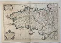
1693324404Paris: Alexis-Hubert Jaillot 1693. Map. Engraving with hand colored outline. Image measures 21" x 31"<br/> <br/> This large 17th century double-page map features the Brittany region of France. Cities towns abbeys government buildings rivers ports and harbors are labeled. Mountains forests and wetlands are depicted pictorially. The attention to detail in topography and population centers hints at the abundance of the region known for its production of Muscadet wine cheese boar seafood and other agricultural products. Executed by Nicolas Sanson in dedication to his son this map was published by Alexis-Hubert Jaillot in Paris and later reproduced in Amsterdam by Jaillot and Pierre Mortier. This early edition is scarce and hard to find. In very good condition with some offsetting to left side and a spot in the right margin. <br> <br> Nicolas Sanson 1600-1667 is considered the founder of the French school of cartography. In reaction to the prevailing trend of Dutch lavishness Sanson favored minimal details focusing rather on accurate cartography than ornament.<br/> <br/> Alexis-Hubert Jaillot unknown
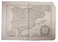
1708E7GCJJB1RUYXParis 1708. Hubert Jaillot Engraved map on 2 assembled sheets 55.5 x 78 cm engraved by Cordier. With title in decorated cartouche on the bottom right corner scales and privilege in decorated cartouche on the bottom left corner and a few lines coloured in green. Large map of Spain and Portugal this state with a privilege for 20 years granted in 1708. Engraved by Cordier after the map by Nicolas Sanson.Strengthened fold damaged corners but map in very good condition.l Cf. Pastoureau Jail. II A map 91. unknown
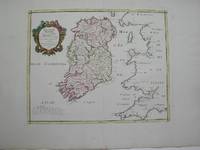
1778M3768Paris 1778. Excellent. Size : 405x501 mm 15.875x19.75 Inches Coloring: Hand Colored Category: ; Maps Europe Ireland unknown
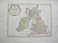
1754M3766Paris 1754. Excellent. Size : 410x540 mm 16.125x21.25 Inches Coloring: Hand Colored Category: ; Maps Europe Ireland;; Maps Europe United Kingdom unknown
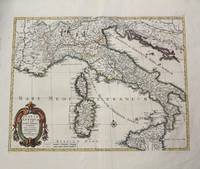
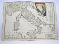
1702M10242Amsterdam: Jean Covens & Corneille Mortier c.1702. Very Good. Size : 420x528 mm 16.54x20.79 Inches Coloring: Hand Colored Category: Maps Europe Italy; Maps Mediterranean Islands; Jean Covens & Corneille Mortier unknown
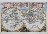
1692M9110Trajecti ad Rhenum : Francisci Halma c. 1692. Very Good. Notes: A finely engraved map of the world by Nicolas Sanson "the father of French cartography" during the late 17th century. Engraved by A. de Winter. There are a lot of fascinating cartographic errors that were made such as California being shown as an island and the western half of North America not being depicted as it had yet to be discovered. But the treatment of far and southeast Asia is much improved when we compare it to Sanson's map of 1652. Korea reverts to an attenuated peninsula instead of the short squat round island in the earlier Sanson version. Likewise the partial outline of Australia changes it shape to a much more realistic outline of Australia. Size : 200x305 mm 7.87x12.01 Inches Coloring: Hand Colored Category: Maps World; Francisci Halma unknown
1760M7988Paris: Sr. Delamarche c.1760. Very Good. Notes: Engraved by Delahaye. Large scale attractive map of France. Size : 493x668 mm 19.41x26.30 Inches Coloring: Original Hand Coloring Category: Maps Europe France; Sr. Delamarche unknown
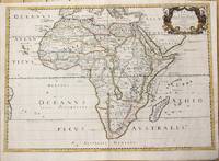
1650M6678Paris: Pierre Mariette c. 1650. Very Good;. Notes: Title cartouche bordered by two outward-facing birds of prey.<br><br>Norwich writes: "This is an early Sanson map. An odd feature is the name Barditus Mons given to a long chain of mountains running continuously from somewhere in Angolato Algoa Bay. No place names appear even on the coast of the southern part of the continent which is labelled 'Agi Symba' a name usually referring to the northern African region and inhabitants are 'Anthropophagi Aethiopes' or cannibals." Size : 396x553 mm 15.59x21.77 Inches Coloring: Hand Colored Reference: Norwich's Map 35. Category: Maps Africa Continent; Pierre Mariette unknown
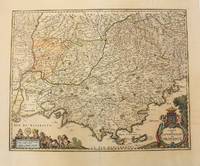
1656M6320Paris 1656. Very Good. Notes: This map shows the southern coast of France. Size : 425x535 mm 16.75x21 Inches Coloring: Original Hand Coloring Category: Maps Europe France unknown
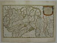
1654M5952Paris 1654. Very Good some mild discoloration along the margins. Size : 350x555 mm 13.75x21.875 Inches Coloring: Original Outline Coloring Reference: Gole 16; Nebenzahl 3.9B Category: Maps Asia South East Thailand Laos Vietnam Cambodia & Burma / Myanmar; Maps Asia Central India & Sri Lanka / Ceylon; unknown
1778M3888Paris: Delamarche 1778. Very Good. Size : 515x685 mm 20.25x27 Inches Coloring: Original Outline Coloring Category: ; Maps Europe Italy Delamarche unknown
166710027Paris 1667. No Binding. Near Fine. 12 ½ x 17 inches. Original outline color; excellent. Earliest map of Martinique listed in Phillips featuring attractive original color and an elegant cartouche. This map depicts the situation on the island before 1660 when it was still largely inhabited by natives and only about half of it had been claimed by colonists for sugar cane farming. The map goes so far as to mark with a printed line the partition dividing the "demeure des François" and the "demeure des savages." However by 1660 the entirety of the native population was either dead expelled or in slavery and Martinique was a full-fledged sugar cane-farming European colony. Phillips Maps P. 389. unknown
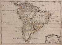
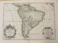
1650309461Paris: Pierre Mariette 1650. unbound. Abraham Peyrounin. Map. Engraving with original outline color. Image measures 15 3/4" x 21 3/4"<br/> <br/> This exceptionally fine map of South America covers the continent in fine detail. Coastlines are extensively labeled and mountains beautifully rendered in profile. The Orinoco and Amazon Rivers as well as Rio de la Plata are prominently rendered. Sanson refrains from drawing a southern coastline to Tierra del Fuego and the relatively unknown Amazon region is depicted in minimal detail. Sanson does however include the mythical lake "Lac de Parime" and the city of gold "Manoa del Dora" between the Orinoco and Amazon rivers. Nice dark impression. In very good condition. Minor dampstain to lower margin not affecting the image and some faint stains near the center of the map - otherwise clean and bright. Hard to find. <Br> <br> Nicolas Sanson 1600-1667 is considered the founder of the French school of cartography. In reaction to the prevailing trend of Dutch lavishness Sanson favored minimal details focusing rather on accurate cartography than ornament.<br/> <br/> Pierre Mariette unknown
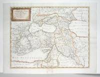
1660M2926Paris: Mariette Pierre 1660. Very Good; some browning on the lower margin near the fold. Size : 407x517 mm 16x20.375 Inches Coloring: Hand Colored Category: ; Maps Mediterranean Sea; Maps Asia Near East Turkey; Mariette, Pierre unknown
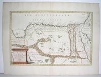
1655M2801Paris: Mariette Pierre 1655. Excellent. Size : 345x523 mm 13.625x20.625 Inches Coloring: Original Outline Coloring Category: Maps Africa North Egypt Mariette, Pierre unknown
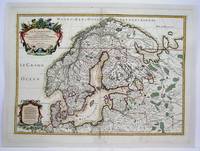
1708M4264Paris 1708. Very Good central fold reinforced mounted on acid free canvas. Size : 474x655 mm 18.625x25.75 Inches Coloring: Hand Colored in Outline Category: ; Maps Europe Scandinavia unknown
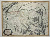
1663M1708Paris: Mariette Pierre 1663. Excellent. Size : 425x575 mm 16.75x22.625 Inches Coloring: Hand Colored Category: ; Maps Europe France Mariette, Pierre unknown
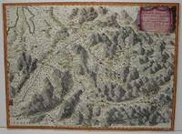
1663M645Paris: Mariette Pierre 1663. Excellent. Size : 420x575 mm 16.5x22.625 Inches Coloring: Hand Colored Category: ; Maps Europe Switzerland Mariette, Pierre unknown
1698M10786Paris 1698. Very Good. Notes: A charming large scale 17th century map of South America with two decorative cartouches and original outline colouring. Size : 460x648 mm 18.11x25.51 Inches Coloring: Original Outline Coloring Category: Maps South America Continent; unknown
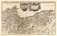
169625836Paris: Hubert Jaillot 1696. Other. In excellent condition. 545 by 874mm 21 by 34 inches. 545 by 874mm 21 by 34 inches. Hand-Colored Original Copperplate Engraving by Nicolas d Abbeville Sanson depicting Le Duche de Pomeranie divis en ses Principales Parties Dress sur les Memoires les plus Nouveaux. Par le Sr. Sanson. Geographe Ordinaire du Roy. A Paris Chez H Iaillot. joignant les grands Augustins aux deux Globes Avec Privilege du Roy Pourvingt Ans 1696. Published Paris Hubert Jaillot 1696. Sheet: 545 by 874mm 21 by 34 inches. A fine and original hand-colored example of Sanson's celebrated cartographic work documenting this region of Germany with the precision and decorative artistry characteristic of the 16900s. Nicolas d Abbeville Sanson was a cartographer active in the 1600s working in the tradition of European copper-engraved cartography. Their maps are valued by collectors for their historical accuracy and decorative quality.This original copperplate engraving with original hand coloring depicts the region of Le Duche de Pomeranie divis en ses Principales Parties Dress sur les Memoires les plus Nouveaux. Par le Sr. Sanson. Geographe Ordinaire du Roy. A Paris Chez H Iaillot. joignant les grands Augustins aux deux Globes Avec Privilege du Roy Pourvingt Ans 1696. published in Paris Hubert Jaillot 1696. The map records the political and geographic boundaries of the region as understood in 1696 offering a fascinating window into the history of German territorial organization. Sheet measures 545 by 874mm 21 by 34 inches. In good condition overall with minor signs of age appropriate for a 17th-century engraving. Ready to frame. Hubert Jaillot unknown
16626235Paris: Chez L'autheur 1662. Book. Good. Full-Leather. 4to - over 9¾" - 12" tall. 104 pages. Text only lacking all maps. Sound leather binding a little war at the top of the spine. No publication date assumed 1662. Chez L'autheur Hardcover
1663283501Paris 1663. unbound. very good. Map. Hand-colored engraving. 15" x 23".<br/> <br/> This map of Sicily from the 17th century shows the entire island as well as the southwesternmost tip of the Italian peninsula. The names of the surrounding bodies of water are named in Latin and rivers mountains lakes and towns are noted on the map. <BR> <BR> Nicolas Sanson 1600-1667 is considered the founder of the French school of cartography. In reaction to the prevailing trend of Dutch lavishness Sanson favored minimal details focusing rather on accurate cartography than ornament. This map is a fine example of his work.<br/> <br/> unknown
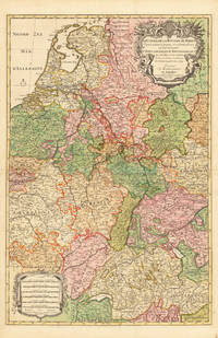
169233626Paris 1692. Schönes tadelloses Exemplar. . 803 by 560mm 31 by 22 inches. Hand-Colored Original Copperplate Engraving by Alexis-Hubert Jaillot & N. Sanson depicting Le Cours de la Riviere du Rhein depuis sa Source jusques a son Emboucheure ou sont distingues Tout les Estats et Souverainetes qui sont dessus et aux enuirons. Tire de tous les Memoires les plus Nouveaux Parle Sr. Sanson Geopgraphe Ordinaire du Roy. Published Paris 1692. Sheet: 803 by 560mm 31 by 22 inches. A fine and original hand-colored example of Jaillot's celebrated cartographic work documenting this region of Germany with the precision and decorative artistry characteristic of the 16900s. Alexis-Hubert Jaillot c.1632-1712 was one of the foremost French cartographers of the late 17th and early 18th centuries. Working in Paris he produced magnificent large-format maps of European territories often in collaboration with Nicolas Sanson -- considered the father of French cartography. Jaillot's maps are known for their striking decorative cartouches generous size and fine hand coloring representing the pinnacle of French Baroque cartography.This original copperplate engraving with original hand coloring depicts the region of Le Cours de la Riviere du Rhein depuis sa Source jusques a son Emboucheure ou sont distingues Tout les Estats et Souverainetes qui sont dessus et aux enuirons. Tire de tous les Memoires les plus Nouveaux Parle Sr. Sanson Geopgraphe Ordinaire du Roy published in Paris 1692. The map records the political and geographic boundaries of the region as understood in 1692 offering a fascinating window into the history of German territorial organization. Sheet measures 803 by 560mm 31 by 22 inches. In good condition overall with minor signs of age appropriate for a 17th-century engraving. Ready to frame. unknown
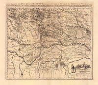
169319103Amsterdam: Pierre Mortier 1693-1700. Other. A strong impression in excellent condition. 490 by 580mm 19 by 22 inches. 490 by 580mm 19 by 22 inches. Original antique copper engraving uncolored from the 'Atlas Nouveau' published in Paris 1693. Depicting Mantua this map is a fine example of 1690s European cartography. Image: 490 by 580mm 19 by 22 inches. An attractive and historically significant 17th-century map for the discerning collector. Nicolas Sanson d'Abbeville 16001667 was the founder of the French school of cartography and arguably the most important French cartographer of the 17th century. Appointed Géographe Ordinaire du Roi to Louis XIII in 1630 he produced hundreds of maps that set a new standard for geographic accuracy and systematic coverage. His work was continued and expanded by Alexis-Hubert Jaillot and later by Pierre Mortier in Amsterdam ensuring that Sanson's surveys remained in use well into the 18th century. Maps bearing the Sanson name are prized for their scholarly precision large format and the elaborate cartouches that reflect the grandeur of the Sun King's court.Large detailed and interesting map by the famous French cartographer Nicolaus Sanson published in the famous sea atlas Le Neptune francois. in Amsterdam at Pierre Mortier. This interesting and large map was originally first published in the Atlas Noveau. by Alexis Hubert Jaillot & N. Sanson in Paris 1683-89. Alexis Hubert Jaillot & Nicolaus Jaillot worked as a royal cartographers for the French royal house for king Louis XIV. His maps published for the Atlas Nouveau. can be regarded as masterpieces of cartography in France in the ending 18th century. Also the maps impress by their accuracy and are providing an enormous amount of place names monasteries rivers trails fortifications etc. Shown is the duchy of Mantua Mantova in Northern Italy. Mantua is shown prominently in the center of the map. The map provides many place names detailed information on the river system also in the lower right corner a cartouche with a mileage scale and a table of explanations.A fine example from Atlas Nouveau Paris / Amsterdam sought after by collectors of antique maps of Italy antique maps of Mantua and antique copper engraving uncoloreds for sale. In good condition consistent with age. Shown is the duchy of Mantua Mantova in Northern Italy. Mantua is shown prominently in the center of the map. The map provides many place names detailed information on the river system also in the lower right corner a cartouche with a mileage scale and a table of explanations. Pierre Mortier unknown
1719E7CG2ENMSWHRParis: Hubert Jaillot 1719. Engraved map on 2 assembled sheets 54.5 x 88 cm. With title in decorated cartouche signed F.C. in upper right corner and scalebars in decorated cartouche in the lower left corner. Coloured in outline. Large map of the Pyrenees a mountain range on the border between France and Spain after Nicolas Sanson 1600-1675. Apparently printed from the original plates differing from the map issued in Mortier's "Jaillot-Atlas".Very good copy slightly browned.l Pastoureau Jail. II C map 166. Hubert Jaillot, unknown