266 résultats
1655M5583Paris 1655. Very Good. Size : 385x535 mm 15.125x21 Inches Coloring: Hand Colored Category: Maps Africa North unknown
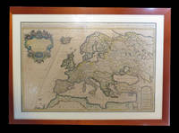
1666M1204Paris: Mariette Pierre 1666. Very Good. Size : 410x555 mm 16.125x21.875 Inches Coloring: Hand Colored Reference: Mojski Piotr Maria "Cartographia Rappersviliana Polonorum" page 388 number 32; Category: ; Maps Europe Poland Lithuania Mariette, Pierre unknown
1665M589Paris: Mariette Pierre 1665. Excellent. Size : 410x560 mm 16.125x22 Inches Coloring: Hand Colored Reference: Mojski Piotr Maria "Cartographia Rappersviliana Polonorum" page 387 number 31; Category: ; Maps Europe Poland Lithuania Mariette, Pierre unknown
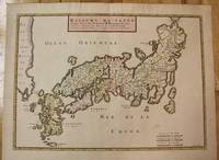
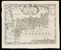
1656M8114Paris c.1656. Very Good. Size : 375x521 mm 14.76x20.51 Inches Coloring: Original Hand Coloring Category: Maps Asia Far East Japan & Korea; unknown
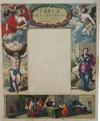
1650M2494Paris 1650. Very Good; light age toning; some browning on lower half of the map. Size : 547x433 mm 21.5x17 Inches Coloring: Original Hand Coloring Category: ; Maps Misc Curiosities Title Pages Games etc. unknown
166710027Paris 1667. No Binding. Near Fine. 12 ½ x 17 inches. Original outline color; excellent. Earliest map of Martinique listed in Phillips featuring attractive original color and an elegant cartouche. This map depicts the situation on the island before 1660 when it was still largely inhabited by natives and only about half of it had been claimed by colonists for sugar cane farming. The map goes so far as to mark with a printed line the partition dividing the "demeure des François" and the "demeure des savages." However by 1660 the entirety of the native population was either dead expelled or in slavery and Martinique was a full-fledged sugar cane-farming European colony. Phillips Maps P. 389. unknown books
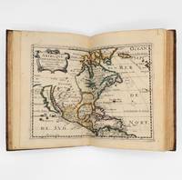
166925695Paris: Chez Pierre Mariette 1669. Copper-engraved map period hand colouring in outline. The most important French map of North America of its generation produced by the country's most esteemed family of cartographers.<br/> <br/>This very influential map was the official successor to Nicolas Sanson's 1650 map of North America. When Nicolas Sanson regarded as the father of the renaissance of cartography under Louis XIV died in July 1667 he left his flourishing business in the care of his eldest son Guillaume. The younger Sanson continued his father's partnership with the Mariette family who were prominent Parisian printers. Guillame was determined to publish a new updated edition of his father's Cartes Generales de toutes parties du Monde the first French general atlas originally published in 1657. The map of North America that appeared in the atlas although masterful was now considered to be geographically outdated. The present map which appeared in the second edition of the atlas featured updated toponymy and is geographically based on Nicolas Sanson's wall map of 1666 of which only two copies survive. While California is shown to be an island in line with popular perception unlike the map from 1650 it no longer attempts to build a geographical mythology in the place of the Pacific Northwest which was then totally unknown. Appropriately the magnificent baroque title cartouche which features swags and ribbons held aloft by putti has been placed to fill this enigmatic space. Cartographically the map appears to be based on Sanson's maps of "Le Canada ou Nouvelle France" and "Le Nouveau Mexique et La Floride." Lake Erie is shown in a recognizable form and the entire Great Lakes network is shown in greater detail than his father's map although the western lakes are still open-ended. On the East coast Long Island is shown and the shape of the Outer Banks is improved. Several Indian tribes are identified in New Mexico where the R. del Norte Rio Grande mistakenly flows from an interior lake and empties into the Mar Vermeio ou Mer Rouge Gulf of California. Iceland now appears in the Atlantic as well as a bit of Britain. The map proved to be highly successful and was sourced on numerous occasions by other mapmakers. The present copy is an example of Burden's first state of the map; a second state would be issued in 1690.<br/> <br/>Burden The Mapping of North America I 404; first state McCorkle New England in Early Printed Maps 669.4; McLaughlin California as an Island 45; Wagner Cartography of the Northwest Coast of America 399; Tooley "California as an Island" 8 in TooleyThe Mapping of America. Chez Pierre Mariette unknown books
169025648Paris: Chez Pierre Mariette 1690. Copper-engraved map period hand colouring in outline. Among the most important French maps of North America of the second half of the 17th century produced by the country's most esteemed family of cartographers.<br/> <br/>This very influential map was the official successor to Nicolas Sanson's 1650 map of North America. When Nicolas Sanson regarded as the father of the renaissance of cartography under Louis XIV died in July 1667 he left his flourishing business under the charge of his eldest son Guillaume. The younger Sanson continued his father's partnership with the Mariette family who were prominent Parisian printers. Guillame was determined to publish a new updated edition of his father's Cartes Generales de toutes parties du Monde the first French general atlas originally published in 1657. The map of North America that appeared in the atlas although masterful was now considered to be geographically outdated. The present map which appeared in the second edition of the atlas featured updated toponymy and is geographically based on Nicolas Sanson's wall map of 1666 of which only two copies survive. While California is shown to be an island in line with popular perception unlike the map from 1650 it no longer attempts to build a geographical mythology in the place of the Pacific Northwest which was then totally unknown. Appropriately the magnificent baroque title cartouche which features swags and ribbons held aloft by putti has been placed to fill this enigmatic space. Cartographically the map appears to be based on Sanson's maps of "Le Canada ou Nouvelle France" and "Le Nouveau Mexique et La Floride." Lake Erie is shown in a recognizable form and the entire Great Lakes network is shown in greater detail than his father's map although the western lakes are still open-ended. On the East coast Long Island is shown and the shape of the Outer Banks is improved. Several Indian tribes are identified in New Mexico where the R. del Norte Rio Grande mistakenly flows from an interior lake and empties into the Mar Vermeio ou Mer Rouge Gulf of California. Iceland now appears in the Atlantic as well as a bit of Britain. The map proved to be highly successful and was sourced on numerous occasions by other mapmakers. The present copy is an example of Burden's second state of the map with the date changed to 1690 in the cartouche and with additional place names and other changes: ".with minor alterations Terre de Jesso and Conibas inserted but without a coastline. Detroit d'Anian placed immediately above California and a few changes in spelling . New Albion is inserted in the north of the island and New York replaces New Amsterdam" Tooley.<br/> <br/>Burden The Mapping of North America 404 second state; McCorkle New England in Early Printed Maps 669.4; cf. McLaughlin California as an Island 45; cf. Wagner Cartography of the Northwest Coast of America 399; Tooley "California as an Island" 9 in TooleyThe Mapping of America. Chez Pierre Mariette unknown books
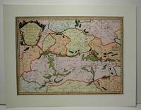
1700104160<p>Copper engraved map double page 24" x 20" hand colored and large uncolored title cartouches. Some minor soiling a little wear along centerfold with old verso repair normal aging; very good. Samson 1600-1667 is often referred to as the father of French cartography. Louis XIII was impressed with his work and appointed him "Geographe Ordinaire du Roi". During his career Sanson would produce about 300 maps and his major atlas "Cartes Generales de Toutes les Parties du Monde" would represent an important part of his body of work. While two of his sons continued publication of his maps after his death Pieter Schenk 1655-1718 an important publisher and engraver in his own right published this map. The map is attractively colored and gives a detailed view of the provinces of France. The map is also decorated with a large title cartouche. Bagrow p. 185. map hist website.</p> books
169648399Amsterdam: Pierre Mortier 1696. Engraved broadside map 19 x 23 5/8 inches plate mark dimensions with extensive pink and green wash. Some light browning but an attractive copy. Matted glazed and framed. One of two issues of this map this one being a bit larger based on the Thornton-Morden map of circa 1685. Pictures the colony from the Santee River to the South Edisto River and well inland up the Cooper River. Physical features and names of plantation and land owners are given in English "Nouveau Londre" on the Edistow sic River being exceptions; soundings are given at river mouths in Charleston Harbor and in the ocean along some beaches. Cumming Southeast in Early Maps 121. Kendall Early Maps of Carolina 17c: "This map has a wealth of names of owners of land in Carolina." <br/><br/> Pierre Mortier unknown books
1647WB16371Lutetiae Parisiorum: Sumptibus & Impensis Autoris 1647. Hardcover. Good. 16mo. Old leather; quite worn. pp 16 246 2. Liber primus only. <br/><br/> Sumptibus & Impensis Autoris hardcover books
1680264415Paris 1680. unbound. Map. Uncolored copper plate engraving. Image measures 7.5" x 10". 1680.<br/><br/> This map of southeast Asia and the East Indies is essentially two maps on a single sheet. The map on the left depicts the northern portion of the India Ganges region representing Burma Myanmar Thailand Cambodia Vietnam and Laos while the map of the right depicts the southern portion and includes the Malay Peninsula Singapore Sumatra. The most interesting feature is the Lacus Chimay Chimay Lake the mythical lake located in northern Burma which was believed to be the source of the river system in Southeast Asia. Important towns and cities are identified with beautifully rendered topography depicted in profile. Map is in very good condition with some toning along original centerfold which shows repairs on verso. Minimal foxing. <br><br>Nicolas Sanson 1600-1667 is considered the founder of the French school of cartography. In reaction to the prevailing trend of Dutch lavishness Sanson favored minimal details focusing rather on accurate cartography than ornament. This map is a fine example of his work.<br/><br/> unknown books
1663283501Paris 1663. unbound. very good. Map. Hand-colored engraving. 15" x 23".<br/><br/> This map of Sicily from the 17th century shows the entire island as well as the southwesternmost tip of the Italian peninsula. The names of the surrounding bodies of water are named in Latin and rivers mountains lakes and towns are noted on the map. Nicolas Sanson 1600-1667 is considered the founder of the French school of cartography. In reaction to the prevailing trend of Dutch lavishness Sanson favored minimal details focusing rather on accurate cartography than ornament. This map is a fine example of his work.<br/><br/> unknown books
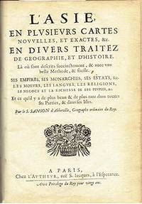
1656006682Paris: Chez l'Autheur 1656. First Edition . Full Calf. Very Good. 4to. 23.5 by 17.5 cm. Unpaginated 100 pages of text plus 2 pp. of ads. With 18 copper engraved maps all two page plates each with hand-colored of boundaries. Maps include one of the entire continent then of its various regions as then known plus the islands off the continent. Also a map of Malta. Bound in contemporary calf. Condition: calf dry and rubbed on spine and joints and edges rubbed. Light to moderate soiling in the margins of the pages. Two bookplates -- one of the Marquis of Lothian the other the Newbattle Abbey Library. <br /><br /> Chez l'Autheur books
1652006683Paris: Chez l'Autheur 1652. First Edition . Full Calf. Very Good. 4to. 23.5 by 17.5 cm. Unpaginated 102 pages of text plus 2 pp. of ads 1 Royal privilege page. With 17 copper engraved maps all two page plates each with hand-colored of boundaries. Maps include one of the entire continent then of its various regions as then known plus island groups. Separate maps for China and Japan. Bound in contemporary calf. Condition: Rebacked with joints making this obvious. Calf dry and rubbed on spine and joints and edges rubbed. Light to moderate soiling in the margins of the pages. Edge of a few leaves with short stretch slightly chewed-looking. Two bookplates -- one of the Marquis of Lothian the other the Newbattle Abbey Library. <br /><br /> Chez l'Autheur books
1652010748twParis: Sanson. Very Good. 1652. A very rare map from Nicolas Sanson. Imprint bears the date of 1652 although it is possible that this copy came from an atlas in the later 1600s. Light toning and edgewear with one corner slightly chipped. Light soil on lower margin. Hand-colored boundaries. Map borders measure 14" x 20 3/4". California is shown as an island and Terre Australe is a vague line encircling the Antarctic. Terre de Iesso is the name given to the land mass northwest of North America. Sanson 1600-1667 published many map versions of the world and is known as "the father of French cartography." ; 16 1/2" x 22 1/4" . Sanson unknown books
1652287521Abbeville: Nicolas Sanson 1652. unbound. Map. Engraving with original outline hand coloring. Image measures 15 1/2" x 20 1/2". Shows light foxing and some mat burn.<br/><br/> A beautiful and unususual double hemisphere hydrological world map from the mid 17th century. Shows and highlights all bodies of water including oceans gulfs lakes straits and rivers. Wonderful light hachure marks hint of a land mass in Terre Australe. Nicolas Sanson 1600-1667 is considered the founder of the French school of cartography. In reaction to the prevailing trend of Dutch baroque design Sanson favored minimal details focusing rather on accurate cartography than ornament. Shirley R.W. World 394<br/><br/> Nicolas Sanson unknown books
1652251161Paris 1652. unbound. Map. Engraving with hand outline color. Image measures 14 x 16.5%u201D.<br/><br/> This map of southeastern France includes the erstwhile provinces of Dauphiné corresponding roughly to the present departments of Isère Drôme and Hautes-Alpes as well as parts of Savoye and Bresse. At the time of the map%u2019s publication in 1652 Dauphiné was under the absolutist rule of King Louis XIV. The cartographer Nicolas Sanson as Royal Geographer to Louis XIV as well as Louis III likely understood the importance of this region to French interests of the time. The map thusly provides ample detail about the area including cities rivers mountains and significant forts. Hand-colored outlines indicate political boundaries. An elegant cartouche in the upper right corner of the map displays the title amidst scrollwork topped with the crown of the French monarchy. The map is in very good condition with full margins and no chips or tears. Nicolas Sanson 1600-1667 is considered the founder of the French school of cartography. In reaction to the prevailing trend of Dutch lavishness Sanson favored minimal details focusing rather on accurate cartography than ornament. This map points to his significant role within the French monarchy.<br/><br/> unknown books
1648251162Paris 1648. unbound. Map. Engraving with hand outline color. Image measures 14.5 x 21.5 inches.<br/><br/> This map of Switzerland centers on Lucerne covering approximately the area from Lake Constance south to Lake Como in Italy. Published in 1648 the map dates to the period of the Old Swiss Confederacy. Furthermore it predates by only a few years the Swiss Peasant War of 1653 a siege of Lucerne and Bern that demonstrated the significance of the rural population to the confederacy%u2019s stability. Hand-colored outlines on the map indicate the various independent states that made up the confederacy. A title cartouche with elaborate scrollwork adorns the lower right corner of the map. The map is in good condition with full margins and no chips or tears. Wear to lower margin. Nicolas Sanson 1600-1667 is considered the founder of the French school of cartography. In reaction to the prevailing trend of Dutch lavishness Sanson favored minimal details focusing rather on accurate cartography than ornament. This map demonstrates the skill that made him such a valuable asset to the French monarchy.<br/><br/> unknown books
1683297468Paris 1683. unbound. Map. Copper engraving with hand coloring. Image measures 7 5/8 x 11 1/4 inches.<br/><br/> This map published in Paris in Afrique en plusieurs cartes is one of Sanson's small atlas maps of depicting various African regions. This map offers extensive detail on the cities of North Africa as well as topographical and geographical features with mountains beautifully rendered in profile. Nicolas Sanson 1600-1667 is considered the founder of the French school of cartography. In reaction to the prevailing trend of Dutch lavishness Sanson favored minimal details focusing rather on accurate cartography than ornament. This map is a fine example of his work.<br/><br/> unknown books
1690192941690. S.l. Alexis Hubert Jaillot 1680. Une grande carte 892 x 592 mm composÂŽe de deux feuillets contrecollÂŽs sous cadre moderne. Attractive 892 x 592 mm carte de la fin du XVIIÂme avec rehauts aquarellÂŽs du temps. Elle s'orne d'un important cartouche aux armes du Grand Dauphin Louis de France et s'agrÂŽmente en marge gauche de la figuration de vaisseaux ayant pris part ˆ un combat naval. Kupcik Cartes gÂŽographiques anciennes p. 159. Papier trÂs lÂŽgÂrement oxydÂŽ. PrÂŽsence de rares et claires rousseurs ou petites t‰ches. Deux plissures et une infime perforation en marge supÂŽrieure droite. Du reste belle condition. b42961 unknown
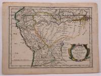
1657W2347Paris: Chez Sanson 1657. Image is 8 1/8 inches by 11 inches on a folded sheet measuring 9 inches by 12 13/16 inches. Original hand-colored copper-engraved map from Sanson's atlas of maps of the Americas: L'Amerique en Plusieurs Cartes. It is a map of the Viceroyalty of Peru that displays the Amazon River and its many tributaries. Nicolas Sanson 1600-1667 was the official geographer for the king of France. His map of Peru and the Amazon became the standard that was copied by almost all geographers/cartographers--even reproduced by Bion for his 1700 treatise on globes. Cintra and Oliveira argue that Sanson's map was a scientific one that holds up well even when compared to 21st century maps of the region. The map is in about very good condition: clean with bright original outline color; minimal foxing ; some edgewear and soiling in the margins. . First Edition. Single Sheet. Very Good-. 8 1/8 inches by 11 Inches. Map. Chez Sanson
1657375003Paris: Chez L'Autheur 1657. 15 engraved double-page maps hand colored in outline. 4 40 of 42 unpaginated text leaves lacks final two leaves of text. 4to. Contemporary mottled calf gilt raised spine bands repairs at joints. Lacks final two leaves of text after the map of Brazil. 15 engraved double-page maps hand colored in outline. 4 40 of 42 unpaginated text leaves lacks final two leaves of text. 4to. First edition of important and quite handsome 17th-century French atlas of the Americas. This atlas was first published in 1657 and stands as a beautiful cartographic record of America for the 17th century. Sanson was official cartographer to the King. The maps include detailed charts of North South and Central America the West Indies Canada Mexico Florida and the southeast and a map of New Mexico showing most of the Spanish southwest territory with California depicted as an island. An impressive and detailed atlas for the time. The maps are titled as follows:<br /> 1 Americque Septentriole<br /> 2 Le Canada ou Nouvelle France &c.<br /> 3 La Floride<br /> 4 Audience de Mexico<br /> 5 Audience de Guadalajara Nouveau Mexique Californie &c.<br /> 6 Audience de Guatimala<br /> 7 Les Isles Antilles &c.<br /> 8 Amerique Meridionale<br /> 9 Terre Ferme Nouveau royme de Grenade &c.<br /> 10 Guiane divisee en Guiane et Caribane<br /> 11 Le Perou et le cours de la rivre Amazone<br /> 12 Le Chili<br /> 13 Le Brasil<br /> 14 Le Paraguay subdivise en ses principales parties suivant les dernieres relaons<br /> 15 Destroit de Magellan Terre et Isles Magellanicques &c. Sabin 76708; Phillips Atlases 1151; Streeter sale 68 undated edition; Leighley California as an Island plate 9 Chez L'Autheur unknown
16626235Paris: Chez L'autheur 1662. Book. Good. Full-Leather. 4to - over 9¾" - 12" tall. 104 pages. Text only lacking all maps. Sound leather binding a little war at the top of the spine. No publication date assumed 1662. Chez L'autheur Hardcover
169915831Amsterdam: Chez Arnout van Ravenstein 1699. 222 by 272mm. 8.75 by 10.75 inches. Engraved map. Second state of the plate first published in Halma's pirated edition of Sanson's 'L'Asie en plvsiers cartes nouvelles et exactes; ' as part of 'L'Europe; L'Asie; L'Amerique en Pluiers Cartes' 1683. A direct copy of Sanson's map of 1652 the only differences being the lack of a privilege and a date in the cartouche the addition of the signature of the engraver Antoine de Winter in the lower left corner. This issue is distinguished by the addition of mountains added in 'Isle de Corey' and 'Terre de Iesso'; and the 'Mer de Japan' above 'Oriental'. Francois Halma 1653-1722 set up his printing business in Utrecht in 1674 where he issued a number of pirated maps and atlases. In this instance since Sanson was dead Halma may have felt that there no harm and much profit to be gained from re-printing his work. The engraver Antoine de Winter c1652-1700 achieved some notoriety for plagiarizing Petter Gedda's charts of the Baltic Sea selling them on to Loots and Doncker for inclusion in their atlases who were subsequently sued and ordered to surrender the plates and pay a fine of 300 florins. Sanson originally credited "Caardin sic Varenius" and 'others' for his map. Generally the geography follows that of Moreira/Blancus only a small portion of the eastern coast of Korea is shown without stating whether it is an island or not and there is only a hint of Hokkaido in the far northeast corner with the place name Matzumay. Varenius or Bernhard Varen fl1622-1650 was a German physician geographer and natural historian. He settled in Amsterdam and was a friend of the Blaeu family. He published 'Descriptio regni Japonia ' in 1649 and came to be known as 'the father of physical geography' Hubbard. Sanson 1600-1667 was a French mapmaker. He supposedly began to make maps to supplement his study of history and a map of Ancient Gaul made early in his career brought him to the attention of Cardinal Richelieu. This foothold in the French court allowed him to rise to the position of Geographe du Roi teaching both Louis XIII and Louis XIV. Louis XIII even made him a counsellor of state. Sanson produced an atlas 'Cartes Generales de Toutes les Parties du Monde' which contained important maps of the post roads and waterways of France. He also produced two major maps of North America: 'Amerique Septentrionale' 1650 was the first map to show the Great Lakes in a recognisable form aided by Sanson's access to The Jesuit Relations a collection of accounts by French missionaries to the area. The map was also drawn on a sinusoidal projection which Sanson was the first to use. In 1656 he made 'Le Canada ou Nouvelle France' which showed the Great Lakes in greater detail and included accurate representations of the Hudson Bay area the Delaware and the Gulf of Saint Lawrence. After Sanson's death the business was carried on by his two surviving sons and grandson in partnership with Hubert Jaillot. Sanson family members were revered among the foremost map makers in France for nearly a century. A leading exemplar of the French school of seventeenth-century cartography Nicholas Sanson I is widely regarded as the founder of modern geography and it is generally held that the so called "Great Age" of French cartography originated with his publications Hubbard 51.2. Chez Arnout van Ravenstein, unknown