946 résultats
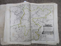
16-6140Paris: 1653. Folio. 30 x 43.2cm. Defective contemporary thick paper covers. Title page and dedication page with losses. Handcolored in outline. One map with loss in lower right corner and one map with tear in lower right corner Sixteen double page maps complete some with waterstains visible verso.Rare to find such a large ensemble of Sanson's maps. Reference: Bibliothèque nationale de France; ark:/12148/btv1b530780775/; Bibliothèque nationale de France département Cartes et plans GE A-592 RES . Paris: 1653. unknown
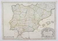
1658356952Paris.: Tavernier. 1658. Dampstain cover mot of the image also some coffee spots otherwise good. 42.5x57.2x.01 cm. Image size 41x55.5 to neatline. An uncommon map of Spain and Portugal with outline color. weight: 0.1 lb. Engraved by Melchior Tavernier. Tavernier. unknown
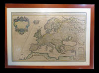
1690192941690. S.l. Alexis Hubert Jaillot 1680. Une grande carte 892 x 592 mm composÂŽe de deux feuillets contrecollÂŽs sous cadre moderne. Attractive 892 x 592 mm carte de la fin du XVIIÂme avec rehauts aquarellÂŽs du temps. Elle s'orne d'un important cartouche aux armes du Grand Dauphin Louis de France et s'agrÂŽmente en marge gauche de la figuration de vaisseaux ayant pris part ˆ un combat naval. Kupcik Cartes gÂŽographiques anciennes p. 159. Papier trÂs lÂŽgÂrement oxydÂŽ. PrÂŽsence de rares et claires rousseurs ou petites t‰ches. Deux plissures et une infime perforation en marge supÂŽrieure droite. Du reste belle condition. b42961 unknown
1812006820Paris: Chez Jean Md d'Estampes 1812 Engraving 59 x 90 cm old color. The first edition of this map was published in 1674 by Hubert Jaillot under the title "La Russie Blanche ou Moscovie divisee suivant l'étendue des Royaumes Duches." It was incorporated into numerous atlases by Jaillot and his successors until approximately 1720 when it became evidently outdated. However around 1812 it was reissued likely to illustrate the French-Russian war. Chez Jean Md d'Estampes unknown
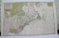
1698M3704Paris 1698. Excellent. Notes: Rather rare original coloured version of this map an important 17th century map of the Great Lakes and East coast with an inset map of Boston.<br><br>Cumming qtd in Arkway: "in spite of its scope and size it has a good deal of information for the Carolina Coast".<br><br>This map by Sanson first appeared in Mortier's sea atlas "Le Neptune Francois"; interestingly it is not generally found in Sanson or Jaillot atlases. Size : 650x924 mm 25.625x36.375 Inches Coloring: Original Hand Coloring Reference: Arkway 58:23 Category: Maps Canada East; Maps United States New England unknown
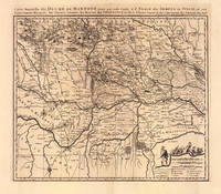
169319103Amsterdam: Pierre Mortier 1693-1700. Other. A strong impression in excellent condition. 490 by 580mm 19 by 22 inches. 490 by 580mm 19 by 22 inches. Original antique copper engraving uncolored from the 'Atlas Nouveau' published in Paris 1693. Depicting Mantua this map is a fine example of 1690s European cartography. Image: 490 by 580mm 19 by 22 inches. An attractive and historically significant 17th-century map for the discerning collector. Nicolas Sanson d'Abbeville 16001667 was the founder of the French school of cartography and arguably the most important French cartographer of the 17th century. Appointed Géographe Ordinaire du Roi to Louis XIII in 1630 he produced hundreds of maps that set a new standard for geographic accuracy and systematic coverage. His work was continued and expanded by Alexis-Hubert Jaillot and later by Pierre Mortier in Amsterdam ensuring that Sanson's surveys remained in use well into the 18th century. Maps bearing the Sanson name are prized for their scholarly precision large format and the elaborate cartouches that reflect the grandeur of the Sun King's court.Large detailed and interesting map by the famous French cartographer Nicolaus Sanson published in the famous sea atlas Le Neptune francois. in Amsterdam at Pierre Mortier. This interesting and large map was originally first published in the Atlas Noveau. by Alexis Hubert Jaillot & N. Sanson in Paris 1683-89. Alexis Hubert Jaillot & Nicolaus Jaillot worked as a royal cartographers for the French royal house for king Louis XIV. His maps published for the Atlas Nouveau. can be regarded as masterpieces of cartography in France in the ending 18th century. Also the maps impress by their accuracy and are providing an enormous amount of place names monasteries rivers trails fortifications etc. Shown is the duchy of Mantua Mantova in Northern Italy. Mantua is shown prominently in the center of the map. The map provides many place names detailed information on the river system also in the lower right corner a cartouche with a mileage scale and a table of explanations.A fine example from Atlas Nouveau Paris / Amsterdam sought after by collectors of antique maps of Italy antique maps of Mantua and antique copper engraving uncoloreds for sale. In good condition consistent with age. Shown is the duchy of Mantua Mantova in Northern Italy. Mantua is shown prominently in the center of the map. The map provides many place names detailed information on the river system also in the lower right corner a cartouche with a mileage scale and a table of explanations. Pierre Mortier unknown
169648399Amsterdam: Pierre Mortier 1696. Engraved broadside map 19 x 23 5/8 inches plate mark dimensions with extensive pink and green wash. Some light browning but an attractive copy. Matted glazed and framed. One of two issues of this map this one being a bit larger based on the Thornton-Morden map of circa 1685. Pictures the colony from the Santee River to the South Edisto River and well inland up the Cooper River. Physical features and names of plantation and land owners are given in English "Nouveau Londre" on the Edistow sic River being exceptions; soundings are given at river mouths in Charleston Harbor and in the ocean along some beaches. Cumming Southeast in Early Maps 121. Kendall Early Maps of Carolina 17c: "This map has a wealth of names of owners of land in Carolina." <br/><br/> Pierre Mortier unknown books
48819Large atlas of Versailles and the surrounding towns with twelve maps total including one map depicting the overall area covered in the atlas and eleven more detailed maps covering the towns and immediate surroundings of Mantes Poissy St. Denis Crépieres Versailles Paris Montfor l'Amaury Chevreuse Sceaux Rambouillet Arpajon and Corbeil. Very minor scattered soiling or toning very fine condition. Elephant folio sheet size 32 x 22 inches. Original full calf binding with handwritten label affixed to front cover. Some minor scattered soiling and abrasions minor wear consistent with age. Paris Dépôt de la Guerre n.d. circa 1807. This suite of maps was commissioned by Louis XV to represent his hunting territories around Versailles and stemmed from his obsession with hunting coupled with a decision to copy an old map of the Duchy of Rambouillet. The maps are the result of three surveys of the land conducted between 1764 and 1773. The first nine maps including the overview were completed in the late 18th century under the reign of Louis XVI but the work was put on hold at the time of the Revolution when the credits allocated for completing the work were taken away by the National Convention. The last four maps were not completed until 1807 after Napoléon became Emperor. These maps are notable for their precision and the multitude of details represented including roads land use features such as plowing meadows vegetable crops barns and parks and hydrography. For his work on these maps Berthier was granted nobility status. A spectacular and scarce volume of beautiful maps; as of January 2018 WorldCat locates only two holdings in North America. unknown books
1988R240077316A COMPTE D'AUTEUR. 1988. In-8. Broché. Etat d'usage, Tâchée, Agraffes rouillées, Pliures. Catalogue de 19 pages - annotation sur le 1er plat - coins légèrement frottés - quelques prix annotés au stylo bleu en face des intitulés des oeuvres.. . . . Classification Dewey : 708-Galeries, musées, collections d'art
1990R240077928A COMPTE D'AUTEUR. 1990. In-8. Broché. Etat d'usage, Couv. convenable, Agraffes rouillées, Intérieur frais. Catalogue d'environ 12 pages - petite annotation au stylo bleu sur la page de titre - illustration en couleurs sur le 1er plat.. . . . Classification Dewey : 708-Galeries, musées, collections d'art
269694Paris: Nicolas Sanson. unbound. Map. Uncolored copper engraving. Image measures 15 3/4" x 19 3/4". c.1660.<br/><br/> This elegant circa 1660 map by Nicolas Sanson features the famous French winemaking region of Champagne and the cheese making region of Brie. It extends south from the regions of Picardie to Burgundy and from Isle de France east to Lorraine. The map notes several towns and rivers with beautifully rendered mountains and forests throughout. An engraved grape surround cartouche features cherubs on the top left and the bottom right scale is surrounded by cherubs with mapping tools. The map has a stain in the upper right margin with minor foxing and minimal wear along the centerfold. Minor edge wear.<br><br>Nicolas Sanson 1600-1667 is considered the founder of the French school of cartography. This map is a fine example of his work and a pleasure to see black and white.<br/><br/> Nicolas Sanson unknown books
2000Q-0967763908Quailmark Books Llc 2000-01-01. hardcover. New. In shrink wrap. Looks like an interesting title! Quailmark Books Llc hardcover
2004R240004050EDITIONS PAROLE ET SILENCE. 2004. In-12. Broché. Parfait état, Couv. fraîche, Dos satisfaisant, Intérieur frais. 90 pages. Nombreuses annotations au crayons a papier.. . . . Classification Dewey : 200-RELIGION
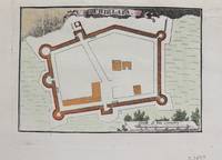
1690M9479Paris c.1690. Very Good. Notes: Map of Chielafa Greece during the late 17th century. Size : 105x152 mm 4.13x5.98 Inches Coloring: Hand Colored Category: Maps Europe Greece Macedonia; unknown
3251Americas: Amsterdam Francois Halma 1705. Copper engraved map of Chili by N. Sanson from Halma's Algemeene Werelde Beschryving Vol. 3 Black and white; title in Dutch; verso blank; strapwork title cartouche. Small version of Sanson's important map of Chili showing the Cuyo provinces. The map is based on the descriptions of Alfonso de Ovalle. This map appeared in Algemeene Weereld-Beschryving nae de Rechte Verdeeling der Landschappen Plaetsen Zeeën Rivieren &c. Geographisch Politisch Historisch Chronologisch en Genealogisch a Dutch edition of A. Phérotée de la Croix's Nouvelle Methode Pour Apprendre Facilement la Geographie Universelle which first appeared in 1690. Dark impression. Nicolas Sanson d'Abbeville.1600-67 ' father of the French cartography' and founder of the Sanson firm. Atlas ' Cartes générales de toutes les parties du Monde' 1658-70 and a pocket atlas in 4 parts 1652-1705. Sanson's small maps from A. Phérotée de la Croix's Nouvelle Methode Pour Apprendre Facilement la Geographie Universelle. first published in 1652 and engraved by A. Peyrounin were copied several times by various map publishers. Johann David Zunners made copies of Sanson's maps for his German translation of Die Gantze Erd-Kugel in 1679. Johannes Ribbius and Simon de Vries published copies in 1682 and 1683 with new maps engraved by Antoine d'Winter. The plates were later sold to Francois Halma who used them in 1699 and then again in 1705 with the titles re-engraved in Dutch. François Halma 1653 - 1722 Dutch publisher/printer; dealer/auction house. Cartographer and publisher of maps active in Utrecht Amsterdam Franeker and Leeuwarden. Published 'Description de l'Univers' 1700; 'Algemene Wereldtbescrijving' 1705; 'Corpus Inscriptionum' 1707 and 'Lexicon Philosophicum' 1713. Keoman: Hal 1; Phillips 528. Americas South America Chili Amsterdam Francois Halma 1705 unknown
1995ABE-1655801755460196 PAGES-19 CM X 27 CM-DOSSIER VERONIQUE SANSON-PANTHEON: FRANCIS LEMARQUE-(EM622)
1993ABE-1655803362898196 PAGES-19 CM X 27 CM-DOSSIER ROMAIN DIDIER-(EM622)
1723209708Amsterdam: Mortier Pieter 1723. unbound. very good. Map. Engraving with hand outline. Image measures 14" x 18.75".<br/> <br/> Beautifully detailed map showing the area between the the Black and Caspian Seas including modern day Russia Georgia Azerbaijan Armenia and Turkey. Full original margins have minor stains. Based on the plates by Nicolas Sanson 1600-1667 who is considered the founder of the French school of cartography. In reaction to the prevailing trend of Dutch lavishness Sanson favored minimal details focusing rather on accurate cartography than ornament.<br/> <br/> Mortier, Pieter unknown
1723209708Amsterdam: Mortier Pieter 1723. unbound. very good. Map. Engraving with hand outline. Image measures 14" x 18.75".<br/><br/> Beautifully detailed map showing the area between the the Black and Caspian Seas including modern day Russia Georgia Azerbaijan Armenia and Turkey. Full original margins have minor stains. Based on the plates by Nicolas Sanson 1600-1667 who is considered the founder of the French school of cartography. In reaction to the prevailing trend of Dutch lavishness Sanson favored minimal details focusing rather on accurate cartography than ornament.<br/><br/> Mortier, Pieter unknown books
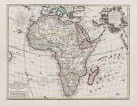
1595100047AG1595. Paris / London / Antwerp and other places of print c.1595 - 1851. Some stunning examples of hand-coloured copper-engravings plus one manuscript map Tuckey / Congo - Zaire. All of these maps in very good / excellent condition. This collection presents itself for becoming an amazing a meaningful starting-point for an Africana-Collection decoration for a Safari-Lodge interior-design for an Africana-themed library etc. etc. The price includes worldwide free shipping per DHL Express-Courier 2-3 day-delivery. Ask for complete list and images and please also inquire about our amazing book-collection of Africana which would be a great match for this collection of vintage maps. unknown
1950158225Rome: Unitalia Film / IFE 1950. Collection of 14 vintage oversize promotional brochures for Italian and international actresses. Each brochure features a one-page biography in Italian and a full-page black-and-white photograph of each actress. <br /> <br /> Actresses represented are Sylvana Mangano Isa Miranda Annamaria Gerrero Yvonne Sanson Alida Valli Delia Scala Ingrid Bergman Silvana Pampanini Lea Padovani Lucia Bose Eleanora Rossi Gina Lollobrigida Carla Del Poggio and Anna Magnani. <br /> <br /> 11 x 14.25 inches folded once vertically as issued with a company statement on the verso. Very Good plus overall some with light toning and foxing and a few with short tears. Unitalia Film / IFE unknown
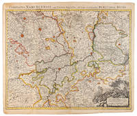
1710009138Amsterdam: Pierre Mortier 1710 Cooper engraving 50.5 x 60.5 cm on paper measuring 54.0 x 63.0 cm with original color in outline minor spotting and creasing remnants of centerfold paper slightly frayed at edges. A good copy of an uncommon map of the province of Namur a region of the Spanish Netherlands published in Amsterdam by Pierre Mortier to illustrate events of the War of the Spanish Succession. Pierre Mortier unknown
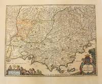
1656M6320Paris 1656. Very Good. Notes: This map shows the southern coast of France. Size : 425x535 mm 16.75x21 Inches Coloring: Original Hand Coloring Category: Maps Europe France unknown
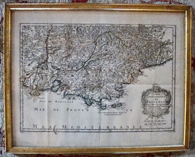
16697613À Paris chez l'autheur. Encadré Très bon Paris 1669 1669 44 x 55 cm avec son cadre ancien.