Rosemonde SansonBiblio.com
442 résultats
1976I-352-508Flammarion 1976. Paperback. Good. Edition 1976. Ammareal gives back up to 15% of this item's net price to charity organizations. Flammarion paperback
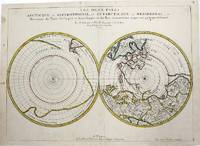
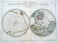
1657M954Paris 1657. Very Good; some occasional mild browning. Notes: 17th century French map of Arctic and Antarctic regions. It was published in Cartes générales de toutes les parties du monde. <br><br>Nicolas Sanson 1600–1667 was a renowned French cartographer termed by some as the "father of French cartography." His works are known for their incorporation of the most up to date information of the time and their clean modern style. Size : 390x537 mm 15.375x21.125 Inches Coloring: Hand Colored in outline Category: ; Maps Polar Arctic Regions; Maps Polar Antarctic Regions unknown
16575033Paris 1657. Par N. Sanson d'Abbeville Geographe ordre du Roy. Spence 3017 lists a slightly different title but undoubtedly the same map. 53x38 cms. Period outline color central fold very good condition. A double hemisphere map to the North and South poles. The North pole is connected to Greenland and Spitzbergen but there is little other detailed coastline in the polar area. Europe Russia and Canada are delineated. The South pole is based on the great unknown Southland of Magellan. The tip of S. America is shown and a large land mass which encompasses the whole of the hemisphere but nothing else. unknown
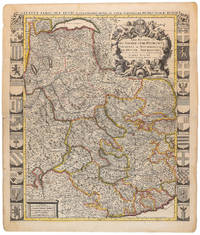
1710009139Amsterdam: Pierre Mortier 1710 Cooper engraving 58.0 x 50.5 cm on paper measuring 63.0 x 54.0 cm with original color in outline minor spotting and creasing remnants of centerfold paper slightly frayed at edges. A good copy of an uncommon map of Savoy and Piedmont published in Amsterdam by Pierre Mortier to illustrate events of the War of the Spanish Succession. Surrounded by twenty-two coats of arms representing various provinces. Pierre Mortier unknown
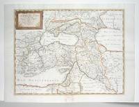
1660M2926Paris: Mariette Pierre 1660. Very Good; some browning on the lower margin near the fold. Size : 407x517 mm 16x20.375 Inches Coloring: Hand Colored Category: ; Maps Mediterranean Sea; Maps Asia Near East Turkey; Mariette, Pierre unknown
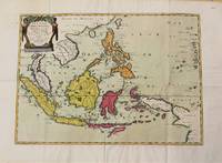
1654M10780Paris 1654. Very Good. Notes: Detailed map of Southeast Asia by Nicholas Sanson 1600-1667 renowned French cartographer. Size : 402x560 mm 15.83x22.05 Inches Coloring: Original Hand Coloring Category: Maps Asia South East Indonesia & Papua New Guinea; Maps Asia South East Thailand Laos Vietnam Cambodia & Burma / Myanmar; Maps Asia South East Philippines; unknown
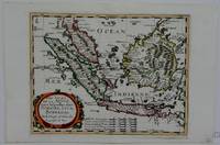
1660M5006Paris 1660. Excellent. Notes: French map of South East Asia. Size : 195x250 mm 7.625x9.875 Inches Coloring: Hand Colored Category: ; Maps Asia South East Malaysia & Singapore; Maps Asia South East Indonesia & Papua New Guinea unknown
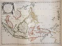
165461177<p>40.1 x 56 cm original outline hand-colour copper engraving. EXTREMELY RARE map probably from ''Cartes generales de toutes les parties du monde' . Condition: with folds as issued with water stains and professionally repaired tear on lower left margin not affecting plate. Reference: Quirino p. 83; BMC Printed Maps XII col.867; Cat.Nat.mar.Mus.271 map 15; Nordenskiöld 275 vol.1 map 17; pastoureau Sanson V map 12.</p> Pierre Mariette, Paris.
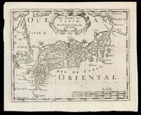
169915831Amsterdam: Chez Arnout van Ravenstein 1699. 222 by 272mm. 8.75 by 10.75 inches. Engraved map. Second state of the plate first published in Halma's pirated edition of Sanson's 'L'Asie en plvsiers cartes nouvelles et exactes; ' as part of 'L'Europe; L'Asie; L'Amerique en Pluiers Cartes' 1683. A direct copy of Sanson's map of 1652 the only differences being the lack of a privilege and a date in the cartouche the addition of the signature of the engraver Antoine de Winter in the lower left corner. This issue is distinguished by the addition of mountains added in 'Isle de Corey' and 'Terre de Iesso'; and the 'Mer de Japan' above 'Oriental'. Francois Halma 1653-1722 set up his printing business in Utrecht in 1674 where he issued a number of pirated maps and atlases. In this instance since Sanson was dead Halma may have felt that there no harm and much profit to be gained from re-printing his work. The engraver Antoine de Winter c1652-1700 achieved some notoriety for plagiarizing Petter Gedda's charts of the Baltic Sea selling them on to Loots and Doncker for inclusion in their atlases who were subsequently sued and ordered to surrender the plates and pay a fine of 300 florins. Sanson originally credited "Caardin sic Varenius" and 'others' for his map. Generally the geography follows that of Moreira/Blancus only a small portion of the eastern coast of Korea is shown without stating whether it is an island or not and there is only a hint of Hokkaido in the far northeast corner with the place name Matzumay. Varenius or Bernhard Varen fl1622-1650 was a German physician geographer and natural historian. He settled in Amsterdam and was a friend of the Blaeu family. He published 'Descriptio regni Japonia ' in 1649 and came to be known as 'the father of physical geography' Hubbard. Sanson 1600-1667 was a French mapmaker. He supposedly began to make maps to supplement his study of history and a map of Ancient Gaul made early in his career brought him to the attention of Cardinal Richelieu. This foothold in the French court allowed him to rise to the position of Geographe du Roi teaching both Louis XIII and Louis XIV. Louis XIII even made him a counsellor of state. Sanson produced an atlas 'Cartes Generales de Toutes les Parties du Monde' which contained important maps of the post roads and waterways of France. He also produced two major maps of North America: 'Amerique Septentrionale' 1650 was the first map to show the Great Lakes in a recognisable form aided by Sanson's access to The Jesuit Relations a collection of accounts by French missionaries to the area. The map was also drawn on a sinusoidal projection which Sanson was the first to use. In 1656 he made 'Le Canada ou Nouvelle France' which showed the Great Lakes in greater detail and included accurate representations of the Hudson Bay area the Delaware and the Gulf of Saint Lawrence. After Sanson's death the business was carried on by his two surviving sons and grandson in partnership with Hubert Jaillot. Sanson family members were revered among the foremost map makers in France for nearly a century. A leading exemplar of the French school of seventeenth-century cartography Nicholas Sanson I is widely regarded as the founder of modern geography and it is generally held that the so called "Great Age" of French cartography originated with his publications Hubbard 51.2. Chez Arnout van Ravenstein, unknown
1719E7CG2ENMSWHRParis: Hubert Jaillot 1719. Engraved map on 2 assembled sheets 54.5 x 88 cm. With title in decorated cartouche signed F.C. in upper right corner and scalebars in decorated cartouche in the lower left corner. Coloured in outline. Large map of the Pyrenees a mountain range on the border between France and Spain after Nicolas Sanson 1600-1675. Apparently printed from the original plates differing from the map issued in Mortier's "Jaillot-Atlas".Very good copy slightly browned.l Pastoureau Jail. II C map 166. Hubert Jaillot, unknown
1648251162Paris 1648. unbound. Map. Engraving with hand outline color. Image measures 14.5 x 21.5 inches.<br/> <br/> This map of Switzerland centers on Lucerne covering approximately the area from Lake Constance south to Lake Como in Italy. Published in 1648 the map dates to the period of the Old Swiss Confederacy. Furthermore it predates by only a few years the Swiss Peasant War of 1653 a siege of Lucerne and Bern that demonstrated the significance of the rural population to the confederacy's stability. Hand-colored outlines on the map indicate the various independent states that made up the confederacy. A title cartouche with elaborate scrollwork adorns the lower right corner of the map. The map is in good condition with full margins and no chips or tears. Wear to lower margin. <br> <br> Nicolas Sanson 1600-1667 is considered the founder of the French school of cartography. In reaction to the prevailing trend of Dutch lavishness Sanson favored minimal details focusing rather on accurate cartography than ornament. This map demonstrates the skill that made him such a valuable asset to the French monarchy.<br/> <br/> unknown
2005H-405-5922005. Paperback. Good. Former library book. Different cover. Different publisher. Ammareal gives back up to 15% of this item's net price to charity organizations. paperback
BN105021Softcover. Les yeux bleus - la non-voyance vous écrit <br/><br/>Les yeux bleus - la non-voyance vous écrit paperback
ria9781019396056_inpHardcover. New. New Book; Fast Shipping from UK; Not signed; Not First Edition; N/A hardcover
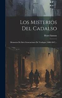
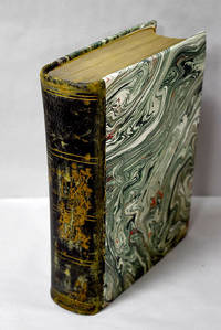
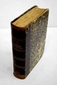
3136661Manini Hnos. Hardcover. Lomo rozado. Good. 22 cm. 860 p. Encuadernación en tapa dura artesanal. Con láminas . Lomo rozado. Literatura.82 82 Manini Hnos. hardcover
18633691903Madrid.: Manini Hermanos. 1863. Hardcover. Encuadernacion muy deteriorada . Good. 24 cm. 863 p. 27 h. de lám. il. Encuadernación en tapa dura artesanal. Traducción española por D. Juan de Sala . Encuadernacion muy deteriorada . Manini Hermanos. hardcover
1021186929.Gpaperback. Good. Access codes and supplements are not guaranteed with used items. May be an ex-library book. paperback
1019396059.Ghardcover. Good. Access codes and supplements are not guaranteed with used items. May be an ex-library book. hardcover
46624209like new. unknown
0807123080.Ghardcover. Good. Access codes and supplements are not guaranteed with used items. May be an ex-library book. hardcover
0807172774.Gpaperback. Good. Access codes and supplements are not guaranteed with used items. May be an ex-library book. paperback
16909797Amsterdam c. 1690. Copper engraving 19.2 x 24.5 cm modern hand colour blank verso. Sansons small map of the Mughal Empire was published in his 1652 atlas of Asia L'Asie en plusieurs cartes nouvelles et exactes. The date privilege and name of the engraver were omitted from later states of the plate but our example appears to be a Dutch version re-engraved for Francois Halmas Description de tout l'Univers. Nicolas Sanson 1600-1667 founder of the Sanson dynasty of map-makers is considered by many to be the father of the French school of cartography. He was a prolific and original map-maker admired for the clarity and scientific accuracy of his maps. Map unknown
165676600Paris 1656. 4to. Samtidig mykt helpergamentbind. 100 s. 2 s. annonser. Med 18 dobbeltsidige grensekolorerte kart. 4to. Contemporary limp vellum. Unpaginated. 100 pp. In addition two pages of advertisements. 18 engraved double page maps. Boundaries coloured. Chez l’Autheur. Fransk. <br/><br/><em>Noen få sider med små rifter affiserer ikke teksten eller kartene. Noe gulnet i ytterkantene.A few pages with small tears not affecting text nor maps. Some browning to extremities. Nicolas Sanson d’Abbeville 1600-1667 “considered by many to be the founder of the French school of cartography†Tooley. </em> hardcover
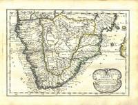
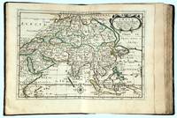
166216493Paris: chez l’Autheur 1662. SECOND EDITION. Complete with 17 double-page engraved maps hand-colored in outline. Contemporary mottled calf corner edges neatly repaired interior has some minor dampstaining mainly on text and on blank verso of maps last blank leaf torn on lower fore-edge. A contemporary signature on first blank leaf. Similar to L’Amerique this atlas of the continent of Asia was first printed in 1652 and reprinted here with a new title page. The maps are all dated 1652 with only one dated 1653 and do not include the address of Mariette. The atlas features maps of India Persia China Japan the Maldives Arabia and the Philippines among others. <br /> <br /> Just prior to publication of this series of works which also included atlases of Europe and Africa Sanson formed a partnership with Pierre Mariette an engraver and printseller. Pursuant to their contract Sanson drew the maps and Mariette engraved and printed them. Each maintained possession of half of the plates and they were allowed to exchange and/or buy from one another. Some bore the address of Sanson others Mariette. But Sanson allowed Mariette to store his plates and Mariette without prior agreement started placing his address on Sanson’s plates. In time a lawsuit which had been prosecuted was settled when both died and their respective sons took over the business.<br /> <br /> This atlas is a fine examples of French mapping by the foremost French cartographer of the seventeenth century. Sanson 1600-1667 “Geographe Ordinaire du Roi†to Louis XIII is considered the founder of French cartography and is generally acknowledged as the originator of the great age of French cartography. chez l’Autheur unknown
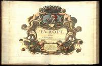
164775287Paris Uten år. 1647-1665. 4to. Samtidig helskinnbind med opphøyde ryggbånd og ryggforgylling. Ryggen rebacked med bruk av den gamle ryggstripen. Håndkolorert gravert dobbeltsidig tittelblad og dedikasjonsblad. Upaginert. 30 bl. Med 12 dobbeltsidige håndkolorerte kart. 4to. Contemporary full calf with raised bands spine gilt. Spine rebacked by using of the old spine. Handcoloured doublepage title and handcoloured doublepage dedication. Not paginated. 30 leaves. With 12 doublepage handcoloured copper engraved maps. Chez Pierre Mariette. Fransk. <br/><br/><em>“Nicolas Sanson le fils 1625 - 1648. Son of Nicolas and his intended heir prevented by his premature death from gunshot wounds. Only three known works. L’Europe 12 maps ca. 1648 compiled by N. Sanson fils engraved by A. Peyrounin theoretically published by Nicolas fils himself but may have been published posthumously by his father republished by Mariette 1660 1665. Tooley’s Dictionary of mapmakers. Revised edition. </em> hardcover