Pierre Mortier ; Nicolas SansonBiblio.com
442 résultats
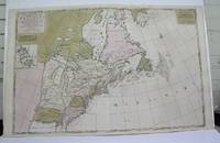
1698M3704Paris 1698. Excellent. Notes: Rather rare original coloured version of this map an important 17th century map of the Great Lakes and East coast with an inset map of Boston.<br><br>Cumming qtd in Arkway: "in spite of its scope and size it has a good deal of information for the Carolina Coast".<br><br>This map by Sanson first appeared in Mortier's sea atlas "Le Neptune Francois"; interestingly it is not generally found in Sanson or Jaillot atlases. Size : 650x924 mm 25.625x36.375 Inches Coloring: Original Hand Coloring Reference: Arkway 58:23 Category: Maps Canada East; Maps United States New England unknown
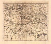
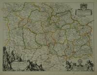
169319103Amsterdam: Pierre Mortier 1693-1700. Other. A strong impression in excellent condition. 490 by 580mm 19 by 22 inches. 490 by 580mm 19 by 22 inches. Original antique copper engraving uncolored from the 'Atlas Nouveau' published in Paris 1693. Depicting Mantua this map is a fine example of 1690s European cartography. Image: 490 by 580mm 19 by 22 inches. An attractive and historically significant 17th-century map for the discerning collector. Nicolas Sanson d'Abbeville 16001667 was the founder of the French school of cartography and arguably the most important French cartographer of the 17th century. Appointed Géographe Ordinaire du Roi to Louis XIII in 1630 he produced hundreds of maps that set a new standard for geographic accuracy and systematic coverage. His work was continued and expanded by Alexis-Hubert Jaillot and later by Pierre Mortier in Amsterdam ensuring that Sanson's surveys remained in use well into the 18th century. Maps bearing the Sanson name are prized for their scholarly precision large format and the elaborate cartouches that reflect the grandeur of the Sun King's court.Large detailed and interesting map by the famous French cartographer Nicolaus Sanson published in the famous sea atlas Le Neptune francois. in Amsterdam at Pierre Mortier. This interesting and large map was originally first published in the Atlas Noveau. by Alexis Hubert Jaillot & N. Sanson in Paris 1683-89. Alexis Hubert Jaillot & Nicolaus Jaillot worked as a royal cartographers for the French royal house for king Louis XIV. His maps published for the Atlas Nouveau. can be regarded as masterpieces of cartography in France in the ending 18th century. Also the maps impress by their accuracy and are providing an enormous amount of place names monasteries rivers trails fortifications etc. Shown is the duchy of Mantua Mantova in Northern Italy. Mantua is shown prominently in the center of the map. The map provides many place names detailed information on the river system also in the lower right corner a cartouche with a mileage scale and a table of explanations.A fine example from Atlas Nouveau Paris / Amsterdam sought after by collectors of antique maps of Italy antique maps of Mantua and antique copper engraving uncoloreds for sale. In good condition consistent with age. Shown is the duchy of Mantua Mantova in Northern Italy. Mantua is shown prominently in the center of the map. The map provides many place names detailed information on the river system also in the lower right corner a cartouche with a mileage scale and a table of explanations. Pierre Mortier unknown
2000Q-0967763908Quailmark Books Llc 2000-01-01. hardcover. New. In shrink wrap. Looks like an interesting title! Quailmark Books Llc hardcover
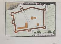
1690M9479Paris c.1690. Very Good. Notes: Map of Chielafa Greece during the late 17th century. Size : 105x152 mm 4.13x5.98 Inches Coloring: Hand Colored Category: Maps Europe Greece Macedonia; unknown
3251Americas: Amsterdam Francois Halma 1705. Copper engraved map of Chili by N. Sanson from Halma's Algemeene Werelde Beschryving Vol. 3 Black and white; title in Dutch; verso blank; strapwork title cartouche. Small version of Sanson's important map of Chili showing the Cuyo provinces. The map is based on the descriptions of Alfonso de Ovalle. This map appeared in Algemeene Weereld-Beschryving nae de Rechte Verdeeling der Landschappen Plaetsen Zeeën Rivieren &c. Geographisch Politisch Historisch Chronologisch en Genealogisch a Dutch edition of A. Phérotée de la Croix's Nouvelle Methode Pour Apprendre Facilement la Geographie Universelle which first appeared in 1690. Dark impression. Nicolas Sanson d'Abbeville.1600-67 ' father of the French cartography' and founder of the Sanson firm. Atlas ' Cartes générales de toutes les parties du Monde' 1658-70 and a pocket atlas in 4 parts 1652-1705. Sanson's small maps from A. Phérotée de la Croix's Nouvelle Methode Pour Apprendre Facilement la Geographie Universelle. first published in 1652 and engraved by A. Peyrounin were copied several times by various map publishers. Johann David Zunners made copies of Sanson's maps for his German translation of Die Gantze Erd-Kugel in 1679. Johannes Ribbius and Simon de Vries published copies in 1682 and 1683 with new maps engraved by Antoine d'Winter. The plates were later sold to Francois Halma who used them in 1699 and then again in 1705 with the titles re-engraved in Dutch. François Halma 1653 - 1722 Dutch publisher/printer; dealer/auction house. Cartographer and publisher of maps active in Utrecht Amsterdam Franeker and Leeuwarden. Published 'Description de l'Univers' 1700; 'Algemene Wereldtbescrijving' 1705; 'Corpus Inscriptionum' 1707 and 'Lexicon Philosophicum' 1713. Keoman: Hal 1; Phillips 528. Americas South America Chili Amsterdam Francois Halma 1705 unknown
1723209708Amsterdam: Mortier Pieter 1723. unbound. very good. Map. Engraving with hand outline. Image measures 14" x 18.75".<br/> <br/> Beautifully detailed map showing the area between the the Black and Caspian Seas including modern day Russia Georgia Azerbaijan Armenia and Turkey. Full original margins have minor stains. Based on the plates by Nicolas Sanson 1600-1667 who is considered the founder of the French school of cartography. In reaction to the prevailing trend of Dutch lavishness Sanson favored minimal details focusing rather on accurate cartography than ornament.<br/> <br/> Mortier, Pieter unknown
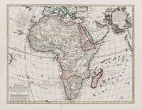
1595100047AG1595. Paris / London / Antwerp and other places of print c.1595 - 1851. Some stunning examples of hand-coloured copper-engravings plus one manuscript map Tuckey / Congo - Zaire. All of these maps in very good / excellent condition. This collection presents itself for becoming an amazing a meaningful starting-point for an Africana-Collection decoration for a Safari-Lodge interior-design for an Africana-themed library etc. etc. The price includes worldwide free shipping per DHL Express-Courier 2-3 day-delivery. Ask for complete list and images and please also inquire about our amazing book-collection of Africana which would be a great match for this collection of vintage maps. unknown
1950158225Rome: Unitalia Film / IFE 1950. Collection of 14 vintage oversize promotional brochures for Italian and international actresses. Each brochure features a one-page biography in Italian and a full-page black-and-white photograph of each actress. <br /> <br /> Actresses represented are Sylvana Mangano Isa Miranda Annamaria Gerrero Yvonne Sanson Alida Valli Delia Scala Ingrid Bergman Silvana Pampanini Lea Padovani Lucia Bose Eleanora Rossi Gina Lollobrigida Carla Del Poggio and Anna Magnani. <br /> <br /> 11 x 14.25 inches folded once vertically as issued with a company statement on the verso. Very Good plus overall some with light toning and foxing and a few with short tears. Unitalia Film / IFE unknown
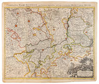
1710009138Amsterdam: Pierre Mortier 1710 Cooper engraving 50.5 x 60.5 cm on paper measuring 54.0 x 63.0 cm with original color in outline minor spotting and creasing remnants of centerfold paper slightly frayed at edges. A good copy of an uncommon map of the province of Namur a region of the Spanish Netherlands published in Amsterdam by Pierre Mortier to illustrate events of the War of the Spanish Succession. Pierre Mortier unknown
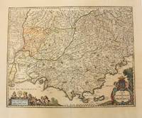
1656M6320Paris 1656. Very Good. Notes: This map shows the southern coast of France. Size : 425x535 mm 16.75x21 Inches Coloring: Original Hand Coloring Category: Maps Europe France unknown
20123360-nnew. unknown
20123360like new. unknown
0190310847New. Brand new and still unused unknown
0190310847.Gpaperback. Good. Access codes and supplements are not guaranteed with used items. May be an ex-library book. paperback
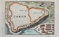
1690M9480Paris c.1690. Very Good. Notes: Map of Coron Greece during the late 17th century. Size : 103x153 mm 4.06x6.02 Inches Coloring: Hand Colored Category: Maps Europe Greece Macedonia; unknown
1824620C22Paris : Bechet Jeune 1824. Cloth. Very Good. 8.5" by 5.5". None. An interesting volume written by three notable French surgeons exploring medical procedures and knowledge of the early nineteenth century. Volume IV only. Lacking volumes I II and III. New edition second edition. Revised and expanded this work discusses new surgical practises surgical dressings and operations of the early 19th century. Written in the original French. With the binder label to the tail of the front pastedown of C. Cooper & Co Ltd. Written by three medical professionals R. B. Sabatier L. J. Sanson and L. J. Begin each of whom were highly regarded medical professionals and surgeons. Ink inscription to the reverse of the title page which reads 'Birmingham Library 14 Days Forfeiture 2d per day over.' In a full cloth binding. Externally generally smart. Light rubbing to the head and tail of the spine resulting in a small amount of fraying. Large crack to the front joint with patches of rubbing to the rear joint. Patches of rubbing also to the extremities. Small white flecks spots to the tail of the front board perhaps paint. Light offsetting to the front and rear endpapers with a small binders label to the tail of the front pastedown. Internally firmly bound. Pages are generally clean with the odd spot and handling mark heavier to the title page. Small amount of loss to the tail of the half-title page. Ink inscription to the reverse of the title page. Very Good Bechet Jeune hardcover
18344319FB1834. Brüssel Louis Hauman et Compe 1834. 12°. 132 S. Pappband der Zeit mit montiertem goldgeprägtem Rückentitel Ecken und Kanten stärker bestoßen und berieben. Umlaufender Rotschnitt. Durchgehend geringfügig fleckig und stellenweise mit sehr leichten Knickspuren. Sonst innen in guter Erhaltung. unknown
2012105280Somogy Editions D'Art. New. 2012. Paperback. 2757205617 . FREE UPGRADE to Courier/Priority Shipping Upon Request - IN STOCK AND IMMEDIATELY AVAILABLE FOR SHIPMENT - Flawless copy brand new pristine never opened -- Text in French. 176 pages. -- with a bonus offer-- . Somogy Editions D'Art paperback
18364318FB1836. Paris J.-B. Baillière 1836. 8°. 1 Tafel fehlend 352 S. Moderne Steifbroschur mit aufgezogenem Originaltitel Titel gebräunt. Durchgehend leicht fleckig. Sonst in schöner Erhaltung. unknown
2012465773.Gpaperback. Good. Access codes and supplements are not guaranteed with used items. May be an ex-library book. paperback
2091202133208116Not Available N.A. Soft Cover. Fine. Number of books: 1 Not Available paperback
92107001Paris 1654 Mariette. Single sheet map center fold minor soil rubbing period hand-color outline mile key French text sheet size: ca 58 x 42 cm. map size: 58 x 35.5 cm. an early example. R A R E With a bit of faint discoloration to the lower left margin barely entering the mile chart else fairly clean. A large scale grand map grand map showing the Ocean Septentrional Glacial et Scythique aujour-dhuy Mer de Tartarie et Mer des Tenebres then to the East "Aux Arabes Deftroit de Ieffo and Terre de Iesso" or the Kurile Islands at the North of Japan. The central map area shows in single outline the areas: Russie Blan Che Mosco Vie; Tartarie Desert; Uraie Tartarie; mer Caspienne/Mer de Gilan de Tabarestan; Usbeczaga; Turchestan Turkestan Central Asia; Cathay; Empire des Perses; Empire du Grand Mogol Mongolia; Partie du Roy au de la Chine with the great wall. The South East corner shows Corey Isle Korea and a tiny tip of the adjacent Iesso Hokkaido or the Kurile Islands the Ocean Oriental. A rather outstanding early view of the Northern and Central Asian areas West of China proper. Includes such mystical place names as Girgian Samarcand Ciartiam Cazan Steppe area Mongolia and the vast Gobi desert &c. Also shows mountains forests lakes rivers cities and borders oceans and deserts. Maps of this area and scale are unusual. Nicely executed early map. . unknown
1823z07242Paris: De l'imprimerie de L.-T. Cellot 1823. First edition. Hardcover. Very Good. First edition 1823. xi1587 pp. Half title. In French. Later half brown morocco and marbled boards spine gilt raised bands. Corners bumped spine lightly scuffed. Contemporary ink ownership signature in upper margin of half title. Ex-lib. with institutional bookplate on front pastedown and inkstamp in rear free endpaper at gutter. Some residue from earlier bookplates in front endpapers. Mild foxing throughout and some faint dampstaining. Overall very good. Early 19th-century French lexicon termes used in the medical and natural sciences. De l'imprimerie de L.-T. Cellot hardcover
HIST1567Brünn Karafiat o.J. 1862 - 1864. Zus. 1.550 Seiten Lnbde. d. Zeit mit goldgepr. Rückentit. etwas schief gelesen u. gebräunt im Ganzen gut erhalten. Brünn, Karafiat o.J. [1862 - 1864]. unknown
28798Paris: Pierre Mariette. c. 1658. 37.4 x 49.5 cm. Original outline colour. Double page map of Maine northern France. Title cartouche to lower left corner dedication cartouche to Christophe de Justel to upper right corner with the coat of arms of his family. Blank on verso. Small tears without loss to left and lower margins. Light stains to lower margin otherwise in good condition. Paris: Pierre Mariette. [c. 1658] unknown