H SansonBiblio.com
946 résultats
1332514030.Gpaperback. Good. Access codes and supplements are not guaranteed with used items. May be an ex-library book. paperback
2012936229.Gpaperback. Good. Access codes and supplements are not guaranteed with used items. May be an ex-library book. paperback
2382740884.Gpaperback. Good. Access codes and supplements are not guaranteed with used items. May be an ex-library book. paperback
0543952754.Gpaperback. Good. Access codes and supplements are not guaranteed with used items. May be an ex-library book. paperback
0543952711.Gpaperback. Good. Access codes and supplements are not guaranteed with used items. May be an ex-library book. paperback
0543952614.Gpaperback. Good. Access codes and supplements are not guaranteed with used items. May be an ex-library book. paperback
0543952533.Gpaperback. Good. Access codes and supplements are not guaranteed with used items. May be an ex-library book. paperback
8874Couverture rigide. Bon/1953. in-folio. Paris 1953 in-folio pet. XI 1bl 148pp 1 carte toile bleutée. Rel. de l'ép. Grande carte dépliante h.t. en couleur logée à l'intérieur du second plat représentant les précipitations annuelles de 1891 à 1930. Cachets gras d'une ancienne bibliothèque unknown
1022175718.Gpaperback. Good. Access codes and supplements are not guaranteed with used items. May be an ex-library book. paperback
1020932449.Ghardcover. Good. Access codes and supplements are not guaranteed with used items. May be an ex-library book. hardcover
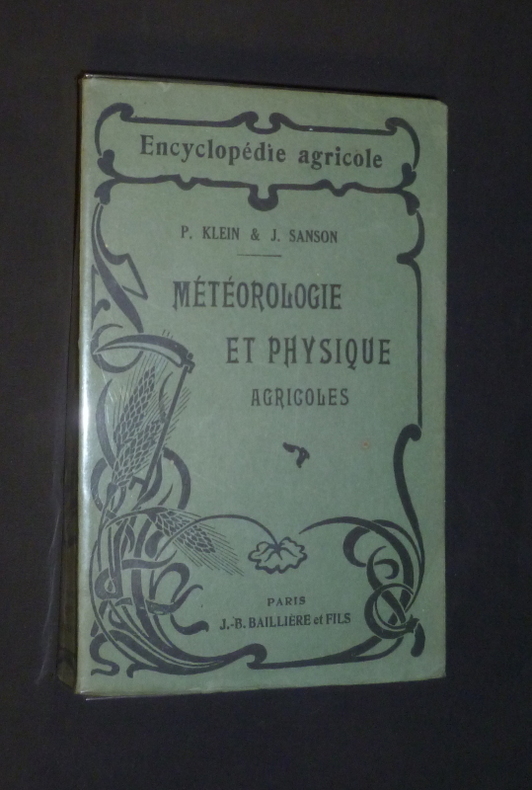
21857P. Baillière, 1925. Fort in-12, 464 pages. Broché.
1925gl1263Paris, J.-B. Baillière et fils Encyclopédie agricole Broché 1925 In-8, (12x19 cm), broché, 464 pages, iconographie en noir et blanc in texte ; pliures sur le dos, rousseurs sur la tranche, coiffes un peu frottées, très bon état par ailleurs. Livraison a domicile (La Poste) ou en Mondial Relay sur simple demande.
R150049521FAYARD.. 1958.. In-12. Broché. Bon état, Couv. légèrement passée, Dos satisfaisant, Intérieur acceptable. 181 pages. 1ère de couverture illustrée en noir et blanc.. . . . Classification Dewey : 200-RELIGION
1958R260220194LIBRAIRIE ARTHEME FAYARD. 1958. In-12. Broché. Etat d'usage, Coins frottés, Dos frotté, Intérieur frais. 181 pages. . . . Classification Dewey : 260-Théologie sociale chrétienne
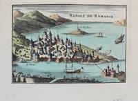
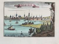
1690M9576Paris c. 1690. Very Good. Notes: A charming map of Nafplio Greece during the late 17th century. Size : 104x152 mm 4.09x5.98 Inches Coloring: Hand Colored Category: Maps Europe Greece Macedonia; unknown
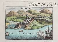
1690M9579Paris c. 1690. Very Good. Notes: A charming map of Pylos Navarino Greece during the late 17th century. Size : 104x154 mm 4.09x6.06 Inches Coloring: Hand Colored Category: Maps Europe Greece Macedonia; unknown
0260844535.Ghardcover. Good. Access codes and supplements are not guaranteed with used items. May be an ex-library book. hardcover
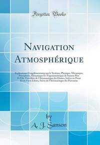
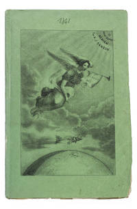
184193KAS1RPK7OLParis 1841. 8vo. De Boulé et Comp. for Ledoyen Original green wrappers in a protective plastic wrapper with a large lithographed plate on the front showing a dirigible flying over the globe underneath a floating angel who is blowing a trumpet with the motto "Conquête de l'aire". With a large folding lithographed plate 40 x 235 cm of the dirigible and a smaller woodcut of the same dirigible on p. 5. 31 1 blank pp. First edition of this very rare early and remarkable brochure on navigation in the air and the dirigible manoeuvrable balloon. The brochure introduces a new project to build a dirigible in the shape of a fish. The cost was estimated at 30.000 francs and was to be financed by the issue of 300 shares of 100 francs. The work explains the expected profits and the workings of the dirigible in order to entice patrons. It is an early example of such a project as the first powered and steerable airship that was able to take flight was invented in 1852 eleven years after the publication of the present work. This curious brochure therefore offers a fascinating insight into the history of aviation.The fish dirigible is shown in detail on the large folding plate. It was proposed to ascend the balloon being in equilibrium by means of wings to obtain propulsion by four small paddle-wheels and to steer by means of a large triangular rudder. It was approximately 25 meters long and 12 meters high and operated from a basket hanging underneath like in a hot air balloon. It was invented by bookseller and author Alexandre-Jacques Sanson 1789-1862 and his father. The dirigible was never built but the Sansons nevertheless published a number of other works elaborating on the same subject in the following years: Navigation atmosphérique. Explications complémentaires sur le système 1845; Explication du système de navigation aérienne 1848 and Solution du problème de la navigation aérienne principes preuves et moyens 1850. The present work ends with a letter by the aeronaut Jules-François Dupuis-Delcourt 1802-1864 giving permission to use some of his data in the brochure and offering his blessing to the project.The wrappers are somewhat creased with tears at the head and foot of the spine. The folding plate has browned. Otherwise in good condition.l Tissandier p. 34; WorldCat 457418223 907812680 1141280150 13 copies. unknown
1992R260233063Desclée de Brouwer. 1992. In-8. Broché. Bon état, Couv. convenable, Dos plié, Intérieur frais. 173 pages.. . . . Classification Dewey : 840.091-XX ème siècle
1992149732Desclée de Brouwer Paris, Desclée de Brouwer, 1992. In-8 broché de 173 pages. Très bon état
19585295582761Bibliothèque Ecclesia 45, GLN-181, Arthème Fayard 1958
1690M9575Paris c. 1690. Very Good. Notes: A charming map of Negroponte Chalcis Greece during the late 17th century. Size : 104x154 mm 4.09x6.06 Inches Coloring: Hand Colored Category: Maps Europe Greece Macedonia; unknown
36637Milano: Rizzoli 1974. First edition primo edizione hardback. Folio 41cm x 35cm 164pp. Colour frontispiece 44 colour plates tavole 132 text figures. Original green cloth dustwrapper green cloth slipcase. The book is in excellent condition; the dustwrapper is very good short closed tear to the front panel some light fraying of the extremities; the slipcase is good to very good some rubbing. A magnificent production with the text pages printed on hand-made paper and the plates printed on cardstock. Text in Italian. Milano: Rizzoli, 1974. hardcover
169616269Paris: Alexis Hubert Jaillot 1696. Copper-engraved map with full original colour and gold embellishment in excellent condition. A stunning map of Normandy by Alexis Jaillot an exceptional example with gilt embellishments.<br/> <br/> One of the most important figures in French cartography Nicolas Sanson initiated the great school of French geographers. Born in Abbeville in 1600 Sanson established his first printing house in Paris in 1638. He soon became geographer to the king establishing himself as one of the most influential cartographers on the Continent. He was succeeded by his sons Adrien and Guillaume and by his son-in-law Pierre Duval who continued to publish a wealth of maps using Sanson's name. At the close of the seventeenth century Sanson's plates were purchased by the influential cartographer Alexis Hubert Jaillot who continued to publish his maps and atlases under Sanson's title. This stunning map of Normandy is based on Sanson's map published in 1650 but was redrawn and enlarged by Jaillot. It shows the provinces of Normandy as well as the northern tip of Brittany and part of the English Channel. Both Jersey and Guernsey are included as is Mont St. Michel off the coast of St. Malo. In keeping with all of Sanson's and Jaillot's superb maps forests rivers and towns are meticulously identified and named. The map includes an ornate cartouche in the upper section as well as a scale and key.<br/> <br/> Tooley Maps & Map-Makers pp. 40-41. Alexis Hubert Jaillot unknown
169616269Paris: Alexis Hubert Jaillot 1696. Copper-engraved map with full original colour and gold embellishment in excellent condition. A stunning map of Normandy by Alexis Jaillot an exceptional example with gilt embellishments.<br/> <br/>One of the most important figures in French cartography Nicolas Sanson initiated the great school of French geographers. Born in Abbeville in 1600 Sanson established his first printing house in Paris in 1638. He soon became geographer to the king establishing himself as one of the most influential cartographers on the Continent. He was succeeded by his sons Adrien and Guillaume and by his son-in-law Pierre Duval who continued to publish a wealth of maps using Sanson's name. At the close of the seventeenth century Sanson's plates were purchased by the influential cartographer Alexis Hubert Jaillot who continued to publish his maps and atlases under Sanson's title. This stunning map of Normandy is based on Sanson's map published in 1650 but was redrawn and enlarged by Jaillot. It shows the provinces of Normandy as well as the northern tip of Brittany and part of the English Channel. Both Jersey and Guernsey are included as is Mont St. Michel off the coast of St. Malo. In keeping with all of Sanson's and Jaillot's superb maps forests rivers and towns are meticulously identified and named. The map includes an ornate cartouche in the upper section as well as a scale and key.<br/> <br/>Tooley Maps & Map-Makers pp. 40-41. Alexis Hubert Jaillot unknown books