Jean-Baptiste Sanson de Pongerville (1782-1870), poète, écrivain, traducteur, membre de l'Académie française.Livre Rare Book
946 résultats
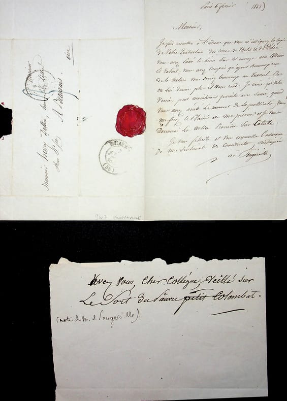
018502Jean-Baptiste Sanson de Pongerville (1782-1870), poète, écrivain, traducteur, membre de l'Académie française. L.A.S., Paris, 6 février 1838, 1p in-8. A l'écrivain Henri Dottin (1816-1883). Belle lettre sur sa traduction des Noces de Thétis & de Pélée, un poème latin de Catulle. Pongerville le félicite et dis l'ouvrage près à être publié. Il le sera effectivement en 1839, avec une notice sur Catulle par Pongerville. On joint un court billet, non signé, de Pongerville (2 lignes). Belle lettre. [180]
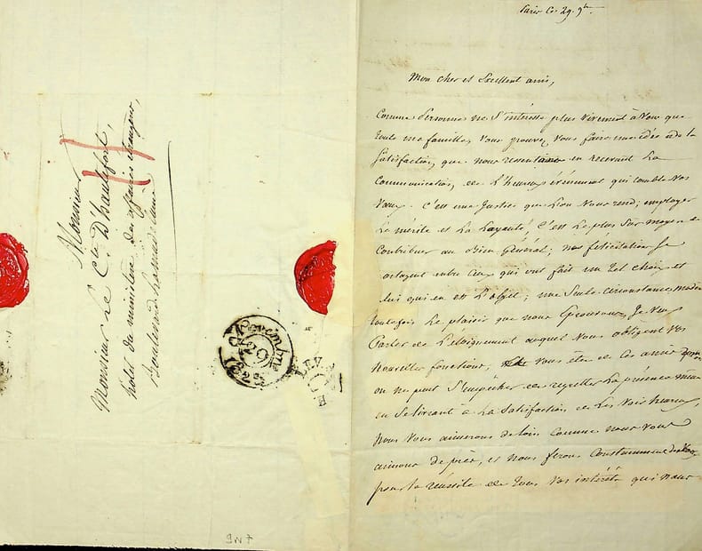
018504Jean-Baptiste Sanson de Pongerville (1782-1870), poète, écrivain, traducteur, membre de l'Académie française. L.A.S., 29 novembre [1825?], 2p in-8. A Jean-Louis-Gustave, comte d'Hautefort (1784-1850), officier de gardes du corps, gentilhomme de sa majesté. Belle lettre de félicitations pour sa nomination, regrettant qu'elle l'emmène loin (Pongerville adresse d'ailleurs sa lettre au ministère des affaires étrangères). Hautefort étant gentilhomme de Louis XVIII, cette nomination suis logiquement le changement de règne. Manque de papier dû au cachet de cire, anciennement réparé (quelques mots mangés sans empêcher la compréhension). [180]
2005H-405-5922005. Paperback. Good. Former library book. Different cover. Different publisher. Ammareal gives back up to 15% of this item's net price to charity organizations. paperback
BN105021Softcover. Les yeux bleus - la non-voyance vous écrit <br/><br/>Les yeux bleus - la non-voyance vous écrit paperback
18528000Paris: Chez L'un des Auteurs et Chez Ledoyen Libraire 1852. 1st. Very Good. 1st edition. Pamphlet in original wraps bound in limp paper covered boards. A beautiful copy. <br/><br/> Chez L'un des Auteurs et Chez Ledoyen Libraire hardcover books
166733634AB(Paris, Nicolas Sanson). 1667. Blattgrösse: 46x61,5 cm. Grenzkolorierte Karte (36,7x55 cm) von Nicolas Sanson, gestochen von Robert Cordier.
1648251162Paris 1648. unbound. Map. Engraving with hand outline color. Image measures 14.5 x 21.5 inches.<br/><br/> This map of Switzerland centers on Lucerne covering approximately the area from Lake Constance south to Lake Como in Italy. Published in 1648 the map dates to the period of the Old Swiss Confederacy. Furthermore it predates by only a few years the Swiss Peasant War of 1653 a siege of Lucerne and Bern that demonstrated the significance of the rural population to the confederacy%u2019s stability. Hand-colored outlines on the map indicate the various independent states that made up the confederacy. A title cartouche with elaborate scrollwork adorns the lower right corner of the map. The map is in good condition with full margins and no chips or tears. Wear to lower margin. Nicolas Sanson 1600-1667 is considered the founder of the French school of cartography. In reaction to the prevailing trend of Dutch lavishness Sanson favored minimal details focusing rather on accurate cartography than ornament. This map demonstrates the skill that made him such a valuable asset to the French monarchy.<br/><br/> unknown books
125389aafParis, Nicolas Sanson, 1667, 38x53 cm., Kupferdrukkarte koloriert / carte gravée sur cuivre et coloriée, bel carte, encadrée baguette or. (50x65 cm.) / Übereck Gerahmt.
126769aafParis, Nicolas Sanson, 1667, 35x53 cm., Kupferdrukkarte schwarz / carte gravés sur cuivre, 1 feuille, montée sur toile. 45x62 cm.
1648251162Paris 1648. unbound. Map. Engraving with hand outline color. Image measures 14.5 x 21.5 inches.<br/> <br/> This map of Switzerland centers on Lucerne covering approximately the area from Lake Constance south to Lake Como in Italy. Published in 1648 the map dates to the period of the Old Swiss Confederacy. Furthermore it predates by only a few years the Swiss Peasant War of 1653 a siege of Lucerne and Bern that demonstrated the significance of the rural population to the confederacy's stability. Hand-colored outlines on the map indicate the various independent states that made up the confederacy. A title cartouche with elaborate scrollwork adorns the lower right corner of the map. The map is in good condition with full margins and no chips or tears. Wear to lower margin. <br> <br> Nicolas Sanson 1600-1667 is considered the founder of the French school of cartography. In reaction to the prevailing trend of Dutch lavishness Sanson favored minimal details focusing rather on accurate cartography than ornament. This map demonstrates the skill that made him such a valuable asset to the French monarchy.<br/> <br/> unknown
13216Pouvoirs, revue française d’études constitutionnelles et politiques, N°12, Paris, PUF, 1980. In-8°, broché.
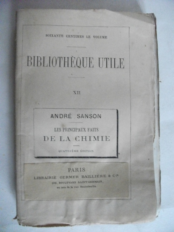
5298in 12 broché,mention de 4ème édition.Titre,192 pages,Germer-Baillière & Cie Bibliothèque utile XII.Rousseurs éparses. Sinon très bon état
ORD-9689Histoire naturelle et zootechnie. 5°édition. 56 gravures. Paris. Maison Rustique. 1894. In-12 (120 x 186mm) broché, couverture jaune imprimée, ornée d'un mouton, VI, 167 pages et catalogue de la librairie, 48 pages. Gravures en noir dans le texte.
1873R320172972Librairie agricole de la maison rustique. 1873. In-12. Broché. Etat d'usage, Couv. légèrement passée, Coiffe en pied abîmée, Intérieur frais. 167+36 pages - quelques gravures en noir et blanc dans le texte - coiffes abîmées - étiquette collée sur le 1er contre plat - annotation au crayon à papier sur la page de garde - annotation sur la page de faux titre.. . . . Classification Dewey : 636.3-Ovins
1894R320041080LIBRAIRIE AGRICOLE DE LA MAISON RUSTIQUE. 1894. In-12. Broché. Bon état, Couv. convenable, Dos satisfaisant, Intérieur frais. VI + 167 pages - Nombreuses figures en noir in texte et en 1er plat.. . . . Classification Dewey : 636.3-Ovins
1719E7CG2ENMSWHRParis: Hubert Jaillot 1719. Engraved map on 2 assembled sheets 54.5 x 88 cm. With title in decorated cartouche signed F.C. in upper right corner and scalebars in decorated cartouche in the lower left corner. Coloured in outline. Large map of the Pyrenees a mountain range on the border between France and Spain after Nicolas Sanson 1600-1675. Apparently printed from the original plates differing from the map issued in Mortier's "Jaillot-Atlas".Very good copy slightly browned.l Pastoureau Jail. II C map 166. Hubert Jaillot, unknown
1700LBW-4948[1700]. 185 x 239 mm.
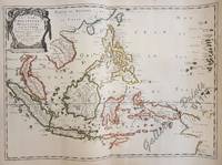
1654M10780Paris 1654. Very Good. Notes: Detailed map of Southeast Asia by Nicholas Sanson 1600-1667 renowned French cartographer. Size : 402x560 mm 15.83x22.05 Inches Coloring: Original Hand Coloring Category: Maps Asia South East Indonesia & Papua New Guinea; Maps Asia South East Thailand Laos Vietnam Cambodia & Burma / Myanmar; Maps Asia South East Philippines; unknown
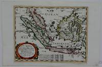
1660M5006Paris 1660. Excellent. Notes: French map of South East Asia. Size : 195x250 mm 7.625x9.875 Inches Coloring: Hand Colored Category: ; Maps Asia South East Malaysia & Singapore; Maps Asia South East Indonesia & Papua New Guinea unknown
165461177<p>40.1 x 56 cm original outline hand-colour copper engraving. EXTREMELY RARE map probably from ''Cartes generales de toutes les parties du monde' . Condition: with folds as issued with water stains and professionally repaired tear on lower left margin not affecting plate. Reference: Quirino p. 83; BMC Printed Maps XII col.867; Cat.Nat.mar.Mus.271 map 15; Nordenskiöld 275 vol.1 map 17; pastoureau Sanson V map 12.</p> Pierre Mariette, Paris.
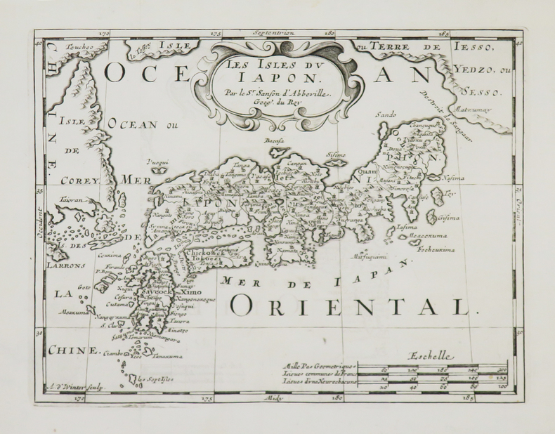
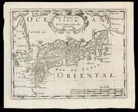
169915831Amsterdam: Chez Arnout van Ravenstein 1699. 222 by 272mm. 8.75 by 10.75 inches. Engraved map. Second state of the plate first published in Halma's pirated edition of Sanson's 'L'Asie en plvsiers cartes nouvelles et exactes; ' as part of 'L'Europe; L'Asie; L'Amerique en Pluiers Cartes' 1683. A direct copy of Sanson's map of 1652 the only differences being the lack of a privilege and a date in the cartouche the addition of the signature of the engraver Antoine de Winter in the lower left corner. This issue is distinguished by the addition of mountains added in 'Isle de Corey' and 'Terre de Iesso'; and the 'Mer de Japan' above 'Oriental'. Francois Halma 1653-1722 set up his printing business in Utrecht in 1674 where he issued a number of pirated maps and atlases. In this instance since Sanson was dead Halma may have felt that there no harm and much profit to be gained from re-printing his work. The engraver Antoine de Winter c1652-1700 achieved some notoriety for plagiarizing Petter Gedda's charts of the Baltic Sea selling them on to Loots and Doncker for inclusion in their atlases who were subsequently sued and ordered to surrender the plates and pay a fine of 300 florins. Sanson originally credited "Caardin sic Varenius" and 'others' for his map. Generally the geography follows that of Moreira/Blancus only a small portion of the eastern coast of Korea is shown without stating whether it is an island or not and there is only a hint of Hokkaido in the far northeast corner with the place name Matzumay. Varenius or Bernhard Varen fl1622-1650 was a German physician geographer and natural historian. He settled in Amsterdam and was a friend of the Blaeu family. He published 'Descriptio regni Japonia ' in 1649 and came to be known as 'the father of physical geography' Hubbard. Sanson 1600-1667 was a French mapmaker. He supposedly began to make maps to supplement his study of history and a map of Ancient Gaul made early in his career brought him to the attention of Cardinal Richelieu. This foothold in the French court allowed him to rise to the position of Geographe du Roi teaching both Louis XIII and Louis XIV. Louis XIII even made him a counsellor of state. Sanson produced an atlas 'Cartes Generales de Toutes les Parties du Monde' which contained important maps of the post roads and waterways of France. He also produced two major maps of North America: 'Amerique Septentrionale' 1650 was the first map to show the Great Lakes in a recognisable form aided by Sanson's access to The Jesuit Relations a collection of accounts by French missionaries to the area. The map was also drawn on a sinusoidal projection which Sanson was the first to use. In 1656 he made 'Le Canada ou Nouvelle France' which showed the Great Lakes in greater detail and included accurate representations of the Hudson Bay area the Delaware and the Gulf of Saint Lawrence. After Sanson's death the business was carried on by his two surviving sons and grandson in partnership with Hubert Jaillot. Sanson family members were revered among the foremost map makers in France for nearly a century. A leading exemplar of the French school of seventeenth-century cartography Nicholas Sanson I is widely regarded as the founder of modern geography and it is generally held that the so called "Great Age" of French cartography originated with his publications Hubbard 51.2. Chez Arnout van Ravenstein, unknown
1652LBW-656Paris, Pierre Mariette, 1652. 404 x 533 mm.
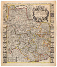
1710009139Amsterdam: Pierre Mortier 1710 Cooper engraving 58.0 x 50.5 cm on paper measuring 63.0 x 54.0 cm with original color in outline minor spotting and creasing remnants of centerfold paper slightly frayed at edges. A good copy of an uncommon map of Savoy and Piedmont published in Amsterdam by Pierre Mortier to illustrate events of the War of the Spanish Succession. Surrounded by twenty-two coats of arms representing various provinces. Pierre Mortier unknown
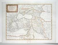
1660M2926Paris: Mariette Pierre 1660. Very Good; some browning on the lower margin near the fold. Size : 407x517 mm 16x20.375 Inches Coloring: Hand Colored Category: ; Maps Mediterranean Sea; Maps Asia Near East Turkey; Mariette, Pierre unknown
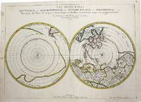
1657M954Paris 1657. Very Good; some occasional mild browning. Notes: 17th century French map of Arctic and Antarctic regions. It was published in Cartes générales de toutes les parties du monde. <br><br>Nicolas Sanson 1600–1667 was a renowned French cartographer termed by some as the "father of French cartography." His works are known for their incorporation of the most up to date information of the time and their clean modern style. Size : 390x537 mm 15.375x21.125 Inches Coloring: Hand Colored in outline Category: ; Maps Polar Arctic Regions; Maps Polar Antarctic Regions unknown