Elwe; Sanson/JaillotBiblio.com
442 résultats
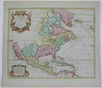
1792M4892Amsterdam 1792. Excellent. Notes: North America revised from the Sanson/Jaillot maps. California is shown as a peninsula but named "isle de California" to the northwest is "Mer de Iesso" and beyond that a small stretch of coastline "Terre de Iesso ou Ieco." The Great Lakes are defined if not with great accuracy a number of settlements in Nouveau Mexico are identified and a R. del Norte flows southwest from a large lake near Taosii to the Gulf of California. Size : 480x580 mm 18.875x22.875 Inches Coloring: Original Hand Coloring Category: Maps North America; Maps Central America; Maps West Indies General unknown
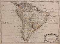
1698M10786Paris 1698. Very Good. Notes: A charming large scale 17th century map of South America with two decorative cartouches and original outline colouring. Size : 460x648 mm 18.11x25.51 Inches Coloring: Original Outline Coloring Category: Maps South America Continent; unknown
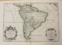
1691M1345Paris 1691. Very Good. Size : 590x885 mm 23.25x34.875 Inches Coloring: Hand Colored in Outline Category: ; Maps South America Continent unknown
1650309461Paris: Pierre Mariette 1650. unbound. Abraham Peyrounin. Map. Engraving with original outline color. Image measures 15 3/4" x 21 3/4"<br/> <br/> This exceptionally fine map of South America covers the continent in fine detail. Coastlines are extensively labeled and mountains beautifully rendered in profile. The Orinoco and Amazon Rivers as well as Rio de la Plata are prominently rendered. Sanson refrains from drawing a southern coastline to Tierra del Fuego and the relatively unknown Amazon region is depicted in minimal detail. Sanson does however include the mythical lake "Lac de Parime" and the city of gold "Manoa del Dora" between the Orinoco and Amazon rivers. Nice dark impression. In very good condition. Minor dampstain to lower margin not affecting the image and some faint stains near the center of the map - otherwise clean and bright. Hard to find. <Br> <br> Nicolas Sanson 1600-1667 is considered the founder of the French school of cartography. In reaction to the prevailing trend of Dutch lavishness Sanson favored minimal details focusing rather on accurate cartography than ornament.<br/> <br/> Pierre Mariette unknown
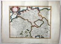
170054035Amsterdam: 1700. Map of Germany divided into regions which at the time extended over much of the Low Countries. Maps by Sanson in original colour are rare. Nicolas Sanson was founder of the French school of mapmakers at a time when the leadership in European cartography passed from the Low Countries to France. This map was published in Brion's treatise on globes. Nicolas Brion was a famous French mathematical and scientific instrument maker. L'Usage des Globes. Copper engraving. Fine condition. Original colour. Size: 23.5 x 18.5 cm. unknown
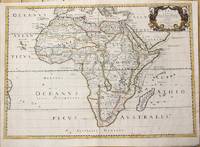
1650M6678Paris: Pierre Mariette c. 1650. Very Good;. Notes: Title cartouche bordered by two outward-facing birds of prey.<br><br>Norwich writes: "This is an early Sanson map. An odd feature is the name Barditus Mons given to a long chain of mountains running continuously from somewhere in Angolato Algoa Bay. No place names appear even on the coast of the southern part of the continent which is labelled 'Agi Symba' a name usually referring to the northern African region and inhabitants are 'Anthropophagi Aethiopes' or cannibals." Size : 396x553 mm 15.59x21.77 Inches Coloring: Hand Colored Reference: Norwich's Map 35. Category: Maps Africa Continent; Pierre Mariette unknown
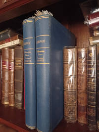
19541440<p>Aerovoz revista mensual organo oficial de la federacion aerea nacional de cuba director calixto sanchez white 4 anos desde enero de 1954 hasta junio de 1957 director macario fernandez coleccion en 2 volumenes.en muy buen estadorevista ilustrada.es una revista muy rara sobre la aviacion cubana de la republica.con interesantes articulos y resenas historicas y de la actualidad.</p> Talleres editorial puga,guanabacoa hardcover
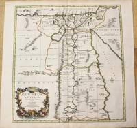
1696M10206Amsterdam: Covens & Mortier c.1696. Very Good. Size : 485x450 mm 19.09x17.72 Inches Coloring: Hand Colored Category: Maps Africa North Egypt; Covens & Mortier unknown
201512211New Zealand 2015. 2nd Edition . Soft cover. As New. 8vo - over 7¾ - 9¾" tall. 264 pages with b/w and colour photos. Paperback. <br/> <br/> paperback
0786649941.Gpaperback. Good. Access codes and supplements are not guaranteed with used items. May be an ex-library book. paperback
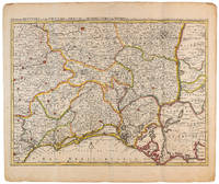
1710009141Amsterdam: Pierre Mortier 1710 Cooper engraving 44.5 x 59.5 cm on paper measuring 54.0 x 64.0 cm with original color in outline minor spotting and creasing remnants of centerfold. A good copy of a map of south-central France the Cévennes Vivarais Occitania published in Amsterdam by Pierre Mortier to illustrate events of the War of the Spanish Succession. Pierre Mortier unknown
1696H40716Rome: Giovannie Giacomo de Rossi 1696. Very good. Sheet measures 27.5 x 20.5 inches map itself measures 20 x 16 inches. Very good some curving and bending from having been stored rolled up but no creases or tears light toning and mildest foxing. Period hand coloring and handsome cartouche. Italian edition of the French mapmaker's map of Germany and Bohemia. Giovannie Giacomo de Rossi unknown
90476PARIS Chez l’Auteur 1654. Title cartouche to lower left corner. Blank on verso. In good condition. Some light tanning on edges with a few faint foxing marks. A few hole top of centre fold on map. Small neatly repair tear lower margin and small hole top margin. With original outline hand colouring. Engraved Size 17.5 x 23 inches Nicolas Sanson 1600-1667 sometimes called Nicolas Sanson d'Abbeville or Sanson d'Abbeville was the most important French cartographer of the 17th century. Tooley called Sanson "the founder of the French school of cartography." He began making maps in the late 1620s and in the 1630s he was working with Melchior Tavernier. Later Sanson worked in concert with the print publisher Pierre Mariette with whom he published his great atlas: Cartes générales de toutes les parties du monde 1658. After Sanson's death in 1667 his son Guillaume carried on the business in partnership with Alexis Hubert Jaillot. Guillaume established himself as a very important French mapmaker in his own right. PARIS Chez l’Auteur 1654. unknown
34013180like new. unknown
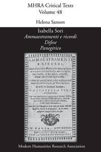
SONG1781881510Modern Humanities Research Association 2018-10-31. Annotated - Bilingual. paperback. Used: Good. 6.14x0.55x9.21. Buy with confidence. Excellent Customer Service & Return policy. Modern Humanities Research Association paperback
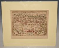
92217Paris Sanson d'Abbeville Nicolas Ca 1660. In ivory mount. Mount size 16 x 13.5 inches 40.5cm x 35cm Engraved size 28cm x 22cm 11 x 8.5 inches In very good condition. Laid Down. Paris Sanson d'Abbeville, Nicolas Ca 1660 unknown
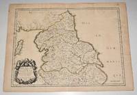
90475PARIS Chez l’Auteur 1654. Title cartouche to lower right corner. Blank on verso. In good condition. Some light tanning on edges with a few faint foxing marks. With original outline hand colouring. Engraved Size 17.5 x 23 inches Nicolas Sanson 1600-1667 sometimes called Nicolas Sanson d'Abbeville or Sanson d'Abbeville was the most important French cartographer of the 17th century. Tooley called Sanson "the founder of the French school of cartography." He began making maps in the late 1620s and in the 1630s he was working with Melchior Tavernier. Later Sanson worked in concert with the print publisher Pierre Mariette with whom he published his great atlas: Cartes générales de toutes les parties du monde 1658. After Sanson's death in 1667 his son Guillaume carried on the business in partnership with Alexis Hubert Jaillot. Guillaume established himself as a very important French mapmaker in his own right. PARIS Chez l’Auteur 1654. unknown