SansonBiblio.com
946 résultats
1665M5118Paris 1665. Very Good central fold reinfrced. Notes: There is a water mark on the right hand portion of the map. Size : 435x540 mm 17.125x21.25 Inches Coloring: Original Outline Coloring Category: ; Maps Europe Italy unknown
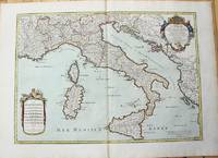
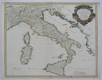
1783M10279Paris: H. Jaillot c.1783. Very Good. Size : 469x655 mm 18.46x25.79 Inches Coloring: Original Hand Coloring Category: Maps Europe Italy; Maps Mediterranean Islands; H. Jaillot unknown
166710027Paris 1667. No Binding. Near Fine. 12 ½ x 17 inches. Original outline color; excellent. Earliest map of Martinique listed in Phillips featuring attractive original color and an elegant cartouche. This map depicts the situation on the island before 1660 when it was still largely inhabited by natives and only about half of it had been claimed by colonists for sugar cane farming. The map goes so far as to mark with a printed line the partition dividing the "demeure des François" and the "demeure des savages." However by 1660 the entirety of the native population was either dead expelled or in slavery and Martinique was a full-fledged sugar cane-farming European colony. Phillips Maps P. 389. unknown books
166710027Paris 1667. No Binding. Near Fine. 12 ½ x 17 inches. Original outline color; excellent. Earliest map of Martinique listed in Phillips featuring attractive original color and an elegant cartouche. This map depicts the situation on the island before 1660 when it was still largely inhabited by natives and only about half of it had been claimed by colonists for sugar cane farming. The map goes so far as to mark with a printed line the partition dividing the "demeure des François" and the "demeure des savages." However by 1660 the entirety of the native population was either dead expelled or in slavery and Martinique was a full-fledged sugar cane-farming European colony. Phillips Maps P. 389. unknown
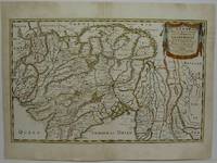
1654M5952Paris 1654. Very Good some mild discoloration along the margins. Size : 350x555 mm 13.75x21.875 Inches Coloring: Original Outline Coloring Reference: Gole 16; Nebenzahl 3.9B Category: Maps Asia South East Thailand Laos Vietnam Cambodia & Burma / Myanmar; Maps Asia Central India & Sri Lanka / Ceylon; unknown
51734PHOTOS SUR DEMANDE
19253813373011Rousseurs sur les 1ère et 4ème de couverture, GLN-7, Spes 1925
19263813761811Exemplaire non relié, GLN-7, Spes 1926
19263836865415GLN-7, Spes 1926
19263836865420GLN-7, Spes 1926
19263836865425GLN-7, Spes 1926
19263836865585GLN-7, Spes 1926
19263836865621GLN-7, Spes 1926
19263836865622GLN-7 Spes 1926
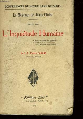
192610471Editions Spes 1926 256 pages in8. 1926. broché. 256 pages. L'Inquiétude Humaine est un livre de conférences données par le R.P. Pierre Sanson pendant le Carême de 1926 à Notre-Dame de Paris. L'ouvrage explore le thème de l'inquiétude humaine à travers le message du christianisme et du judaïsme en s'appuyant sur la Bible
1925LFA-126735587Un ouvrage de 278 pages, format 120 x 190 mm, broché, publié en 1925, Editions Spes, bon état
1925RO40075761EDITIONS SPES. 1925. In-12. Broché. Etat d'usage, Couv. légèrement passée, Dos frotté, Intérieur bon état. 276 pages.. . . . Classification Dewey : 230-Christianisme. Théologie chrétienne
1925RO80026950SPES.. 1925. In-12. Broché. Etat d'usage, Couv. défraîchie, Dos satisfaisant, Intérieur frais. 278 pages. Notes au stylo noir sur 1ère de garde. Charnières fendues.. . . . Classification Dewey : 840-Littératures des langues romanes. Littérature française
1926RO80104309SPES. 1926. In-12. Relié. Etat d'usage, Couv. défraîchie, Dos satisfaisant, Intérieur acceptable. VII + 278 pages. Etiquette de code sur la coiffe en-tête. Quelques pages se détachant.. . . . Classification Dewey : 232-Jésus Christ
1925RO40246732Spes. 1925. In-12. Broché. Etat d'usage, Couv. légèrement passée, Dos satisfaisant, Déchirures. 278 pages. Papier muet encollé sur le dos, le consolidant. Etiquette de code sur la couverture. Quelques tampons de bibliothèque.. . . . Classification Dewey : 248-Vie chrétienne et méditations
1651R320074492A COMPTE D'AUTEUR. 1651. In-Folio. Broché. Etat d'usage, Couv. défraîchie, Dos satisfaisant, Intérieur frais. 43 pages - Quelques taches jaunatres en fin de volume (en tranches - gouttiere) sans conséquence sur la lecture - + 1 planche depliante. Bandeau et lettrine en tete de chapitre. Renfort en 1er plat et dos. Bandaux; lettrines et culs de lampe. 4 PHOTOS DISPONIBLES -. . . . Classification Dewey : 94.2-Livres anciens XVII ème
1926RO80185386SPES. 1926. In-12. Broché. Etat d'usage, Tâchée, Dos abîmé, Quelques rousseurs. 256 Pages. Quelques rousseurs sans conséquence pour la lecture. 1 Ex-dono sur la page de faux titre.. . . . Classification Dewey : 248-Vie chrétienne et méditations
1652287521Abbeville: Nicolas Sanson 1652. unbound. Map. Engraving with original outline hand coloring. Image measures 15 1/2" x 20 1/2". Shows light foxing and some mat burn.<br/><br/> A beautiful and unususual double hemisphere hydrological world map from the mid 17th century. Shows and highlights all bodies of water including oceans gulfs lakes straits and rivers. Wonderful light hachure marks hint of a land mass in Terre Australe. Nicolas Sanson 1600-1667 is considered the founder of the French school of cartography. In reaction to the prevailing trend of Dutch baroque design Sanson favored minimal details focusing rather on accurate cartography than ornament. Shirley R.W. World 394<br/><br/> Nicolas Sanson unknown books
1652010748twParis: Sanson. Very Good. 1652. A very rare map from Nicolas Sanson. Imprint bears the date of 1652 although it is possible that this copy came from an atlas in the later 1600s. Light toning and edgewear with one corner slightly chipped. Light soil on lower margin. Hand-colored boundaries. Map borders measure 14" x 20 3/4". California is shown as an island and Terre Australe is a vague line encircling the Antarctic. Terre de Iesso is the name given to the land mass northwest of North America. Sanson 1600-1667 published many map versions of the world and is known as "the father of French cartography." ; 16 1/2" x 22 1/4" . Sanson unknown books
165214178Paris: Sanson 1652. Double hemisphere world map showing the rivers and water bodies of the world. Original outline color. 20 3/4 x 15 3/4". Depicts Australia prior to Tasman's discoveries and labels North Australia "Beach" according to Marco Polo and California as an island. References: Shirley R.W. World 394. Sanson unknown