SANSON, H.Livre Rare Book

946 résultats
83285Berlin, Hasselberg’sche Verlagshandlung ohne Jahr, 190x130mm, 199 + 190 + 191Seiten, Halbperkalin.
2005R300269955Gaz de Bordeaux/Le petit théâtre. 2005. In-8. Broché. Etat d'usage, Couv. convenable, Agraffes rouillées, Intérieur frais. 25 pages - quelques photos en noir et blanc dans le texte. Plats contrepliés en un rabat.. . . . Classification Dewey : 750-La peinture et les peintres
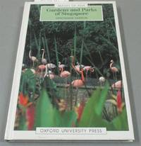
1992I8181Singapore: White Lotus Press 1992. Paperback. Good/no dj. 0.24. Gardens and Parks of Singapore White Lotus Press paperback
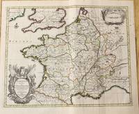
1760M7988Paris: Sr. Delamarche c.1760. Very Good. Notes: Engraved by Delahaye. Large scale attractive map of France. Size : 493x668 mm 19.41x26.30 Inches Coloring: Original Hand Coloring Category: Maps Europe France; Sr. Delamarche unknown
16411809140021Paris : Tavernier et a present Pierre Mariette 1641. First Edition. Maps. Good. 53 x 40 cm. Original engraved double page map of France. In gilt and black frame under glass. Some browning. Scale: 1:3000000. Paris : Tavernier, et a present Pierre Mariette unknown
1710M10329Amsterdam: Jean Covens & Corneille Mortier c.1710. Very Good. Size : 378x486 mm 14.88x19.13 Inches Coloring: Original Outline Coloring Category: Maps Europe France; Jean Covens & Corneille Mortier unknown
215370Amsterdam: Pierre Mortier. unbound. very good. Map. Engraving with hand outline. Image measures 13 11/16" x 22 3/8".<br/><br/> Rare map of northern Turkey centered around Ankara circa 1700. Minor scattered toning chipping to edges. Full original margins.<br/><br/> Pierre Mortier unknown books
1678M3431Paris: Mariette Pierre 1678. Excellent. Size : 357x595 mm 14x23.375 Inches Coloring: Original Outline with later cartouche coloring Category: ; Maps Asia Near East Turkey Mariette, Pierre unknown
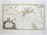
215370Amsterdam: Pierre Mortier. unbound. very good. Map. Engraving with hand outline. Image measures 13 3/4" x 22 1/2".<br/> <br/> Rare map of Galatia an ancient region of northern Anatolia present-day Turkey along the southern coast of the Black Sea. Published circa 1705 this map is centered on Ankara and shows provinces inhabited by Trocmi Tectosages and Tolistobogi - three Celtic tribes who inhabited the region from the 3rd century BC. Neighboring historical regions of Paphlagonia Pontus Phyrgia Cappadocia and Lycaonia are labeled. Mountains and cities are depicted pictorially. The map shows major roads connecting cities throughout the region. A decorative cartouche features lively figures celebrating with percussion and wind instruments. Full original margins minor offsetting. Based on earlier plates by Sanson. This map appeared in "Atlas Antiquus Sacer Ecclesiasticus et Profanus" published in Amsterdam by Pieter Mortier. <br> <br> Nicolas Sanson 1600-1667 who is considered the founder of the French school of cartography. In reaction to the prevailing trend of Dutch lavishness Sanson favored minimal details focusing rather on accurate cartography than ornament. <br> Pierre Mortier 1661-1711 was a Dutch cartographer engraver and printseller who worked in Amsterdam. He used advanced Dutch printing methods to produce high quality editions of contemporary French maps by cartographers such as De L'Isle Sanson Jaillot de Fer and De Wit. This map is a lovely example of his work.<br/> <br/> Pierre Mortier unknown
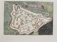
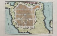
1690M9475Paris c.1690. Very Good. Notes: A charming map of Forteresse de Zante Greece during the late 17th century. Size : 104x154 mm 4.09x6.06 Inches Coloring: Hand Colored Category: Maps Europe Greece Macedonia; unknown
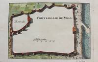
1690M9474Paris c.1690. Very Good. Notes: A charming map of Forteresse de Volo Greece during the late 17th century. Size : 104x153 mm 4.09x6.02 Inches Coloring: Hand Colored Category: Maps Europe Greece Macedonia; unknown
3240Americas: Amsterdam Francois Halma 1705. Copper engraved map of Florida by N. Sanson from Halma's Algemeene Werelde Beschryving Vol. 3 Black and white; title in Dutch; verso blank; strapwork title cartouche. This influential map shows the Spanish and French possessions in the southern part of the United States. The map extends from the southernmost part of Virginia to the coast of what is now Texas. When first introduced by Sanson in 1657 this map was the first to use the name L. Erie in an atlas and to introduce several new rivers in Virginia. The French claims in the Carolinas are reasserted with the region named Floride Francoise despite the region not having had any French presence for nearly 100 years. The place name Caroline is not related to the future English colony of Carolina. Instead it is a confusion between the French Fort Caroline on the St. Johns River and Charlefort that was located near Port Royal. According to Burden this is the third state of the map. Published in Francois Halma's Dutch edition of A. Pherotee de la Croix's Nouvelle Methode Pour Apprendre facilement la Geographie Universelle. Dark impression; pin hole paper fault to upper right below latitude 40. Nicolas Sanson d'Abbeville.1600-67 ' father of the French cartography' and founder of the Sanson firm. Atlas ' Cartes générales de toutes les parties du Monde' 1658-70 and a pocket atlas in 4 parts 1652-1705. Sanson's small maps from A. Phérotée de la Croix's Nouvelle Methode Pour Apprendre Facilement la Geographie Universelle. first published in 1652 and engraved by A. Peyrounin were copied several times by various map publishers. Johann David Zunners made copies of Sanson's maps for his German translation of Die Gantze Erd-Kugel in 1679. Johannes Ribbius and Simon de Vries published copies in 1682 and 1683 with new maps engraved by Antoine d'Winter. The plates were later sold to Francois Halma who used them in 1699 and then again in 1705 with the titles re-engraved in Dutch. François Halma 1653 - 1722 Dutch publisher/printer; dealer/auction house. Cartographer and publisher of maps active in Utrecht Amsterdam Franeker and Leeuwarden. Published 'Description de l'Univers' 1700; 'Algemene Wereldtbescrijving' 1705; 'Corpus Inscriptionum' 1707 and 'Lexicon Philosophicum' 1713. Keoman: Hal 1; Phillips 528; Burden #546; Cumming SE #53. Americas Florida Amsterdam Francois Halma 1705 unknown
17053903Attractive original hand-color. Pin-head size stain just south of Mississippi delta please see image. An otherwise very nice clean copy. Paper size: 8 1/4 x 12 1/4 in 210 x 310 mm. Image size: 7 x 9.8 in 178 x 250 mm. ; All shipments through USPS insured Priority Mail.
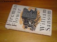
1944ARC93931The Hogarth Press London 1944. Book. Very Good. Hardcover. 1st Edition. First Edition first printing of which 2000 copies were printed. 8vo. 163pp. Beige cloth lettered in blue at the spine. Corner tips gently rubbed. Small triangular inkstamp to the front free endpaper. A very good copy in the Keith Vaughan dust wrapper split into two parts at the spine panel-front panel fold and a little tanned rubbed and chipped with several tiny fractions of edge-loss and a small area of light staining. The author's scarce first book bar his anonymous 1941 'Fire Over London' pamphlet: twelve short stories drawing their inspiration from his experiences as a fireman during the Blitz. A super copy albeit somewhat disfigured by the state of the dust wrapper. The Hogarth Press, London Hardcover
2026__0197609945Oxford University Press Inc 2026. Hardcover. New. 232 pages. 6.51x0.84x9.51 inches. Oxford University Press Inc hardcover
1690M9473Paris c.1690. Very Good. Notes: A charming map of Fort D'Asso Greece during the late 17th century. Size : 104x153 mm 4.09x6.02 Inches Coloring: Hand Colored Category: Maps Europe Greece Macedonia; unknown
196271286Neville Spearman Ltd. 1962. hardback. very good condition in a very good dust jacket with a bit of edgewear - shipping via USPS. Neville Spearman Ltd. hardcover
05696London: S. W. Fores 1800. The Rarest Woodward of All<br /> London Is No Place To Be In The Summer<br /> <br /> WOODWARD George Moutard designer. SANSON Francis engraver. Every Body Out Of Town exemplified in six characteristic prints and illustrative labels with Every Body In Town exemplified in six characteristic prints and illustrative labels. London: S.W. Fores 1800. <br /> <br /> Second editions originally published by Woodward himself in 1794/1796. Quarto 10 1/8 x 8 3/8 in; 259 x 213 mm. Twelve hand-colored engraved plates 9 x 7 1/2 in; 297 x 192 mm two hand-colored engraved title-pages each imprinted Feb. 14 1800 and mounted on fourteen quarto sheets 133/4 x 18 1/4 in; 349 x 470 mm of various colors. Four blank leaves at rear folded blank quarto sheet inserted in rear pocket. <br /> <br /> Bound in contemporary full maroon morocco with double gilt fillets enclosing extravagantly blindstamped covers with an outer frame of floral and foliate motifs volutes curls with bacchants along lower edge an inner rolled frame and a central panel with center lozenge within an elaborately blocked medallion. Pocket to rear cover. Astonishingly bright clean and very fine. Housed in a felt-lined half maroon morocco over gray cloth clamshell case spine with five raised bands ruled and lettered in gilt in compartments.<br /> <br /> OCLC records one copy of the 1800 edition of Every Body Out of Town and only two copies of the 1800 edition of Every Body In Town in institutional holdings worldwide. Not found in the British Museum's collection of satirical prints. According to the ABPC Index the last time either title came to auction was in 1942 Every Body Out of Town 1800 and 1923 Every Body In Town 1800. <br /> <br /> These 1800 reprints are rarer than the original issues. They are also larger than the 1794-1796 first issues which measured only 7 7/8 x 6 5/8 inches 200 x 170 mm.<br /> <br /> Of George Murgatroyd Woodward 1760-1809 caricaturist and author the DNB notes that he "later known as Mustard George grew up in a Derbyshire town living with his father and to judge by the evidence of his later writings received a sound education. He took early to caricature ridiculing his neighbours in Derbyshire; a folio of these drawings dated 1781 is in the Derby Local Studies Library among a sizable collection of his prints drawings and book illustrations. His caricatures having caused something of a local stir he persuaded his father to let him seek his fortune in London.<br /> <br /> "Apart from two caricature prints dated 1785 designed by Woodward and published by him from 28 Cary Street Lincoln's Inn London it was not until 1790 that he made an impact on the London scene. Thereafter his output was copious. The British Museum catalogues list 525 examples of his work from the next twenty years published by Holland Fores Ackermann and latterly Tegg all leading printsellers. These prints designed by Woodward are etched by others-Rowlandson who was his friend and drinking companion Isaac Cruikshank Roberts and Williams. Woodward's original drawings are vigorous. and his value lay in his humorous ideas.<br /> <br /> "Woodward.might have rivalled Hogarth. Certainly his collaboration with Rowlandson constituted a lively if frivolous commentary on the social scene. Dorothy George described him as 'original prolific varied humorous and good-humoured' and few students of the subject would dispute her conclusion that his death was 'a loss to caricature' George English Political Caricature 1.174" Simon Heneage 'Woodward George Murgatroyd 1760-1809 Oxford Dictionary of National Biography Oxford University Press 2004.<br /> <br /> Etcher and engraver Francis Sanson was active 1784-1799.<br /> <br /> Bobins IV 1365; Gordon Library BC28 BC29; Not in Abbey or Tooley. London: S. W. Fores, 1800 unknown
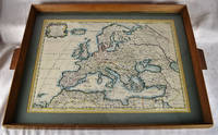
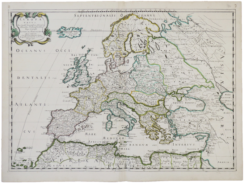
16502312280001Petrum Mariette: Lutetiae Parisiorum 1650. First Edition. Maps. Very Good. Ancient Europe : The Roman Empire Fine hand-colored double-page engraved map of Roman provinces of Europe. Mounted in wood frame with wooden side handles. Dimensions of mounted image: 40 x 56 cm. 53 x 69.5 cm in frame. Latin province names cities seas. This is an oversized or heavy book which requires additional postage for international delivery outside the US. Petrum Mariette: Lutetiae Parisiorum unknown
1650LBW-4944Paris, chez l'auteur et chez Pierre Mariette, 1650. 393 x 553 mm.
165556109Paris. 1655. Attractive map of Morocco and parts of Algeria. Maps by Sanson in original colour are rare. Nicolas Sanson was founder of the French school of mapmakers at a time when the leadership in European cartography passed from the Low Countries to France. Copper engraving. Very good condition. Some light browning to the centre fold. Attractive water mark. Original colour. Size: 53 x 40 cm. 21 x 15½ inches unknown
1692001000Paris: Chez H. Jaillot 1692. First edition thus. Map. Good/No jacket as issued. Large double page copper engraved map 23" x 34 1/2". Contains wide margins and a decorative cartouche. Hand-colored boundaries and cartouche. General age-toning with minor browning. Nicely framed in modern rope effected matte gold frame 32" x 42" with gilt bordered white mat and acrylic glaze. A good copy of this scarce map. All text in French Printed just 9 years after the Ottomans besieged Vienna. Extra shipping may apply for foreign orders. Chez H. Jaillot unknown
1683M11172Paris c.1683. Very Good. Notes: French map showing Poland and the surrounding region.<br>Nicolas Sanson 1600–1667 was a renowned French cartographer termed by some as the "father of French cartography." His works are known for their incorporation of the most up to date information of the time and their clean modern style. Size : 188x256 mm 7.40x10.08 Inches Coloring: Hand Colored Category: Maps Europe Poland Lithuania; unknown
1720M8856Amsterdam: Pierre Mortier 1720. Very Good. Notes: A fine large scale map of Mediterranean Sea Italy Greece Eastern Europe Turkey. The map depicts the Ottoman Empire in the mid to late seventeenth century. Size : 530x864 mm 20.87x34.02 Inches Coloring: Original Hand Coloring Category: Maps Europe Balkans; Maps Mediterranean Sea; Maps Europe Italy; Maps Europe Greece Macedonia; Maps Asia Near East Turkey; Pierre Mortier unknown
1654G1ADV7RKD7B6Paris 1654. Engraved map 42 x 56 cm coloured in outline. Map of the Turkish Empire showing Ottoman possessions in the Balkans Eastern Mediterranean Egypt and Arabia - marking topography and settlements.l Al Ankary 59; Al-Qasimi 60; Tibbetts 99. unknown