1 707 résultats
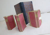
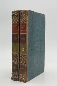
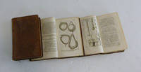
51-6669Paris: Desaint; & Boubers Bruxelles. 1782. 8vo. 3 vols. 12 x 20 cm. Contemporary calf. Leather peeled from corner and edge of one volume but solid. 176 plates.Duhamel was a passionate advocate of fruit "Je n'ai garde cependant de conseiller tout le monde indistinctement de manger de toutes sortes de fruits" he dismisses contemporary opinion that fruit could adversely affect health and presents the work as a practical manual intended to aid the spread of both the cultivation and consumption of fruit. His earlier interest in pears is demonstrated by the subjects of the plates: 58 of pears; 32 of peaches; 20 of plums; 16 of cherries; 14 of apples. Other fruits include almonds apricots and strawberries. References: OCLC Number / Unique Identifier:6743922; Dunthorne 109; Great Flower Books p.55; Nissen BBI 550; ; Stafleu and Cowan 1546.3 vol. in-8 veau raciné doslisses ornés p. de titre et de tom. brun et vert reliure del'époque. Fortes épidermures et manques de cuir.176 planches 29 84 63 gravées concernant les arbresfruitiers fruits feuilles graines et bourgeons dessinées parMagd. Basseporte et Le Berriays et gravées par Benoist Maison-Neuve Mesnil Tardieu etc. Les bibliographes indiquent 180 voire181 planches en tout mais en réalité le nombre de planches varieselon les exemplaires et n'est pas fixe.Duhamel du Monceau est l'un des plus grands botanistes du XVIIIesiècle. Originaire de la petite noblesse la richesse de sa famille luipermit de poursuivre ses recherches en agronomie botaniquechimie et technologie navale bien que l'on retienne avant tout delui ses travaux sur les arbres fruitiers. Nissen IV 550. Paris: Desaint; & Boubers, Bruxelles. 1782. hardcover
51-6926Paris: Dentu An X 1802. 3 text volumes in original pink wrappers. 14 x 21cm. Atlas: folio. 27.5 x 36cm. Half goatskin and marbled boards by the artisan binder Sasha Mosalov. Original pink boards saved separately. . A few plates with marginal waterstains.OCLC Numbers465192568 and 1501424368.3 vol. ; in-8 XVIII-303 332 315-1 p. Atlas with 14 pages 43 leaves of plates 4 folded : 37 illustrations.The atlas includes plates of Corfu Zante Ithaca and Athens in addition to 5 views of the plain of Troy which have been re-engraved from the aquatints in Morritt's Vindication. Le Chevalier's survey of the Troad marks the beginning of modern archaeological exploration in that area despite the fact that his theory as to the location of Troy proved to be incorrect. Le Chevalier worked with Choiseul Gouffier and Louis Francois Cassas. Paris: Dentu, An X (1802) hardcover
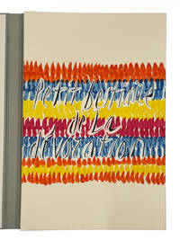
11371Paris: Maeght Editeur 1991. No. 111 of 120 copies signed by Jean Tardieu and Jean Cortot on the colophon. With a presentation inscription by the author “A Catherine Jajolet a une amie de longue date en la felicitant de son talent exceptionnel et en la remerciant pour ses merveilleuses photographies en affectueux hommage Paris 21 janier 92â€. 18 colour lithographs and silk-screen prints including one which is printed across both wrappers. 33 x 50.5 cms. Large folio loose as issued in the original wrappers housed in a silver cloth chemise with lettering in black on the cover and spine with a matching silver cloth slipcase.Four poems by Jean Tardieu 1903-95 are printed elegantly by l’Imprimerie Arte and dramatically illustrated with lithographs combined with silk screen printing by the artist Jean Cortot 1925-2018 who was an important French graphic artist painter and illustrator. Strikingly illustrated by Cortot Maeght Editeur hardcover
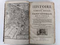
51-5721Paris:Grégoire Du Puis1724. . Folio. 24.5 cx 38 cm. Qtr. contemporary roan and marbled boards. 20 326 clxxxviii 30 pp. From page 323 onwards with clipped bottom corner. Numerous hors texte and folding plates. OCLC Number / Unique Identifier 1177089803. . Préface Sommaire des livres Catalogue des Abbez de Saint Germain-328-clxxxviij Recueil des pièces justificatives pour l’histoire de l’Abbaye Royale de Saint Germain des prez.bandeaux. 24 planches : Un plan du faubourg Saint Germain en frontispice Un plan général Planche double de l’Abbaye de Saint Germain des Prez comme est présentement 1723 Vuë septentrionale de l’Abbaye de St.Germain des Prez telle qu’elle est presentement Chaufourier Tombeau de la Reine Frédegonde Chaufourier Vue orientale de l’Abbaye de St.Germain des Prez telle qu’elle étoit en 1368 Chaufourier Chasse de S.Germain Evêque de Paris Chaufourier Retable du grand autel de St.Germain des Prez Chafourier Vuë méridionale de l’Abbaye de St.Germain des Prez en 1440 et du Louvre Tel quil étoit depuis Philippe Auguste jusques à François I Chaufourier Planche double Vuë ocidentale de l’Abbaye de S.Germain des Prez telle qu’elle étoit avant 1640 Chaufourier Planche double Tombeau de Guillaume Douglas prince d’Ecosse Chaufourier Tombeau de Jean Casimir Roi de Pologne Chaufourier Chapelle de Sainte Marguerite Tombeau de MM.de Castellan Chaufourier Tombeau de Saint Germain rétabli en 1690 ChaufourierTombeau du cardinal de Fustemberg et du comte Ferdinand son nepveu Chaufourier Plan ancien et moderne de l’église de St.Germain des Prez Chaufourier Grand portail de l’église de S.Germain des Prez Chaufourier Grand autel de St.Germain des Prez Chaufourier Reliques Chaufourier Reliques Chaufourier Reliques Chaufourier Reliques Chaufourier Tombeau de Jacques Douglas prince d’Ecosse Chaufourier Habits des religieux de S.Germain des Prez Dessignez sur leurs tombes Chaufourier. Paris:Grégoire Du Puis,1724. hardcover
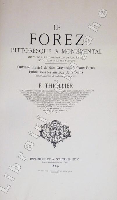
188918238Lyon, Imprimerie A. Waltener, 1889 ; 2 tomes grand in-folio, en feuilles sous chemises cartonnées illustrées, XXXVI, 451 pp. et plusieurs centaines de dessins in-texte ; 127 feuillets hors-texte représentant 155 planches en héliogravure ou gravées à l'eau-forte.
51-3516Paris:Buisson An VII de la République 1798 or 1799 . Large 4to. 19th Century 1/4 calf with marbled boards. 30 x 22 cm. Atlas only with all the plates. 44 plates some folding. Very good. Expertise by Dominique Courvoisier Paris.Brunet V p. 527OCLC Number: 68847877French translation of "Narrative of a five years' expedition against the revolted negroes of Surinam : in Guiana on the wild coast of South America ; from the year 1772 to 1777: elucidating the history of that country and describing its productions . with an account of the Indians of Guiana & Negroes of Guinea."Paris Buisson An VII de la République. In-4 demi-veau vert olive dos lisse orné pièces de titre rouges Reliure pastiche moderne.Atlas seul complet des 44 très jolies planches gravées en taille-douce par Tardieu l'aîné certaines se dépliant: carte du Surinam plan de Paramaribo portrait de l'auteur scènes d'esclavage animaux plantes vues de plantation etc.Quelques légères rousseurs dos passé. Paris,:Buisson, An VII de la République [1798 or 1799 )] hardcover
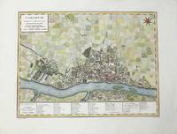
1785M10371Paris c.1785. Excellent wide margins. Notes: A fine early plan of Warsaw is based upon the 4-sheet plan of Warsaw by Pierre Ricaud de Tirregaille entitled Plan de la ville de Varsovie first published in 1762 and Antonio Rizzi-Zannoni's single sheet version of the map published in 1772.<br>Pierre Ricaud de Tirregaille a French Architect and Engineer worked in Warsaw as a surveyor and as an army engineer. Crown Marchal Bielinski commissioned Tirregaille to prepare a detailed plan of the city of Warsaw which resulted in the first map of Warsaw based upon a scientific survey.<br>Rizzi-Zannoni's plan published in 1772 of which we have an example coincided with the efforts of Polish Nobles to enlist the assistance of French "democracy" experts in Paris including Rosseau and Malby to help restructure the Polish "Republic" on the eve of the first partition.<br> Size : 345x455 mm 13.58x17.91 Inches Coloring: Hand Colored Category: Maps City Maps; Maps Europe Poland Lithuania; unknown
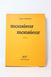
195165467Paris: Gallimard 1951. Fine. Gallimard Paris 1951 14 x 19.50 cm broché First edition one of 13 numbered copies on Hollande paper the tirage de tête. A nice copy. Gallimard unknown
182419863Paris, Chez Auguste Boulland et Cie, 1824. 2 parties en un volume in-8 de VIII-306 et [4]- de 305 à 623-[1] pages. Demi-chagrin brun, dos (passé) orné de filets et fleurons dorés.
18256181Paris, P. Dupont, 1825. In-folio broché de [4]p. et 15 cartes dépliantes, couverture grise d'éditeur. Non rogné.
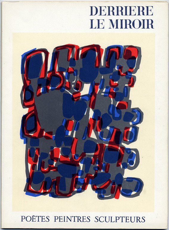
1960801Paris, Maeght éditeur, 1960. In-folio (380 x 280 mm) en feuilles, 36 pages. Édition originale et 1er tirage des 12 lithographies hors-texte, soit : 8 LITHOGRAPHIES ORIGINALES EN COULEURS de Braque (double-page), Chagall, Mirò (double-page), Bazaine (double-page), Ubac, Palazuelo, Tal-Coat (double-page) et Chillida ; 2 LITHOGRAPHIES ORIGINALES EN NOIR de Fiedler et Giacometti ; 2 LITHOGRAPHIES EN COULEURS d'après Wassily Kandinsky et Fernand Léger (double-page). DLM publié en mars 1960 pour l'exposition d'œuvres de Braque, Chagall, Kandinsky, Léger, etc. Textes de Char, Cendrars, Volboudt, Brossa, Queneau, Leclercq, Frénaud, Tardieu, Hernandez, Guillén et du Bouchet. Magnifique numéro, ici à l'état de neuf.
183756150<p>lithograph double-page sheet. EXTREMELY RARE map from "Atlas Journal de la Navigation Autour du Globe de la Frégate la Thétis et de la Corvette l'Esperance pendant les années 1824 1825 et 1826"; pl. 52; REFERENCE: Borba de Moraes I p. 115; Sabin 6874; cf. Ferguson 2236; Ferguson 1204; cf. Hill p. 31; Numa Broc Oceanie 89; cf. Nissen ZBI 483; Howgego B50.</p> Arthus Bertrand, Paris.
51-5756Paris: Etienne Ledoux 1821. Folio. 30 x 45cm. Fifteen mainly double-page maps colored in outline. Original qtr. calf. and boards.OCLC Number Identifier:558050636.Very good. Paris: Etienne Ledoux, 1821. hardcover
286753Pierre-Francois Tardieu. unbound. Map. Engraving with modern hand coloring. Image measures 12.5 x 16.75 inches. Sheet measures 17 x 22 inches. In very good condition.<br/><br/> Beautiful early map of Florida and Georgia western Louisiana southern parts of the Carolinas and the Bahamas. The interior of Florida was not yet mapped with distortions to Baie du St. Espirit. Pierre Francois Tardieu 1711-1771 came from a family of engravers and map makers based in Paris. This map was engraved by Jean Emmanuel Jerome Vallet. Hard to find.<br/><br/> Pierre-Francois Tardieu unknown books
51-4364Paris: Circa mid-18th Century. Plate volume with 189 engraved plates. 4to. 29 x 22 cm. Contemporary marbled calf. restored. Graveur à l'eau-forte et au burin. - Élève de Lepautre puis de Gérard et Bernard'Audran.Figures de la Bible et de l'histoire sainte.Paris Tardieu milieu du XVIII°siècle.In-4 veau marbré dos lisse orné reliure de l'époque.Suite de 189 planches gravées par Tardieu d'après des tableaux illustrant l'ancien testament 22 le nouveau testament 144 et l'histoire sainte 23.Bon état intérieur. Coiffes et coins usagés.Expertise by Christian GASCHExpertise Livres Anciens et Modernes58004 NEVERS Cédex Paris: Circa mid-18th Century unknown
286753Pierre-Francois Tardieu. unbound. Map. Engraving with modern hand coloring. Image measures 12.5 x 16.75 inches. Sheet measures 17 x 22 inches. In very good condition.<br/> <br/> Beautiful early map of Florida and Georgia western Louisiana southern parts of the Carolinas and the Bahamas circa 1798. The interior of Florida was not yet mapped with distortions to Baie du St. Espirit. Pierre Francois Tardieu 1711-1771 came from a family of engravers and map makers based in Paris. This map was engraved by Jean Emmanuel Jerome Vallet. Hard to find.<br/> <br/> Pierre-Francois Tardieu unknown
1838LBW-7160Paris, Binet, 1838. Gravure originale (52 x 64,5 cm).
195165467Gallimard | Paris 1951 | 14 x 19.50 cm | broché
1838LBW-6527Paris, Binet, 1838. 520 x 645 mm.
16-3606Paris Chez F. Buisson Imprimeur-Libraire an X 1802. 4to. Contemporary qtr. roan and marbled boards and eps. Table of plates and 15 engraved plates including a map "Carte de Détroit qui sépare l'Asie de l'Amérique."Map 44.5 x 63 cm. by Tardieu. Map with loss lower right center 8.5 x 1 cm. The first edition in French of the atlas volume only. Sauer’s work documents the Russian Northeast Expedition led by Captain Billings. He served as secretary on the voyage and Lada-Mocarski notes that he was "critical of Billings and sorely disappointed when Billings decided to abandon the idea of going back to the American coast south of Cook's River." Arctic Bib. 37229 text vols only not mentioning atlas; Howes-S 117; cf. Lada-Mocarski 58; Sabin 77153; Tourville 3974; Wickersham 6135.Alaska Description and travelAleutian Islands AlaskaSiberia Russia Description and travelVoyages 18e siècle Russie nordIn-4° demi-veau dos à nerfs orné d’un décor doré et à froid reliure de l’époque.ÉDITION ORIGINALE.Quinze planches gravées sur cuivre dont une carte repliée.Planches seules de cet ouvrage qui comprend deux volumes in-8° de texte.Dos légèrement passé ; petite fente à un pli de la carte. Paris, Chez F. Buisson, Imprimeur-Libraire, an X (1802). hardcover
195173758Paris: Gallimard 1951. Fine. Gallimard Paris 1951 14.50 x 19 cm broché First edition one of 8 numbered copies on Holland paper ours being one of 3 hors commerce deluxe issue. A pleasant copy. Gallimard unknown
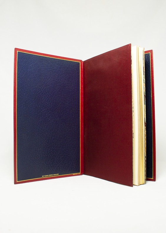
175116344Londres [Paris], Nourse, 1751. Album in-8, maroquin rouge janséniste, doublure de maroquin bleu, gardes de moire rouge indien, tranches dorées. De la bibliothèque Henri Beraldi (I, 1934, n°223) avec l’ex-libris au bas du premier contreplat; ex-libris R. Zierer, et Jean-François Chaponnière. Reliure signée Noulhac, 1918.
1960801-1Paris, Maeght éditeur, 1960. In-folio (380 x 280 mm) en feuilles, 36 pages. Édition originale et 1er tirage des 12 lithographies hors-texte, soit : 8 LITHOGRAPHIES ORIGINALES EN COULEURS de Braque (double-page), Chagall, Mirò (double-page), Bazaine (double-page), Ubac, Palazuelo, Tal-Coat (double-page) et Chillida ; 2 LITHOGRAPHIES ORIGINALES EN NOIR de Fiedler et Giacometti ; 2 LITHOGRAPHIES EN COULEURS d'après Wassily Kandinsky et Fernand Léger (double-page). DLM publié en mars 1960 pour l'exposition d'œuvres de Braque, Chagall, Kandinsky, Léger, etc. Textes de Char, Cendrars, Volboudt, Brossa, Queneau, Leclercq, Frénaud, Tardieu, Hernandez, Guillén et du Bouchet. Magnifique numéro.
182089082Paris: Madame Veuve Courcier 1820. Fine. One of the earliest explorations of Senegal Madame Veuve Courcier Paris 1820 13.2 x 21.1 cm Relié First edition illustrated with 4 engraved plates by Ambroise Tardieu portrait of Diai-Boukari in marabout attire from Foutatoro view of the Foutatoro army on the march view of the sources of the Rio Grande and the Gambia view of Timbo; and a large folding map at the end of the first volume copy signed by the author on the verso of the title page of vol. I. Contemporary half calf bindings spines decorated with gilt roll tooling in place of raised bands title and volume labels in red calf paper covered boards speckled blue edges small wormhole to the lower hinge of the first volume. Shortly after the Treaty of Paris returned Senegal to France Molliena mere naval clerk and survivor of the Medusa shipwreckwas sent to Africa by the French government on a geographical and political mission Sent to explore the sources of the Senegal and Gambia rivers Mollien was also tasked with countering British expansion in the region. At the end of volume 2 are found an itinerary and glossaries of the Iolof Wolof Poule Peul and Serer languages along with geographical observations on Mollien's discoveries by Eyries. Madame Veuve Courcier hardcover
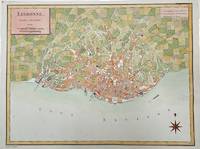
1792M4211Paris 1792. Very Good upper margin has been extended. Notes: Map of Lisbon capital of Portugal published in late 18th century.<br>Antoine-François Tardieu 1757-1822 was a French geographical engraver and publisher active in Paris during the late 18th and early 19th centuries. Size : 340x447 mm 13.375x17.625 Inches Coloring: Hand Colored Category: Maps City Maps; Maps Europe Portugal unknown