1 707 résultats
1950017573Paris: Editions Vincent Freal & Cie. 1950. HEAVY. 30pp text approx 200pp bw ills 350 bw ills bibliography. Or light brown cloth with embossed brown title. Prev owners name stamp and number at rear. An exceptional and important reference for dating French regional furniture from the 16th through mid-19th centuries. Limited text in French rather superfluous as the hundreds of details illustrations provide the necessary information. Text in French/en Francais. First Edition. Hard Cover. Very Good. 4to. Editions Vincent, Freal & Cie. Hardcover
1950106489Paris : Editions Vincent Freal & cie. 1950. 280x225mm. 110 planches en n/b broch. Couverture rabats. Petites dchicures sur le haut du dos autrement bel exemplaire. 1011 Editions Vincent, Freal & cie. unknown
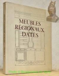
000213Paris: Vincent Fréal & Cie 1950. viii 32pp plus 350 monochrome illustrations. Cloth 28x22.5cms. Detailed drawings and photographic reproductions of examples of regional French furniture from 1563 onwards. With concordances bibliogaphy documentation. Text in French. Paris: Vincent, Fréal & Cie, 1950. hardcover
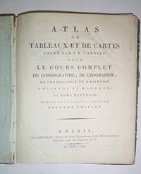
51-4449Paris: Chez Bernard 1804. 4to . 23 x 25 cm . Modern half Sakora goat and marbled boards by the artisan binder Sasha Mosalov. Without the title page. 15 handcolored double page maps each 25 x 41cm. . Includes a world map and maps of North and south America. .OCLC Number: 879716030; 45848528. Paris: Chez Bernard, 1804. hardcover
16-4498Paris Bernard 1804. 4to. 21 x 25.5 cm. With 19 of handcloored double-page maps Lacks the 20th of France but the 2 of America are present.Contemporary qtr. roan somewhat worn.in-4 relié demi-basane frottée. Illustrées de 6 tableaux dépliants montés sur onglet et de 19 cartes ou plans sur 20 manque la dernière. Quelques restaurations dans les marges blanches de quelques cartes Paris, Bernard, 1804, unknown
1783M2768Paris: Le Clerc Nicolas Gabriel 1783. Excellent. Size : 238x480 mm 9.375x18.875 Inches Coloring: Hand Colored Category: ; Maps Europe Ukraine Le Clerc, Nicolas Gabriel unknown
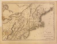
1801301221Paris: Maradan 1801. Map. Uncolored engraving. Image measures 14 1/4" x 19 3/4". Stains and foxing but otherwise in good condition.<br/> <br/> Important early map of the United States published in "Voyage dans la Haute Pensylvanie et dans l'etat de New-York" by Michel Guillame de Crevecoeur. One of the most highly detailed and comprehensive maps published post-Revolution it depicts the northeast US extending from Maine to northern Virginia and westward to the Ohio River. In the Finger Lakes region surveyed bounty land known as the Central New York Military Tract or New Military Tract is indicated. Following the Revolutionary War New York soldiers were guaranteed 500 acres as compensation for their service. Nearly two million acres were reserved for this purpose. Other interesting features of the map include the Connecticut Western Reserve in present day Ohio and lack of a northern border in Maine. Cities counties rivers and roadways are labeled. Some stains along left margin. Minor spotting. <br> <br> Pierre Francois Tardieu 1711-1771 came from a family of engravers and map makers based in Paris.<br/> <br/> Maradan unknown
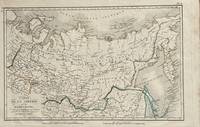
1821172Paris: Tarieu Pirre 1821. 9 3/4 x 15 1/2 inches. Very good. Beautifully engraved map of Siberia as delineated in the early 19th century. Laid down on a small scale the map covers from Novelle Zemla to Kamtchatka Peninsula. From the Arctic Ocean to the Territory of the Chines there is an underlying physical geography focused on a riverine regime. Overall a very nice cartifact. Tarieu, Pirre unknown
286753Pierre-Francois Tardieu. unbound. Map. Engraving with modern hand coloring. Image measures 12.5 x 16.75 inches. Sheet measures 17 x 22 inches. In very good condition.<br/> <br/> Beautiful early map of Florida and Georgia western Louisiana southern parts of the Carolinas and the Bahamas circa 1798. The interior of Florida was not yet mapped with distortions to Baie du St. Espirit. Pierre Francois Tardieu 1711-1771 came from a family of engravers and map makers based in Paris. This map was engraved by Jean Emmanuel Jerome Vallet. Hard to find.<br/> <br/> Pierre-Francois Tardieu unknown
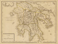
179734633Paris um 1797. In excellent condition. 34.5 x 435 cm 13.5 x 1725 inches. Original antique copper engraving colored in outline when published. Antique map of the Peloponnes in Greece hand colored in outline. Many place names rivers and mountains are shown. Title cartouche in the lower left corner mile sclae in the left sided middle. Pierre Antoine Tardieu also known as P.F. Tardieu March 9 1784 in Paris July 17 1869 in Paris was a French engraver steel engraver and cartographer.Pierre Antoine Tardieu was born in his family's ancestral home on Place de Estrapade. He was taught his craft by his father Antoine François Tardieu. He was the first of his family to carry out his maps in steel engraving. The extraordinary quality of his work even drew the attention of Alexander von Humboldt.In 1818 he married Eugénie-Isabelle de Bonnaire.1 In the years 1832 to 1834 he was involved in several arms dealerships as a volunteer in the reintroduced Garde Nationale. During this time he also became an elementary school inspector.He also took part in the industrial exhibition in 1834 where he received the bronze medal from Louis-Philippe I for his work. In 1837 he was finally appointed Knight of the Legion of Honour. He worked in his father's workshop for a total of 25 years before becoming self-employed. However he continued to live in the house where he was born until his death. In 1861 he retired at the age of 77. In excellent condition. unknown
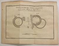
1801301145Paris: Maradan 1801. Print. Uncolored engraving. Plate measures 6" x 8 1/2"<br/> <br/> This map and diagram published in "Voyage dans la Haute Pensylvanie et dans l'etat de New-York" by Michel Crevecoeur depicts ancient circular fortifications built by Native Americans along the Huron River. The Huron River is also referred to as the Bald Eagle River named after a large nest found at the mouth of the river in the 18th century. The engraving reads "This sketch was sent to George Washington by A. Steiner on May 28 1789." Pierre Francois Tardieu 1711-1771 came from a family of engravers and map makers based in Paris. Rare.<br/> <br/> Maradan unknown
68-0238Paris France: Tardieu ca. 1820. Engraving mounted on backing paper. 4to. Very Good. Text in French. Paris, France: Tardieu [ca. 1820]. unknown
2010DADAX1160842531Kessinger Publishing 2010-03-19. paperback. New. 6.00x1.20x9.00. Buy with confidence. Excellent Customer Service & Return policy. Kessinger Publishing paperback
2010DADAX1168154049Kessinger Publishing 2010-09-10. paperback. New. 6.00x1.20x9.00. Buy with confidence. Excellent Customer Service & Return policy. Kessinger Publishing paperback
1168154049.Gpaperback. Good. Access codes and supplements are not guaranteed with used items. May be an ex-library book. paperback
1160842531.Gpaperback. Good. Access codes and supplements are not guaranteed with used items. May be an ex-library book. paperback
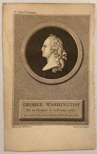
1801301127Paris: Maradan 1801. Print. Uncolored engraving Image measures 6" x 4 1/8"<br/> <br/> This bust of George Washington was published as the frontispiece to "Voyage dans la Haute Pensylvanie et dans l'etat de New-York" by Michel Crevecoeur. In this portrait Washington's left profile is depicted on a medallion. Pierre Francois Tardieu 1711-1771 came from a family of engravers and map makers based in Paris.<br/> <br/> Maradan unknown
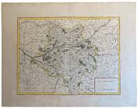
18065192Paris: Pierre Gilles Chanlaire and Edme Mentelle 1806. First edition. An attractive map of Touraine by the celebrated French map maker Tardieu. Hand coloured. engraved by Pierre François Tardieu drawn by Dubuisson. Very good condition slight central crease where folded in the atlas minimal stains on the margins. Government of Touraine showing the department of Indre et Loire. Taken from the Universal Atlas of Mentelle and Chanlaire. 32cm x 42cm. Loosely held under passe partout. Pierre François Tardieu 1711–1771 belonged to a family of cartographers and engravers of the mid- to late-18th and early-19th centuries. He was a highly regarded map engraver during his lifetime enjoying the patronage of Alexander von Humboldt and the respect of his colleagues. He engraved several maps of the Americas including Virginia and the southeast coast Canada the northeastern United States as well as several maps of European and American cities. . Première édition. Une jolie carte de la Touraine par le célèbre cartographe français Tardieu. Colorée à la main gravée par Pierre François Tardieu dessinée par Dubuisson. Très bon état léger pli central à l'endroit où la carte a été pliée dans l'atlas petites taches dans les marges. Gouvernement de la Touraine montrant le département de l'Indre et Loire. Tiré de l'Atlas universel de Mentelle et Chanlaire. 32cm x 42cm. Tenue libre sous passe partout. Pierre François Tardieu 1711-1771 appartenait à une famille de cartographes et de graveurs du milieu et de la fin du XVIIIe siècle et du début du XIXe siècle. Il fut de son vivant un graveur de cartes très apprécié bénéficiant du patronage d'Alexander von Humboldt et du respect de ses confrères. Il a gravé plusieurs cartes des Amériques notamment de la Virginie et de la côte sud-est du Canada du nord-est des États-Unis ainsi que plusieurs cartes de villes européennes et américaines. Pierre Gilles Chanlaire and Edme Mentelle unknown
2201763Contentum Ltd. Loose sheet. New. High-quality art print based on an original work from the Rijksmuseum. Created in the 18th century 1721. Professionally printed on premium fine-art paper Photo Matt Fibre in size A2. The artwork is printed with a white border museum-style presentation. Contentum Ltd. unknown
2201765Contentum Ltd. Loose sheet. New. High-quality art print based on an original work from the Rijksmuseum. Created in the 18th century 1721. Professionally printed on premium fine-art paper Museum Etching museum quality in size A2. The artwork is printed with a white border museum-style presentation. Contentum Ltd. unknown
2201764Contentum Ltd. Loose sheet. New. High-quality art print based on an original work from the Rijksmuseum. Created in the 18th century 1721. Professionally printed on premium fine-art paper Photo Rag Bright White premium quality in size A2. The artwork is printed with a white border museum-style presentation. Contentum Ltd. unknown
2201762Contentum Ltd. Loose sheet. New. High-quality art print based on an original work from the Rijksmuseum. Created in the 18th century 1721. Professionally printed on premium fine-art paper Museum Etching museum quality in size A3. The artwork is printed with a white border museum-style presentation. Contentum Ltd. unknown
179324813France 1793. Very good condition. Handsome copper engraved portrait bust of the great French Pacific explorer whose last known stop on his circumnavigational voyage was at Botany Bay the newly founded colony of New South Wales. After he departed Botany Bay and explored the coast of Australia he went on to New Caledonia the expedition vanished. <br /> <br /> La Perouse 1741 - 1788 was commissioned in 1785 to head a scientific expedition the Pacific for fur and whaling resources and to claim new territory in Australia for the French crown. He explored widely from Chile and Hawaii to Alaska and California where he was the first foreign visitor since its founding in 1769 making a detailed description of the country.<br /> <br /> Showing the head and shoulders of la Perouse in braid-trimmed naval coat within an oval frame. Printed below the image "Grave d'apres une Miniature par Alex.r Tardieu 1793". <br /> 9 1/4 x 11 1/2". Wide margins with 2 of the impression lines visible on thick gauge paper. Trove 9635425. unknown
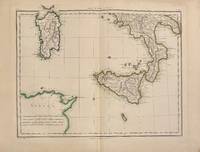
1802331189Paris: Edme Mentelle 1802. Map. Engraving with hand coloring. Image measures 14" x 17"<br/> <br/> This 1802 map by Tardieu depicts southern Italy the islands of Sicily and Sardinia and the northern coast of present-day Tunisia. The highly detailed map identifies towns cities roads and rivers. Mountains are depicted pictorially. The map is in very good condition with minor toning to edges. <br> <Br> Pierre Francois Tardieu 1711-1771 came from a family of engravers and map makers based in Paris.<br/> <br/> Edme Mentelle unknown
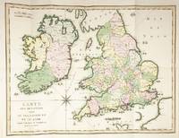
51474A Paris: de l'Imprimerie de Crapelet An VI 1797/1798. 4to. 27 x 21cm. pp.43. Original pink boards with white printed label. Large folding map overall: 48 x 63cm image: 42 x 55cm in full original hand colour titled 'Carte des Descentes faites en Angleterre et en Irlande depuis Guillaume le Conquerant jusqu'a nos jours. An VI' showing the locations of the attempted invasions of Britain since William the Conqueror in 1066. Boards rubbed map very clean and attractive. A history of the invasions of Britain. A Paris: de l'Imprimerie de Crapelet An VI [1797/1798]. hardcover