Hyacinthe Yves Bougainville / Baron de Potentien / Edmond de la Touanne / Tardieu / de VaisseauBiblio.com

88 résultats
183760644<p>lithograph 3 maps on double-page sheet EXTREMELY RARE. Maps from "Atlas Journal de la Navigation Autour du Globe de la Frégate la Thétis et de la Corvette l'Esperance pendant les années 1824 1825 et 1826"; pl. 47; REFERENCE: Borba de Moraes I p. 115; Sabin 6874; cf. Ferguson 2236; Ferguson 1204; cf. Hill p. 31; Numa Broc Oceanie 89; cf. Nissen ZBI 483; Howgego B50. Condition: with heavy foxing in margins slight foxing on plate. Soft cover.</p> Arthus Bertrand, Paris.
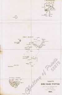
183756149<p>lithograph map and 2 profiles on double-page sheet. EXTREMELY RARE map from "Atlas Journal de la Navigation Autour du Globe de la Frégate la Thétis et de la Corvette l'Esperance pendant les années 1824 1825 et 1826"; pl. 51; REFERENCE: Borba de Moraes I p. 115; Sabin 6874; cf. Ferguson 2236; Ferguson 1204; cf. Hill p. 31; Numa Broc Oceanie 89; cf. Nissen ZBI 483; Howgego B50.</p> Arthus Bertrand, Paris.
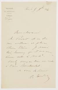
1864603961864. Paris 5.XII.1864. 1 Seite gr.-8°. Mit Siegelspur und Adresse. Gestochener Briefkopf "Faculté de Médecine / Cabinet du Doyen". Ambroise Auguste Tardieu 1818-1879 französischer Rechtsmediziner; das Battered-Child-Syndrome ist auch als Tardieu-Syndrom bekannt. - An Professor Regnauld mit der Bitte um Empfehlung eines Schülers. ". Mr. Prévost est un de mes meilleurs et plus chers elèves. Je serais très heureux qu'il eut une bonne note à sortie. Voulez-vous en dire un mot à l'ami Boucharelat ." unknown
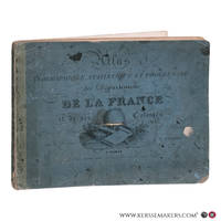
183578717Paris: Chez de Pelafol libraire c 1835. Oblong folio 26x34 cm. Original printed publishers wrappers with vignette soiled some small stains and a few loss of paper. - Missing: endpapers title the 2 large flding maps and 1 folding map "Ile de Bourbon". But still a nice collection of all the 86 engraved departemental maps & "Paris" & "Environs de Paris" coloured by hand in vivid colors and the folding maps: "Alger" and 5 of 6 of the colonial maps "Guyane" "Sénéal" "Martinique etc" Guadaloupe" and "Les Possessions Françaises Orientales" also coloured by hand. - Together 94 maps. Chez de Pelafol, libraire unknown
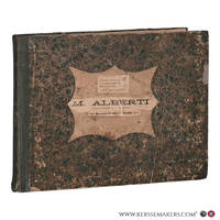
183078711Paris: Pelasol c. 1830. Oblong folio 25x33 cm. Contemporary half cloth covers marbled paper spine partly damaged; marbled paper rubbed and loss of paper at the borders; first endpapaers renewed. Calligraphed title with on verso "Table. composant l'Atlas"and explications of "Signes conventionnels pour les Departemens". And 97 engraved maps 'sous la direction de P. Tardieu' with explanatory texts printed in the margins in a very small type. A bit loose in binding small lightbrown spots in places. 97 maps complete: 2 large folding maps 'France' & 'Douanes'. - 86 'Departements'. 2 second copy of 'Seine' & 'environs de Paris' only these 2 handcoloured. - 1 'Alger' folding map - 6 'Colonies' folding maps. - Binding used; small waterstain in lower margins but on the whole an acceptable copy Pelasol hardcover
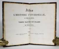
1836014368Paris: Furne & Fruger et Brunet 1836. Hardcover. Very Good/No Jacket. 12mo - over 6¾ - 7¾" tall. Half morocco marbled paper boards gilt spine decoration. Marbled endpapers. Twenty double-page map spreads designed and engraved by Ambroise Tardieu featuring plans of the cities of Athens Sparta ruins Carthage Jerusalem Syracuse Rome and Constantinople. Spine sunned light rubbing to extremities. Inner hinge cracked at flyleaf. Bookplates to flyleaves. Furne & Fruger et Brunet hardcover
1853117582Paris : Furne 1853. 425x280mm. 2 ff. 30 doubles planches avec frontiÂres coloriÂŽes demi-chagrin ˆ coins titre et filets dorÂŽs au dos plats papier marbrÂŽ reliure moderne. 2156 Furne unknown
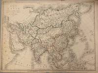
1821331698Paris: Ambroise Tardieu 1821. unbound. Map. Original outline color. Image measures 21 1/2" x 16"<br/> <br/> Simple and elegant map of Asia. Highly detailed the map shows rivers population centers and topography. Relief is depicted pictorially. In good condition with some closed tears to margins and edge toning.<br> <Br> Ambroise Tardieu 1788-1841 was a French engraver mapmaker and publisher. From a family of engravers he was trained by his uncle Pierre Alexandre Tardieu and became celebrated for his portraits. He also published a number of atlases. He and his uncle are not to be confused with Jean Baptiste Pierre Tardieu an unrelated French cartographer and engraver.<br/> <br/> Ambroise Tardieu unknown
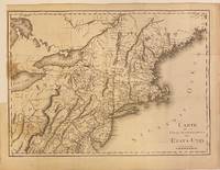
1801301221Paris: Maradan 1801. Map. Uncolored engraving. Image measures 14 1/4" x 19 3/4". Stains and foxing but otherwise in good condition.<br/> <br/> Important early map of the United States published in "Voyage dans la Haute Pensylvanie et dans l'etat de New-York" by Michel Guillame de Crevecoeur. One of the most highly detailed and comprehensive maps published post-Revolution it depicts the northeast US extending from Maine to northern Virginia and westward to the Ohio River. In the Finger Lakes region surveyed bounty land known as the Central New York Military Tract or New Military Tract is indicated. Following the Revolutionary War New York soldiers were guaranteed 500 acres as compensation for their service. Nearly two million acres were reserved for this purpose. Other interesting features of the map include the Connecticut Western Reserve in present day Ohio and lack of a northern border in Maine. Cities counties rivers and roadways are labeled. Some stains along left margin. Minor spotting. <br> <br> Pierre Francois Tardieu 1711-1771 came from a family of engravers and map makers based in Paris.<br/> <br/> Maradan unknown
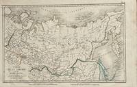
1821172Paris: Tarieu Pirre 1821. 9 3/4 x 15 1/2 inches. Very good. Beautifully engraved map of Siberia as delineated in the early 19th century. Laid down on a small scale the map covers from Novelle Zemla to Kamtchatka Peninsula. From the Arctic Ocean to the Territory of the Chines there is an underlying physical geography focused on a riverine regime. Overall a very nice cartifact. Tarieu, Pirre unknown
183455879<p>steel engraving map from 'Voyage Pittoresque Autour du Monde' vol.1 pl. 74. Dumont was a French explorer and naval officer. For thirty-eight months he explored the south and western Pacific Australia New Zealand and Antarctica. Several seaweeds plants and shrubs are named after him as well as D'Urville Island. Reference: Taylor 19 Graesse VIII 227. Condition: with paper loss and burn marks slightly into plate.</p> L. Tenré in Paris.
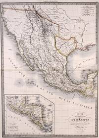
1842M7906Paris: P. Lehuby c. 1842. Very Good;. Notes: A rare and important version of Lapie's Mexico map circa 1842 which depicts Texas as an independent Republic. With an inset map in the lower left of Guatemala. Size : 550x395 mm 21.65x15.55 Inches Coloring: Original Outline Coloring Category: Maps United States South;Maps United States South Texas;Maps Central America Mexico; P. Lehuby unknown
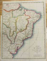
1821M2689Paris 1821. Very good. Size : 407x545 mm 16x21.5 Inches Coloring: Original Hand Coloring Category: Maps South America Countries; unknown
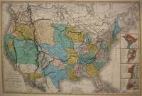
1848M7518Paris: A. Bes & F. Dubreuil Fils c. 1848. Very Good. Folding map flattened and backed acid-free tissue paper for long-term preservation. Two marginal tears repaired expertly. Notes: A scarce large-scale map of the Mexican-American War era and of the entire West. <br><br>To the very north the boundaries of the United States extend well into future British Columbia and within the current states of Washington and Oregon is carved the District of Columbia which was owned by the British. California Arizona and Nevada are together and California's central valley is highlighted for its gold deposits.<br><br>The map is based upon the Eustache Herisson map of the United States 1799 and its major cities. As various publications were made 1826 1834 the map started to take shape. Various projections of the Rocky Mountains were used based off of the Humboldt and Pike projections. Much of the Northwest is based off of the Lewis and Clark expedition. <br><br>This particular map is a scarce and important example as it focuses on the changes brought about by the Mexican-American War. The major differences in this regard are a small inset map of Central America and the delineation of the Mexican-American border; as this map shows all the territory that the United States had captured since the onset of the war. <br><br>Five inset maps depict Mexico and the cities of Washington Boston Philadelphia and New York. Size : 509x662 mm 20.04x26.06 Inches Coloring: Original Hand Coloring Category: Maps United States; A. Bes & F. Dubreuil Fils unknown
183652355Paris. 1836. Splendid route map of Switzerland showing all routes in detail and the cantons in outline colour. A key to the map at top right is in English German and French. Title at top left engraved in steel. Scales at lower right. La Suisse Pittoresque. Souverain Paris. Copper engraving. The whole map has been laid down on newer paper. Minor marks mainly towards margins but otherwise clean and crisp. Very good condition. Later colour. Size: 68 x 48 cm. unknown
18201103020030Grave par P.F. Tardieu 1820. Map. Very Good. 5-1/4 x 18-1/2 inches. Copperplate engraving of Constantinople including labeled geographic features and key in top-right corner listing them. Pierre Francois Tardieu 1711-1774 was a prominent French cartographer and engraver working in the mid 18th century. This print provides a fine example of his cartographic work and attention to detail. Two small pinholes on middle left side of image border. Smudge marks on top-right corner of border. Image itself remains clear and detailed. Ink lines are crisp and clean. A superior chart in excellent condition. Grave par P.F. Tardieu unknown
181053137Precis de la Geographie Universelle by Malte Brun. 1810. Clear and detailed engraving of Scandinavia with inset maps of Iceland and the Faroe Islands. Illustrated cartouche at lower right showing title on a rock in a forest. Two scales below Copper engraving. Fine condition Later colour. Size: 30 x 21 cm. 12 x 8½ inches unknown
18684079EB1868. Erlangen Verl. Ferdinand Enke 1868. 27 xylographische Abb. XIII 598 S. Original-Halblederband geringfügig berieben/bestoßen. Titelblatt unauffaellig gestempelt. Seiten teilw. geringfügig fleckig eine Seite mit Anmerkungen von alter Hand. Sonst in sehr gutem Zustand. unknown
18750033609Paris: Librairie J.-B. Bailliere et Fils 1875. Second Edition. Hardcover Hardcover. Good Condition. 22cm x 13cm. xx 1236 pages 2 plates 54 illustrations in the text. Quarter leather marbled papered boards gilt lettering. Text is in French. Medico-Legal and Clinical Study on Poisoning. Text is in French. Board edges rubbed. Some foxing. Bookseller's label of Tyrrell's Sydney. Category: Medicine & Health; Foreign Language::French; French Language; Inventory No: 0033609. BZDB407 Medicine & Health; Foreign Language::French; French Language; Unbranded Ambroise Tardieu; Z. Roussin E'tude Medico-Legale et Clinique sur L'Empoisonnement Librairie J.-B. Bailliere et Fils hardcover
1821D7867Paris: Chez Masson et fils 1821. Hardcover. Very Good. 8vo 210 x 125mm. 660pp. 11 plates on various subjects; 1 principles of the head and symmetry of the face; 2 principles of the human body and anatomy; 3 orders of columns and architecture; 4 architecture for military naval or marine; 5 cosmography folding; 6 the mappe-monde in two hemispheres 400 x 230mm folding; 7 physics; 8 Seven Wonders of the World folding; 9 portraits of Greek mythology; 10 personifications of the sun and muses; 11 portraits of divine muses; and one in-text illustration of signs of the zodiac on p. 54. Contemporary calf marbled endpapers; intermittent browning and foxing plates are bright and clean. Good. Large oval engraved bookplate of Biblioteca Francisci Riccardi De Verna and royal armorial book label; stamp of Bibl. Gust. Galletti Florence to title. <br/><br/>French childrens encyclopedia from 1821 with folding mappe-monde plate by Tardieu in excellent shape. Stated fourth edition of Massons encyclopedia for children; the first was published in 1804. Massons encyclopedia is arranged as a series of questions and answers on an encyclopedic range of topics suitable for the schools of deux sexes. The folding mappemonde map is an exquisite addition to the encyclopedia and looks like it was harldy ever unfolded. All the wonderful and expertly executed plates are on a richer and sturdier paper that has resisted age well. The well-known Parisian engraver Pierre François Tardieu executed the map as well as the plate on cosmography. Chez Masson et fils hardcover
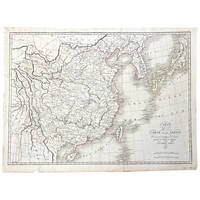
1821364072Paris 1821. Very good. An engraved map of China and the countries to the east by Ambrose Tardieu with period outline color. The text is in French.<br /> <br /> 22 by 16 inches on a larger sheet. Dated 1821 in the plate and published in Atlas pour servir a l'Intelligence de l'Histoire Générale des Voyages de Laharpe. Very good. Folded as issued. Page margin chipped in place not affecting the image. A short tear at the fold has been repaired with tissue. unknown
188226232BARCELONA: Imp. De los Sucesores de Ramirez y Cª 1882. 4º menor.- Media piel de época lomera con nervios filetes florones y textos dorados.- 422 páginass.- 2 hojas.- 5 láminas fuera de texto en litografia. . Imp. De los Sucesores de Ramirez y Cª unknown
1882154939Barcelona.: La Popular casa editorial de Francisco Pérez. 1882. Hardcover. Good. 8º m. Encuadernación en tapa dura artesanal con lomo estampado. Tardieu Ambroise 1818-1879. vá comprendida la legislación actual española. Imp. de los sucesores de Ramírez Cª. Derecho. 61 61 La Popular casa editorial de Francisco Pérez. hardcover