Ozanam, A FredericBiblio.com

778 résultats
0282137629.Gpaperback. Good. Access codes and supplements are not guaranteed with used items. May be an ex-library book. paperback
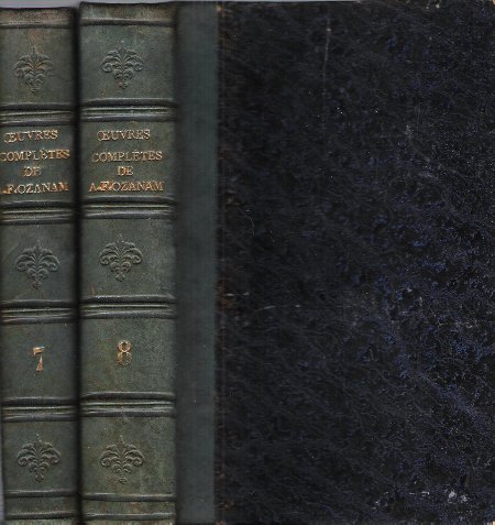
1859017753Paris Jacques Lecoffre et Cie Éditeurs 1859 In 8 Demi-cuir en veau vert anglais à 4 nerfs . Dos avec 3 fleurons en creux , auteur et tomaison dorés . Cartonnage légèrement frotté en bordure . Tranches jaspées . Imprimé sur bon papier mais avec quelques rousseurs pour certains tomes ( cf tomes 2 , 3 , 5 , 9 , 6 dans notre catalogue ) . L'auteur fut professeur de littérature étrangère à Paris . Historien catholique il fut récemment canonisé par le Pape Jean-Paul II . Notes et pièces justificatives . - 522 p. + 598 p. , ensemble 1 kg 650 gr.
19793Paris, Lecoffre et Fils, 1872. 11 x 18, 2 volumes, 599 + 681 pages, reliure dos cuir, bon état d'ensemble (quelques rousseurs, page 5 déchirée mais sans manque, soulignages).
187288721872 Paris, Lecoffre, 1872, 2 tomes en 2 vol. in 8 de (4)-558-(1) pp., (4)-628-(1) pp., rel. d'ép. demi-chagrin vert sombre, dos à nerfs, rousseurs éparses, bon ex.
0428073387.Gpaperback. Good. Access codes and supplements are not guaranteed with used items. May be an ex-library book. paperback
0428535208.Ghardcover. Good. Access codes and supplements are not guaranteed with used items. May be an ex-library book. hardcover
1872ROD0049604V.Palmé. 1872. In-8. Broché. Bon état, Couv. convenable, Dos satisfaisant, Intérieur frais. 576pp. Coiffes un peu abîmées.. . . . Classification Dewey : 270-Histoire et géographie de l'Eglise
1147375119.Gpaperback. Good. Access codes and supplements are not guaranteed with used items. May be an ex-library book. paperback
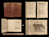
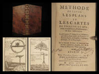
175024898<p><strong>1750 Surveying Map Making Cartography Tools FORT PLANS Ozanam Mathematics</strong></p><p>Jacques Ozanam was a 17th-century French mathematician most-known for his work '<em>Recreations'</em> or '<em>Mathematics'.</em> However in addition to his studies in mathematics he published one of the best works on surveying. '<em>Methode de Lever Les Plans'</em> is an important book on how to create maps and survey land both with and without technical instruments. Ozanam covers how to find the best location for mapping a location how to use necessary tools and how to use geometry to create plans of castles and forts!</p><p>Note the impressive folding maps and engravings bound at the end of this first edition book!</p><p>Item number: #24898</p><p>Price: $499</p><p>OZANAM Jacques</p><p><strong><em>MeÌthode de lever les plans et les cartes de terre et de mer avec toutes sortes d'instrumens & sans instrumens</em></strong></p><p>A Paris: chez Charles-Antoine Jombert 1750.</p><p><u>Details</u>: </p><p><!-- if !supportLists-->· <!--endif-->Collation: Complete with all pages</p><p><!-- if !supportLists-->o <!--endif-->12 244 8</p><p><!-- if !supportLists-->o <!--endif-->16 folding engravings</p><p><!-- if !supportLists-->· <!--endif-->Language: French</p><p><!-- if !supportLists-->· <!--endif-->Binding: Leather; tight and secure</p><p><!-- if !supportLists-->· <!--endif-->Size: ~6.5in X 4in 16.5cm x 10cm</p><p>Our Guarantee:</p><p>Very Fast. Very Safe. Free Shipping Worldwide.</p><p>Customer satisfaction is our priority! Notify us with 7 days of receiving and we will offer a full refund without reservation!</p><p>24898</p><p>Photos available upon request. </p> Charles-Antoine Jombert hardcover
036491811X.Ghardcover. Good. Access codes and supplements are not guaranteed with used items. May be an ex-library book. hardcover
036409303X.Gpaperback. Good. Access codes and supplements are not guaranteed with used items. May be an ex-library book. paperback
A9781166324810New. unknown
B9781166324810New. unknown
0270278176.Gpaperback. Good. Access codes and supplements are not guaranteed with used items. May be an ex-library book. paperback
1166324818.Gpaperback. Good. Access codes and supplements are not guaranteed with used items. May be an ex-library book. paperback
1120005671.Gpaperback. Good. Access codes and supplements are not guaranteed with used items. May be an ex-library book. paperback
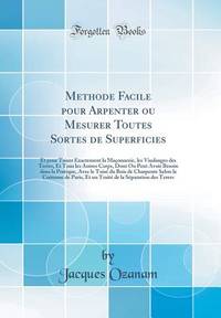
169911168Paris France: Chez Claude Jombert 1699. First Edition. Full Calf. Very Good. First Edition. Full Calf. Translation to English: Treatise on Method For Surveying Or Measuring All Kinds Of Areas: And For Exactly Surveying Masonry Land Surveys. Jacques Ozanam was born in Sainte-Olive Ain France. In 1670 he published trigonometric and logarithmic tables more accurate than the existing ones of Ulacq Pitiscus and Briggs; after which he secured an invitation to settle in Paris. There he enjoyed prosperity and contentment for many years. He married had a large family and derived an ample income from teaching mathematics to private pupils chiefly foreigners. His mathematical publications were numerous and well received. Récréations published 1694 was later translated into English and is well known today. He was elected a member of the Académie des Sciences in 1701. Early treatise on surveying mathematics forests and forestry measurements for wood. Minimal head and tail wear rubbing to boards minor foxing small tear on endpapers evidence of dampstaining minimal annotations small loss to rear otherwise tight bright and unmarred. Full calf gilt titling raised bands 8vo 397 pp. illus. In French. Bibliothek Der Mecklenburgischen Ritter- U. Landschaft ex libris stamp--title verso. Chez Claude Jombert unknown
1750264961Paris: Quay des Augiustin.Jombert 1750. Nouvelle edition. 16 folding plates. xii 244 pp. 1 vols. 12mo. Motlled contemporary calf edges red. Nouvelle edition. 16 folding plates. xii 244 pp. 1 vols. 12mo. Jacques Ozanam 1640-1718 was self-taught maths teacher. This book was very popular and was first published in 1693. There are several chapter on mapping the sea. Barbier III 92; Brunet IV 302; Smith History of Mathematics II p. 135 Quay des Augiustin...Jombert unknown books
32253OZANAM Jacques. METHODE DE LEVER LES PLANS ET LES CARTES DE TERRE ET DES MER. Paris: Charles-Antoine Jombert 1755. Small 8vo. Contemporary calf. xii 2 8 pages 16 folding engraved plates. First published in 1693. Illustrated with sixteen plates showing various instruments including the surveyor's compass the plane table the instrument universal and "Niveau de M. Huygens" a surveyor's level. There are severa chapters on the mapping the sea. Bookplate. Ex-library stamps on title page some minor cover wear. Still an attractive copy. unknown books
1750264961Paris: Quay des Augiustin.Jombert 1750. Nouvelle edition. 16 folding plates. xii 244 pp. 1 vols. 12mo. Motlled contemporary calf edges red. Nouvelle edition. 16 folding plates. xii 244 pp. 1 vols. 12mo. Jacques Ozanam 1640-1718 was self-taught maths teacher. This book was very popular and was first published in 1693. There are several chapter on mapping the sea. Barbier III 92; Brunet IV 302; Smith History of Mathematics II p. 135 Quay des Augiustin...Jombert unknown
171650311716. : 75 First 20 pages have light stains in the corners everything still readable. . Title Page / 10 NNP / 215 Pages / 1 NNP / 14 Engraved Plates Binding: Contemporary Full Leather Sextodecimo 16mo Height cm: 17 CM Width cm: 10 CM Thickness cm: 3 CM hardcover
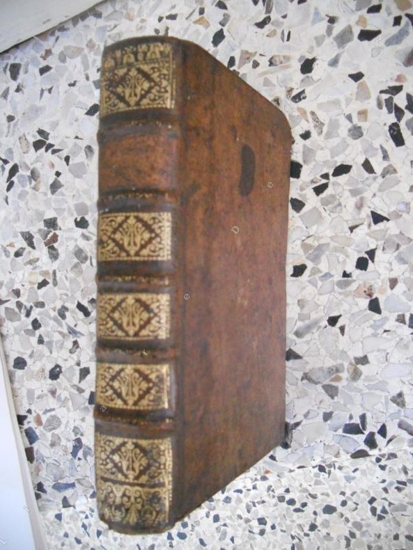
1750357353Paris.: Antoine Jombert. 1750. 12mo. Hardcover Contemporary full mottled calf raised bands gilt spine decorations and title edges stained red marbled endpapers ribbon marker. Very good cover extremities worn contents tight and clean ols bookseller’s pencil notes to endpapers. 17x9.5x3 cm. French text. A nice copy of this popular treatise on surveying and drawing maps by a well-known French mathematician. An interesting reference on eighteenth century cartography. weight: 0.6 lb. 16 fold-out engraved plates. Antoine Jombert. hardcover
171620253<p><b>1716 1ed Surveying Map Making Cartography Tools FORT PLANS Ozanam Mathematics</b></p><p>Jacques Ozanam was a 17th-century French mathematician most-known for his work '<i>Recreations'</i> or '<i>Mathematics'.</i>However in addition to his studies in mathematics he published one of the best works on surveying. '<i>Methode de Lever Les Plans'</i> is an important book on how to create maps and survey land both with and without technical instruments. Ozanam covers how to find the best location for mapping a location how to use necessary tools and how to use geometry to create plans of castles and forts!</p><p>Note the impressive folding maps and engravings bound at the end of this first edition book!</p><p>Item number: #20253</p><p>Price: $599</p><p>OZANAM Jacques</p><p><b><i>Methode de lever les plans et les cartes de terre et de mer avec toutes sortes d'Instrumens & sans Instrumens</i></b></p><p>A Paris : chez Claude Jombert 1716.</p><p><br /></p><p><u>Details</u>: </p><p>· Collation: Complete with all pages</p><p>o 12 215 1</p><p>o 14 folding engravings</p><p>· Provenance: Handwritten – <i>Alex.der Chagotte</i></p><p>· Language: French</p><p>· Binding: Leather; tight and secure</p><p>· Size: ~6.5in X 3.75in 16.5cm x 9.5cm</p><p>Our Guarantee:</p><p>Very Fast. Very Safe. Free Shipping Worldwide.</p><p>Customer satisfaction is our priority! Notify us with 7 days of receiving and we will offer a full refund without reservation!</p><p>20253</p><p>Photos available upon request. </p> Claude Jombert hardcover
1725R300123349CHEZ CLAUDE JOMBERT. 1725. In-12. Relié plein cuir. Etat passable, Plats abîmés, Manque en coiffe de pied, Intérieur acceptable. 396 pages - nombreuses figures en noir et blanc dans le texte - coins abîmés - manque de cuir sur le 1er plat - plats frottés - coiffe en tête abîmée - coiffe en pied absente - titre doré absent sur le dos - 3 photos disponibles.. . . . Classification Dewey : 840.05-XVIII ème siècle
34935A Paris, chez Claude Jombert, 1725. In-12, format 17x24 cm, reliure plein veau, tranches rouges, (12)+396 pages. La reliure est tres usee, il manque la piece de titre, mais l'interieur est tres frais. Etat acceptable.