627 résultats
19362083002116300387Coal Mining Federation 1936. Soft Cover. Fine. Number of pages: 161p Size: 27cm Coal Mining Federation paperback
19672080302106801383Not Available 1967. Soft Cover. Fine. Number of books: 2 Not Available paperback
208 pages. Black and white photographic plates. Colour Geological Reconnaissance Map of Southern Vancouver Island stored in pocket inside back board. This map has been bolstered in many places with adhesive tape which has yellowed over the years. Above-average wear. Binding intact. It appears that a reference library may have added stiff boards to what was initially a softcover copy. A worthy copy of this very informative work. Book
1896009346PARIS MASSON ET CIE 1896 I ) ETUDE PALEONTOLOGIQUE ET STRATIGRAPHIQUE DES FAUNES - II ) TRANSGRESSION DE LA MER CARBONIFERE - III ) ANCIENS GLACIERS DE LA PERIODE HOUILLERE SUPERIEURE DANS LA FRANCE CENTRALE ; un fort volume grand in-4 broché de XXIII + 303 pages ,coupes géologiques et bien complet des 17 planches de fossiles sous serpentes in-fine , la couverture a été plastifiée , une pliure au deuxième plat , infimes taches , bon exemplaire . Bon Couverture souple
pp. viii, 100, 12 [Appendix : Rules and regulations of the Bute Docks at Cardiff] + Two engraved maps. Yellow endpapers. Thin 8vo. 230 mm. Original full cloth binding, decorated in blind. Cloth taped spine. Manuscript presentation from the Marquess of Bute to Robert Stephenson. Bute Docks: Following the development of the coal found in South Wales, the export of both coal and iron products required a sea connection to the Bristol Channel. In 1794, the Glamorganshire Canal was completed, linking the then small town of Cardiff with Merthyr, and in 1798 a basin was built, connecting the canal to the sea. By the 1830s, Cardiff became the pre-eminent iron-exporting port, shipping almost half of British overseas iron exports; between 1840 and 1870. Lack of proper dock facilities led Cardiff's foremost landowner, John Crichton-Stuart, 2nd Marquess of Bute (1793-1848), to promote the construction of the (West) Bute Dock. Designed by Admiral William Henry Smyth (1788-1865), hydrographer, astronomer, antiquary, and author of this work. It opened in October 1839. Just two years later, the Taff Vale Railway was opened, following much the same route as the canal. Bute created modern Cardiff, Wales and the docks there. Robert Stephenson (1803-1859) was an English civil engineer. He was the only son of George Stephenson, the famed locomotive builder and railway engineer (many of the achievements popularly credited to his father were actually the joint efforts of father and son). Robert also gained fame as a bridge builder. The book also has an early pencil ownership for: W.J. Lewis, The Mardy, Aberdare. **PRICE JUST REDUCED! W151 Far Rt
19094198Durango CO 1909. Manuscript map in black ink 75 cm x 83 cm / 29 1/2" x 32 1/2" on a single sheet 81 cm x 89 cm / 32" x 35" in Nice condition with no rips tears or stains. Large mine map for the Perins Peak Mine which was north of Durango Colorado on Lightner Creek. Later it was known as the Boston Mine and between 1901 to 1926 produced over one million tons of coal. The mine boomed long enough for the now ghost town of Perrin to have three-hundred people call it home. Presumed unique. Rare. unknown books
Abundantly illustrated with contemporary black and white photographs. Contents: Switzerland's position among the nations; the army; mobilization and its effects; declarations of neutrality; frontier incidents; German-Swiss and French-Swiss opinion; Herr Spitteler's Speech; Gradual change in public opinion; Swiss dislike of militarism; Methods of the General Staff; The Arrest of 'Times' correspondents; The Affair of the Two Colonels; British Ministers in Switzerland; Federal Council and President Wilson; Swiss Protest against intensified blockade; M. Ritter's action in Washington; The Hoffmann-Grimm Affair; Colonel Stegemann; The economic situation; Establishment of the S.S.S.; The 'Fiduciary Bureau; Coal and Cotton; Swiss-German Agreement; Smuggling - The Financial Situation; Various Loans - Swiss good works; Refugees; Rapatries; Evacues; The Missing; Visits to Prison Camps; Medical aid to belligerents; Grands Blesses; Internes; Protests by the Federal Council and International Committee of the Red Cross Against German Inhumanity. Average wear. Unmarked. Sound copy. It is recommended that this issue be read in conjuction with: Issue 89 - Sea Power and Neutrality. Magazine
Reprint of the 2006 first edition. Bibliography. Footnotes. Index. Many reproductions of archival black and white photos. Appears to have been privately printed in limited quantity. "The modern history of Departure Bay began in the 1800's after the discovery of coal in Nanaimo. For a short time it was the centre of a hub of commerce and industry, only to settle back into relative obscurity. This is the story of the place and its people." - from back cover. Clean, bright and unmarked with very light wear. Appears unread. An excellent copy of this highly-informative work. Book
63 pages. A detailed description of how mines were intricately surveyed in 1842 - 1892. "Be the mine limestone, ironstone, coal or clay, the same process is gone through." - from chapter one. Maroon cloth cover with gilt lettering. Page 56/57 binding loose but intact. Foxing to endpapers and title page. Minor foxing to sides of content on pages that fold out. Otherwise content unmarked. Minor wear to spine and corners. A worthy copy. Book
350 pages. Many detailed diagrams. A serious and highly-informative treatment of these topics which were vital to profitable operation of underground mines at the turn of the last century. Two names upon verso of front free endpaper. Name stamped inside back free endpaper. Binding firm. Average wear. A sound vintage copy. Book
18511204Theoretisch-praktische Abhandlung über die fossilen Brennstoffe, als Steinkohle, Kohlenblende, Braunkohle etc. Aus dem Französischen übersetzt. Mit 19 lithogr. Tafeln mit 52 Abb. Quedlinburg u. Leipzig, G. Basse, 1851. 8vo. (21,3 x 13,6 cm). IV, 284 S. Leinwandband d. Zt.
18483434Précédé d'une notice géologique sur le bassin houillier de cette localité. Extrait des Annales de Mines. Mit 2 gefalt. gest. Tafeln. Paris, Carilian-Goeury et V. Dalmont, 1848. 8vo. (20,3 x 12,8 cm). 2 Bll., 243 S. Halblederband d. Zt. mit etwas Rückenvergoldung.
1879GITb154Munich Paris Oldenbourg Eugène Lacroix 1879. 1vol in-8 texte XVI 676pp + 1vol in-4 atlas IV 77 feuillets. Demi chagrin bleu nuit, dos à nerfs, rel époque. Le texte est orné de 388 figures et 4 graphiques, l'atlas se compose de 77 planches regroupant plusieurs sujets. Accroc en tête du dos du volume de texte. Papier des plats légèrement frotté, ancienne restauration angulaire p353 sans perte de texte. Atlas bien complet de toutes ses planches.
183926058Pennsylvania 1839. Manuscript broadside 11" x 22". Two drawings at head of report followed by detailed descriptions of each drawing: boundaries chutes directions of veins projected coal output etc. Old horizontal folds some splits along fold edges a few small chips. Drafted on paper which bears the watermark of "John C. Clark Phila" the oldest legal stationers in the United States founded in 1817 and the 9th oldest continuously operating business in Philadelphia according to its current website.<br /> <br /> The Peach Mountain mines were situated near Pottsville in the county of Schuylkill Pennsylvania. Peach Mountain was one of several mines in the area which produced red ash anthracite. According to this offering the mine bordered the Delaware Coal Company which was responsible for working it. <br /> "Mr. Read thinks that the above coal can be delivered on the bank at $1. per ton. He would contract at that note after the tunnel was driven. The driving of the tunnel would effect a saving of 10c per ton on all the coal lying above the level of the present tunnel. The said 10c per ton are now paid for loading and running to and unloading into the chute of 79 feet whence it is again loaded into drift waggons on the deep level. It would take a year to drive the tunnel at a total cost of about $2500. unknown
183926058Pennsylvania 1839. Manuscript broadside 11" x 22". Two drawings at head of report followed by detailed descriptions of each drawing: boundaries chutes directions of veins projected coal output etc. Old horizontal folds some splits along fold edges a few small chips. Drafted on paper which bears the watermark of "John C. Clark Phila" the oldest legal stationers in the United States founded in 1817 and the 9th oldest continuously operating business in Philadelphia according to its current website.<br/><br/> The Peach Mountain mines were situated near Pottsville in the county of Schuylkill Pennsylvania. Peach Mountain was one of several mines in the area which produced red ash anthracite. According to this offering the mine bordered the Delaware Coal Company which was responsible for working it. <br/> "Mr. Read thinks that the above coal can be delivered on the bank at $1. per ton. He would contract at that note after the tunnel was driven. The driving of the tunnel would effect a saving of 10c per ton on all the coal lying above the level of the present tunnel. The said 10c per ton are now paid for loading and running to and unloading into the chute of 79 feet whence it is again loaded into drift waggons on the deep level. It would take a year to drive the tunnel at a total cost of about $2500. unknown books
19632081002109000575Meiji-Taisho Coal Mine Print Book Publishing Association 1963. Soft Cover. Fine. Number of pages: 1 book Size: 22 x 30cm Number of books: 1 Meiji-Taisho Coal Mine Print Book Publishing Association paperback
20192081502111900302China Coal Industry 2019. Soft Cover. Fine. Size: Hardcover China Coal Industry paperback
2513Paris, Langlois et Leclercq, 1858 ; in-8, broché. 3ff.-480pp.-2ff. Dos légèrement frotté avec un petit manque, mais exemplaire solide, en bon état.
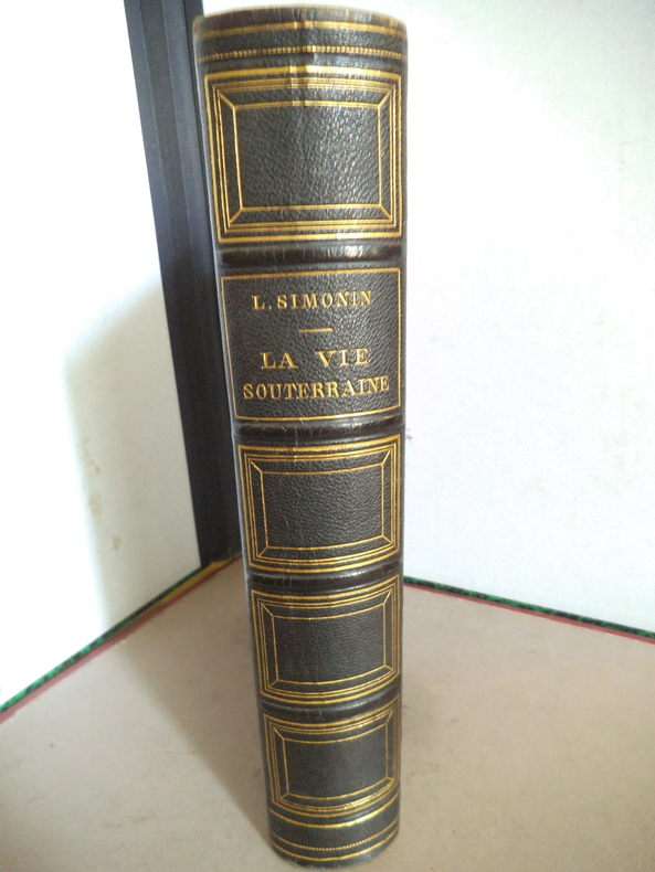
14505La vie souterraine ou les mines et les mineurs. Ouvrage illustré de 100 gravures sur bois hors texte et dans le texte 30 cartes tirées en couleurs et de 10 planches imprimées en chromolithographie dont le frontispice. In 8 demi chagrin vert titre, filets caissons dorés, plats percaline chagrinée verte, filets à froid en encadrement. 190x270mm, poids 2n2kg. Faux titre, frontispice, titre ; 604 pages ; tranches dorées, rousseurs éparses plus fortes en en début et fin de volume. Paris librairie hachette & Cie 1867. Bon exemplaire.
19402091502135500741Not Available 1940. Soft Cover. Fine. Size: 19x26cm Not Available paperback
19272111902160201389Japan Agricultural Society 1927. Soft Cover. Fine. Volume: 1 Japan Agricultural Society paperback
1968012073ALBI LES HOUILLERES DU BASSIN D'AQUITAINE 1968 3 volumes ( COMPLET ) grand in-4 brochés de 435 pages avec tableaux et 100 figures dont une partie dépliante + 3 planches in-fine et une chemise cartonnée contenant 8 planches dépliantes pour le TOME I et pour le TOME II , il y a 194 pages + tableaux dépliants et BIEN COMPLET DES XLIX PLANCHES in-fine avec pages explicatives , infimes défauts , autrement très bons exemplaires . Très bon Couverture souple
Signed, without inscription, by author upon title page. viii, 160 pages. Generously illustrated with colour photos and black and white reproductions of archival photos. Illustrated endpapers. "The information used in this book pertaining to the end of the eighteenth and the beginning of the nineteenth century has been obtained from the most reliable sources possible. I am grateful to those that so willingly furnished photos to identify the Elk Valley Pioneers and authenticate the articles written by me." - from author's Foreword. Clean and unmarked with moderate wear. Binding sound. A quality copy of the 1984 revised edition. Book
38.5" x 26.75" map. Indicates sixty-seven coal mines and prospects. Extensive descriptive notes along right margin. Legend in left margin indicates the various formations shown on the map, including Gabriola, Northumberland, De Courcy, Cedar, Protection, Newcastle, Cranberry, Extension, Haslam and East Wellington, and Benson. Stored in original government-issued kraft envelope with some markings. Covers the area from Ladysmith Harbour north to Arbutus Point, south of Parksville. Includes most of Gabriola Island on the east and several miles inland from the coast on the west. Clean and unmarked with very light wear. A fascinating and highly-informative guide to the historic industry upon which Nanaimo was founded. An excellent vintage copy, most suitable for framing. Book
504 pages. Index. Black and white photographic plates. Fold-out maps. Maps in text. Obituary for William Sloan, B.C. Minister of Mines for over eleven years. "Statistical tables provide the total mineral production of the Province and show by Districts and Divisions the output of the various metals and minerals for the year 1927 and comparative figures for previous years. The reports of the Resident Mining Engineers give much information about the progress of mining, development, and prospecting throughout the province. The reports of the Inspectors of Mines cover fully coal-mining in British Columbia." - Provincial Mineralogist. A comprehensive and extremely informative snapshot of the state of mining in B.C. in 1927, the archival photos and maps being of particular value. Average external wear and soiling. Blue card covers nearly detached from textblock. Unmarked. A worthy reference copy. Book