7 586 résultats
8vo., handsomely bound in dark red full morocco, back gilt with five raised bands, second and fourth compartments lettered and ruled in gilt, all other compartments tooled and ruled in gilt, original printed label preserved and mounted on new leaf at front, a most attractive copy ideal as a gift or for presentation. LSE Reprints of Scarce Tracts in Economics and Political Science, No. 14. Now very scarce in its own right.
Sm. 8vo., with a folding engraved map as frontispiece and a full-page plan, endpapers lightly foxed; original cloth, blocked in gilt and blind, a remarkably bright, clean copy. 'Thoroughly revised by means of information collected locally for the purpose'. Anderson records only the second edition of 1880.
Sm. 8vo., Fourth Edition, with large folding map as frontispiece, small neat contemporary signature on front free endpaper, endpapers very lightly spotted; original terracotta cloth, upper board with multiple frame border in blind enclosing title in gilt, gilt back, upper hinge starting (but binding entirely sound), a remarkably bright, clean copy. With 40pp of trade advertisements at end.
Sm. 8vo., Second Edition, with folding map as frontispiece, endpapers mildly browned, small stamp on title; original cloth, sides with triple frame border in blind enclosing title blocked in gilt, gilt back, upper hinge tender (but binding entirely sound), fore-edges a little age-stained else a bright, clean copy. Substantially revised and extended version of the first edition of 1882.
8vo., Fourth Edition, with full-page plan and folding map, free endpapers lightly browned; original brown cloth, upper board and backstrip lettered in gilt, case a little shaken (but binding entirely sound), a bright, clean copy. With 24pp publisher's catalogue bound in at end. We have never seen a copy with two maps as called for. If a second map was present, it would probably have been a county map; the exisiting map shows roads and railways.
Sm. 8vo., Seventh Edition, with folding map as frontispiece and 2 plans (one folding), some occasional underlining towards rear of text; original terracotta cloth, boards framed in blind, upper board lettered in gilt, gilt back, a near fine copy. A remarkably well-preserved copy. SCARCE IN THIS CONDITION. Bennett, p.204.
8vo., First Edition, with folding map as frontispiece and full-page plan; original terracotta cloth, upper board framed in blind and lettered in gilt, gilt back, upper hinge tender (but binding entirely sound) else a very good, bright, clean copy. With trade advertisements at front and rear.
8vo., Fourth Edition, with folding map as frontispiece; original terracotta cloth, upper board and backstrip lettered in gilt, covers very lightly age-marked else a remarkably bright, clean copy.
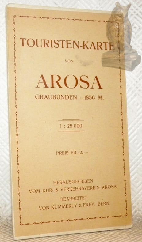
119449Bern, Kümmerly & Frey ohne Jahr, ca. 1920 220x120mm,
ORD-16941Vers 1660. Planche gravée de 168 x 258 mm, contrecollée sur feuille de papier fort, trace d'onglet d'attache au dos. Très bon état. Photo sur demande.
<p>24 cm, brossura editoriale, p. 229. Con 83 illustrazioni in nero f.t.</p>
cm. 24,5 x 34, x-388 pp. con 467 ill. n.t., 4 tavv. f.t. a col. e 3 pieghevoli a col. Forma Italiae - Serie I Il volume esamina un vasto settore della Campagna Romana particolarmente conservato dal punto di vista ambientale e ricco di evidenze archeologiche. Il lavoro, condotto con le tecniche pi? avanzate di ricognizione e documentazione, ha permesso l?identificazione e localizzazione di pi? di 800 siti archeologici, alcuni dei quali sottoposti a forte rischio o gi? parzialmente danneggiati; molti di essi sono di grande importanza archeologica, ed alcuni, oltre 700, del tutto sconosciuti. The volume examines a large part of the Roman Campagna with a particularly well preserved environment, very rich in archaeological remains. This work has been conducted with the most recent tecniques of survey and documentation that permitted the identification of more than 800 sites, some of which risk being completely destroyed, others having been already damaged. Many are of great archeological importance and over 700 sites were previously not known. 2485 gr. x-388 p.
Stato di conservazione: OTTIMO, il colore del cartonato alla quarta di copertina risulta in parte alterato (strisce lievemente ingiallite dovute all'esposizione alla luce), per il resto il volume è perfetto. Nuova edizione a cura di Lelia Sereni con note linguistiche di Giovanni Frau. Premessa di Pier Silverio Leicht all'edizione del 1928. Allegate al volume due cartine: la riproduzione della carta dell'Istituto Geografico Militare (copia ridotta dell'originale allegata all'edizione del 1928) e della Pianta della Città di Udine eseguita dalla sezione tecnica municipale (anch'essa riproduzione dell'originale del 1928). La Toponomastica del co. Giovanni Battista Della Porta (1873-1954) è ancora oggi una delle opere più consultate dagli studiosi di storia locale e rappresenta una delle fonti più ricche di notizie sull'origine ed il significato dei toponimi del comune di Udine. E' sembrato conveniente mantenere inalterata la struttura del lavoro così come era stata concepita dall'Autore, intervenendo con correzioni ed integrazioni solo nel caso di alcune fonti esistenti nella Biblioteca Comunale, in prevalenza Annales e Acta, che per una più precisa citazione necessitavano di un riscontro diretto sull'originale. (dalla Presentazione di Lelia Sereni, p. 7)
196820023ABMinsk, Nauka i tekhnika, 1968. 8° 183 pages. Origanal half-cloth. Die Versandkosten für Kunstwerke und mehrbändige Werke können von den Standard-Versandkosten abweichen. Good condition.
In-8 gr., 2 volumi, brossura (piccoli spacchi a un dorso), pp. (4),IX,330; (6),674 (numeraz. continua); con alcune figg. nel testo e oltre 265 carte topografiche (numerose sono bis o ter). Studio ragionato delle forme topografiche di Francia, Algeria, Tunisia: “Géologie - Topologie: Régions montagneuses, Hautes montagnes, Vallées des régions moyennes, Plaines et plateaux, Appareils littoraux et volcaniques”. Testo ben conservato.
Sm. 8vo., First Edition thus, with large folding map at end; brown cloth, gilt back, a fine copy in unclipped dustwrapper. LTS Publication No. 148.
1129700Topography of Terror Found. Oversized Paperback. Very Good - Cash. Light reader wear and rubbing to the edges corners covers and pages. The book is in great condition! Stock photos may not look exactly like the book. Topography of Terror Found. paperback
1974277549Walluf (bei Wiesbaden) : Sändig, 1974. XLVII, 691 Seiten. 22 cm Originalleinen.
197217319Sändig, Walluf 1972. XXII S., 1290 u. 1590 Spalten mit 1 Karte der Amtsbezirke. Blaues Leinen. Geringe Gebrsp. Einbände etwas angestaubt. - 2. überarbeitete u. wesentlich erweiterte Auflage. Auswertung der Urkundenabteilungen, Kopial- u. Lagerbücher (Beraine) süddeutscher u.
1905SB-07128Heidelberg, Carl Winter's Universitätsbuchhandlung, 1905. Zweite durchgesehene und stark vermehrte Auflage. 1590 Sp. Beiger Original-Halblederband mit vier Zierbünden. Buchdeckel in mehrfarbiger Marmorierung und mit Lederecken. Aufwendig marmorierter Buchschnitt. Einschlägiges topographisches Nachschlagewerk zum Großherzogtum Baden.
1863REIS0770Würzburg, Stahel 1863. 2 Bl., 585, 86 Seiten, Ln.d. Zt. mit schwarzgepr. Verz., sehr gut erhalten, im Text frisch u. fleckenfrei, Titel mit Stempl einer k.k. Postbliothek.