16 résultats
1728279748James and John Knapton 1728. First. unbound. Sea Chart. Colored engraving. Sheet measures 21 1/4" x 25". Image measures 19 1/2" x 23 1/2".<br/> <br/> This stunning map of the western hemisphere depicts Guiana and Brazil in South America presented on Edward Wright's projection also called a globular projection. It features rhumb lines to facilitate navigation. The map focuses more on the coastlines rather than the interiors. <br> <br> This chart was made for the 1728 issued of "Atlas maritimus & commercialis or A general view of the world so far as relates to trade and navigation". The atlas which was meant to compete with Mount and Page's popular "English Pilot" was a collaboration between some of the leading cartographers of the time including Sir Edmund Halley John Senex Nathaniel Cutler Steven Parker and Daniel Defoe. The atlas unfortunately failed to achieve commercial success as great as its rival making this a hard-to-find map.<br> <br> The map is in good condition with minor wear along the original folds and overall toning. Some toning over joint. Original plate mark is visible.<br> <br> John Senex 1678-1740 was a kind of Renaissance man of the 18th-century map world working at times as a scholar surveyor engraver astrologer book seller and publisher of maps atlases and globes. In a short period he developed from an apprentice into one of the most important cartographers of the period and became a Fellow of the Royal Society of London as well as Official Geographer to Queen Anne of Great Britain. Although well regarded for his pocket-size maps Senex is probably best known for his globes which display a knowledge of astronomy equal to the skill of their craftsmanship. After his death in 1740 his wife Mary continued his business and continued to produce and sell cartographic works of high quality. Together their work represents a successful and valuable partnership in 18th-century mapmaking and publishing.<br> <br> Sir Edmond Halley 1656--1742 was an English astronomer geophysicist mathematician meteorologist and physicist known for computing the orbit of the eponymous Halley's Comet. He was the second Astronomer Royal in Britain after John Flamsteed. Globular Projection maps were invented by Halley Harris and Senex. This is a wonderful example of their collaborative work.<br/> <br/> James and John Knapton unknown
1728268137London: James and John Knapton 1728. unbound. Sea Chart. Uncolored engraving.19 x 22 1/2 inches.<br/> <br/> This beautiful early sea chart of the Coromandel coast in Southeast India covers the entire eastern coast of India as well as the western coast of Burma Myanmar and southern Thailand. Extends from modern day Kanyakumari north to include the Ganges River Delta the coast of Bangladesh and then south along western coast of Burma or Myanmar to Thailand. The northern parts of Sri Lanka or Ceylon are also included. The chart notes several villages and settlements along the coast. Islands coastal features rhumb lines and other geographical features are also noted.<br> <br> The Coromandel Coast was one of the most important regions for the British Dutch French Danish and Portuguese during this time as much of the Indian trade was controlled through its various harbors and ports.<br> <br> This chart was made by Senex for the 1728 issued of "Atlas maritimus & commercialis or A general view of the world so far as relates to trade and navigation". The atlas which was meant to compete with Mount and Page's popular "English Pilot" was a collaboration between some of the leading cartographers of the time including Sir Edmund Halley John Senex Nathaniel Cutler Steven Parker and Daniel Defoe. The atlas unfortunately failed to achieve commercial success as great as its rival making this a hard-to-find map.<br> <br> The map is in good condition with minor wear along the original centerfold and overall toning. Map is lined with archival paper.<br> <br> John Senex 1678-1740 was a kind of Renaissance man of the 18th-century map world working at times as a scholar surveyor engraver astrologer book seller and publisher of maps atlases and globes. In a short period he developed from an apprentice into one of the most important cartographers of the period and became a Fellow of the Royal Society of London as well as Official Geographer to Queen Anne of Great Britain. Although well regarded for his pocket-size maps Senex is probably best known for his globes which display a knowledge of astronomy equal to the skill of their craftsmanship. After his death in 1740 his wife Mary continued his business and continued to produce and sell cartographic works of high quality. Together their work represents a successful and valuable partnership in 18th-century mapmaking and publishing.<br> <br> Sir Edmond Halley 1656--1742 was an English astronomer geophysicist mathematician meteorologist and physicist known for computing the orbit of the eponymous Halley's Comet. He was the second Astronomer Royal in Britain after John Flamsteed. Globular Projection maps were invented by Halley Harris and Senex. This is a wonderful example of their collaborative work.<br/> <br/> James and John Knapton unknown
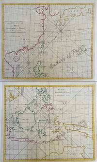
172856704/56705hand-coloured copper engravings. Condition: with centerfold as issued.<br />EXTREMELY RARE a very special and difficult to find maps from Atlas Maritimus & Commercialis: or a General View of the World for J. & J. Knapton W. & J. Innys London. The chart specially features the Philippines.<br />The Atlas Maritimus can be used as an index of English trading activity at this period since detailed insets and harbour plans emphasize those areas of greatest commercial significance.<br />Although the author of the text is anonymous Daniel Defoe is thought to have contributed to it and Halley the Astronomer-Royal added a prefatory note discussing the use of the charts; it is therefore sometimes catalogued under his name. It has also been attributed to Harris Senex and Wilson whose name appears on one chart. John Senex was certainly responsible for one of the atlas's innovations the globular chart of Western Europe whose projection according to the title-page was "authorized by letters patent". The atlas was purely commercial and was not a real rival to the 'English Pilot'. <br /><br /><br /><br /> J. & J. Knapton, W. & J. Innys, London
1728250790London: James Knapton 1728. Sea Chart. Uncolored engraving.<br/> <br/> An alternate projection of the globe as a flat map to the prevailing Mercator Projection. Includes rhumb lines and coastal details. From Atlas Maritimus a commercial sea atlas was published as a guide to British global commerce. Good condition with some stains along lower center fold. Sir Edmond Halley 1656--1742 was an English astronomer geophysicist mathematician meteorologist and physicist known for computing the orbit of the eponymous Halley's Comet. He was the second Astronomer Royal in Britain after John Flamsteed. John Senex 1678 to1740 was an English cartographer engraver and explorer who worked prominently in the 18th century. He is especially known for his maps of the world some of which have added elevations and minuscule detailed engravings. Globular Projection maps were invented by Halley Harris and Senex.<br/> <br/> James Knapton unknown
1728236366London: James Knapton 1728. hardcover. Two parts in one volume. Illustrated with 53 of 54 fine uncolored copper plate maps last celestial chart is missing with a full size facsimile version provided from the British Library edition and 5 fold-out diagrams tipped into the second text. Title page printed in black and red foreword preface list of subscribers and list of charts. Dedication page has a repair to the margin. "Atlas maritimus & commercialis" 340 pp. plus index. "General Coasting Pilot" 195 pp. plus maps. Page numbers written in ink. Elephant folio 21.25" x 13" scuffing and corner wear to original brown leather binding gilt spine in 8 compartments. Some toning and light scattered foxing to text and maps. Repairs to World Chart North America chart and Celestial map along bottom fold out small abrasion in margin of China map. Bookplate pasted down with Coat of Arms of Verney.<br/> <br/> This commercial sea atlas was published in 1728 as a guide to British global commerce. Today it is a historically significant English overview of world trade during a rapid period of development of the British Empire's trading power. The atlas consists of two parts. The first is the "Atlas Maritimus & Commercialis" proper which provides a geographical overview of the world as it relates to trade and navigation. It also gives an account of contemporary commerce including the traded commodities of each country. The second part is "A General Coasting Pilot" by Nathaniel Cutler which provides sailing directions. The volume was published anonymously though the maps are often attributed to Sir Edmond Halley the Astronomer Royal of Britain who also wrote the prefatory note discussing the charts' use. The atlas's emphasis on commerce in addition to geography distinguishes it from "The English Pilot" the period's standard in maritime charts. It was also notable for covering the entire globe including the south and west coasts of America in one volume. This is an early issue of the Atlas with A Chart of the Coast of Scotland on a globular projection. London: 1728. <br> <br> Sir Edmond Halley 1656--1742 was an English astronomer geophysicist mathematician meteorologist and physicist known for computing the orbit of the eponymous Halley's Comet. He was the second Astronomer Royal in Britain after John Flamsteed. John Senex 1678-1740 was a kind of Renaissance man of the 18th-century map world working at times as a scholar surveyor engraver astrologer book seller and publisher of maps atlases and globes. In a short period he developed from an apprentice into one of the most important cartographers of the period and became a Fellow of the Royal Society of London as well as Official Geographer to Queen Anne of Great Britain. A wonderful rarity about 'Globular Projection" maps which was invented by Halley Harris and Senex. Includes the unforgettable large four sheet map "A Chart of the Atlantick Ocean Shewing the Coast from Texel to C. Cantin".<br/> <br/> James Knapton unknown
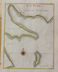
1728M10726London c.1728. Very Good. Notes: Published in Atlas Maritimus & Commercialis. Size : 344x260 mm 13.54x10.24 Inches Coloring: Hand Colored Category: Maps Canada East Newfoundland; unknown
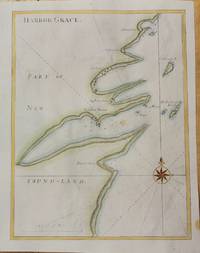
1728M10725London c.1728. Very Good. Notes: Published in Atlas Maritimus & Commercialis. Size : 345x264 mm 13.58x10.39 Inches Coloring: Hand Colored Category: Maps Canada East Newfoundland; unknown
180035297Boston: James Cutler 1800. Elephant folio broadsheet folded to 12-1/4" x 20-1/2". 4pp. Old folds several fox spots untrimmed. Good.<br /> <br /> This issue is No. 4 of volume IX. The Gazette is filled with advertisements; a several-column list of wholesale prices current at Boston; commercial news; and several items of "Political Miscellany." Of the latter one is from Cato discussing President Adams and the fall from grace of Timothy Pickering. James Cutler unknown
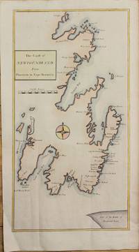
1728M10724London c.1728. Very Good. Notes: Published in Atlas Maritimus & Commercialis. Size : 475x250 mm 18.70x9.84 Inches Coloring: Hand Colored Category: Maps Canada East Newfoundland; unknown