41 résultats
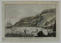
1785267711785. Very Good. Engraving of A View of Karakakooa in Owyhee. Remargined paper size 15 1/4 x 10 3/4 inches 38.5 x 27.3 cm. Professionally remargined and laid down on tissue by Green Dragon bindery. We think the first edition of this engraving was created by John Webber engraved by W. Byrne and published in the atlas plate 68 to accompany "A Voyage to the Pacific Ocean London: W. and A. Strahan for G. Nicol 1784."<br/><br/>This example is smaller lightly tinted and rather than being engraved by Byrne is marked "Taylor sculp" lower right. In pencil it is marked on rear "opposite p. 577 Cooks' Voyages 1785 edition". We have been unable to trace to our satisfaction exactly where this engraving was published. It is nonetheless a famous scene and desirable to those who collect voyages Hawaii and the location where Captain Cook eventually died. unknown books
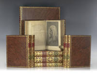
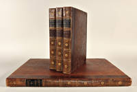
1773112342London: W. Strahan and T. Cadell 1773 1777 1784. Rare first edition set of the official accounts of Captain James Cook's voyages "the foundation of modern knowledge of the Pacific and a cornerstone of the literature of travel and exploration" Beddie 648 1216 1543; Hill 782 358 361. Nine volumes altogether. Quarto bound in full calf with morocco spine labels elaborate gilt titles to the spine front and rear panels raised bands. Large folio atlas bound in the same manner. The First Voyage is comprised of three volumes edited by John Hawkesworth. "An Account of the Voyages. for making Discoveries in the Southern Hemisphere. In the Dolphin the Swallow and the Endeavour." The Second Voyage includes two volumes published in 1777: "A Voyage Towards the South Pole and Round the World. Performed in His Majesty's Ships Resolution and Adventure In the Years 1772 1773 1774 and 1775". First edition. Portrait frontispiece and 63 plates and charts several folding or double-page. The Third Voyage was published in 1784: "A Voyage to the Pacific Ocean. Undertaken by the command of His Majesty for making Discoveries in the Northern Hemisphere. To determine The Position and Extent of the West Side of North America; its Distance from Asia; and the Practicability of a Northern Passage to Europe." Four volumes first edition. The text with 24 plates and charts as called for with two large folding maps and 61 plates. An exceptional set. Captain Cooks Voyages are an iconic symbol of discovery and served not only to contribute to many diverse fields of knowledge but also to inspire many who followed after him. "He was really the first scientific navigator" Hill and the only explorer during this time to lead three circumnavigations. The knowledge accumulated during these explorations greatly expanded the awareness of the worlds geography and his writings maps and drawings significantly aided in future navigations making sea travel much more certain and educating the general public. Cooks first voyage sailed from England in 1768 rounded Cape Horn and continued westward to arrive in Tahiiti in April of 1769 where the Royal Society had engaged Cook to observe the transit of Venus across the Sun. He then sailed to New Zealand mapping the complete coastline and then travelling to Australia where his expedition became the first recorded Europeans to encounter the eastern coastline. The voyage was fraught with many perils including being nearly ship-wrecked on the Great Barrier Reef and losing many of the crew to malaria in modern day Indonesia but they were able to finally sail past the Cape of Good Hope and return to England in 1771. Cooks second voyage took place between 1772-1775 with a mission to search for the hypothetical Terra Australis. Cook crossed the Antarctic Circle for the first time in history and thought he disproved the existence of the "Great Southern Continent." He actually almost reached Antarctica on one occasion but then turned towards Tahiti for supplies. In Cooks third voyage 1776-79 his aim was to search for the North-West Passage through the American continent. He charted the American west coast from Northern California through the Bering Straight. "Cook was the first navigator to accurately map the coast and by carrying away a collection of furs he introduced the fur trade to the English and American traders whose subsequent expeditions were based upon his discoveries no other contemporaneously printed source narrative is of comparable importance" Eberstadt. On this voyage he also discovered the Hawaiian Islands which he named the Sandwich Islands. Cook died during this third voyage on the Hawaiian islands. With the publication of the first two voyages and his dramatic death in Hawaii James Cook became a national hero. So eagerly awaited was his account of the third voyage that it was sold out a few days after publication. Among his accomplishments Cook discovered New Caledonia Norfolk Island the Isle of Pines Sandwich Land Hawaii and rediscovered and charted numerous other lands. He was the first to survey New Zealand where he spent six months. He was also a pioneer in regard to the health of his men. On his second voyage Cook lost only one man out of 118 in a voyage of more than 1000 days one of the first to conquer scurvy. As a commander an observer and a practical physician his merits were equally great. He won the affection of those who served under him by sympathy kindness and unselfish care of others which were as noteworthy as his gifts of discovery and intellect. W. Strahan and T. Cadell hardcover books
1798247299London: G. C. & J. Robinson 1798. Engraving and etching. Image measures 13 3/8 x 15 7/8". Sheet measures 16 1/4 x 21".<br/><br/> Often referred to as the French and Indian War 1756-1763 the otherwise known Seven Years War reignited British concerns of a French invasion as well as a culturally-ingrained anti-French feeling among the populace. With his usual skill for satirical detail Hogarth allows us to gain the British perspective of a war so often only considered an American conflict. This print and its companion piece "England" illustrate the stark contrasts between the French and their significantly better-off adversaries the English. For example one of the most prominent threats that France represented was religious as well as political in the form of Catholicism and its implications of superstition inquisition and tyranny. Therefore Hogarth portrays a monk as a leader of the invasion preparing a boat filled with various torture devices. Hogarth also plays upon the perceived physical differences between France and Britain. In France most of the inhabitants are emaciated and forced to roast frogs for food while in Britain the people are stout from a steady diet of beer and roast beef. This print is additionally fascinating because it serves as an early example of the comedic connection between France and frogs. This particular print was published in the 1798 edition of "Hogarth Restored: The Whole Works of the celebrated William Hogarth" by G. C. & J. Robinson. The plates of this edition were engraved after Hogarth's plates by Thomas Cook and thus this is usually referred to as the Cook edition. The original plate by Hogarth is part of a set entitled "The Invasion" first published in 1756 of which this is the first plate. The print is in good condition with some scuffs to the margin. William Hogarth 1697-1764 is considered by many scholars and print enthusiasts as the grandfather of English graphic satire but he was also an accomplished oil painter portraitist engraver and draughtsman. Hogarth mastered the art of depicting human nature and all of its hypocrisies in society with graphic satire. The universality of his humor and the all-too-human characters featured in his works make Hogarth's satires remarkable. This print represents the epitome of Hogarth's skills as an artist and as a conscientious observer of humanity.<br/><br/> G. C. & J. Robinson unknown books
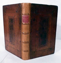
172419972London: Eliz. Bell John Darby Arthur Bettesworth et al. 1724. Third Edition Corrected. leather-bound. Contemporary cambridge style full morocco with rectangular cover panels decorated in blind modern reback with raised bands and red leather spine label printed in gilt. Near fine. 273 3 pages. 19.5 x 12 cm. Copper engraved frontispiece four copper engraved folding plates at rear -- illustrations for avenues walks and lawns. First published 1676. the author was gardener to the Earl of Essex. Also included are "Rules and Tables shewing how the Ingenious Planter may measure superficial Figures divide Woods or Land and measure Timber and other solid Bodies either by Arithmetick or Geometry: With the Uses of that excellent Line the "Line of Numbers" by several new Examples and many other rules useful for most Men." Modest scattered toning armorial bookplate. Eliz. Bell, John Darby, Arthur Bettesworth, et al. unknown books
17846476Dublin: Printed for H. Chamberlaine W. Watson Potts et al. 1784. First Irish Edition. Hardcover. Good Textblocks Very Good. Light shelf/edge wear ownership markes at ffeps touch of toning/foxing at preliminaries spines slightly darkened and dried likely exposed to a fire at some point else tight bright and unmarred. Full brown period boards red and black leather spine labels gilt lettering frontispiece fold-out chart. 8vo. 421pp; 549pp; 559pp. Appendix. <br/><br/>First Dublin edition of the official account of Cook's third voyage. This edition occurs with maps and plates included in the three volumes; with the maps and plates in a separate atlas volume in 4 vs and without any plates & maps. This set is of later iteration having only the frontispiece and fold-out chart in Appendix. Beddie 1546. Sabin 16250. Howes C-729a. Noted flaws notwithstanding a very presentiable set of this classic work. Printed for H. Chamberlaine, W. Watson, Potts, et al. hardcover books
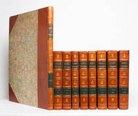
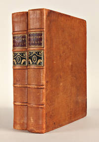
17853329London: W. Strahan and T. Cadell 1785. Second edition First edition Second edition. Second edition of the 1773 Hawkesworth edition complete with the "directions for placing the cuts" and The Chart of the Strait of Magellan which are sometimes lacking. This edition includes the Preface to the Second edition with Hawkesworth's famous rebuttal to Alexander Dalrymple. Three quarto volumes 284 x 227 mm bound in uniform contemporary calf expertly rebacked; collating: xx xxxvi iv directions for cuts 456; xiv 410; 395. Complete with 21 plates and charts in volume 1 22 in volume 2 and 9 in volume 3 most of which are folding. A Very Good set. Internal contents are generally in excellent shape; a few repairs the folding plates minor foxing but on the whole an attractive set.<br/><br/>First edition of A Voyage Towards the South Pole. Two quarto volumes 291 x 230 mm bound in contemporary calf expertly rebacked; collating: xl 378; viii 396. Complete with 37 plates and charts in volume 1 including the frontis portrait of Cook and 27 in volume 2 including frontis plus the folding table at p. 364. Internal contents are generally in excellent condition although with some minor browning to plates or adjacent leaves. <br/><br/>Second edition of A Voyage to the Pacific Ocean with the medallion on the title page of each volume. Three quarto volumes 296 x 234 bound in contemporary calf expertly rebacked; collating: x xcvi 421; xiv 548; xiv 556. Complete with 11 plates and charts in volume 1 including frontis 10 in volume 2 and 6 in volume 3 plus a folding table at p. 528. Volume one has two plates not called for apparently proof plates of "A Man of Van Diemen's Land" and "A Woman of Van Diemen's Land." Internal contents generally in excellent shape. On the whole a lovely set. With the Atlas volume 527 x 400 mm: containing 63 plates complete but for the "Death of Cook" plate which is only bound into some sets. Atlas volume uniformly bound to style with leather spine over marbled paper boards. Internally the plates are generally clean with only a bit of marginal foxing much nicer than typically found. <br/><br/>"In his three voyages to the Pacific Cook disproved the existence of a great southern continent completed the outlines of Australia and New Zealand charted the Society Islands the New Hebrides New Caledonia and the Hawaiian Islands and depicted accurately for the first time the north-west coast of America leaving no major discoveries for his successors. In addition the scientific discoveries in the fields of natural history and ethnology were considerable and the drawings made by the artists were of great significance" ODNB. On the heels of exploration came imperial exploitation. The Cook expeditions' mapping efforts enabled the British Empire to move safely and efficiently through the oceans in order to establish a world-wide system of economic and cultural control. <br/><br/>Beddie 648 1216 1553. PMM 223. W. Strahan and T. Cadell unknown books
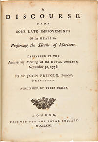
1776WRCAM36096London: Printed for the Royal Society 1776. 444pp. Half title. Small quarto. 20th-century three- quarter calf and marbled boards gilt label. Leaf C4 signed C3 a cancel as usual. Occasional minor foxing ink stain on p.2. Very good bound with five other works by Pringle see below. One of the most significant of all the printed works relating to Cook's voyages and their importance. This is the extremely rare first appearance in print of Cook's epoch- making account of the successful measures taken against scurvy on his first two voyages. There were several later versions and translations but the original edition of this milestone publication has long been acknowledged as a major rarity. The paper on scurvy was read to the Royal Society by its president Sir John Pringle in the absence of Cook himself then just beginning his final voyage as the year's Copley medal award winner and immediately published in this form. Pringle's long presentation address quoting directly from Cook and other sources is followed by Cook's paper and an extract from a letter by Cook to Pringle written from Plymouth Sound in July 1776. The paper subsequently appeared in the official account of the second voyage and in the PHILOSOPHICAL TRANSACTIONS of the Royal Society. In 1783 a series of six of Pringle's discourses at the annual presentations of the Copley medal was published in one volume. <br> <br> "In Pringle's discourse on preserving the health of mariners he includes the first printing of Captain Cook's important paper entitled: 'The Method taken for preserving the Health of the Crew of His Majesty's Ship the Resolution during her late Voyage round the World.' In this paper which Cook communicated to Pringle President of the Royal Society Cook describes the supplies carried on the voyage and his maintenance of the cleanliness of his ship and crew. It was included by Pringle in his discourse commemorating Cook's receipt of the Copley medal" - Norman sale. The winning of the battle against scurvy was one of the most important achievements in the general field of exploration. It made possible the major voyages that followed. As Robert Hughes so aptly put it in THE FATAL SHORE "malt juice and pickled cabbage put Europeans in Australia as microchip circuitry would put Americans on the moon." <br> <br> This copy is very appropriately accompanied by five other Royal Society discourses of the period. A DISCOURSE. is here bound chronologically with five other Pringle first editions: <br> <br> 1 A DISCOURSE ON THE DIFFERENT KINDS OF AIR. 1774. <br> <br> 2 A DISCOURSE ON THE TORPEDO. 1775. <br> <br> 3 A DISCOURSE ON THE ATTRACTION OF MOUNTAINS. 1775. <br> <br> 4 A DISCOURSE ON THE INVENTION AND IMPROVEMENTS OF THE REFLECTING TELESCOPE. 1778. <br> <br> 5 A DISCOURSE ON THE THEORY OF GUNNERY. 1778. <br> <br> The Streeter-Norman copy of the DISCOURSE.FOR PRESERVING THE HEALTH OF MARINERS was also bound with these five additional works by Pringle. STREETER SALE 2410. NORMAN SALE 378. GARRISON-MORTON 2156 3714. BEDDIE 1290. HOLMES 20. KROEPELIEN 1065. Printed for the Royal Society hardcover books
1784WRCAM43625Dublin 1784. Three volumes. 8xcviii421; 14549; 11559pp. plus frontispiece portrait eighteen folding maps and charts seven folding plates and folding table. Contemporary calf spines gilt leather labels. Extremities lightly worn slight wear to spine ends and hinges first volume expertly rebacked with original spine laid down. Minor occasional foxing. A very good set. First Dublin edition of the official account of Cook's third and final voyage including text on the exploration of Hawaii and the west coasts of America Canada and Alaska. The third voyage was undertaken to continue the British survey of the Pacific but most particularly to search for a northwest passage from the western side. Sailing in 1776 the expedition called at Kerguelen Island Tasmania New Zealand and the Cook Tonga and Society islands then sailed north and discovered Christmas Island and the Hawaiian Islands. They then thoroughly explored and charted the Northwest Coast from the Bering Straits along the coast of Alaska and Canada as far south as present northern California. Returning to Hawaii in 1778 the expedition was at first received warmly; but after departing and being forced to return to repair a mast trouble developed which led to a tragic series of events in which the great navigator was killed. However the expedition pressed on under Clerke and then Gore and explored the coasts of Siberia and Kamchatka before returning to England in 1780. Forbes calls this work "arguably the single most important book on the Hawaiian islands." The Dublin edition was issued both with and without the plates; this copy is the issue with the plates which is considerably more desirable and difficult to come by. HOWES C729a. SABIN 16250. BEDDIE 1546. London edition: HILL 361. FORBES 62. LADA-MOCARSKI 37. REESE BEST OF THE WEST 14 ref. hardcover books
1773WRCAM18891London 1773. with: Cook James: A VOYAGE TOWARDS THE SOUTH POLE AND ROUND THE WORLD.IN THE YEARS 1772 1773 1774 AND 1775. London. 1784. with: Cook James: A VOYAGE TO THE PACIFIC OCEAN. London. 1784-85. with: Kippis Andrew: THE LIFE OF CAPTAIN JAMES COOK. London. 1788. Ten volumes all together including atlas volume. Text volumes: Large quarto. Contemporary calf expertly rebacked. Atlas: Large folio. Modern three-quarter calf and contemporary boards expertly rebacked in a complementary manner. Boards slightly worn particularly at edges. Upper right corner of upper board of second volume of third voyage chipped. Light foxing and dampstaining in some volumes particularly in margins. Some paper restoration on some plates in the atlas particularly in corners. Armorial bookplates. Overall very good. A complete set of Cook's three voyages being the second and best edition of the first voyage the first edition of the second voyage and a mixed set of the third voyage volumes one and two are from the second edition volume three from the first edition with the plates of the third voyage bound in an atlas lacks the rare "Death of Cook" plate as usual and with Kippis' biography of Cook. The first voyage describes Cook's explorations of New Zealand Australia Tahiti and other islands. The second voyage describes his southern voyages in search of a southern continent. The third is his north Pacific explorations of Alaska the Northwest Coast and Hawaii where the great navigator met his death. Of equal importance as a text of exploration a cartographic source for the numerous maps and charts included in the work and a visual source of the engravings of fauna flora and inhabitants of the Pacific. In all the entire set contains more than 200 maps and plates. HILL 782 783. HOWES C729a 3rd voyage. HOLMES 5 24 47. BEDDIE 650 1216 1552. LADA-MOCARSKI 37 3rd voyage. MITCHELL LIBRARY COOK BIBLIOGRAPHY passim. FORBES 62 3rd voyage. ROSOVE ANTARCTIC 77 2nd voyage. hardcover books
1774WRCAM15266Paris 1774. Four volumes. ivxvi2xxxii388pp. plus sixteen folding maps and plates; 2536pp. plus sixteen maps and plates mostly folding; 2394pp. plus seventeen maps and plates mostly folding; viii367pp. plus three maps and plates two folding. Quarto. Modern half mottled calf and marbled boards spines gilt leather labels. Some scattered foxing and tanning. Overall very good. The first French edition after the original English edition of the previous year. Hawkesworth was commissioned by the Admiralty to edit this collection of voyages which includes Cook's first voyage to Tahiti to observe the transit of Venus across the sun determine the distance between the sun and the earth and continue Byron's explorations. During this voyage Cook visited Tahiti and made the necessary calculations named and charted the Society Islands explored and surveyed New Zealand and charted the eastern coast of Australia naming it New South Wales finally returning to England in 1771. Other narratives are of Byron's voyage to the Gilbert and Tuamoto Islands Wallace's discovery of Tahiti and Moorea and Carteret's discovery of Pitcairn Island after his separation from Capt. Wallis in a storm. The handsome plates depict the natives landscapes and seascapes and the maps show the routes of the ships and areas charted. An early and important compilation. This French edition is not listed in Hill. Sabin calls for only 361 pages in the fourth volume and states that the French editions "should be accompanied by an Atlas entitled: CARTES ET FIGURES a Paris Chez Saillant et Nyon. M.DCC.LXXIV. 4to." The NUC makes no mention of an atlas but the set cited there is imperfect lacking the third volume. SABIN 30940. hardcover books
1777WRCAM54751London 1777. Two volumes. xviii26021; 4607pp. including errata leaf plus large folding map. Quarto. Contemporary speckled calf rebacked with original gilt leather labels preserved raised bands corners renewed. Minor shelf wear one contemporary and one modern bookplate on pastedowns institutional bookplates on verso of titlepages. Minor occasional foxing some penciled marginalia and underlining to text. Very good. Forster's important account of Cook's second voyage and an essential component of the record of that great expedition. Forster and his father John Reinhold served as official botanists during the expedition. When the Admiralty decided to prevent the elder Forster from contributing to the official report George produced his own publication preceding the official account by several weeks. <br> <br> The Admiralty commissioned Cook to undertake his second voyage in the wake of the great success of the first expedition. The purpose of the second voyage was to circumnavigate the globe as far to the south as possible searching for any southern land masses previously unknown. Cook proved that "Terra Australis" which was supposed to lie between South America and New Zealand was nonexistent; but the party became the first to traverse the Antarctic Circle and discovered and rediscovered islands in the Pacific. <br> <br> "For all the controversy A VOYAGE ROUND THE WORLD is an interesting and important account that complements the official one with facts and astute observations on the human side of the voyage" - Rosove. Davidson describes this account as "an important work and a necessary supplement to the official account." HILL 625. BEDDIE 1247. HOLMES 23. SABIN 25130. SPENCE 464. DAVIDSON pp.61-62. ROSOVE ANTARCTIC 132. hardcover books
17785440Paris: Hôtel de Thou 1778. Very Good/Attractive set of the French-language version of Cook's account of his second expedition A Voyage towards the South Pole and Round the World London 1777. This astonishing journey from 1772 to 1775 went around the globe as far south as possible to explore the existence or not of a postulated southern landmass. In the course of the voyage Cooks ships Resolution and Adventure crossed deeply into Antarctic waters ultimately turned back by ice barriers. Zig-zagging through the South Pacific Cooks ships also visited Easter Island the Marquesas Tahiti the Society Islands Niue the Tonga Islands the New Hebrides New Caledonia Norfolk Island Palmerston Island South Sandwich Islands and South Georgia many of which Cook named in the process. This French edition of his report was published close on the heels of the English version in two distinct formats a five-volume quarto and a six-volume octavo with a quarto atlas containing the extraordinary set of 66 engraved plates after William Hodges. The French translator Jean-Baptiste-Antoine Suard incorporated into the text a great deal of material from the rival account of the voyage that Johann Reinhold Forster published under guise of his son Georg based on a draft of Cooks own journal. In English Forsters account was published separately. A fine set. Six volumes octavo 20 cm and atlas volume in quarto 27 cm. Text volumes bound in cat's paw calf; six-panel spines tooled in gilt with red leather title labels lettered in gilt. Marbled endleaves. Minimal wear. Atlas volume bound separately in contemporary speckled calf with black leather title label. 65 copper-engraved plates including double-page folding "Carte de l'Hemisphere Austral" portraits scenes botanical representations plans and other maps. Excellent condition throughout. References: Mitchell Library p. 52; Sabin 16249 4to ed. Hôtel de Thou hardcover books
1790E00534 of 6 volumes. Volume 1: i-ix-372 pages with 23 plates including frontispiece plate of Cook and 4 folding maps; Volume II lacking; Volume 3: 793-1184 pages with 11 plates including frontispiece of Possession Bay and 5 fold out maps; Volume IV: 1185-1546 pages with 26 plates including frontispiece of Woman Child and Man of Van Diemen's Land and 6 folding maps; Volume V: 1547-1938 pages with 30 plates including frontispiece of A View of Huaheine and 8 folding maps; Volume VI lacking. Octavo 8 1/2" x 5 1/2" bound in original full leather with red labels to spine with gilt lettering. Abridged by George William Anderson. An earlier Large folio edition by Anderson was published earlier. This edition originally issued in 80 weekly parts and also called the Large octavo edition. M K Beddie: 39 First edition of the bound edition.<br /><br />Captain James Cook RN was a British explorer navigator and cartographer ultimately rising to the rank of Captain in the Royal Navy. Cook made detailed maps of Newfoundland prior to making three voyages to the Pacific Ocean during which he achieved the first European contact with the eastern coastline of Australia and the Hawaiian Islands as well as the first recorded circumnavigation of New Zealand. Cook joined the British merchant navy as a teenager and joined the Royal Navy in 1755. He saw action in the Seven Years' War and subsequently surveyed and mapped much of the entrance to the Saint Lawrence River during the siege of Quebec. This helped bring Cook to the attention of the Admiralty and Royal Society. This notice came at a crucial moment both in his personal career and in the direction of British overseas exploration and led to his commission in 1766 as commander of HM Bark Endeavour for the first of three Pacific voyages. Cook charted many areas and recorded several islands and coastlines on European maps for the first time. His achievements can be attributed to a combination of seamanship superior surveying and cartographic skills courage in exploring dangerous locations to confirm the facts for example dipping into the Antarctic Circle repeatedly and exploring around the Great Barrier Reef an ability to lead men in adverse conditions and boldness both with regard to the extent of his explorations and his willingness to exceed the instructions given to him by the Admiralty. Cook was killed in Hawaii in a fight with Hawaiians during his third exploratory voyage in the Pacific in 1779.<br /><br />Condition:<br /><br />Lacks volume II and VI. First signature of volume one loose inner hinges cracked some interior soiling spine ends and corners of leather rubbed some scuffing to leather else a good set. Printed for A Millar, W Law, and R Cater hardcover books
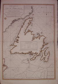
1784204041Paris: Marechal de Castries 1784. unbound. very good. Sea Chart. Engraving with modern hand coloring. Image measures 33.75" x 23.75".<br/><br/> French edition based on the maps of James Cook from his third voyage 1776-9. Michael Lane was marine surveyor who was trained by Cook. Includes rhumb lines and depths as well as a table of landmarks and their coordinates. Minor staining along right margin.<br/><br/> Marechal de Castries unknown books
1784310843Dublin: Chamberlaine W. Watson Potts Williams Cross Jackson Moncriefe et al. 1784. First Dublin edition. With engraved portrait frontispiece and folding appendix table. 8 xcviii 421; 14 549; 12 559 pp. 3 vols. 8vo. Near contemporary straight grained black morocco over marbled boards. Some shelfwear to boards internally clean. First Dublin edition. With engraved portrait frontispiece and folding appendix table. 8 xcviii 421; 14 549; 12 559 pp. 3 vols. 8vo. First Dublin edition of the official account of Cook's final voyage the issue without plates and maps. Beddie 1546; Forbes 72; Howes C-729a; Sabin 16250 Chamberlaine, W. Watson, Potts, Williams, Cross, Jackson, Moncriefe, et al. unknown books
179919378Lonbdon: T. Chapman 1799. Map. Very good. Single page engraved12 by 16 inches the image being 11 by 15 inches and matter in a 16 by 20 inch mat. Engraved by T. Foot. Later hand-coloring. Several flattened folds as published closed marginal tear affecting the outside border but stopping short of the image of the island else a very good copy. T. Chapman unknown books
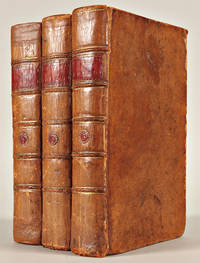
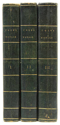
1784WRCAM54194London: Printed by W. and A. Strahan for G. Nichol and T. Cadell 1784. Three quarto text volumes plus large folio atlas. Text: Twenty-four engraved maps coastal profiles and charts thirteen folding; folding letterpress table. Atlas: Sixty-three engraved plates charts and maps including one folding map and one double- page map. Text: Contemporary speckled calf gilt ruled expertly rebacked in matching gilt calf with gilt leather labels all edges painted red. 20th-century bookplates on front pastedowns. Light offsetting from plates light tanning and scattered faint foxing. Atlas: Expertly bound to style in half calf and marbled boards spines gilt black morocco label. Contemporary ink inscription on verso of final plate. Marginal light foxing and dust soiling. A very good set. A lovely set of the first edition of Cook's Third Voyage with a note of presentation in the atlas volume by Captain James King: "Thomas Venables The gift of Captain King." King was the author of the third text volume in the set and the preparer of Cook's journals that comprise the first two text volumes. Venables was probably a member of an ancient Cheshire landowning family later involved in early Australian settlement. King began Cook's final expedition as the expedition's astronomer and as a lieutenant on the Resolution but by the end of the expedition had been promoted to command of the Discovery and second-in-command. "At the time of Cook's death at Hawaii 14 February 1779 King was on shore in charge of the observatory. He had with him only a few men but was reinforced by some of a boat's crew who had been rowing off the mouth of the bay before the disturbance with the Hawaiians began. This brought the number of the party up to twenty-four and fortifying themselves in a neighbouring heiau or open-air temple they succeeded in repelling the attack of the Hawaiians until they were relieved two hours later by the ships' boats" - DNB. 6/10/2019 <br> <br> "Cook's third voyage was organized to seek the Northwest Passage and to return the islander Omai to Tahiti. Officers of the crew included William Bligh James Burney James Colnett and George Vancouver. John Webber was appointed artist to the expedition. After calling at Kerguelen Island Tasmania New Zealand and the Cook Tonga and Society Islands the expedition sailed north and discovered Christmas Island and the Hawaiian Islands which Cook named the Sandwich Islands. Cook charted the American west coast from Northern California through the Bering Strait as far north as latitude 70 degrees 44 minutes before he was stopped by pack ice. He returned to Hawaii for the winter and was killed in an unhappy skirmish with the natives. Charles Clarke took command and after he died six months later the ships returned to England under John Gore. Despite hostilities with the United States and France the scientific nature of this expedition caused the various governments to exempt these vessels from capture. The voyage resulted in what Cook judged his most valuable discovery - the Hawaiian Islands" - Hill. <br> <br> An excellent set of one the great Pacific voyages inscribed by one of its ultimate commanders and the partial author of the present published account Capt. James King. BEDDIE 1543. FORBES 62. HILL 361. HOWES C729a "aa." LADA-MOCARSKI 37 later issue. PRINTING AND THE MIND OF MAN 223. SABIN 16250. STREETER SALE 3478. REESE BEST OF THE WEST 14. DNB online. Printed by W. and A. Strahan for G. Nichol and T. Cadell hardcover books
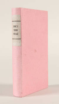
1796WRCAM46432Philadelphia: W. Woodward for B. Johnson 1796. 252pp. 12mo. Modern pink paper boards printed paper label. Light dampstaining and soiling to text heavier in some places. Good plus. "Faithfully abridged from the quarto edition." An abridged children's version of Captain James Cook's third and final voyage on which he was murdered by natives. The third voyage was undertaken to continue the British survey of the Pacific but most particularly to search for a northwest passage from the western side. Sailing in 1776 the expedition called at Kerguelen Island Tasmania New Zealand and the Cook Tonga and Society islands then sailed north and discovered Christmas Island and the Hawaiian Islands. They then thoroughly explored and charted the Northwest Coast from the Bering Straits along the coast of Alaska and Canada as far south as present northern California. Returning to Hawaii in 1778 the expedition was at first received warmly; but after departing and being forced to return to repair a mast trouble developed which led to a tragic series of events in which the great navigator was killed. Relatively scarce with fewer than ten copies listed in ESTC. EVANS 30276. ESTC W37314. FORBES 257. REESE BEST OF THE WEST 14 ref. W. Woodward, for B. Johnson hardcover books
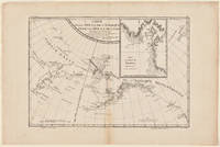
1785WRCAM29328Paris 1785. Map 18 x 12 inches. Single vertical fold through center four- inch tape repair near bottom edge. Minor browning at edges. Very good. Archival matting and protected with Mylar sheet. This is the general map of the Northwest Coast from the atlas volume of the first French edition of Cook's third and final voyage. The Aleutian Islands are shown in particular detail while the entrance to the natural harbor of Nootka is displayed in an inset. FORBES 90 ref. unknown books
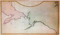
1784271442London: James Cook 1784. unbound. Map. Engraving with modern hand coloring. Image measures 16" x 27.25".<br/><br/> This important and scarce 1784 map of the North Pacific covers the northwest coast of America including Alaska east as far as the Hudson Bay and the northeast coast of Asia including Kamchatka. The map is from the first edition of the official account of Captain James Cook's Third Voyage in the HMS Revolution between 1778 and 1779. The route of his journey is depicted in detail with depth soundings noted along the route. Several Capes islands and bays are labeled. This map is among the first to accurately map the coastlines of the region.<br><br>It was during this voyage that Cook encountered an 'impenetrable wall of ice' in the Arctic as he searched for the Northwest Passage thus putting to rest the hopes for the discovery of an Arctic Northwest Passage. Map was engraved by T. Harmer for the official account of Cook's voyages. The map is in fair condition. Right margin is extended and filled in. Minor loss near bottom margin not affecting printed area. Shows wear along original fold lines. Minor foxing. Verso repair near top left. Lined with archival paper.<br><BR>Captain Cook 1728 -1779 was among the most famous and important explorer navigator cartographer and captain of his time whose scientific and geographical knowledge influenced his successors well into the 20th century. He started sailing as a teenager and went on to join the Royal Navy in 1755. In 1766 he was commissioned to explore the Pacific and went on the sail thousands of miles across largely uncharted regions of the world. These three historic voyages led him to some of the first sightings of Antarctica his discovery of many Polynesian islands including the Hawaiian Islands first European contact with east Australia the circumnavigation of New Zealand and the first correct mapping of the Pacific Northwest.<br/><br/> James Cook unknown books
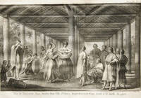
1785291039Paris 1785. Engraving. 9 x 18 1/4 inches. Margin trimmed to neat line on left folded as issued.<br/><br/> Lively scene with groups of people at work in front of a village on the Hawaiian Village on the Island of Kauai. The island is the oldest of the Hawaiian Islands and the fourth largest of the archipelago. From the French edition of the Official Report of Cook's 3rd voyage.<br/><br/> unknown books
17706043241770. of Captain James Cook. 3 1/2" x 5 1/2" hinged to a sheet 6" x 9 1/2". Light foxing very good. ca. 1770. No Binding. Very Good/No Jacket. unknown books
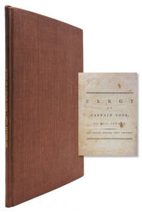
1784318236London: Printed and Sold by J.Jackson and J. Dodsley 1784. Fourth Edition. 25 pp. 4to. Modern brown buckram. Fourth Edition. 25 pp. 4to. SIGNED. Signed "Anna Seward" at the bottom of the last page. Seward wasknbown as the Swan of Litchfield. She remained single and recently scholars have argued she was a lesbian. ESTC T95493 Printed and Sold by J.Jackson and J. Dodsley unknown books
1781Embry 151275Printed for E. Newbery London: 1781. Second edition. Occasional light foxing throughout short tear to folding map overall near fine in fine but simple modern binding. Five plates including two folding and one supplied in facsimile. Folding map. Rebound in modern brown morocco spine simple gilt. Folding frontis depicts Cook's death. Printed for E. Newbery, London: 1781. Second edition. unknown books
1781310852Dublin: Price Whitestone Chamberlain et al. 1781. First Dublin edition. Complete with 5 engraved plates including frontispiece plate of the Death of Cook and large folding map. 4 xlvii 1 396 pp. 1 vols. 8vo. Contemporary calf rebacked to style marbled endpapers. Occasional spotting and dustsoiling better than very good. First Dublin edition. Complete with 5 engraved plates including frontispiece plate of the Death of Cook and large folding map. 4 xlvii 1 396 pp. 1 vols. 8vo. First Dublin edition. The first Dublin edition of the first full account in English of Cook's third and final voyage. Rickman was a second lieutenant aboard the Discovery. "It provides an important supplement to the official account of the Third Voyage published in 1784" Forbes. Howes R-276 "aa"; Forbes 36; Wickersham 6555a; Davidson p 64; Kroepelien 1078; Beddie 1608 Price, Whitestone, Chamberlain, et al. unknown books