497 résultats
179654355Lausanne Hignou 1796. 8vo. Bound in 8 nice uniform contemp. hcalf. profusely gilt spines. Tome-and titlelabels with gilt lettering. Light wear to 3 spineends. Stamp on halftitles. Ca. 2000 pp. Some scattered brownspots. <br/><br/><em>Comprising: Vol. I. Byron. - II. Carteret. - III. Wallis & Cook. - IV-VIII: Cook. </em> unknown
178357766Upsala Johan Edman 1783. 8vo. In contemporary half calf with five raised bands spine with gilt lettering and ornamentation. Ex-libris pasted on to pasted down front end-paper. Light wear to extremities internally fine and clean. 24 366 10 pp. <br/><br/><em>First Swedish translation of the official account of Cook's second voyage and Georg Forster's unofficial Voyage round the World."Cook earned his place in history by opening up the Pacific to western civilization and by the foundation of British Australia. The world was given for the first time an essentially complete knowledge of the Pacific Ocean and Australia and Cook proved once and for all that there was no great southern continent as had always been believed. He also suggested the existence of antarctic land in the southern ice ring a fact which was not proved until the explorations of the nineteenth century" Printing and the Mind of Man p.135. "The success of Cook's first voyage led the Admiralty to send him on a second expedition described in the present work which was to circumnavigate the globe as far south as possible in search of any southern continents. The men of this expedition became the first to cross the Antarctic Circle. Further visits were made to New Zealand and on two great sweeps Cook made an astonishing series of discoveries and rediscoveries including Easter Island the Marquesas Tahiti and the Society Islands Niue the Tonga Islands the New Hebrides New Caledonia Norfolk Island … Cook discovered and charted South Georgia after which he called at Cape Town St. Helena and Ascension and the Azores. This voyage produced a vast amount of information concerning the Pacific peoples and islands proved the value of the chronometer as an aid to finding longitude and improved techniques for preventing scurvy" Hill p.123 </em> hardcover
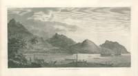
178529428London 1785. Copper engraved images of Tonga Tahiti & the Society Islands from the folio atlas of Cook's 3rd voyage Pacific Ocean exploration. The images illustrate the native islanders rowing out to receive Cook; a reception with warriors demonstrating their strength; a human sacrifice; famous image of Tahitian women dancing and the harbour at Huaheine with Cook's ships Resolution and Discovery in the harbor. Plate numbers included are #1314 25 28 & 31. All with very wide margin. Paper sizes 21 5/8 x 16". Some light marginal dusting overall very good condition. unknown
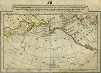
179814495Philadelphia 1798. The Columbia River is added to what is a later imprint of the 1795 edition of this early American map showing Cook's explorations of Hawaii and Alaska. Cary re-engraved a British map of 1784 and added changes reflecting American patriotism. Longitude is measured west from Philadelphia & Greenwich. "Engraved for Cary's American Edition of Guthrie's Geography improved." & "J.T. Scott Sculp." are erased from the printing plate with some light traces left in the impression. Copper engraving impression 292x197 mm engraved surface 283x189 mm. The number "58" is scratched into the top corner as well as penned in the top margin. Rumsey #2542020 is a similar plate although the sizes are a couple of millimeters different possibly because this map is mounted on light card. <br /> <br /> The chart centers on the Pacific Northwest Coast from the Gulf of California the Baja Peninsula to the Alaska Coast Prince William Sound Cook's River the Bering Strait the Aleutian Islands and Russian Kamtschatka. This edition includes the Columbia River which earlier editions did not and it first appeared on a British map of 1798 connecting it with the Missouri from Vancouver's explorations. According to Fiske Captain Gray a New England trader of the ship "Columbia" charted it and shared his maps with Vancouver. The tracks of Capt. Cook in his ship "The Resolution" and Capt. Clerke in "The Discovery" are shown crossing the Pacific from Hawaii to the NW Coast & Kamtschatka. Capt. Clerke took over as Master of "The Resolution" after Cook's death in Hawaii in 1779. Samuel Hearne's discoveries to the north of Hudson's Bay are depicted as well as the area where he located the Coppermine River in 1770. Hearne was the first white man to to cross overland from Hudson's Bay tracing the river to the Arctic Ocean. A faint water mark in the right side of the map with early outline color on the continents. Very good condition overall. unknown
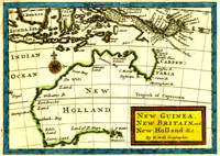
171614414London: Eliz. Nutt for John Nichoson 1716. This Moll map of Australia entitled "New Guinea New Britain and New Holland &c." is one of the earliest English maps devoted to the Australian continent Tooley p 122 no 90. The map shows Australian locations named Carpentaria Dimens Land De Wits Land Eendracht Land Edels Land Lewins Land and Land of P. Nuys. At the top of the map can be seen N. Guinea and the Sunda Islands. Image size 7 x 5". With later outline color and title block in yellow with red border. Trimmed close at the top leaving 1/8" margin and with 1 1/2" bottom margin. One original fold line very good. Eliz. Nutt for John Nichoson unknown
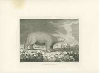
178529434London 1785. Copper engraved images of Alaska & Vancouver Island from the folio atlas of Cook's 3rd voyage Pacific Ocean exploration. The plate numbers included are #40 41 48 49. 52 57 & 73. Two images are of Alaskan natives their boats and huts going about their daily lives. <br /> Sea Horses refers to seals and the white polar bear is majestic. Two with a corner waterstain one with a slight brown circle in the margin one with marginal foxing. <br /> Paper sizes 21.5 x 16.25" and one is 22 7/8 all with wide margins. Some light marginal dusting overall very good condition. unknown
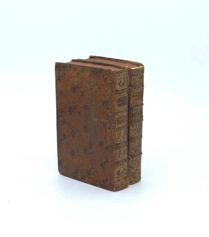
1750WOC-814Vins et Liqueurs, leurs qualité, leurs effets relativement aux différens âges,&différens tempéramens;Avec la Manière de les Apprêter, Ancienne et Moderne, Suivant la méthode des plus habiles Chefs-d'Office & Chefs de Cuifine, de la Cour, & de la Ville. Ouvrage très-utile dans toutes les familles. Par M.C.D.Chef de Cuifine de M. le Prince de***.(Mr. Briand). Paris, Chez Gissey & Bordelet, 1750. 2/3volumes in-12 (17x10cm) reliés plein veau d'époque, dos à nerfs ornés de fleurons, coiffes faibles et coins légèrement émoussés.XVI-XXVIII, 538pp.+1ff pour le Privilège et 576pp.(Manque ici le tome 3ème de 559pp.).
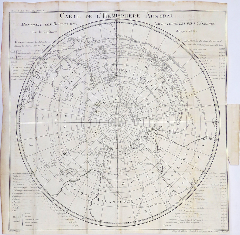
1772PHO-1350Paris, de Hansy, 1774. 2 vol. in-8 de xlviii, 522 pp., (1) f., 1 carte dépliante; (4), 572, (4) pp. , plein veau marbré, dos à nerfs ornés avec tomaison et pièce de titre rouge , tr. Rouge (reliure de l'époque). Accroc au dos ,coiffes, mors et coins usagés, frottés, déchirure et réparation à la carte .
1786130758à Paris, chez Buisson 1786 5 volumes. In-16 17 x 9,5 cm. Reliures de l’époque veau havane marbré, dos à nerfs encadrés de fers dorés, pièces de titre et de tomaison maroquin fauve, 400-439-421-404-432 pp., 2-3-3-3-3 planches repliées, table des matières à la fin de chaque volume.
1798A121-593Dublin, Printed by Z. Jackson, [1798-1800]. original map, Copper Engraving, size c. 26,5 43 cm
1790021046London: A. Millar W. Law & R. Cater 1790. Lacking all the folding maps and charts. Six volumes octavo pp 2242 4 generally age-toned throughout lacking most of page 1445/6 a cracked hinge with weakness in volume two a few pages lacking small marginal pieces but otherwise surprisingly sound throughout with 126 of 129 engraved plates three plates repaired one with slight loss bound in a very simple and unsophiticated half calf and marbled boards rather dull the spines un-lettered apart from numerals chipped and with slight loss. The binding is a little tight and whereas the text is easily read the titles of some plates are hidden though there is a binding list with titles at the rear of the last volume. Despite some condition faults this a curiously satisfying and unassuming set. . Half Leather. Good. A. Millar, W. Law & R. Cater Hardcover
1788g9124London: G Kearsley. G : in good condition. Modern rebind. Neat ownership signature on title page and first page of text. 1788. Sixth Edition. Brown hardback cloth cover. 180mm x 110mm 7" x 4". viii 430pp. 8 engraved plates some trimmed along fore edge. The text ends on page 429 with only one advertisement page; apparently 448pp. called for. . G Kearsley hardcover
179762909Berlin, Arnold Wever, 1797. 8°. VIII S., 2 Bll., 200 S.; 1 Bl., 163 S.; 1 Bl., 176 S. (angebunden 184 zeitgen. beschriebene Seiten m. Kochrezepten), HLdr. d. Zt. m. Rückenverg. u. goldgepr. Rückenschild.
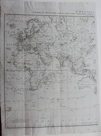
1780LBW-4310[1780]. 535 x 535 mm.
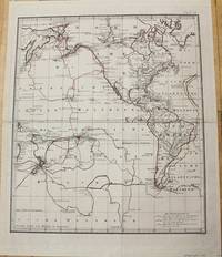
1781M10623Amsterdam c.1781. Very Good. Notes: A fine map of the Voyages of Captain James Cook around America and the Pacific Ocean. <br>The route of his voyages are shown in 3 different colours indicating first second third voyages.<br>British explorer Capt. James Cook who reached New Zealand in October 1769 on the first of his three voyages was the first European to circumnavigate and map New Zealand. Size : 610x495 mm 24.02x19.49 Inches Coloring: Original Outline Coloring Category: Maps South America Continent; Maps North America; Maps Ocean Pacific; unknown
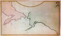
1784271442London: James Cook 1784. unbound. Map. Engraving with modern hand coloring. Image measures 16" x 27.25".<br/><br/> This important and scarce 1784 map of the North Pacific covers the northwest coast of America including Alaska east as far as the Hudson Bay and the northeast coast of Asia including Kamchatka. The map is from the first edition of the official account of Captain James Cook's Third Voyage in the HMS Revolution between 1778 and 1779. The route of his journey is depicted in detail with depth soundings noted along the route. Several Capes islands and bays are labeled. This map is among the first to accurately map the coastlines of the region.<br><br>It was during this voyage that Cook encountered an 'impenetrable wall of ice' in the Arctic as he searched for the Northwest Passage thus putting to rest the hopes for the discovery of an Arctic Northwest Passage. Map was engraved by T. Harmer for the official account of Cook's voyages. The map is in fair condition. Right margin is extended and filled in. Minor loss near bottom margin not affecting printed area. Shows wear along original fold lines. Minor foxing. Verso repair near top left. Lined with archival paper.<br><BR>Captain Cook 1728 -1779 was among the most famous and important explorer navigator cartographer and captain of his time whose scientific and geographical knowledge influenced his successors well into the 20th century. He started sailing as a teenager and went on to join the Royal Navy in 1755. In 1766 he was commissioned to explore the Pacific and went on the sail thousands of miles across largely uncharted regions of the world. These three historic voyages led him to some of the first sightings of Antarctica his discovery of many Polynesian islands including the Hawaiian Islands first European contact with east Australia the circumnavigation of New Zealand and the first correct mapping of the Pacific Northwest.<br/><br/> James Cook unknown books
1784271442London: James Cook 1784. unbound. Map. Engraving with modern hand coloring. Image measures 16" x 27.25".<br/> <br/> This important and scarce 1784 map of the North Pacific covers the northwest coast of America including Alaska east as far as the Hudson Bay and the northeast coast of Asia including Kamchatka. The map is from the first edition of the official account of Captain James Cook's Third Voyage in the HMS Revolution between 1778 and 1779. The route of his journey is depicted in detail with depth soundings noted along the route. Several Capes islands and bays are labeled. This map is among the first to accurately map the coastlines of the region.<br> <br> It was during this voyage that Cook encountered an 'impenetrable wall of ice' in the Arctic as he searched for the Northwest Passage thus putting to rest the hopes for the discovery of an Arctic Northwest Passage. Map was engraved by T. Harmer for the official account of Cook's voyages. The map is in fair condition. Right margin is extended and filled in. Minor loss near bottom margin not affecting printed area. Shows wear along original fold lines. Minor foxing. Verso repair near top left. Lined with archival paper.<br> <BR> Captain Cook 1728 -1779 was among the most famous and important explorer navigator cartographer and captain of his time whose scientific and geographical knowledge influenced his successors well into the 20th century. He started sailing as a teenager and went on to join the Royal Navy in 1755. In 1766 he was commissioned to explore the Pacific and went on the sail thousands of miles across largely uncharted regions of the world. These three historic voyages led him to some of the first sightings of Antarctica his discovery of many Polynesian islands including the Hawaiian Islands first European contact with east Australia the circumnavigation of New Zealand and the first correct mapping of the Pacific Northwest.<br/> <br/> James Cook unknown
17905644Mit großer Holzschnitt-Vignette auf dem Titel. Berlin und Magdeburg, (d. i. Stendal, Franzen und Grosse, 1790). 8vo. (16,5 x 10,2 cm). LXXX, 268 S., 4 Bl. Register. Schlichter Halblederband d. Zt. auf Holzdeckeln.
1772PHO-1925Paris, Saillant & Nyon, 1772, 2 volumes in-8 (200x130), relié plein veau marbré époque, dos à nerfs orné, pièce de titre et tomaison, tranches rouges 2ff. xliii , 336pp-2ff.453pp,1ff-1ff. , illustré de 3 planches et 20 cartes dépliantes ( sur 21, manque la carte n°3), 2 cartes détachées, déchirures et léger manque en marge à 3 cartes , coins et coupes usés, coiffes absentes tome 2, petit manque au plat, charnière fendillée tome 2.
178900523203Chez Nyon Chez Merigot 1789. Leather Binding. Good/No Jacket. 8vo - over 7¾" - 9¾" Exceptionally scarce. Among other important contents this work includes the account of Cook's first voyage: Volumes 3-8 contain 'Relation D'un voyage fait autour du monde dans les annees 1768 1769 1770 & 1771 par. James Cook'. Beddie #671. 8 octavo volumes complete as issued. Bound in period quarter calf over speckled calf with vellum tips spines stamped in gilt spines and boards rubbed and nicked hinges splitting with old repairs - some with non-traditional materials - front inner hinge of volume 1 reinforced with light gray cloth tape; bookplates in each volume; occasional foxing. Aside from the occasional foxing the text is clean and unmarked. There was no Atlas volume issued with this edition. Text in French. Traduction par Suard de : An Account of the voyages undertaken by order of His present Majesty for making discoveries in the southern hemisphere. Cf. Sabin 30940. Chez Nyon Chez Merigot unknown
1777M9006London c.1777. Very Good backed on acid free tissue paper for long term preservation. Notes: The Asia part of the World map by Capt. James Cook which depicts his various paths and discoveries. Size : 593x465 mm 23.35x18.31 Inches Coloring: Hand Colored Category: Maps Asia Continent; unknown
1784ABE-EBAY-205728107209London: John Stockdale Scatcherd and Whitaker John Fielding and John Hardy 1784. Hardcover. Good. A Voyage to the Pacific Ocean; Undertaken by Command of his Majesty for making Discoveries in the Northern Hemisphere: Performed under the Direction of Captains Cook Clerke and Gore In the Years 1776 1777 1778 1779 and 1780. Being a copious comprehensive and satisfactory Abridgement of the Voyage written by Captain James Cook F.R.S. and Captain James King LL.D. and F.R.S. Illustrated with Cuts. In Four Volumes. London: Printed for John Stockdale Scatcherd and Whitaker John Fielding and John Hardy 1784. Four volume set bound in two. The first octavo edition of Cook's third voyage. Half-leather. Flaws: Vol. 1 lacks 2 leaves from the Contents section. Vol. 2 lacks title page. All except Vol. 3 lack half-titles. Lacks the large folding map and two plates. Has the folding map of Hawaii the frontispiece portrait and 46 of 48 further plates. The front board of the first volume is detached. The top half of the front join of the second volume is cracked with the backstrip pulling away and the front board weakly attached. Average wear chipping scuffing. The pages of the first of the four volumes have a heavy amount of foxing smudges stains creases a little marginal dampstain and a lot of tears with several tears reaching into text without loss one page torn half across without loss a large torn-out piece of margin nicking a few letters a large tear at a hinge with a repair. The other volumes have a more average level of foxing smudges and minor blemishes excepting some ugly staining to the first Contents leaf of Vol. 3 pictured; a large tear into text elsewhere but neatly repaired without loss; a plate torn near the hinge with slight loss to illustration pictured; and the creased torn and repaired folding plate of Cook's death pictured. Some of the plates are trimmed a little close in a few instances nicking the text and in one instance slightly cutting into the illustration. The folding map of Hawaii has tears is laid down on a plain paper backing but remains rather attractive. Good condition on balance. Old pencil ownership signature faint: John Alderman Sanders old owner stamp: I. Sanders. John Stockdale, Scatcherd and Whitaker, John Fielding, and John Hardy hardcover
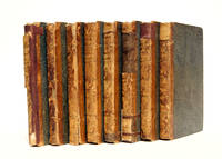
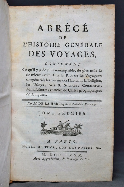
17807210Paris, Hôtel de Thou, et Laporte, 1780, 1786. 23 volumes in-8 en plein veau marbré brun. Dos, coiffes, coupes et mors frottés ou tapés. Reliures qu'on ne peut qualifiées de belles...
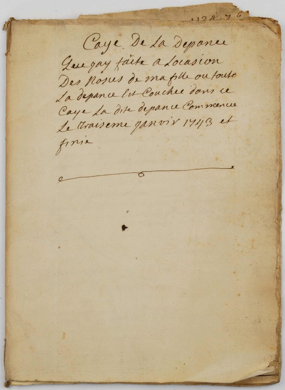
17433757, , 1743. Manuscrit in-4 broché de (20) pp. [A la fin] (2) ff. : Mémoire de la recette commencée / Recette commencée le 15eme janvier 1743 : Du 15eme janvier 1743 Resceu de Mme de M Laurens etc ».
1709634349Amsterdam, Janssonius-Waesberge, 1709. 8vo. Gestochenes Frontispiz, 18 Bl., 277 S., 21 Bl. Leder d. Zt.