Perdomo Guache, AndresBiblio.com
7 résultats
1721896937.Gpaperback. Good. Access codes and supplements are not guaranteed with used items. May be an ex-library book. paperback
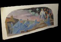
16599Dimensions marges incluses : 487 x 197mm. Gouache originale - non signÂŽe - rÂŽalisÂŽe circa 1950 sur vergÂŽ ˆ pontuseaux figurant des militaires dans une scÂne de tranchÂŽe.Petites altÂŽrations marginales. Du reste trÂs belle condition. b42961 unknown
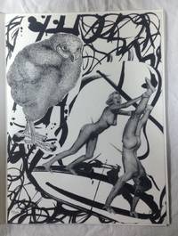
65-037520th cent. Gouache colored engraving. 38 x 56 cm. 30 x 40 cm. in the plate. Stamped "5028 / Made in France" on verso lower right. Edges torn in margins <3 cm; otherwise Good. 20th cent. unknown
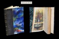
1912302441912. Lyon H. Lardanchet / Coll. ''BibliothÂque du Bibliophile'' 1921. Un vol. au format pt in-8 205 x 137 mm de 160 pp. Reliure de l'ÂŽpoque de demi-maroquin marine filet vertical ˆ froid portÂŽ sur chacun des plats dos ˆ nerfs ornÂŽ de filets gras en noir titre dorÂŽ date dorÂŽe en queue tÂte dorÂŽe sur tÂŽmoins couvertures et dos conservÂŽs. Tirage unique ˆ 1.000 exemplaires ; celui-ci comptant parmi les 969 exemplaires numÂŽrotÂŽs du tirage sur vÂŽlin de France BFK au filigrane de la collection. En regard du faux-titre une gouache originale signÂŽe Paul Baudier. ''Paul Baudier fut l'ÂŽlÂve et collaborateur d'Edmond Duplessis. Il a exposÂŽ des paysages aux IndÂŽpendants. Il a travaillÂŽ pour l'ÂŽdition et la presse pÂŽriodique''. in BÂŽnÂŽzit. LaissÂŽe pour ainsi dire ˆ l'abandon la Versailles d'antan est ici chantÂŽe par RÂŽgnier. ''Le poÂte sÕest assimilÂŽ par une sorte dÕendosmose gÂŽniale lÕesprit de lՎpoque ÂŽpars dans les jardins ; son Âtre adhÂre aux lieux jadis babillards encore imprÂŽgnÂŽs dՉme ; une sympathie magique lui fait vivre cette vie rÂŽtrospective et les mÃurs les pensers lÕhabitus du grand siÂcle lÕenserrent ÂŽtroitement en leurs lianes ÂŽmotives. Chaque vers appara”tra dÂs lors comme un lambeau palpitant arrachÂŽ au Temps.'' TancrÂde de Visan. BÂŽnÂŽzit I Dictionnaire des peintres p. 516 - Osterwalder II Dictionnaire des illustrateurs p. 67. Angles trÂs lÂŽgÂrement ÂŽlimÂŽs. Rares rousseurs dans le corps d'ouvrage. Du reste belle condition. b42961 unknown
200520290Madrid: Ediciones Sen 2005. 30x23'5. Esta obra consta de cinco photogravures de Manolo Dimas estampados en Madrid en el taller de Dan Benveniste y un poema de Angel Guache con una tirada de cien ejemplares más diez pruebas de artista y diez ejemplares fuera de comercio numerados y firmados por los autores. Este ejemplar es el nº 74/100. Rústica en rama con solapas y sobrecubierta. Ediciones Sen paperback
80799Paris Editions Le Soleil Noir 1969. 8° Buch: 91 S. m. 1 losen Gouache hinter Passepartout; Skulptur: 15 x 5 x 4 cm; Sockel: 2 x 23 x 8 cm Brosch. m. OU Der OU-Rücken min. gebräunt sonst tadelloses unaufgeschnittenes Ex. und tadellose Beigaben Ex. Nr. 29 der 50 Ex. der Luxusausgabe auf Vélin d’Arches mit 1. der beiliegenden signierten Gouache von Isabelle Waldberg 2. im Plexiglas-Schuber und 3. mit dem Plexiglas-Sockel mit der im Sockel monogrammierten Bronzeskulptur von derselben. - Isabelle Waldberg 1911 Oberstammheim - 1990 Chartres «sculptrice ayant participé aux activités du groupe surréaliste à Paris et membre du groupe Allianz; professeure à l'Ecole des beaux-arts de Paris» SIKART. 010 Paris, Editions Le Soleil Noir, 1969 unknown
38009901Korea late 18th-early 19th century 1780-1810. Eight color gouache pastel tinted maps ca. 57.5 x 90.1 cm.contemporary re-backing very solid clean examples complete set of all provinces hand-painted gouache manuscripts. RARE & OBSCURE . . . . A RARE & COMPLETE SET OF ANTIQUARIAN MANUSCRIPT KOREAN . . . YI PERIOD PROVINCIAL MAPS . . "P'ALTO CHIDO" OR "EIGHT PROVINCES MAPS" . . . DELUXE ELEPHANT FOLIO SIZE SHEETS . . . HAND-COLORED GOUACHE PASTELS . This is a very RARE & COMPLETE set of eight Korean provincial manuscript maps. Drawn circa 1780-1810 by an unsigned Korean cartographer. These maps are of historical importance giving place names isolating the time frame. . Painted on very thin finely hand-made mulberry-fiber tissue paper contemporary re-backed with a stiff hand-made paper. Beautifully hand-painted & colored in gouache pastels. . The record shows several reliable verities of manuscript maps showing the eight ancient Korean provinces. . Commonly these maps had no title cartographer's name date or other critical bibliographic colophon data. This is a common theme with Korean manuscript maps. . Political divisions of Korea are by and large mostly stable making name comparisons easier. . PROBABLE MAP TITLES INCLUDE: . a. The "SINJUNG-TONGGUK-YOJI-SUNGNAM:" "EIGHT SEPARATE MAPS EACH SHOWING ONE COMPLETE PROVINCE OF THE EIGHT KOREAN PROVINCES similar in intention to the "P'ALTO CHIDO." . The eight provinces were established during the Chosen dynasty 1392-1910 alternately and commonly called the Yi dynasty. . The eight provinces are from the north to south: . 1. Hamgyong 2. P'yong'an 3. P'yongyang 4. Kangwon 5. Hwanghae 6. Kanghwa 7. Kyongsang 8. Cholla'ungch'ong . During the Sejo reign 1455-68 Yang Songji made the first "P'Alt-do "P'ALTO CHIDO" type maps of the eight provinces this type and style became the "standard" for future examples. There after his style and format were copied by others for centuries. . b. A second version and style of the above eight provinces maps is called "TONGGUK CHIDO: MAP OF THE EASTERN COUNTRY i.e. KOREA" showing a compressed northern frontier along Manchuria the characteristic "CHONG CH'OK" style. . c. A third similar map: "P'ALDO-CHONGDO: A SINGLE MAP SHOWING THE EIGHT PROVINCES OF KOREA." . These maps are pictorially beautiful and artistically drawn in detail. Graphics expressing a primitive naive folk charm depicts prominent geological landscape features. Mountain ranges hills forests in green streams/rivers blues political district seats distinctively painted cartouches box-like in various differing colors for each province. Roads paddy coastal shore line & islands in blue tints with other features nicely colored. . There are a large number of name throughout each map all written in Hanzi traditional Chinese characters called "Hanja" in Korean as was the common practice at that time for Koreans. There are no Hangul characters at all. The Hanja identify navigational directions names of surrounding ocean harbors beaches geographical names city towns villages mountains rivers roads and the like. . Each of the eight maps illustrates a complete single province. Within each of the various political divisions and boundaries outlined and named. . RARITY OF KOREAN ANTIQUITIES: Antiquarian Korean examples are sparse when compared to items of the same period in China and Japan. Korean works are less than 10% of those created elsewhere. . Fewer Korean items were made survived and preserved. The attrition rate: bad weather unstable ancient mud building structures fires natural disasters earthquakes war and other factors diminished the remaining examples. . Those the numbers that come to marked are steadily reduced while the value continues to appreciate. Many never return to market when acquired by institutions or private collectors who eventually donate to museums. . DATING THESE MAPS: These were mostly undated. . There are three possible methods of dating. . a. BY PLACE NAME: there are details in the reference books about county seat names being colored or put in various kinds of 'boxes' on the map depending on that according to the resources approximate dates can be derived. . b. PAPER TECHNOLOGY & FIBERS: Koreans have been using hand-made mulberry bark and fiber paper from the Zhenguan period AD 627-649 printing Buddhist sutras by woodblocks on similar kinds of paper. . These two technologies papermaking and woodblock printing was transmitted to Japan around 700 AD. . Since that time both Koreans & Japanese have utilized mulberry paper Washi in Japanese to woodblock print and paint a large variety of items including maps books and single page works. . By comparing the paper of these maps with known dated printed Japanese books a very close approximate date can be derived. . These Korean map papers are nearly identical to dated woodblock-printed Japanese examples we have. It is therefore highly possible these maps were painted on hand-made mulberry paper from circa 1780-1810 period. . In ancient times sheet size was limited to a small size then joined to other sheets to create a large size single sheet. These maps are of that format. See McCune below where he states the kind of paper used which matches our examples. . CONDITION: Per McCune we summarize: as usual these maps were folded several times from their creation time so they could be safely stored and carried in small 'book' format in covers with a tied string. See McCune below. . Being painted on very fine & thin hand-made mulberry paper most all examples were eventually re-backed. Ours as typical have period re-backing using the same character hand-made mulberry fiber paper of a thicker quality. . They are well preserved however nevertheless as usual there remains some old original wear at the folds the expected light water stains dustiness with other typical very minor flaws for an item of this grand size being 200 years old. These do not detract from the overall excellent impression and stunning appeal. . RARITY: . The complete set is RARE! The work is nicely executed in a firm hand with artistic value illustrating artistically hills mountains and other features of the map pictorially. It is not only a map but a work of art. Tastefully colored in subtle pastels nice representation of water rives and sea. . Such early and beautifully artistic examples seldom come to market. . A RARE AND FRESH EXAMPLE NEVER BEEN ON THE MARKET IN THE LAST 120 YEARS ! . PROVENANCE: These items were acquired from a former missionary's estate who was stationed in Korea from circa 1900-1930's. They have been in this private collection since and have never been on the market. . Color scans are posted to our website. . REFERENCES: . TOOLEY Ronald V. et al.: Article: Shannon McCune: SOME KOREAN MAPS pp.70-102 with illustrations. McCUNE Shannon.: KOREAN MAPS OF THE YI DYNASTY KOREAN CULTURE Korean Consulate General L.A. Ca. Sept. 1983 pp.21-31 34 back cover color plate color & b.w. illustrated. . He discusses "P'ALTO CHIDO""EIGHT PROVINCES MAP" origins maps without scale and were copies of a Korean scholar named Won his title was: Haksaeng works based on Chong Ch'ok's 1390-1475 TONGGUK CHIDO MAP OF THE EASTERN COUNTRY then modified by Won to be the more typical "P'ALTO CHIDO" "EIGHT PROVINCES MAP" but in his new style. This new style clearly resembles our maps in layout format color of county seats and similar boxes around them and other critical details. KOREAN CONSUL GENERAL KOREAN CULTURE September 1983 pp.21-31 34 color map on back cover color and b.w. illustrated. . It was from these maps that the later versions similar to ours eventually emerged mostly by Imperial Order by the ".Yi Dynasty court specifically decreed that both magistrates and governors should prepare up-to-date maps of their territories udder their supervision." p.25. HARLEY J.B. ed. et al.: CARTOGRAPHY IN THE TRADITIONAL EAST AND SOUTHEAST ASIAN SOCIETIES. Ahead of Title: THE HISTORY OF CARTOGRAPHY Vol. 2 Book 2 an excellent article by Gari Ledyard: CARTOGRAPHY IN KOREA pp. 235-345239 figures 10.23 10.24 et al. NAKAMURA Hiroshi.: EAST ASIA IN OLD MAPS. . --. NIHON KO CHIZU TAISEI: GREAT COLLECTION OF OLD JAPANESE MAPS MONUMENTA CARTOGRAPHICA JAPONICA . --. OLD CHINESE WORLD MAPS PRESERVED BY THE KOREANS. Article in IMAGO MUNDI IV 1958. LEE Chan. CH'AN Yi.: OLD MAPS OF KOREA. Han'guk ko chido. By: Ch'an Yi Hong-gyu Che Han'guk Tosogwanhak Yon'guhoe. He discusses and illustrates a good number of similar examples. On pp.226-27 he outlines an early Yi Dynasty example of: THE MAP OF EIGHT provinces found in TONGGUK YOJI SUNGNAM Chong Sang-gi's Tongguk Chido. These manuscripts were on large paper one province per sheet. Many other fine related examples are illustrated & discussed. . --. OLD MAPS OF KOREA: HISTORICAL SKETCH. He traces the early origins of Early Yi dynasty1392-1910 Eight Provinces Map origins and progressions excellent lucid article with illustrations and references to Yi HOE's MAP OF EIGHT PROVINCES. Excellent essay on provincial maps. SHIN Michael D. ed.: KOREAN HISTORY IN MAPS: From Prehistory to the Twenty-First Century. British Museum similar examples cited: commons-wikimedia-org/wiki/Category:Room_67_British_Museum# /media/File:Map_of_the_Jeolla_Province_British_Library_c.27. f.14_fol.12_n02.jpg Library of Congress: Young Il Kim: dong-kookyu-do: A RECENTLY DISCOVERED MANUSCRIPT OF A MAP OF KOREA. Imago Mundi vol.21 1967 pp.31-49 illustrated. . . unknown