2 747 résultats
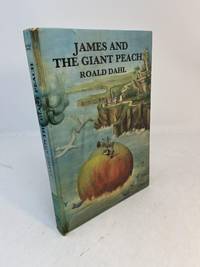
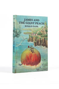
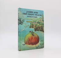
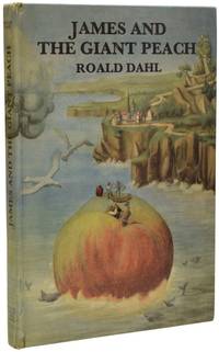
70186London: George Allen and Unwin Limited 1967. Children's classic FIRST UK EDITION. Octavo 25 x 18cm pp.112. Publisher's glazed pictorial boards illustrated throughout the text with black and white line drawings. Contents clean without spotting no inscriptions. Notoriously fragile covers are in very good condition showing gentle use some laminate shrinkage and wear. An attractive example. Basis for the Oscar-nominated 1996 family feature film Best Original Musical. Listed in BBC's Big Read 200 Best Novels 2003. London: George Allen and Unwin Limited, 1967 unknown
196735458London: George Allen & Unwin Ltd 1967. 1st UK edition. Hardcover. Very Good. 1st UK edition 1967. A Very Good copy. No jacket as issued. 8vo. Light blue illustrated paper boards. A bit of wear at the spine's crown and foot. The board's laminate if lifting with a small section gone at the spine's crown area. Previous owner's name in pencil on the front end paper. George Allen & Unwin Ltd hardcover
121589London George Allen & Unwin ltd 1967 . First UK edition; 4to 242 x 170mm; several illustrations in b&w usual age-toning no spotting; publisher's original laminated pictorial boards laminate cover to upper board is fragile but the binding is very good a clean copy in very good condition; 112pp.<br /> It has often been said that the author owed his writing success to the bedtime stories he created for his own children. What makes this book so special is that it reads as if the author were telling a remarkable story spontaneously as it were to a group of children listening intently at his feet.<br /> London, George Allen & Unwin ltd, 1967, hardcover
29807London: George Allen and Unwin. 1967. First UK edition first printing. First UK edition first printing. Publisher's original illustrated laminated boards with black titles printed to the upper board and spine without dustwrapper as issued. Illustrated with line drawings throughout by Michel Simeon. A near fine copy the binding firm and slightly cocked the cover artwork bright and fresh lightly rubbed to the extremities with a couple of small chips to the fragile laminate film at the spine and just a little scuffing to the spine tips. The contents with a touch of toning to the closed text block are otherwise clean throughout and without inscriptions or stamps. An excellent example of a notoriously brittle production. The first British printing of this classic of children's literature and the first edition to feature illustrations by Michel Simeon which remained the standard up until 1990. Quentin Blake first illustrated the book in 1995. The story was first published in America in 1961 by Alfred A. Knopf with illustrations by Nancy Ekholm Burkert. It has been adapted many times most notably for the 1996 musical feature film directed by Henry Selick and starring Paul Terry as James Henry Trotter which is now considered a cult classic. Further details and images for any of the items listed are available on request. Lucius Books welcomes direct contact with our customers. London: George Allen and Unwin. 1967 hardcover
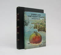
23380London: George Allen and Unwin. 1967. First UK edition first printing. First UK edition first printing. Publisher's original pictorial laminated boards without dustwrapper as issued. Illustrated with line drawings throughout by Michel Simeon. A lovely fine copy the binding square and firm and the fragile laminate film intact. The contents are clean and bright throughout and without previous owners' marks. Housed in a bespoke quarter black morocco solander case with titles in gilt to the spine. A superb example of a notoriously brittle production. The first British printing of this classic of children's literature and the first edition to feature illustrations by Michel Simeon which remained the standard up until 1990. Quentin Blake first illustrated the book in 1995. The story was first published in America in 1961 by Alfred A. Knopf with illustrations by Nancy Ekholm Burkert. Further details and images for any of the items listed are available on request. Lucius Books welcomes direct contact with our customers. London: George Allen and Unwin. 1967 hardcover
1810935like new. unknown
1810935-nnew. unknown
1585620807.Gpaperback. Good. Access codes and supplements are not guaranteed with used items. May be an ex-library book. paperback
20061-0195170229Oxford Univ Pr 2006. Hardcover. New. 1st edition. 242 pages. 9.50x6.25x1.00 inches. Oxford Univ Pr hardcover
2006Q-0195170229Oxford University Press 2006-04-20. Hardcover. New. New. In shrink wrap. Looks like an interesting title! Oxford University Press hardcover
A9780880488082Paperback / softback. New. This volume presents a comprehensive nosology of self-injurious behaviors classifying them as stereotypic compulsive and impulsive. It coverS both the theoretical and the practical as they discuss these categories in relation to phenomenology biological and psychological theories and pharmacological and psychotherapeutic treatment approaches. paperback
102387010X.Ghardcover. Good. Access codes and supplements are not guaranteed with used items. May be an ex-library book. hardcover
50658529like new. unknown
lc_62621Paris, 1954 Jonquières
198513668Office du Livre Editions Vilo Paris 1985 40 pages infolio. 1985. reliure editeur. 40 pages. Cet ouvrage présente une reproduction intégrale de la Haggadah ashkénaze un manuscrit hébraïque enluminé du milieu du XVe siècle décoré par Joël ben Siméon. Il inclut un commentaire attribué à Eléazar ben Juda de Worms avec une introduction et des notes sur les enluminures par David Goldstein. Le livre est destiné à un public intéressé par l'art médiéval la liturgie juive et l'histoire des manuscrits
1662B120645Mons, de l'imprimerie de Simeon de la Roche 1662-1664 [16] + 51 + [3] + 486 + [2] pp., 20cm., avec 12 pages de titre supplémentaires [Contenu: Ordonnances et provisions decretees le souverain cheflieu dudit Mons (1662, pp.1-14), 2: Decrets des archiducs pour le souverain heflieu de Mons du XX. Mars 1606 (1663, pp.15-22), Chartes et coustumes locales de la ville de Binch (1663, pp.23-62)), Coustumes [..] de Nivelles (1663, pp.63-96), Extraict des articles des chartes de Landrechies (1663, pp.97-120), Coustumes et usages de la franche ville de Lessines (1663, pp.121-148), Coutumes des droits et iurisdictions.. de Chimay (1663, pp.149-174), Coustumes de la ville de Valenciennes (1663, pp.175-230), Coustumes générales de la cité et duché de Cambray (1663, pp.231-298), Coustumes de la ville et eschevinage de Douay (1663, pp.299-332), Coustumes.. de Tournay (1663, pp.333-394), Coustumes de.. La Bassee (pp.395-398), Nouvelle ordonnance et moderation.. sur le fait des Loix & Coustumes du Pays & Comté de Namur (1663, pp.399-424), Recueil des poincts marquez pour coustumes du Pays de Liège (1663, pp.425-486)], reliure d'époque en plein-cuir (charnières abimées mais intactes, coins forts usés), tranches rouges, ex-libris effacé et ancien cachet sur la page de titre, texte frais,exemplaire toujours convenable // RELIÉ avec "Recueil de plusieurs placcarts fort utiles au pays de Haynnau, dont les chartes dudit pays renvoient a quantité d'iceux. Avec le decret de l'an 1601. L'edit perpetuel, le reglement de la navigation, mesures des heritages du susdit pays & d'autres circonvoisins, aussi la largeur des chemins & voyes d'iceluy" (Mons, de l'imprimerie de Simeon de la Roche, 1664, [4] + 246 + [12] pp., avec le blason gravé de Hainaut (au verso de la page de titre, pleine-page)], B120645
1770R113695Lovanii [Leuven], Typis academicis 1770 Complete in 2 volumes, [2] + LXIV + 623pp. & [2] + 828pp., 26cm., text in Latin, uniform 19th cy. hardcover bindings (spines in brown leather, gilt title), marbled endpapers, with head- and tail pieces & ornamental initials, stamp at blanco endpaper, text is clean and bright, weight: 3.7kg., R113695
1166804755.Gpaperback. Good. Access codes and supplements are not guaranteed with used items. May be an ex-library book. paperback
1120520185.Gpaperback. Good. Access codes and supplements are not guaranteed with used items. May be an ex-library book. paperback
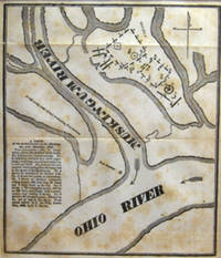
18338242bamAlbany NY 1833. Book. Very good condition. No Binding. Maps; matted; 8 1/4" x 9 1/2"; drawn by S. D. Drown from actual survey by Simeon De Witt; extracted from Josiah Priest American antiquities Albany 1833. unknown books
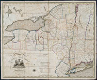
181225627New York 1812. Engraved map hand-coloured in outline sectioned and linen-backed at a contemporary date. Housed in a black morocco backed box. Unique copy of De Witt's important 1804 map of New York with county divisions updated to 1812.<br/> <br/>In 1778 George Washington appointed Simeon De Witt as the assistant to Robert Erskine the first Geographer and Surveyor General of the United States a position De Witt attained several years later. Following the war De Witt became the first Surveyor General of New York a position he held for an unprecedented fifty years. Among his first acts was to create the definitive first map of the state based on actual surveys. Following the settlement of the state's boundaries and accurate surveys which he directed De Witt published a large wall map in 1802 - the first map of the state and the progenitor of similar mappings in other states. Two years later De Witt issued this "contracted" version of his wall map intending its circulation to meet a wider audience. According to Allen however the map which was sold by subscription "does not seem to have been as widely distributed as its predecessor although it appears to have been designed to reach a wider audience. It may be that De Witt's 1804 map was unable to find a niche in competition with other small-scale maps of the state such as those of Samuel Lewis" Allen. Nevertheless as Streeter commented De Witt's 1804 map is "one of the earliest separate folding maps of New York after it became a state." Interestingly the present copy suggests that De Witt or an enterprising mapseller made an additional attempt to market this map. This copy of the 1804 map is updated to 1812; that is the map is as printed in 1804 but the county boundaries shown via period hand colouring depicts the state in 1812: the far western counties established in 1808 are clearly delineated e.g. Chautauqua Cattaraugus and Niagara counties but Erie County created in 1821 is not shown; Putnam county is shown separate from Dutchess County as per its establishment in 1812; Oneida County is shown with its western boundary on Lake Ontario i.e. before the 1816 establishment of Oswego County; among other additions. In all the state is divided into 47 counties. We find no other example of De Witt's 1804 map altered in this fashion. The exactness and appearance of the colouring however suggests it to be a distinct issue of the map or done for some official purpose as opposed to an early owner's mere manuscript addition.<br/> <br/>Ristow American Maps and Mapmakers pp. 73-83; Rumsey 2489; Streeter Sale 893; David Y. Allen How Simeon De Witt Mapped New York State. unknown books
1019781793.Ghardcover. Good. Access codes and supplements are not guaranteed with used items. May be an ex-library book. hardcover
1359388907.Ghardcover. Good. Access codes and supplements are not guaranteed with used items. May be an ex-library book. hardcover
181225627New York 1812. Engraved map hand-coloured in outline sectioned and linen-backed at a contemporary date. Housed in a black morocco backed box. Unique copy of De Witt's important 1804 map of New York with county divisions updated to 1812.<br/> <br/> In 1778 George Washington appointed Simeon De Witt as the assistant to Robert Erskine the first Geographer and Surveyor General of the United States a position De Witt attained several years later. Following the war De Witt became the first Surveyor General of New York a position he held for an unprecedented fifty years. Among his first acts was to create the definitive first map of the state based on actual surveys. Following the settlement of the state's boundaries and accurate surveys which he directed De Witt published a large wall map in 1802 - the first map of the state and the progenitor of similar mappings in other states. Two years later De Witt issued this "contracted" version of his wall map intending its circulation to meet a wider audience. According to Allen however the map which was sold by subscription "does not seem to have been as widely distributed as its predecessor although it appears to have been designed to reach a wider audience. It may be that De Witt's 1804 map was unable to find a niche in competition with other small-scale maps of the state such as those of Samuel Lewis" Allen. Nevertheless as Streeter commented De Witt's 1804 map is "one of the earliest separate folding maps of New York after it became a state." Interestingly the present copy suggests that De Witt or an enterprising mapseller made an additional attempt to market this map. This copy of the 1804 map is updated to 1812; that is the map is as printed in 1804 but the county boundaries shown via period hand colouring depicts the state in 1812: the far western counties established in 1808 are clearly delineated e.g. Chautauqua Cattaraugus and Niagara counties but Erie County created in 1821 is not shown; Putnam county is shown separate from Dutchess County as per its establishment in 1812; Oneida County is shown with its western boundary on Lake Ontario i.e. before the 1816 establishment of Oswego County; among other additions. In all the state is divided into 47 counties. We find no other example of De Witt's 1804 map altered in this fashion. The exactness and appearance of the colouring however suggests it to be a distinct issue of the map or done for some official purpose as opposed to an early owner's mere manuscript addition.<br/> <br/> Ristow American Maps and Mapmakers pp. 73-83; Rumsey 2489; Streeter Sale 893; David Y. Allen How Simeon De Witt Mapped New York State. unknown
32438225like new. unknown