Warner & BeersBiblio.com
417 résultats
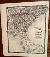
1874252New York: H. H. Lloyd & Co 1874. 16 1/2 x 14 inches. Very good. Beautiful map oof the entire peninsula of Florida with the adjacent states to the north. H. H. Lloyd & Co unknown
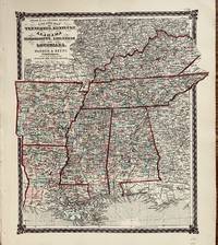
1876134Chicago IL: Warner & Beers 1876. 14 3/4 x 16 1/2 Inches. very good. Map of the central-South of the United States. Map is expertly covered and prominently displays the railroads of the early 1870's. Warner & Beers unknown
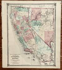
1872321Chicago: Warner & Beers 1872. 18 x 15 1/2 inches. Very good. Very nice single sheet map of California and Nevada. All counties are designated in color applied by hand. The latest info on road raids is posted on the map with the U.S. Mail Route displayed near San Diego. The fight for railroad access was critical in the development of Southern California towns. Warner & Beers unknown
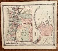
1872329Chicago: Warner & Beers 1872. 17 x 13 1/2 inches. Very good. Beautiful combination of two maps on one page. The coastal mountain range isolates more complex settlement in the western parts of Oregon and Washington. The areas east of the mountain range are highlighted by the notation of Great Plain of the Columbia. The Alaska map shows the extent of Seward's Folly of 1867. In its simple presentation the map is on a smaller scale disguising the enormity of the Territory of Alaska. This is comparatively difficult map to find. Warner & Beers unknown
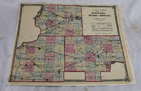
18742512290008Warner & Beers 1874. maps. Very Good. 17 x 14 in. 4 mi/in. Hand tinted shows townships. Single map removed from 1874 Atlas of Illinois. Legear P1512. Same as 1871 issue. Hand colored lithographed map. Shows townships towns county seat post offices creeks roads and railroads. Includes reference. Warner & Beers unknown
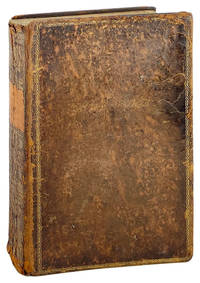
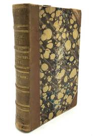
1837TB31667New Haven: Durrie & Peck and J. W. Barber 1837. Second Edition. Very good in its original binding of full leather covered boards with a black leather label with gilt text and extensive gilt decorations on the spine. The front and rear boards are decorated with gilt borders. An octavo measuring 8 7/8 by 5 1/2 inches with heavy rubbing to the leather over the joints and to the edges of the boards. The front free end page is torn at its lower two inches and there is an early prior owner's name Lynda Brownell Sherman Conn. written in pencil on the third free end page. The hand-colored fold-out map of Connecticut is completely intact and has suffered no damage. The preliminaries show moderate foxing and the last 50 pages of the text also show moderate foxing. The joints and hinges remain tight and strong. 560 pages of text. Illustrated throughout with 190 wood block engravings. Contrary to the information contained in Wright Howes bibliography U.S. Iana the first edition of this title was published in 1836. Barber an illustrator and historian 1798-1885 was Connecticut's first popular historian creating one of the first travel guides of the state. Following the index in the front of the book is a hand colored fold-out map of the State of Connecticut noting all of its towns at the time see note above regarding condition. Considered to be "mildly scarce" by Howes. Howes B-120 Originally published in 1836. Durrie & Peck and J. W. Barber hardcover books
1837TB27239New Haven: Durrie & Peck and J. W. Barber 1837. Second Edition. Very good in a recent dark blue cloth binding with gilt text on the spine. An octavo measuring 9 by 5 1/2 inches with new end sheets. The pages are uniformly lightly foxed throughout and the preliminaries and through page 36 the upper fore corners are nibbled in the margins. The hand-colored fold-out map of Connecticut is lacking by 2/3rds. With some minor foxing throughout. 560 pages of text. Illustrated throughout with 190 wood block engravings. Barber an illustrator and historian 1798-1885 was Connecticut's first popular historian creating one of the first travel guides of the state. Following the index in the front of the book is a hand colored fold-out map of the State of Connecticut noting all of its towns at the time see note above regarding condition. Considered to be "mildly scarce" by Howes. Howes B-120 Originally published in 1836. Durrie & Peck and J. W. Barber hardcover books
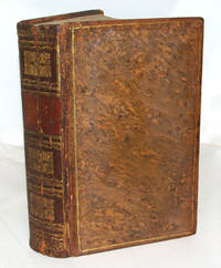
1838TB31668New Haven: Durrie & Peck and J. W. Barber 1838. Second Edition. Very good in its original binding of full leather covered boards with extensive gilt decorations on the spine. Unfortunately the original gilt decorated leather title label has been lost. The edges of the text block are marbled. An octavo measuring 8 3/4 by 5 1/2 inches with marbled end sheets. The leather over the spine shows evidence of drying with cracking of the leather's surface and rubbing to the leather at the tips of the boards. The contents are remarkable clean and free of tanning and foxing. The hand-colored fold-out map of Connecticut is in excellent condition. 560 pages of text. Illustrated throughout with 190 wood block engravings. Contrary to the information contained in Wright Howes bibliography U.S. Iana the first edition of this title was published in 1836. Barber an illustrator and historian 1798-1885 was Connecticut's first popular historian creating one of the first travel guides of the state Following the index in the front of the book is a hand colored fold-out map of the State of Connecticut noting all of its towns at the time see note above regarding condition. Considered to be "mildly scarce" by Howes. Howes B-120 Originally published in 1836. Durrie & Peck and J. W. Barber hardcover
1838199050New Haven: Durrie & Peck and J.W. Barber 1838. Hardcover. Fair Boards are heavily edgeworn/scuffed/smudged; spine is heavily worn and chipped; covers are starting; hinges are cracked; textblock is broken at page 16 and is beginning to crack around page 368/369; interior is toned with moderate foxing. Three-quarter-bound boards with black leather spine and corners and purple covers; 560 pp.; richly illustrated; folded map. Illustrated by 190 engravings. Durrie & Peck and J.W. Barber hardcover
1837TB31667New Haven: Durrie & Peck and J. W. Barber 1837. Second Edition. Very good in its original binding of full leather covered boards with a black leather label with gilt text and extensive gilt decorations on the spine. The front and rear boards are decorated with gilt borders. An octavo measuring 8 7/8 by 5 1/2 inches with heavy rubbing to the leather over the joints and to the edges of the boards. The front free end page is torn at its lower two inches and there is an early prior owner's name Lynda Brownell Sherman Conn. written in pencil on the third free end page. The hand-colored fold-out map of Connecticut is completely intact and has suffered no damage. The preliminaries show moderate foxing and the last 50 pages of the text also show moderate foxing. The joints and hinges remain tight and strong. 560 pages of text. Illustrated throughout with 190 wood block engravings. Contrary to the information contained in Wright Howes bibliography U.S. Iana the first edition of this title was published in 1836. Barber an illustrator and historian 1798-1885 was Connecticut's first popular historian creating one of the first travel guides of the state. Following the index in the front of the book is a hand colored fold-out map of the State of Connecticut noting all of its towns at the time see note above regarding condition. Considered to be "mildly scarce" by Howes. Howes B-120 Originally published in 1836. Durrie & Peck and J. W. Barber hardcover
1836004578New Haven: Durrie and Peck 1836. Folding colored map. Spine ends and one corner a little worn; front joint repaired; occasional spots & foxing. Second Edition. Contemporary Calf. Good Plus. Durrie and Peck Hardcover
1836433505New Haven and Hartford: John W. Barber and A. Willard 1836. Hardcover. Good. First edition. Thick octavo. viii 9-560pp. Illustrated by 180 engravings six plates lacking the map. Full brown leather with gilt-stamped black leather spine label gilt-tooled on board edges. Owner's name inked on blank preliminary pages foxed with hints of dampstaining in margins hinges cracked leather is dry and worn and chipped a good only copy lacking the rear fly and the fold-out map. Barber a notable engraver unwittingly became the state's historian while traveling through Connecticut. He spoke to the local townspeople collected documents made sketches of important locations and buildings. This book has been called "the first popular local history published in the U.S. John W. Barber and A. Willard hardcover
183677221New Haven J. W. Barber: Hartford A. Willard 1836. First Edition. Hardback. Scattered minor marginal foxing. Finely bound in modern aniline calf over marble boards. Raised bands with gilt cross-bands and titling. An exceptional example - scans and additional bibliographic detail on request. ; 560 pages; Description: 560 p. Illus. Fold. Map. 23 cm. Subjects: Connecticut--History. Connecticut--Description and travel. Connecticut--History Local. Notes: Map colored by hand. New Haven, J. W. Barber: Hartford, A. Willard hardcover
183628038New Haven and Hartford: Published and Sold by John W. Barber and A. Willard 1836. Very Good. New Haven and Hartford: Published and Sold by John W. Barber and A. Willard 1836. First Edition. Octavo; full contemporary gilt-tooled calf gilt spine lacking label all edges marbled marbled endpapers; 560pp.; hand-colored folding map; six plates; numerous in-text illustrations.<br /> <br /> Boards worn and scuffed with chipping to extremities split at top of spine heavier rubbing and surface fractures to spine and front board bowed towards fore-edge binding otherwise sound. Map toned with a few splits along folds else intact and sound. Ownership inscriptions of Joseph H. Clayton to endpapers along with his inscription presenting the volume to the Library of Harmony Lodge. Clayton is also listed in the subscriber list at rear with residence listed as New Haven. Very Good copy of a scarce local history uncommon with the hand-colored map. . Published and Sold by John W. Barber and A. Willard unknown
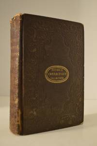
1838111111114147Durrie & Peck and J.W. Barber 1838. Hardcover. Good. Durrie & Peck and J.W. Barber; New Haven 1838. Hardcover. A Good brown cloth binding with gilt lettering on front board and spine blind stamped ornate design on boards gilt ornate design on spine binding a bit shaky some handling/scuffing to boards tear to rear joint with spine separating from backing material tear top and bottom front joint but still partially attached at middle exposed board corners small rub mark bottom text block corner age toning to pages rubbing along board edges specked text block edges scattered foxing throughout previous owner handwritten ink name top prelim discoloration to pastedowns and endpapers without Dust wrapper. A good copy. 8vooctavo or approx. 6 x 9 inches. 594pp. maps indexed b&w illustrations. We pack securely and ship daily with delivery confirmation on every book. The picture on the listing page is of the actual book for sale. Additional Scans are available for any item please inquire. Durrie & Peck and J.W. Barber hardcover
183624178New Haven CT: Durrie and Peck and J. W. Barber. 1836. Second Edition. Leather. Good in No Dust Jacket dust jacket. Sadly part of the colored map is missing but everything else is present and the binding is tight. This copy has been handsomely bound in full leather. The spine is intact but with some wear to the surface and fading of the titles. The book has marbled endpapers and a marbled fore-edge. The hinges are sound front and back and I see no markings or inscriptions. The main condition problem is widespread foxing which is probably true of all copies. Still a lovely collectible for the Connecticutian. . Durrie and Peck and J. W. Barber hardcover
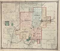
1876754Chicago: Warner & Beers 1876. 16 x 13 1/4 inches. Very good condition. This is a very nice single page map of Decatur IL and vicinity. It was printed in black and white. Color was then added at the time of publication.There were five wards in the city each delineated by the use of color. The railroad landscape was prominently placed in this map. The Illinois Central main line runs through the right center of the map. The Wabash intersects on the east side of town. The Indiana & Illinois Central runs through the major junction. Overall a very nice transportation map of Decatur Illinois. Warner & Beers unknown
186713669New York: F. W. Beers 1867. Very good. 14.5 by 17.5 inches engraved map with separate views of Carmel Towners Station South East Centre and Mill Town. This is from the Beers atlas that includes Westchester Putnam & Dutchess County which is unusual. Very good condition. F. W. Beers unknown
186818051312NY: Robert Carter 1868. Green cloth. Spine top chipped/chewed binding cracked in various places but still tight 1 signature sprung owner inscription in pencil on endpaper text foxed/stained: Good. 12mo. Illustrated in black and white. of Ellen Montgomery's Book Shelf. Robert Carter hardcover
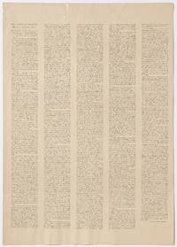
1900510626New York: National Institute of Arts and Letters 1900. Unbound. Very Good. Broadside. Measuring approximately 14" x 19¾". Backed onto acid-free Japanese tissue. A bit of light creasing a couple of short tears and tiny chips very good. A scarce broadside printing president Charles Dudley Warner's address before the first public meeting of the National Institute of Arts and Letters; he speaks at some length about copyright law as well as the relationship between publishers and authors "and I mean the the author and not the mere craftsman who manufactures books for a recognized market". The National Institute of Arts and Letters was formed by members of the American Social Science Association in 1898 and merged with the American Academy of Arts in 1976 to form what is now known as the American Academy of Arts and Letters. Warner was an essayist novelist and friend of Mark Twain with whom he co-authored the The Gilded Age: A Tale of Today. Not in OCLC or BAL. National Institute of Arts and Letters unknown
188357964ABLeipzig, O. Wigand, 1883. VI, 172 S. Hlwd. d. Zt. - Gutes Ex.
1875158273Robert Carter and Brothers 1875. Hardcover. Fair Condition/No Dust Jacket. Illustrator: . 434 pages. Considerable wear and damage to the green covers; broken front hinge and cracked in middle but still intact. Some soiling to the pages; name inside dated 1877; a reading copy of a rare old book. Author is not named inside noted as the author of "The Wide Wide World" only. Illustrator: . Quantity Available: 1. Category: Antiquarian & Rare; Inventory No: 158273. . Robert Carter and Brothers hardcover
1811H22984London: J. Dodsley / G. Wilkie & J. Robinson / James Cawthorn 1811. Hardcover. Very Good. In mid-19th century half light brown calf and marbled boards gilt titled on spine very good light rubbing and wear to binding. Bookplate of Thomas Fuller and his signature on the Anstey title page -- he was an architect native of Bath. With frontispiece. The Anstey is the 13th edition; the Bath Characters by Warner is a second edition from 1808 light foxing small clipped porttion from title page probably a previous owner's name; The Wonders of a Week at Bath appears to be a first edition from 1811 and has occasional pencil marginalia by a helpful old reader. Nice compilation of three works on Bath all of which are satirical. J. Dodsley / G. Wilkie & J. Robinson / James Cawthorn hardcover
1882288920New York: H. H. Warner & Co 1882. Second Edition. Soft Cover. Good binding. Book advertising the various H. H. Warner & Co. 'Safe' series of patent medical products. Beneath the testimonials descriptions of diseases and other usual medical advertisements of the time H. H. Warner offered large cash prizes for solving two or more of his ten 'enigmas.' About half are cyphers one quizzes the reader on trivia from Shakespeare's plays and another draws upon biblical knowledge. Pink printed wrappers with some sunning and a small tear to the front cover. Good binding. H. H. Warner & Co unknown books
1883149639Rochester NY: H. H. Warner & Co 1883. Softcover. G- Substantial edge wear and soiling to covers; page edges are beginning to flake off; pages are aged but not foxed; text is clear. Pinkish paper wraps 32 pp. BW illus. A pamphlet that touts the virtues of H. H. Warner's Safe Kidney & Liver Cure which treated Bright's disease; stones found in kidney and bladder; inflammation of the kidneys liver and urinary organs; and much much more. So safe a product was this medicine that its bottles carried a picture of a safe on them. This 32-page advertisement for the liquid is caged in the guise of a customer contest in which a total of $2000 would be doled out to various levels of winners. Top prize $1000; second prize $300; third prize $250 etc. All you had to do was figure out the 10 "enigmas" that ran along the bottom edges of these pages. Detailed directions for submissions were included. Since this is the "fourth annual pamphlet" this marketing approach must have worked for the Warners. But really most of the pages are testimonials from folks all over the country who used the medicine and were cured of their maladies and calamities. Each one carries a facsimile of the person's signature. The front and back covers show engraved portraits of a total of 18 gentlemen who are presumably either satisfied customers or people mentioned in the enigmas. Central on the front cover is Chester A. Arthur with his signature. It sure would be fun to track down all of the people named in this lengthy promotional piece. Ah well. Maybe you have the time. The seven-story Gothic style H. H. Warner Building still stands in Rochester and is on the National Register of Historic Places. H. H. Warner & Co paperback books