11 981 résultats
6054709-nnew. unknown
0548504954.Gpaperback. Good. Access codes and supplements are not guaranteed with used items. May be an ex-library book. paperback
1163797596.Gpaperback. Good. Access codes and supplements are not guaranteed with used items. May be an ex-library book. paperback
0484610104.Ghardcover. Good. Access codes and supplements are not guaranteed with used items. May be an ex-library book. hardcover
1332427383.Gpaperback. Good. Access codes and supplements are not guaranteed with used items. May be an ex-library book. paperback
3732645231.Gpaperback. Good. Access codes and supplements are not guaranteed with used items. May be an ex-library book. paperback
3847220632.Gpaperback. Good. Access codes and supplements are not guaranteed with used items. May be an ex-library book. paperback
1970030208Hartford Connecticut: The Hartford Courant 1970. Undated ca. 1970s. First separately published edition of short town histories reprinted from the Hartford Courant. Tall softcover folder 14" tall containing 28 loose leaves complete containing an engraving of a town landmark from the early 1800s mainly from John Warner Barber accompanied by a brief town history updated demographics and the role the Courant has played over the years. Covers a bit worn with a few short closed tears near the spine pages very clean and unmarked. Towns include: Barkhamsted Berlin Bristol Canton Colchester Coventry Durham East Hartford East Windsor Enfield and Thompsonville Farmington Granby Hartford Litchfield Manchester Meriden Middletown New Britain Old Saybrook Plymouth Simsbury Southington Stafford Tolland Vernon Wethersfield Windham and Willimantic Windsor. First Edition. Soft Cover. Good. Folio - 12" - 15" Tall. The Hartford Courant Paperback
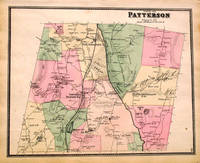
186713665New York: F. W. Beers 1867. Very good. 14.5 by 17.5 inches engraved map. This is from the Beers atlas that includes Westchester Putnam & Dutchess County which is unusual. Very good condition. F. W. Beers unknown
186713649New York: F. W. Beers 1867. Very good. 14.5 by 17.5 inches engraved map. This is from the Beers atlas that includes Westchester Putnam & Dutchess County which is unusual. Very good condition. F. W. Beers unknown
186713666New York: F. W. Beers 1867. Very good. 14.5 by 17.5 inches engraved map. This is from the Beers atlas that includes Westchester Putnam & Dutchess County which is unusual. Very good condition. F. W. Beers unknown
186713654New York: F. W. Beers 1867. Very good. 14.5 by 17.5 inches engraved map. This is from the Beers atlas that includes Westchester Putnam & Dutchess County which is unusual. Very good condition. F. W. Beers unknown
186713674New York: F. W. Beers 1867. Very good. 14.5 by 17.5 inches engraved map. This is from the Beers atlas that includes Westchester Putnam & Dutchess County which is unusual. Very good condition. F. W. Beers unknown
186713685New York: F. W. Beers 1867. Very good. 14.5 by 17.5 inches engraved map which includes a view of New Hamburgh. This is from the Beers atlas that includes Westchester Putnam & Dutchess County which is unusual. Very good condition. F. W. Beers unknown
186713671New York: F. W. Beers 1867. Very good. 14.5 by 17.5 inches engraved map. This is from the Beers atlas that includes Westchester Putnam & Dutchess County which is unusual. Very good condition. F. W. Beers unknown
186713657New York: F. W. Beers 1867. Very good. 14.5 by 17.5 inches engraved map. This is from the Beers atlas that includes Westchester Putnam & Dutchess County which is unusual. Very good condition. F. W. Beers unknown
186713696New York: F. W. Beers 1867. Very good. 14.5 by 17.5 inches engraved map. Includes views of Croton Falls North Salem and Purdy Station. This is from the Beers atlas that includes Westchester Putnam & Dutchess County which is unusual. Very good condition. F. W. Beers unknown
186713661New York: F. W. Beers 1867. Very good. 14.5 by 17.5 inches engraved map. Includes views of Newcastle and Chappaqua. This is from the Beers atlas that includes Westchester Putnam & Dutchess County which is unusual. Very good condition. F. W. Beers unknown
186713695New York: F. W. Beers 1867. Very good. 14.5 by 17.5 inches engraved map. Includes a view of Pelhamville. This is from the Beers atlas that includes Westchester Putnam & Dutchess County which is unusual. Very good condition. F. W. Beers unknown
186713683New York: F. W. Beers 1867. Very good. 14.5 by 17.5 inches engraved map which includes views of Washington Hollow and Salt Point. This is from the Beers atlas that includes Westchester Putnam & Dutchess County which is unusual. Very good condition. F. W. Beers unknown
186713670New York: F. W. Beers 1867. Very good. 14.5 by 17.5 inches engraved map. This is from the Beers atlas that includes Westchester Putnam & Dutchess County which is unusual. Very good condition. F. W. Beers unknown
186729169New York: F. W. Beers 1867. Very good overall. A lithograph map of this Westchester NY town which extends from Peekskill down to Croton Point. From the Beers atlas that includes Westchester Putnam & Dutchess County. 14.5 by 17.5 F. W. Beers unknown
186713678New York: F. W. Beers 1867. Very good. 14.5 by 17.5 inches engraved map. This is from the Beers atlas that includes Westchester Putnam & Dutchess County which is unusual. Very good condition. F. W. Beers unknown
186713668New York: F. W. Beers 1867. Very good. 14.5 by 17.5 inches engraved map. This is from the Beers atlas that includes Westchester Putnam & Dutchess County which is unusual. Very good condition. F. W. Beers unknown