Smith, J CalvinBiblio.com
164 résultats
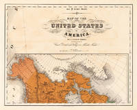
185524691Kassel: Theodor Fischer 1855-60. Other. In excellent condition. 372 by 468mm 14 by 18 inches. 372 by 468mm 14 by 18 inches. Lithograph original color in outline by Smith J. Calvin published 1855-60 by Theodor Fischer Kassel. Image size: 372 by 468mm 14 by 18 inches. From Smith's multi-sheet Special-Karte one of the most detailed and accurate mid-19th-century maps of the United States. John Calvin J. Calvin Smith c.18091890 was an American surveyor geographer and engraver active in New York City from the 1840s. Working with partners including George Sherman under the Sherman & Smith imprint 18401853 and later in association with J.H. Colton Smith produced some of the most accurate and widely used general-purpose maps of the United States of his era. His maps appeared in government publications military surveys and commercial atlases and his multi-sheet Special-Karte der Vereinigten Staaten published in a German-language edition brought American cartographic standards to European audiences. Despite his prolific output and importance to American cartographic history much of Smith's personal biography remains obscure.This antique map of Map of the United States of America No: 12 was published in 1855-60 by Theodor Fischer Kassel 372 by 468mm 14 by 18 inches. It is printed as a lithograph original color in outline. The map documents the region with careful attention to rivers settlements roads and political boundaries reflecting the geographical knowledge available at the time of publication and offering an invaluable primary source for historians and collectors of North American antique cartography. In excellent condition. Theodor Fischer unknown
18486386New York: Published by J. Disturnell 1848. Engraved on steel by Sherman & Smith. Full period color 19 x 23-1/2" folding into gilt stamped brown cloth covers. Two insets: The St. Lawrence River from the New York State Line to Quebec; and City of New York with Part of Brooklyn and Williamsburgh. This is a finely engraved and detailed general map of the State of New York. Canals are shown in blue and railroads in orange. Docketed on verso in blue pencil: "Jay Fiske Fort Plain N.Y." and "Map of New York State/ Fiske". Phillips p. 513; not in Rumsey. Published by J. Disturnell unknown
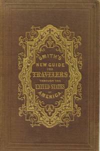
1848011489New York: Sherman & Smith. Good. 1848. Hardcover. An early guide to travel in the United States missing the map. Brown blind embossed cloth boards with gilt imprint. Light rubbing of board faces and corners. Adhesive mark on rear pastedown where map was tipped in. Foxed pages with dampstained corners and a few tears on first pages. The tables give mileages and routes for everywhere you'd want to go in the United States including from St. Louis Missouri to Astoria Oregon or the newly acquired Santa Fe. ; 5 3/4" x 3 3/4"; 79 pp . Sherman & Smith hardcover
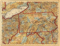
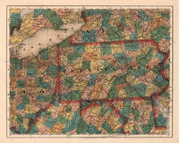
184519691Cassel: Th. Fischer 1845. Other. In very good condition. A few small marginal mended tears at the blank bottom verso old backed not affecting the image of the map and a few minor marginal pin holes. 373 by 476mm 14 by 18 inches. 373 by 476mm 14 by 18 inches. Lithograph hand-colored in outline by Smith J. Calvin published 1845 by Th. Fischer Cassel. Image size: 373 by 476mm 14 by 18 inches. From Smith's multi-sheet Special-Karte one of the most detailed and accurate mid-19th-century maps of the United States. John Calvin J. Calvin Smith c.18091890 was an American surveyor geographer and engraver active in New York City from the 1840s. Working with partners including George Sherman under the Sherman & Smith imprint 18401853 and later in association with J.H. Colton Smith produced some of the most accurate and widely used general-purpose maps of the United States of his era. His maps appeared in government publications military surveys and commercial atlases and his multi-sheet Special-Karte der Vereinigten Staaten published in a German-language edition brought American cartographic standards to European audiences. Despite his prolific output and importance to American cartographic history much of Smith's personal biography remains obscure.This antique map shows prominent in its centre the state of Pennsylvania with its neighboring states New York Ohio Delaware Maryland and Virginia. Inside the map are many place names rivers lakes mountains railroads etc. Many counties are named and finely hand colored in wash. A detailed map of this part of the Eastern United States by the famous 19th century mapmaker and cartographer Calvin Smith. In very good condition. A few small marginal mended tears at the blank bottom verso old backed not affecting the image of the map and a few minor marginal pin holes. Th. Fischer unknown
185524687Kassel: Theodor Fischer 1855-60. Other. In excellent condition. 374 by 470mm 14 by 18 inches. 374 by 470mm 14 by 18 inches. Lithograph original color in outline by Smith J. Calvin published 1855-60 by Theodor Fischer Kassel. Image size: 374 by 470mm 14 by 18 inches. From Smith's multi-sheet Special-Karte one of the most detailed and accurate mid-19th-century maps of the United States. John Calvin J. Calvin Smith c.18091890 was an American surveyor geographer and engraver active in New York City from the 1840s. Working with partners including George Sherman under the Sherman & Smith imprint 18401853 and later in association with J.H. Colton Smith produced some of the most accurate and widely used general-purpose maps of the United States of his era. His maps appeared in government publications military surveys and commercial atlases and his multi-sheet Special-Karte der Vereinigten Staaten published in a German-language edition brought American cartographic standards to European audiences. Despite his prolific output and importance to American cartographic history much of Smith's personal biography remains obscure.This antique map of Pennsylvania No:7 was published in 1855-60 by Theodor Fischer Kassel 374 by 470mm 14 by 18 inches. It is printed as a lithograph original color in outline. The map documents the region with careful attention to rivers settlements roads and political boundaries reflecting the geographical knowledge available at the time of publication and offering an invaluable primary source for historians and collectors of North American antique cartography. In excellent condition. Theodor Fischer unknown
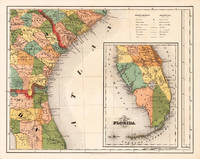
185524684Kassel: Theodor Fischer 1855-60. Other. In excellent condition. 370 by 470mm 14 by 18 inches. Lithograph original color in outline by Smith J. Calvin published 1855-60 by Theodor Fischer Kassel. Image size: 370 by 470mm 14 by 18 inches. From Smith's multi-sheet Special-Karte one of the most detailed and accurate mid-19th-century maps of the United States. John Calvin J. Calvin Smith c.18091890 was an American surveyor geographer and engraver active in New York City from the 1840s. Working with partners including George Sherman under the Sherman & Smith imprint 18401853 and later in association with J.H. Colton Smith produced some of the most accurate and widely used general-purpose maps of the United States of his era. His maps appeared in government publications military surveys and commercial atlases and his multi-sheet Special-Karte der Vereinigten Staaten published in a German-language edition brought American cartographic standards to European audiences. Despite his prolific output and importance to American cartographic history much of Smith's personal biography remains obscure.This antique map of Southern Part of Florida No: 15 was published in 1855-60 by Theodor Fischer Kassel 370 by 470mm 14 by 18 inches. It is printed as a lithograph original color in outline. The map documents the region with careful attention to rivers settlements roads and political boundaries reflecting the geographical knowledge available at the time of publication and offering an invaluable primary source for historians and collectors of North American antique cartography. In excellent condition. Theodor Fischer unknown
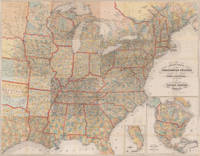
184520600Kassel: Theodor Fischer 1845. Other. Throughout all maps in excellent condition. Protected in their original cover as published. Our illustration shows all 16 folded maps digital joint together to a large wall map 56 1/2 x 72 inches. 1440 by 1840mm 56 by 72 inches. 1440 by 1840mm 56 by 72 inches. Lithograph color by Smith J. Calvin published 1845 by Theodor Fischer Kassel. Image size: 1440 by 1840mm 56 by 72 inches. From Smith's multi-sheet Special-Karte one of the most detailed and accurate mid-19th-century maps of the United States. John Calvin J. Calvin Smith c.18091890 was an American surveyor geographer and engraver active in New York City from the 1840s. Working with partners including George Sherman under the Sherman & Smith imprint 18401853 and later in association with J.H. Colton Smith produced some of the most accurate and widely used general-purpose maps of the United States of his era. His maps appeared in government publications military surveys and commercial atlases and his multi-sheet Special-Karte der Vereinigten Staaten published in a German-language edition brought American cartographic standards to European audiences. Despite his prolific output and importance to American cartographic history much of Smith's personal biography remains obscure.This is the rare German edition printed in lithograph of Calvin Smiths large wall map of the United States of America. Complete with all 16 folded maps to join together to a large map of the United States including a general map of the US. A splendid detailed map showing nicely the adjacenting Indian territories in the West further the map is showing detailed a larger part of Texas the gulf of Mexico and Florida. The general key map of the entire United States is extending towards the Western territories with California and Oregon as well New Mexico and the Indian territories. Throughout all maps in excellent condition. Protected in their original cover as published. Our illustration shows all 16 folded maps digital joint together to a large wall map 56 1/2 x 72 inches. 1440 by 1840mm 56 by 72 inches. Theodor Fischer unknown
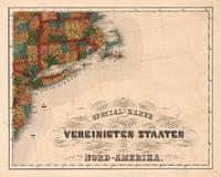
185524688Kassel: Theodor Fischer 1855-60. Other. In excellent condition. 375 by 473mm 14 by 18 inches. 375 by 473mm 14 by 18 inches. Lithograph original color in outline by Smith J. Calvin published 1855-60 by Theodor Fischer Kassel. Image size: 375 by 473mm 14 by 18 inches. From Smith's multi-sheet Special-Karte one of the most detailed and accurate mid-19th-century maps of the United States. John Calvin J. Calvin Smith c.18091890 was an American surveyor geographer and engraver active in New York City from the 1840s. Working with partners including George Sherman under the Sherman & Smith imprint 18401853 and later in association with J.H. Colton Smith produced some of the most accurate and widely used general-purpose maps of the United States of his era. His maps appeared in government publications military surveys and commercial atlases and his multi-sheet Special-Karte der Vereinigten Staaten published in a German-language edition brought American cartographic standards to European audiences. Despite his prolific output and importance to American cartographic history much of Smith's personal biography remains obscure.This antique map of Special-Karte der Vereinigten Staaten von Nord-Amerika No: 8 was published in 1855-60 by Theodor Fischer Kassel 375 by 473mm 14 by 18 inches. It is printed as a lithograph original color in outline. The map documents the region with careful attention to rivers settlements roads and political boundaries reflecting the geographical knowledge available at the time of publication and offering an invaluable primary source for historians and collectors of North American antique cartography. In excellent condition. Theodor Fischer unknown
1850008430New York: Sherman & Smith 1850 Book. Very Good. Hardcover. 16mo - over 5¾ - 6¾" tall. 16mo. 6x3¾ inches Pp. 2 advts 233 234 blank. Steel-engraved frontis wood-engraved title vignette 123 wood-engraved illustrations interspersed throughout the text large folding hand-colored engraved map 21½ x 27 inches. Publisher's light green cloth gilt lettering and design on front cover and spine blind stamped on rear cover. Light wear to spine ends and corners bookplate on inner cover. Light foxing to engraved frontis plate a few tiny breaks at some fold junctions of map 3 inch split to center of one fold. A very good copy and with the exception noted the map in very nice condition. New York: Sherman & Smith 1850. First published in 1846 and reprinted with the same collation in 1847 '48 '49 and 1850. Rare in any of the early printings. The large folding map with contemporary hand-coloring in outline is titled "A New Map for Travelers through the United States of America showing the Rail Roads Canals & Stage Roads. With the Distances. Published by Sherman & Smith. New York 1850" entered 1846. The important map was first published in the 1846 edition and then updated for the editions of 1848 1849 and this edition 1850. This fine map includes engraved pictorial vignettes and 4 inset maps. The insets include "Rail Road Route from New York to Philadelphia" "Rail Roads between the cities of New York Boston and Albany" "Rail Road and Canal Routes from Albany to Buffalo" and "Oregon Northern California Santa Fe etc." The latter inset first published in the 1846 edition is important for showing regions before the Mexican War. The map extends as far west as central Texas. Howes I: S-614; Howes II: 622; Sabin: 82928; see Wheat Mapping the Transmississippi West volume 3: p. 267. . Sherman & Smith hardcover
184871260New York:: Sherman & Smith 1848. publisher's gilt-lettered cloth. A beautiful clean unworn copy. 16mo. Embellished with 125 highly finished Engravings. Accompanied by a Large and Accurate Map by J. Calvin Smith. The folding"New Map Through the United States of America Showing the Railroads Canals & Stage Routes" measures approx. 21 x 26 inches and includes inset maps of Oregon & California New York etc. . Sherman & Smith, hardcover
1839397071New York: Published by J.H. Colton 1839. Hardcover. Near Fine. First edition. 12mo. 180pp. Large folding map. Gray-green cloth gilt. Scattered foxing throughout modest rubbing on the boards a solid very good copy with a small stain on the map otherwise in nice near fine condition. Howes S615. Published by J.H. Colton hardcover
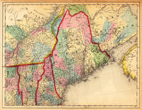
184514251Cassel: Th. Fischer 1845. Other. In very good condition. A few small marginal mended tears at the blank margins verso old backed not affecting the image of the map. 370 by 475mm 14 by 18 inches. 370 by 475mm 14 by 18 inches. Lithograph hand-colored in outline by Smith J. Calvin published 1845 by Th. Fischer Cassel. Image size: 370 by 475mm 14 by 18 inches. From Smith's multi-sheet Special-Karte one of the most detailed and accurate mid-19th-century maps of the United States. John Calvin J. Calvin Smith c.18091890 was an American surveyor geographer and engraver active in New York City from the 1840s. Working with partners including George Sherman under the Sherman & Smith imprint 18401853 and later in association with J.H. Colton Smith produced some of the most accurate and widely used general-purpose maps of the United States of his era. His maps appeared in government publications military surveys and commercial atlases and his multi-sheet Special-Karte der Vereinigten Staaten published in a German-language edition brought American cartographic standards to European audiences. Despite his prolific output and importance to American cartographic history much of Smith's personal biography remains obscure.This antique map shows prominent in its centre the state of Maine with its neighboring states Vermont New Hampshire and New Brunswick. The map extends from Salisbury in the south towards New Brunswick and the neighboring Nova Scotia. Inside the map are many place names rivers lakes mountains railroads etc. Many counties are named and finely hand colored in wash. A detailed map of this part of the Northeastern United States by the famous 19th century mapmaker and cartographer Calvin Smith. In very good condition. A few small marginal mended tears at the blank margins verso old backed not affecting the image of the map. Th. Fischer unknown
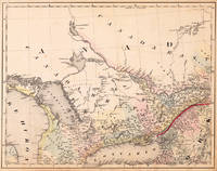
184520539Cassel: Th. Fischer 1845. Other. In very good to excellent condition. A few small marginal mended tears at the blank bottom not affecting the image of the map and a few minor marginal pin holes. 373 by 479mm 14 by 18 inches. Lithograph original color in outline by Smith J. Calvin published 1845 by Th. Fischer Cassel. Image size: 373 by 479mm 14 by 18 inches. From Smith's multi-sheet Special-Karte one of the most detailed and accurate mid-19th-century maps of the United States. John Calvin J. Calvin Smith c.18091890 was an American surveyor geographer and engraver active in New York City from the 1840s. Working with partners including George Sherman under the Sherman & Smith imprint 18401853 and later in association with J.H. Colton Smith produced some of the most accurate and widely used general-purpose maps of the United States of his era. His maps appeared in government publications military surveys and commercial atlases and his multi-sheet Special-Karte der Vereinigten Staaten published in a German-language edition brought American cartographic standards to European audiences. Despite his prolific output and importance to American cartographic history much of Smith's personal biography remains obscure.This decorative map shows the region from West Canada Ottawa River towards East Canada. Detailed information on the map on Lake Ontario the Georgian Bay Nipissing Lake Temiscaming Lake and the Ottawa River. Inside the map are many place names rivers lakes etc. engraved. As well names on Indian tribes are given. In very good to excellent condition. A few small marginal mended tears at the blank bottom not affecting the image of the map and a few minor marginal pin holes. Th. Fischer unknown
185059668New York:: Sherman & Smith 1850. . in publisher's gilt-lettered cloth portfolio as issued. A few neat tissue repairs on verso to tiny splits at fold intersections; a beautiful copy. 22 x 27 inches folded to 12mo. Folding map with original outline color; inset maps of Boston and New York environs; and engraved vignettes of Niagara Falls Notch of White Mountains Falls of Montmorenci and View of Mount Holyoke Mass. . Sherman & Smith, hardcover
1849r3543New York: Sherman & Smith. G : in Good condition. Cover lightly rubbed soiled and bumped. Slight darkening to page ends. Stamps of previous owner on fep and base of title page. Pencil annotation on ffep. Rear fold out map G with small tear at fore edge of centre fold. Contents tight. 1849. Reprint. Red/gilt hardback cloth cover. 150mm x 90mm 6" x 4". 234pp. 125 highly finished engravings and a large and accurate map hand coloured in outline. Containing a description of the states cities towns villages watering places colleges etc.etc.; with the railroad stage and steamboat routes the distance from place to place and the fares on the great travelling routes. . Sherman & Smith hardcover
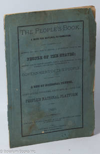
1883309800Place of publication not identified: publisher not identified 1883. Pamphlet. 44p. wraps. 9 x 6 in. Errata slip inserted after final leaf. Platform for a post-Civil War political organization founded by West Virginian Luther C. Shinn a Greenbacker. Strong theocratic themes. Opposed to foreign capital investment and monopolies. Interspersed are excerpts from speeches. Shinn was a candidate for political office in 1868 and 1872. WorldCat reports only one location as of September 2023. [publisher not identified] unknown
1891204495Springfield Massachusetts: French Protestant College 1891. 1st Edition 1st Printing. Hardcover. Very Good. 203p. A green hardcover book in very good condition. Edges and covers a bit worn and scuffed; text clean and binding tight. A book about the increase in French Canadian immigrants to the United States arguing that their citizenship is dangerous because the Catholic clergy is conspiring to control their votes. The author believes the solution is to convert these immigrants to Protestantism. French Protestant College hardcover
1891111371Springfield MA: French Protestant College 1891 Book. Good. Hardcover. First Edition. An anti-Catholic nativist text written by Rev. Calvin Elijah Amaron. Published in 1891 by the French Protestant College of Springfield Massachusetts the 213-page book addresses the massive influx of French-Canadian immigrants into New England during the late 19th century. Amaron argues that the rapid growth of the French-Canadian population-which reached roughly 10% of New England's total population by 1900-poses an existential risk to the region's Anglo-Saxon Puritan-rooted heritage. Book has moderate age wear including scuffs soils torn flyleaf etc. . French Protestant College hardcover
1897036191St. Louis: Anna C. Reifsnider Book Company 1897. Book. Good. Hardcover. First Edition. Scarce! Some sunning to cloth otherwise well-preserved copy in light blue pictorial cloth. 292pp. Anna C. Reifsnider Book Company Hardcover
189626764Salt Lake City UT 1896. First Edition. Octavo 23cm.; original white printed wrappers; 139pp. Binding staples heavily oxidized short closed tear to bottom edge of upper wrapper not affecting text title page a bit dampstained. Still a Very Good still bright copy. Upper cover dated Dec. 22nd 1896; title page dated Dec. 15 1896. unknown
185553902New York: Dix & Edwards 1855. First edition; 8vo pp. 2 264 8 pages of advertisements 2; the advertisements include reviews for Putnam's Monthly Magazine and for the weekly literary journal Household Words edited by Charles Dickens; original blindstamped brown cloth with gilt decorations and lettering on the spine; near fine. Wright II 1888. Dix & Edwards unknown
1855NS0241New York Dix & Edwards / London Sampson Low & Son 1855. Holman & Gray printers and stereotypers. Wright <i>American Fiction</i> II. 1851-1875 #1888. Last 8 pages are Dix & Edwards publisher advertisements. Hard Cover. 264 8 pages; 19 cm. VG in bright original boards. stock#NS0241. Dix & Edwards / Sampson Low & Son. hardcover
1856N117bas6Free Press Print 1856. Book. Fair. Cloth. First edition. 16mo - over 5¾" - 6¾" tall. Type: Book Type: Book Type: Book Binding copy in blind stamped cloth cover. Neat library repair of black tape to spine. Cover is loose from text. String bound booklet. Crease where booklet has been folded by previous owner. 35 pages. Ex-Medical library book book plate inside front cover from The Archibald Church Library Northwestern University Medical School. Free Press Print Hardcover
185403-0285Worcester MA: D. & M. Calkins 1854. 440pp includes a biographical section on Professor Calvin Newton some staining to pgs slight soiling & wear to cover wear at top of spine top 1" of front cover starting to separate from spine. Full-Leather. Good. D. & M. Calkins Hardcover
188079427New York: : Moss Engraving Co. no date 1880s. Some light use to the metal plate; image very nice. 4-1/2 x 7-1/2 inches. John Calvin Moss is credited with developing the first practical photo-engraving process in 1863. He worked in a partnership as the Actinic Engraving Co 1871-1872; then as the Moss Photo-Engraving Company and finally enjoyed success as the Moss Engraving Company from 1880 until his death in 1892. Moss Engraving Co., unknown