Abraham Ortelius (1527-1598)Biblio.com
155 résultats
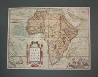
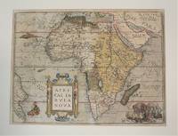
1570M10981Antwerp Belgium 1570. Very Good age toning. Notes: Map of Africa Continent by Abraham Ortelius published in Theatrum Orbis Terrarum <br>Latin Text on verso. Size : 367x495 mm 14.45x19.49 Inches Coloring: Original Hand Coloring Reference: Marcel P. R. van den Broecke #8.<br><br> Category: Maps Africa Continent; unknown
1570M10980Antwerp Belgium 1570. Very Good age toning. . Notes: Map of Africa Continent by Abraham Ortelius published in Theatrum Orbis Terrarum<br>Latin Text on verso. Size : 378x507 mm 14.88x19.96 Inches Coloring: Original Hand Coloring Reference: Marcel P. R. van den Broecke #8. Category: Maps Africa Continent; unknown
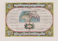
1590M8858Antwerp 1590. Very Good margins are extended. Notes: A fine world map by Abraham Ortelius based on Ptolemy surrounded by the maps of the four continents Americas Europe Asia and Africa. Map is superbly decorated within ornamental 16th century design. Latin text on verso. Size : 310x439 mm 12.20x17.28 Inches Coloring: Original Hand Coloring Reference: Shirley World 176: Van den Broecke 186. Category: Maps World; unknown
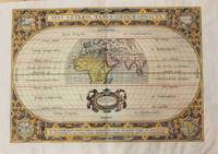
1590200018AG1590. Antwerp Ortelius 1590. Original hand-coloured engraving. Plate Size: 44 cm x 31 cm. Sheet Size: 53.7 cm x 38.5 cm. Original map. Very good actually stunning condition. Really clean and crisp. Generous margins. Reverse recto carries Latin text. Shirley 176; Broecke 186.1; Koeman III 0800H:31. Beautifully unusual and richly decorated map of the Ancient World based upon the work of Claudius Ptolemy from Ortelius' Parergon 'Supplement'. The depicted land masses of Europe Africa and western Asia are largely in their modern configurations although the place names on the map are based upon Ptolemy. The southern portion of Africa is missing and China is not included on the map. A small number of cities including Hispalis Seville Lutetia Paris Rome Byzantium Istanbul Hierusalem Jerusalem Alexandria and Memphis are identified. Relief shown pictorially. The mythical Luna Montes Mountains of the Moon - the fabled source of the Nile - can be seen in the southern half of Africa. Madagascar is also included. The climate zones are shown as 'Zona frigida et inhabitablis' 'Zona temperata et habitabilis' and 'Zona torrida et ob Solis nimium fervorem a veteribus inhabitabilis credita.' The tropics and Arctic and Antarctic circles are also shown. The 'Zona frigida' lying above the Arctic Circle and the region lying at the Equator are described as being inhospitable. The border of the globe carries longitudinal and latitudinal information. The outer areas of the map are decoratively patterned and there is one inset roundel map in each corner showing the different continents depicting in clockwise order Europe Asia Africa and the Americas. Ortelius' characteristic strapwork design ornaments the title cartouche above the globe as it does the cartouche seen beneath it. It bears the inscription: "En Spectator Pilae Totius Terrae Ichnographiam at Veteribus Usque ad Annum Salutis Nonagesimum Secundum Supra Milles Quadrigent. Cognitae Tantum Geographiam." Immediately underneath the illustrated landmass is a further cartouche similarly ornamented decorated with two lion heads and bearing an oval inset statement of responsibility in Latin script. The Parergon was conceived initially as a supplement to Ortelius' Theatrum Orbis Terrarum Theatre of the World. The work a vast and finely researched index of the Classical world was accompanied by a number of ancient world maps. Unlike the maps of the Theatrum the majority of which were reductions of earlier maps the maps of the Parergon were researched and drawn by Ortelius himself. The work was a great commercial success and the maps themselves set the standard for ancient world maps for the duration of the 17th Century. Abraham Ortelius was a Flemish cartographer and geographer conventionally recognized as the creator of the first modern atlas the Theatrum Orbis Terrarum Theatre of the World. He was one of the most notable figures of the Dutch school of cartography during its golden age approximately 1570s-1670s. unknown
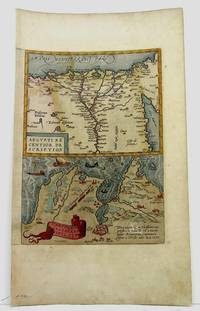
1590M3954Antwerp 1590. Very Good. Size : 320x230 mm 12.625x9 Inches Coloring: Hand Colored Category: Maps Africa North Egypt unknown