GRAAF, Abraham deBiblio.com
201 résultats
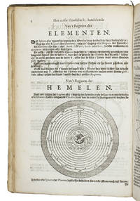
1658ABC_47326Amsterdam 1658. Folio. Pieter Goos Contemporary vellum with a manuscript title on the spine. With a half-page engraving on the half-title a woodcut vignette on the title-page 6 folding engraved tables and numerous woodcut mathematical diagrams figures tables and other illustrations in the text. With woodcut tailpieces and woodcut decorated initials. 7 parts in 1 volume. 1 1 blank 8 39 1 blank; 2 4 45 1 blank 90 5-91 1 blank; 96; 86 2 blank; 39 1 blank; 60 18 2 blank; 96 7 1 blank pp. Rare first edition of Abraham de Graaf's mathematical work published for nautical experts studying navigation. The mathematical and astronomical theories are illustrated with countless woodcut diagrams and figures in the text and 6 additional folding engraved plates. Included are numerous incredibly detailed logarithmical and other mathematical tables mainly in the second book. "The tables are the first logarithmical tables in a Dutch navigation book. The tables are probably computed and computed and enlarged by Adriaen Vlacq and based on those of John Napier and Henry Briggs" Crone 210.The present work comprises 7 parts with individual title-pages each dated 1657 bound and published as one with two general title-pages and a comprehensive index. The subject of the "books" include for example: astronomy geometry calculations regarding compasses cartography concerning "paskaarten" a type of nautical chart and observation and navigation at sea.Binding browned and somewhat worn mainly the back board some mould spots on the pastedowns and flyleaves some light water staining to the head margin slight foxing throughout. With a tear in the 3rd and 4th folding plates. Overall in good condition.l Bibl. Nautica 2048; Cat. NHSM p. 666; Crone Library 210; STCN 09324195X 6 copies; WorldCat 1156962499 1 copy 993578800 1 copy 1154627661 8 copies; for the author: NNBW part 10 cols. 293-296. hardcover
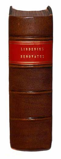
16861110210007Norimbergae : Impensis Johannis Georgii Endteri 1686. Leather Bound. Very Good. Nuremberg: Johann Georg Endter 1686. Thick 4to. Two parts in one volume. 24 1097 pp. 59; 6 160pp. 2. Latin. Fully bound in contemporary calf. Modern reback with gilt lettered bright red spine label. Wear and chipping to extremities. Covers decoratively blind stamped. New endpapers. Warrington Dispensary Library stamp. Minor browning/foxing to pages. Interior pages are clean and unmarked. Beautiful engravings and printed titles. <br><br>Fourth edition considerably expanded by Georg Abraham Mercklin. "Van der Linden's book was at the time of its appearance the most complete medical bibliography yet produced"-Garrison-Morton 6744 referenceing the 1637 orginal edition.<br><br> Norimbergae : Impensis Johannis Georgii Endteri hardcover
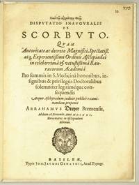
1621446261621. Basileae: Typis Joh. Jacobi Genathii 1621 Kl.4° 16 pp. Pappband. Disputatio inauguralis de scorbuto / quam . pro summis in S. Medicina honoribus insignibus & privilegiis doctoralibus solemniter legitimeque consequendis . publice examinandam proponit Abrahamus Dreyer Bremensis ad diem 28. Novembr. Anni MDCXXI. Abrahma Dreyer " war zu Bremen am Ende des 16ten Jahrhunderts ebohren wurde zu Basel am 28. November 1621 Medicu. Dr. mit einer Disp. De Scorbuto und practicirte als Arzt in Minden." Heinr. Wilh. Rtoermund Lexikon aller Gelehrten . in Bremen 1818. Husner: Verzeichnis bas. med. Univ.Schriften Nr. 892 unknown
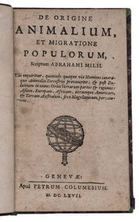
1667L3IDFLMHTUVUGeneva 1667. 12mo. Petrus Columesius 19th-century gold-tooled half calf with the title lettered in gold on the spine decorated "pseudo-marbled" paper sides marbled end papers. With a woodcut printer's device on the title page. 68 4 blank pp. First edition of treatise on the origin and migration of man and animals a posthumously published work by the Dutch linguist and minister Abraham van der Myl 1563-1637. "It was only after the discovery of America that the attention of naturalists was powerfully drawn to the wonderful differences between the animal population of the central and southern parts of the new world and that of those parts of the old world which lie under the same parallels of latitude. So far back as 1667 Abraham Mylius in his treatise "De Animalium origine et migratione populorum" argues that since there are innumerable species of animals in America which do not exist elsewhere they must have been made and placed there by the Deity" Huxley. "lncludes a curious dissertation on the origin of the American races" Sabin. A German translation appeared in 1670. The front board is detached but still present. The work is lightly browned throughout.l BMC NH suppl. p. 840; T.H. Huxley The problems of the deep sea 1873; Leclerc 383; Palau 169293; Sabin 48982. unknown
169531368AB1695. Altdorf Meyer 1695. 24 S. Geheftet. Mit Holzschnitt-Initiale. Etwas schräg beschnitten sonst ein sehr sauberes und gut erhaltenes Exemplar. unknown
1669228507London: Henry Herringman 1669. Soft cover. Very Good. Softcover; 4to; pp. 51-70; 154; 23. Rare. Davideis Cowley's epic poem on King David in four parts bound as one. Includes author's notes on each book after the text. Bound with the back half of the Pindarique Odes before the main text. Printed for Henry Herringman at the sign of the Blew Anchor in the lower walk of the New Exchange. In a manuscript waste parchment binding with cuttings from indentures serving as endpapers from 1791. Especially beautiful calligraphy on the front endpaper. Blue embossed stamps on fep and bep emblazoned with a crest and "One Pound" as well as a sliver of metal embedded. Edges a little scuffed and soiled but in largely great condition. Binding tight and interior bright and clean. Includes a Latin translation of the first book appended at rear 23 pages. Excellent early impression of this rare poetic work. VG <br/> <br/> Henry Herringman paperback
1657012951Nurnberg: Zufinden bey Paulus Fursten Kuntsthandler 1657. Book. Very good condition. Hardcover. First Edition. Oblong 16mo. Engraved title page 20 leaves of introductory text followed by 71 leaves of text followed by four leaves of black and white copper-engraved plates numbered I-IIII followed by 226 leaves of black and white copper-engraved plates numbered 1-226. Each engraved leaf is engraved on one side only. Original full leather binding is moderately worn on the exterior hinges and extremities with minor warping of front board. Front endpapers are lacking. Minor staining to the fore-edge of the majority of pages affecting the margins only. Minor foxing scattered throughout in several instances affecting the plates. Previous owner's stamp circa 1900 on title page and half title page and bookplate on front pastedown endpaper: Henry von Wackerbarth Chicago. The final two leaves of plates are creased on the edge not affecting the engravings and the rear endpapers are heavily creased. A very attractive first edition of this work. No author is stated on the title page but Sibmacher is mentioned in the text. "gedruckt bey Christoff Gerhard zufinden bey Paulus Fursten." Title continues "aussgebildet zuersehen. Erste-Theil.". Zufinden bey Paulus Fursten Kuntsthandler Hardcover
1612M10826Antwerp Belgium 1612. Very Good. Notes: Latin text on verso.<br>Antioch on the Orontes was a Hellenistic city by the Orontes River. Its ruins lie near the current city of Antakya Turkey to which the ancient city lends its name. Size : 366x486 mm 14.41x19.13 Inches Coloring: Hand Colored Reference: Marcel P. R. van den Broecke #232 Category: Maps Asia Near East Turkey; unknown
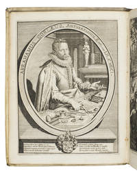
1601ABC_46116Leiden 1601. 4to. Petrus van de Aa Contemporary limp vellum manuscript title on spine. With 2 different engraved allegorical title-pages reflecting the themes of rings and intaglio-carved gems 2 letterpress title-pages in red and black with one of Van der Aas engraved allegorical devices Minerva/Athena books a cock and Hercules/Heracles with motto "studio et vigilantia" a portrait of the author by Jacques de Gheyn with a calligraphic verse by Hugo de Groot below 138 engraved plates: 196 numbered illustrations of ancient rings with carved gems shown at actual size on 101 engraved plates and 148 numbered illustrations of carved gems alone on 37 engraved plates. 2 volumes. 22 28 16 16 pp. plus 109 plates; 64 32 pp. plus 173 plates. The second much enlarged edition by the Dutch classical scholar Jacobus Gronovius of the first extensive repertory of Greco-Roman rings with intaglio-carved gems by Abraham Gorlaeus Van Goorle; 1549-1608 which Gorlaeus had published in 1601 with the title Dactiliotheca seu annulorum sigillarium quorum apud priscos tam Graecos quam Romanos usos 1601 as a catalogue of engraved gems in his cabinet of curiosities.The present edition is also remarkable as one of the earliest books too incorporate - at the end of vol. 2 pp. 1-32 - a medieval treatise on precious stones by Marbodi the bishop of Rennes ca. 1035-1123: Marbodaei Galli Poetae vetusti Carmen de gemmis sive lapidibus pretiosis. The poem is written in exquisite Latin metre and each of the 63 sections is devoted to a single gem explaining its formation appearance etymology exotic origins medical properties and preparations. In his prologue Marbodi says it is partly based on a work on the subject by the first century Arabian King Evax addressed to Emperor Tiberius.With three inserted pages with titles in German translation written by a 19th-century hand and one leaf inserted with 43 tracings of rings etc. from the book also in a 19th-century hand-writing. Bindings a little dust-soiled otherwise in very good condition.l Brunet II 1671; Ebert 8711; Kockel-Graepler Daktyliotheken Kat. 2006 pp. 111-112; Simoni G126; Sinkankas 2470; Ter Meulen & Diermanse 247; STCN 5 copies incl. 2 incomplete; Vinet 1609; cf. Ciconara 2871; J. G. van Gelder Notes on the royal collection - IV: the 'Dutch gift' of 1610 to Henry Prince of Wales'. in: The Burlington Magazine 105 December 1963 pp. 541-545; David Jaffé Aspects of gem collecting in the early seventeenth century Nicolas-Claude Peiresc and Lelio Pasqualini in: The Burlington magazine 135 February 1993 pp. 103-120; Sinkankas 2472; P. & H. Zazoff Gemmensammler pp. 31-34; for the author: NNBW 5 1921 cols. 209-210. hardcover
1695191214Petrus Vander Aa 1695. Hardcover. Fair boards show medium shelfwear; internal spine hinges are split with some loose pages; light age toning as expected; small tear to the foldout plate. Brown cloth over boards; Black title block with gilt lettering on spine. Various paginations throughout with unpaginated bw plates throughout one foldout. Text in Latin. At head of title: Abrahami Gorlaei antverplani./ Rubricated title-pages with vignettes; added title-pages engraved./ Part 2 has title: Dactyliothecae . seu variarum gemmarum quibus antiquitas in signando uti solita scalpturae triplo quam fuerunt partim antehae ineditarum partim ex scriptis eruditorum virorum collectarum numero locupletiores . Accedit Marbodaei galli caenomanensis Carmen de gemmis & lapidibus. The panels show Greek and Roman signet rings cameos and amulets as well as a portrait of Gronovius 1645 - 1716. Petrus Vander Aa hardcover
16248000Antwerp: Plantin-Moretus 1624. Copper engraving 36 x 46 cms modern hand colour Latin text on verso. Ancient Dacia and Moesia modern Romania and Bulgaria on the Black Sea. Our example was published by Balthasar Moretus at the Plantin Press in the final edition of the Parergon. Ortelius's Theatrum Orbis Terrarum is generally considered the first modern atlas of the world originally published in 1570. Ortelius gathered and selected the best available cartographic knowledge and presented it in a single volume duly credited and finely engraved in a consistent style with explanatory text. The Theatrum was very decorative and hugely popular amongst the wealthy and educated running into over forty editions in Latin and the major European languages. For Ortelius himself however his accompanying atlas of ancient geography the Parergon was a "personal work" Koeman. He seems to have regarded himself first and foremost as an antiquary and rather than copying other people's maps he drew the originals himself; they were subsequently engraved for him by the master engraver Jan Wierix. The results have to be evaluated as the most outstanding engravings depicting the wide-spread interest in classical geography in the 16th century Koeman. Koeman Atlantes Neerlandici Ort 46. Van den Broecke 212.2 Map Plantin-Moretus unknown
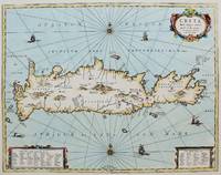
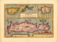
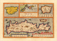
1640M8308Amsterdam c. 1640. Very Good. Notes: Striking map of Crete with decorative cartouche ships and one sea monster scattered along the ocean. The map is based on the earlier work of Ortelius. Size : 375x485 mm 14.75x19.10 Inches Coloring: Hand Colored Category: Maps Mediterranean Sea; Maps Europe Greece Macedonia; unknown
161220464Antwerp: Juan Baptist Vrients 1612. Other. In excellent condition. 342 by 491mm 13 by 19 inches. Original copper engraving published 1624 in the famous historical Atlas Parergon Latin text-edition by Abraham Ortelius. Finely later hand-colored in wash and outline. Four maps on one plate: Corsica the Ionian Islands Cephalonia Zacynthus Corcyra Sardinia and Crete. Villages and towns are shown as miniature views moreover the map at the bottom is ornated with ships sea monsters and animals. At the bottom we find two cartouches with listings of antique place names and explanations. Ortelius was born on 14 April 1527 in the city of Antwerp which was then in the Habsburg Netherlands modern-day Belgium. The Orthellius family were originally from Augsburg a Free imperial city of the Holy Roman Empire. In 1535 the family had fallen under suspicion of Protestantism. Following the death of Ortelius's father his uncle Jacobus van Meteren returned from religious exile in England to take care of Ortelius. Abraham remained close to his cousin Emanuel van Meteren who would later moved to London. In 1575 he was appointed geographer to the king of Spain Philip II on the recommendation of Arias Montanus who vouched for his orthodoxy. He travelled extensively in Europe and is specifically known to have traveled throughout the Seventeen Provinces; in southern western northern and eastern Germany e.g. 1560 15751576; France 15591560; England and Ireland 1576; and Italy 1578 and perhaps twice or thrice between 1550 and 1558. Beginning as a map-engraver in 1547 he entered the Antwerp Guild of Saint Luke as an illuminator of maps. He supplemented his income trading in books prints and maps and his journeys included yearly visits to the Frankfurt book and print fair where he met Gerardus Mercator in 1554. In 1560 however when travelling with Mercator to Trier Lorraine and Poitiers he seems to have been attracted largely by Mercator's influence towards the career of a scientific geographer. Wikipedia Broe. 217 Juan Baptist Vrients unknown
161213729Antwerp: Juan Baptist Vrients 1612. Other. In excellent condition. 342 by 491mm 13 by 19 inches. Original antique copper engraving decorative hand colored. Published 1612 in the historical Atlas "Parergon" by Abraham Ortelius bound with his famous Theatrum Orbis Terrarum. Finely hand-colored in wash and outline. Four maps on one plate: Corsica the Ionian Islands Cephalonia Zacynthus Corcyra Sardinia and Crete. Villages and towns are shown as miniature views moreover the map at the bottom is ornated with ships sea monsters and animals. At the bottom we find two cartouches with listings of antique place names and explanations. A very good example in excellent condition. Ortelius was born on 14 April 1527 in the city of Antwerp which was then in the Habsburg Netherlands modern-day Belgium. The Orthellius family were originally from Augsburg a Free imperial city of the Holy Roman Empire. In 1535 the family had fallen under suspicion of Protestantism. Following the death of Ortelius's father his uncle Jacobus van Meteren returned from religious exile in England to take care of Ortelius. Abraham remained close to his cousin Emanuel van Meteren who would later moved to London. In 1575 he was appointed geographer to the king of Spain Philip II on the recommendation of Arias Montanus who vouched for his orthodoxy. He travelled extensively in Europe and is specifically known to have traveled throughout the Seventeen Provinces; in southern western northern and eastern Germany e.g. 1560 15751576; France 15591560; England and Ireland 1576; and Italy 1578 and perhaps twice or thrice between 1550 and 1558. Beginning as a map-engraver in 1547 he entered the Antwerp Guild of Saint Luke as an illuminator of maps. He supplemented his income trading in books prints and maps and his journeys included yearly visits to the Frankfurt book and print fair where he met Gerardus Mercator in 1554. In 1560 however when travelling with Mercator to Trier Lorraine and Poitiers he seems to have been attracted largely by Mercator's influence towards the career of a scientific geographer. Wikipedia Broe. 217 Juan Baptist Vrients unknown
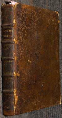
168840157London: Owley Abraham. the Works. Good with no dust jacket. 1688. Leather. frontis portrait b/w; Folio 19; 58 41 1 80 4 70 154 23 1 pages; 1 folio volume. Contemporary mottled calf spine gilt in 6 compartments; joints split extremities worn covers attached but a little loose. Scattered foxing generally sound otherwise. Wing C6658. Andre de Boismorel ink ex-libris on title. Small Lavington bookplate crest on pastedown. . Owley, Abraham. the Works. hardcover
16891512050020Amsterdam: Ex typographia P. & J. Blaeu protant apud A. Wolfgang Janssonio-Waesbergios Boom Somer & Goethals 1689-01-01. Hardcover. Very Good. Blind stamped contemporary vellum binding. Hand written title. Folio 40 cm. Title in red and black with printer's device. Engraved portrait of Louis Cappel. Collated: 24 979 11 pp. Printed in 2 columns. A few stray spots generally clean and unmarked internally. <br>"Cappel gained imperishable fame by his two books 'Arcanum Punctationis Revelatum' published anonymously by Thomas Erpenius at Leyden in 1624 and 'Critica Sacra' printed at Paris in 1650. In the 'Arcanum' he proved conclusively that the Hebrew text was first pointed after the Christian era until which time it had been composed merely of consonants; in the 'Critica' he proved that not even the consonantal text had been transmitted without errors but needed emendation with the help of the versions and of conjecture. It is to the lasting credit of Cappel that he was the first who dared to undertake with exemplary clearness penetration and method a purely philologic and scientific treatment of the text of the Bible." Crawford Howell Toy Karl Heinrich Cornill; Jewish Encyclopedia 1906. <br><br> Signature of Thomas J. Conant 1824. Conant was a noted American Biblical scholar. Gift inscription from Conant to the Newton Theological Seminary from 1827. This is an oversized or heavy book that requires additional postage for international delivery outside the US. Amsterdam: Ex typographia P. & J. Blaeu, protant apud A. Wolfgang, Janssonio-Waesbergios, Boom, Somer, & Goethals hardcover
1612406876Antwerp 1612. Tape reinforcements along edge on verso without show-through and not affecting image a few foxmarks overall in very good condition with good color. Hand colored engraved map 12 5/8 x 9 7/8 inches image 16 1/2 x 10 5/8 inches sheet. Crossed arrows watermark. A fine map from Ortelius's atlas showing Lake Constance the Danube and Rhine. Bounded by the Lech Odenwald Alsace and Chur in Switzerland. unknown
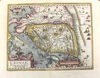
1612M10204Antwerp 1612. Very Good. Notes: Italian text on verso wide margins. <br>The first map of China to appear in a Western atlas with decorative cartouches.<br>The map is based on the work of Jorge de Barbuda a Portuguese Jesuit also known as Ludovicus Georgius whose manuscript map reached Ortelius by way of Arias Montanus. <br><br> Size : 365x470 mm 14.37x18.50 Inches Coloring: Original Hand Coloring Reference: Marcel P. R. van den Broecke #164 Category: Maps Asia Far East China; unknown
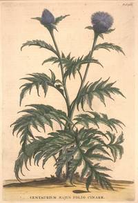
1696324021Leyden and Utrecht: Pieter Vander Aa 1696. unbound. Botanical. Copper plate engraving with hand coloring. Image measures 12 1/2" x 8 1/2".<br/> <br/> Fine print of a purple thistle-like flowering plant with jagged leaves. <BR> <BR> Abraham Munting 1626-1683 taught medicine and botany at the Academy of Groningem in the Netherlands. He had a particular interest in the uses of plants especially medicinally. This engraving is from "Naauwkeurige Beschryving Der Aardgewassen". Aging around edges and minor foxing. Please visit our gallery for more Munting prints.<br/> <br/> Pieter Vander Aa unknown
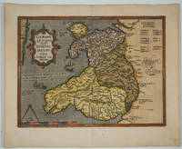
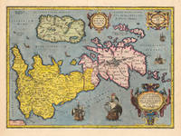
160915882Antwerp 1609. The first printed map of Wales with title translated as "Map of Wales by the author Humphrey Lhuyd the Welshman from Denbigh". Based on Mercator's 1564 wall map of the British Isles and Lhuyd's manuscript map of 1568. Ornate cartouche sailing ship and sea monsters. Latin text on verso. Van den Broecke and van den Broecke-Günzburger's Ortelius Map No. 21; 300 copies of this edition were printed. Image size: 19 1/2 x 14 1/2". Paper size: 23 x 18 3/4". Two stray printer's marks at lower margin otherwise very good. unknown
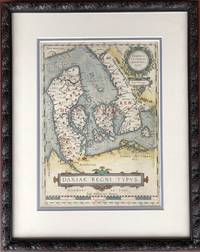
1610H15377Amsterdam 1610. Very Good. 13.5 x 9.75 inches double-matted and nicely framed; frame measures 20 x 16 inches. With original hand coloring very good with mild surface soil. Not examined outside of frame. This is the left-hand map of a sheet that had on the right a detailed map of Jutland. Part of Ortelius's Theatrum Orbis Terrarum considered the first great world atlas. unknown
163555473Leiden:: Ex officina Elzeviriana 1635. later full vellum with red gilt-lettered spine labels. Aside from the repair to the engraved title a beautiful clean copy. 16mo. Engraved title page trimmed close to the platemark and laid down; five full-page woodcut illustrations; three folding maps; portrait medallion. . Ex officina Elzeviriana, hardcover
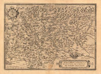
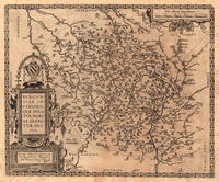
161223589Antwerp: Juan Baptist Vrients 1612. Other. In excellent condition. 365 by 504mm 14 by 19 inches. Original antique copper engraving published 1612 in the famous Italian text edition of the" Theatrum Orbis Terrarum published by Juan Baptist Vrients in Antwerp. An early and decorative map of Burgundy in France by Abraham Ortelius which is based on the cartographical sources Ferdinand de Lannoy who made a map of Burgundy in 1563 for which he obtained a privilege but which was subsequently suppressed by the Spaniards for political reasons Broe. Ortelius was born on 14 April 1527 in the city of Antwerp which was then in the Habsburg Netherlands modern-day Belgium. The Orthellius family were originally from Augsburg a Free imperial city of the Holy Roman Empire. In 1535 the family had fallen under suspicion of Protestantism. Following the death of Ortelius's father his uncle Jacobus van Meteren returned from religious exile in England to take care of Ortelius. Abraham remained close to his cousin Emanuel van Meteren who would later moved to London. In 1575 he was appointed geographer to the king of Spain Philip II on the recommendation of Arias Montanus who vouched for his orthodoxy. He travelled extensively in Europe and is specifically known to have traveled throughout the Seventeen Provinces; in southern western northern and eastern Germany e.g. 1560 15751576; France 15591560; England and Ireland 1576; and Italy 1578 and perhaps twice or thrice between 1550 and 1558. Beginning as a map-engraver in 1547 he entered the Antwerp Guild of Saint Luke as an illuminator of maps. He supplemented his income trading in books prints and maps and his journeys included yearly visits to the Frankfurt book and print fair where he met Gerardus Mercator in 1554. In 1560 however when travelling with Mercator to Trier Lorraine and Poitiers he seems to have been attracted largely by Mercator's influence towards the career of a scientific geographer. Wikipedia Broe. 51 Juan Baptist Vrients unknown
161218807Antwerp: Juan Baptist Vrients 1612. Other. In excellent condition. 375 by 458mm 14 by 18 inches. Original antique copper engraving published 1612 in the famous Italian text edition of the" Theatrum Orbis Terrarum published by Juan Baptist Vrients in Antwerp. An early and decorative map of the duchy of Burgundy in France by Abraham Ortelius published and printed from 1584 for the first time onwards. Ortelius was born on 14 April 1527 in the city of Antwerp which was then in the Habsburg Netherlands modern-day Belgium. The Orthellius family were originally from Augsburg a Free imperial city of the Holy Roman Empire. In 1535 the family had fallen under suspicion of Protestantism. Following the death of Ortelius's father his uncle Jacobus van Meteren returned from religious exile in England to take care of Ortelius. Abraham remained close to his cousin Emanuel van Meteren who would later moved to London. In 1575 he was appointed geographer to the king of Spain Philip II on the recommendation of Arias Montanus who vouched for his orthodoxy. He travelled extensively in Europe and is specifically known to have traveled throughout the Seventeen Provinces; in southern western northern and eastern Germany e.g. 1560 15751576; France 15591560; England and Ireland 1576; and Italy 1578 and perhaps twice or thrice between 1550 and 1558. Beginning as a map-engraver in 1547 he entered the Antwerp Guild of Saint Luke as an illuminator of maps. He supplemented his income trading in books prints and maps and his journeys included yearly visits to the Frankfurt book and print fair where he met Gerardus Mercator in 1554. In 1560 however when travelling with Mercator to Trier Lorraine and Poitiers he seems to have been attracted largely by Mercator's influence towards the career of a scientific geographer. Wikipedia Broe. 54 Juan Baptist Vrients unknown
160323753Antwerpen: J.B. Vrients 1603. Other. In excellent condition. 363 by 504mm 14 by 19 inches. Original antique copper engraving published 1603 at J.B. Vrients in an edition of Abraham Ortelius Theatrum. Finely hand colored in wash and outline. This antique historical map was published from 1595 to 1624 onwards in various edition of the Theatrum and the Parergon by Ortelius. Verso Latin text last line of text endsputant and with signature ix. The map is ornated with three cartouches in the upper middle the title cartouche in the upper right corner we find a cartouche with the privilegium. On the lower right side cartouche with text. Villages and towns are shown as miniature views moreover the map is ornated with ships. Ortelius was born on 14 April 1527 in the city of Antwerp which was then in the Habsburg Netherlands modern-day Belgium. The Orthellius family were originally from Augsburg a Free imperial city of the Holy Roman Empire. In 1535 the family had fallen under suspicion of Protestantism. Following the death of Ortelius's father his uncle Jacobus van Meteren returned from religious exile in England to take care of Ortelius. Abraham remained close to his cousin Emanuel van Meteren who would later moved to London. In 1575 he was appointed geographer to the king of Spain Philip II on the recommendation of Arias Montanus who vouched for his orthodoxy. He travelled extensively in Europe and is specifically known to have traveled throughout the Seventeen Provinces; in southern western northern and eastern Germany e.g. 1560 15751576; France 15591560; England and Ireland 1576; and Italy 1578 and perhaps twice or thrice between 1550 and 1558. Beginning as a map-engraver in 1547 he entered the Antwerp Guild of Saint Luke as an illuminator of maps. He supplemented his income trading in books prints and maps and his journeys included yearly visits to the Frankfurt book and print fair where he met Gerardus Mercator in 1554. In 1560 however when travelling with Mercator to Trier Lorraine and Poitiers he seems to have been attracted largely by Mercator's influence towards the career of a scientific geographer. Wikipedia Koe. Ort. 46; Broe. 192 Theatrum 16o3 Latin text edition signature ix; Shirley 1991 maps 186 pl. 71 259a 365. J.B. Vrients unknown