Sterne, LaurenceBiblio.com
117 résultats
1782008641London: A. Millar & J. Hodges 1782. Two volumes 12mo pp 159; 159 a little aging and dustiness throughout the first volume contains an early and probably contemporary indistinct signature on the front endpaper and also the signature of Michael Maguire 1955. Contemporary full calf rubbed spines rather worn and lacking the morocco title-labels joints cracked upper cover of volume one detached. Full-Leather. Fair. A. Millar & J. Hodges Hardcover
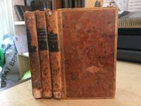
179349099No stated publisher Paris 1793. Later Edition. Hardcover Full Leather. Good Condition. Size: 32mo <5 1/2". 202 / 200 / 184pp. 3-volume set complete. Hinges cracking/cracked but boards remain firmly affixed. Loss to title pieces vols 1 & 3. Spines worn with loss to ends. Foxing front/rear pages but body of book mostly clean and unfoxed. All edges gilt faded. Occasional creasing to page corners. Some damp staining vol 1. Covers worn. Corners bumped. This edition notable for being published in Paris during Year 1 or 2 of the French Republic. Quantity Available: 1. Shipped Weight: Under 500 grams. Category: Fiction; Spain; Travel & Places. Pictures of this item not already displayed here available upon request. Inventory No: 49099. . No stated publisher hardcover
178510735London. Very Good with no dust jacket. ca1785. Engraving. This superb engraving is in very good condition full borders as published plate marks well defined very fine detail an extremely scarce engraving. ; 16" x 12" . unknown
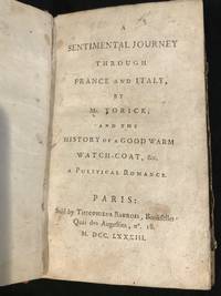
1783003235Paris: Theophilus Barrois 1783. 2nd Edition . Hardcover. Fair. 16mo - over 5¾" - 6¾" tall. xx 205pp. Half leather marbled paper over boards leather spine label. Front board detached but present covers worn very occasional foxing text block is sound light staining and notations on endpapers. Other than board detachment contents are in a very well preserved state. One of the earliest editions published in French 1783. <br/> <br/> Theophilus Barrois hardcover
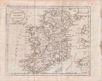
1796176602circa1796. Engraved map 18.3 x 22 cm 21.7 x 27 cm sheet original folds age toning and some offsetting inner edge darkened and discoloured but the map in good condition. Finely engraved map showing Ireland divided into counties lower coast of Scotland and Wales and the Isles of Man and Anglesea; also noting Nymph Bank 'discovered in 1735 by Capt. Doyle.' . unknown
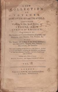
176736492London: Printed by J. Knox 1767. Hardcover. Poor. Octavo. Volume III only. 2 520 pages. Illustrated with fold out chart map of the southern section of South America and a chart map of the Pacific Ocean. Binding in poor condition. Marbled paper covered boards are detached. Text block split into two sections. Spine is dry and cracked with no title label. Boards extremely worn. Text is untrimmed. Light staining and fading to the the title page. Previous owner ink name stamp on page 1. A persistent brown stain in the upper gutter of the text partly affecting the Pacific Ocean fold out map in the margins. Page 214 torn in the margin with no loss of print. Some doodles in the margins of a few pages. Light toning to the contents. A poor copy. <br /> <br /> Contents include voyage accounts of Captain William Dampier Captain Woodes Rogers and Anson's voyage around the world The Pacific Ocean map shows California and parts of the Philippines. The map has some brown stains in the margins. Printed by J. Knox hardcover
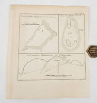
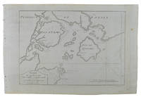
1774174260A Paris.: Chez Saillant et Nyon rue Saint-Jean-de-Beauvais Chez Panckoucke Hotel de Thou rue des Poitevins. 1774. Engraved map on laid paper 27.2 x 19.9cm 26.5 x 22.2cm sheet size edge fold slight marginal toning but in very good condition. Map of the treacherous coastal waters sandbars submerged rocks and reefs surrounding Mindanao and the Joseph Freewill Islands Mapia Atoll in the Philippines finely re-engraved for the French edition of Captain James Cook's First Voyage 1768-1771 "Relation des voyages.pour faire des decouvertes dans l'hemisphere meridional et successivement executes par le commodore Byron le capitaine Carteret le capitaine Wallis & le capitaine Cook.". . Chez Saillant et Nyon, rue Saint-Jean-de-Beauvais, [Chez] Panckoucke, Hotel de Thou, rue des Poitevins. unknown
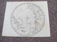
17914033Longman & Co. Literary-Press London 1791. Early Edition. Map. Good Condition/No Dust Jacket. Uncoloured; light signs of old folds possibly from how it was folded in the book. Trimmed close to neatline at bottom with loss of engraver's imprint. The map is 19cm in diameter. A map of the Arctic Circle to just over 60 degrees south. The northern coast of North America and Greenland is very sketchy. Engraved by Samuel Neele. Undated but Longman & Co. published a similar but slightly more detailed map in 1808. "The Copper Indians" are mentioned and at 80 degrees a note stating "Boundary of Ice 1773". Greenland is shown connected to the continent across Baffin's Bay. Possibly the map came from Part 1 of the book "The habitable world described: or the present state of the people in all parts of the globe.With a great variety of maps and copper-plates" by the Rev. Dr. John Trusler. Publication date 1791. Quantity Available: 1. Shipped Weight: Under 1 kilogram. Category: Geography & Maps; Exploration. Pictures of this item not already displayed here available upon request. Inventory No: 4033. . Longman & Co. Literary-Press ? unknown
1789r2256aaLondon: R. Blamire. G : in Good condition plus. Rebound wirth new eps. Offsetting from plates. Ex-lib. with embossed stamps. 1789. First Edition. Quarter leather marbled board cover. 210mm x 130mm 8" x 5". xx 196pp. Tinted plates. . R. Blamire hardcover
1776d3264acLondon: S. Hooper. G : in good condition with marbled eps and tape reinforcement at inner hinges. Cover edge worn. Some light scattered browning otherwise contents VG. Aeg. 1776. First Edition. Brown hardback leather cover. 330mm x 240mm 13" x 9". 130pp. Numerous steel-engraved plates. Heavy item - shipping supplement may apply for overseas. . S. Hooper hardcover
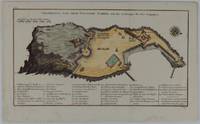
1748175859Leipzig.: Schwabe Johann Joachim. 1748. Engraved map on laid paper 20.5 x 36 cm plate -mark inc. captions 24 x 39 cm sheet size original fold later hand-colouring slight marginal spotting but in very good condition. Fine 18th century ground plan of Gorée Island off the coast of Senegal infamous for its association with slavery. The map shows encampments and forts with a detailed key. Originally published in Abbe Prevost's "Histoire générale des voyages." 1746 -1789 with maps and plans by the great cartographer Jacques-Nicolas Bellin this was prepared for volume two of the the German edition "Allgemeine Historie der Reisen." published in 1748. . (Schwabe, Johann Joachim) unknown
1774174257Paris.: Chez Saillant et Nyon rue Saint-Jean-de-Beauvais Chez Panckoucke Hotel de Thou rue des Poitevins. 1774. Engraved map on laid paper 18.5 x 31cm 25.6 x 34.4cm sheet size central fold slight marginal toning but a very good dark impression. Map of Bonthain Bay situated southeast of Macassar on the island of Celebes finely re-engraved for the French edition of Captain James Cook's First Voyage 1768-1771 "Relation des voyages.pour faire des decouvertes dans l'hemisphere meridional et successivement executes par le commodore Byron le capitaine Carteret le capitaine Wallis & le capitaine Cook.". . Chez Saillant et Nyon, rue Saint-Jean-de-Beauvais, [Chez] Panckoucke, Hotel de Thou, rue des Poitevins. unknown
1795039256Trenton New Jersey: Printed by Isaac Collins 1795. First US Edition. Full Leather. Very Good. pp: vi 418. Bound in contemporary sheepskin gilt-ruled spine with red leather label. 7.25" x 4.25" The author a Quaker minister traveled widely to spread the word in the United Kingdom and on the Continent. This book is based on her journals and letters. Isaac Collins also a Quaker and New Jersey's second printer printed this first American edition. Provenance: Flyleaf signatures of John and Elizabeth Satterthwaite and Mary Baily. Felcone New Jersey Books 110. Evans 28776. Printed by Isaac Collins unknown
177355007London: London; Edward and Charles Dilly 1773. First UK edition. Hardcover. Good. vii 383 pages. 5 1/2 X 8 1/2 in. high. Full polished calf with 5 raised bands and a maroon leather label with gilt title 'Forster's Travels' on spine. Condition of the book is GOOD; Light wear and soiling to covers & spine front cover detached after title page front hinge repaired with clear plastic tape the rest of the binding is very tight. Slight uniform toning to paper but no foxing staining etc. No illustrations in this edition. Travel Rare RGR Case London; Edward and Charles Dilly hardcover
177521457London: T. Cadell 1775. Hardcover. Very good. Second edition. 8vo 411 pp with folding map as frontispiece. Bound in early full calf with gilt spine in six compartments red spine label. Front joint rubbed and partially cracked; binding otherwise sound text very clean. Armorial bookplate of Johnathan Pytts Esq. on front pastedown. "Wraxall's travelogue is elegantly written and its Scandinavian and Russian itinerary was novel and therefore of great interest to the reading public.The narrative is self-consciously chivalric and testifies to Wraxall's lifelong interest in tales of intrigue and distress although Queen Caroline Matilda's predicament does not figure in the text presumably in the interests of diplomacy" ODNB. T. Cadell hardcover
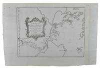
1749136795Paris. circa1749. Black and white engraved map of Quanzhou and Zhangzhou 21.1 x 30 cm here spelled Chin-chew and Chang-chew and both final words with added superscript "ou" on watermarked laid paper 25.6 x 38 cm original folds a few marginal spots simplified compass rose and a decorative fleur de lis bottom right in very good condition. Attractive map including the estuary of Quanzhou River Xiamen Emowi and Kinmen or Quemoy Quemowi island. The map was designed by the eminent French cartographer Jacques-Nicolas Bellin and here published as plate No. 22 in the impressive 15 volume compilation of voyages "Histoire Generale des Voyages" by Antoine François Prévost. . unknown
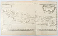
1750136782circa1750. Black and white copperplate engraving map of Java a little light even browning neat colour pencil highlighting of rivers and two settlements. Folded as issued. Good copy. 26 x 44cm. Issued in Prevost's Histoire Générale des Voyages ou nouvelle collection de toutes les relations de voyages par mer et par terre. . unknown
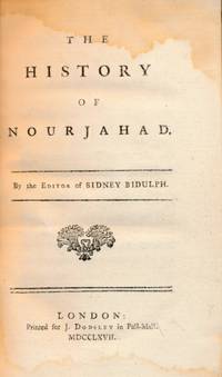
1767j5038London: J Dodsley. G : in good condition. 20th century rebind with new eps. Prelims stained. 1767. First Edition. Marbled hardback boards with brown leather spine. 180mm x 120mm 7" x 5". 240pp. . J Dodsley hardcover
17950848bLondon: Printed for W Peacock. G : in good condition. Browning within impacting on most maps. Aeg. 1795. Second Edition. Red hardback leather cover. 140mm x 100mm 6" x 4". iv 200pp. Fold out frontis world map plan of the solar system fold out maps of Africa North America South America Asia and Europe. . Printed for W Peacock hardcover
1749136827Paris. Circa1749. Engraved map on watermarked laid paper 20 x 27.3 cm of Fuzhou and coastline of Fujian Province original folds designed by the great French cartographer Jacques-Nicolas Bellin. This map is from the impressive 15-volume "Histoire Génèrale des Voyages" compiled by Antoine François Prévost map no. 2 Vol. 6. This map shows the estuary of Yangtze River Rivière de Chang. Very light browning on sheet edges but in very good condition. . unknown
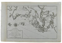
1749136826Paris. circa1749. Black and white engraved map on watermarked laid paper 20.9 x 32.7cm showing coastal area of Zhejiang Province Province de Che-kiang including Zhoushan Archipelago Isle de Chusan Zhoushan Bay Bay de Chusan and Xiangshan County Siang-chan-luen a walled city outside of upper border Ningbo Ning-po prefecture under Qing administration title cartouche lower left original folds. This map is No. 3 Vol. 6 from the impressive 15-volume "Histoire Generale des Voyages" compiled by Antoine François Prévost. Even browning mainly to the sheet edges in very good condition. . unknown
1714009329London: W. Taylor 1714. Book. Fair. Hardcover. 1st Edition. First edition W. Taylor 1714 although exterior of spine states 1715 London. Good hardocover. Original leather binding. Closed tear to spine. Frontispiece torn and tape repaired. Previous owner's handwritten notes to flyleaf. Browning to rear endpaper rear hinge cracked. Front endpaper bears the bookplate of English novelist Joseph Henry Shorthouse. . W. Taylor Hardcover
1794BB1335London: printed for T. N. Longman Pater-Noster-Row 1794. Early Reprint. Wraps. Very Good. Small 8vo: xxxvi380 numbered columns381-394 Index to the County Seatspp with folding copper-engraved map frontispiece. Recently bound to style by Fitterer in drab wraps printed paper spine label end papers renewed. A Very Good or better copy map and title page lightly browned browning and creases to some early page margins only in a Fine binding. Lowndes 1798. Fordham Road-Books p. 27. Not in Hodson. Tenth edition originally published 1771 with "addition of nearly ninety pages including considerable improvements in the direct roads many new cross roads and a great number of noblemen’s and gentlemen’s seats." Although Paterson contributed no significant innovations to the compilation of road books relying on the advances of Norden Ogilby and others he "made improvements in style and presentation and added factual detail—so much so that his name was for many years an indicator of reliability in road books and was attached to them long after he had stopped compiling them." ODNB N. B. With few exceptions always identified we only stock books in exceptional condition. All orders are packaged with care and posted promptly. Satisfaction guaranteed. printed for T. N. Longman, Pater-Noster-Row unknown
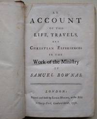
1756017803At the Bible in George Yard Lombard Street: Luke Hinde 1756. First edition. Small octavo pp viii 198 publisher's advert 2 pages a little used internally some pages with slight tears to the gutter margin contemporary full calf rubbed worn at the corners raised bands to the spine but no label. With the signature of an early owner John Gillett on the rear endpaper. With the further Quaker signatures of Joseph Gillett of Somerton and William S. Clark. Samuel Bownas was born in 1676 to Quaker parents although his father died when he was a month old. His father had been a Friend during the time of Quaker persecution with meetings of the Friends having been held in his house. In 1696 his life was changed. At this time he was apprenticed to Samuel Parrott a Friend from Briggflatts meeting in Sedbergh. Attending meeting for worship another Friend Anne Wilson rose in worship and accused him of being no better for his attendance of meeting for worship and that would prove perilous for him "in the end". Afterwards he felt called to preach and read the Bible with greater ease. His famous "A Description of the Qualifications Necessary to a Gospel Minister" was first printed in 1750. Having first journeyed to Scotland he sailed for America aboard the Josiah John Sowden master. He landed two months later in Potuxant River Maryland about 29 May 1702 and continued his work. Bownas died at Bridport Dorset on 2 April 1753. First Edition. Full Leather. Good. Luke Hinde Hardcover
17981951London: Printed for T.Cadell Jun. and W. Davies 1798. Third Edition . Hardcover. Very Good/No Jacket. Volume I. cccli 146 1 pgs. Folding map. Volume II. 444 pgs. Nicely rebound in modern black half leather and marbled paper over boards. New endpapers. Name to first blank pages dated 1911. Text pages are bright and fresh with only a hint of foxing to the first few pages. An excellent copy in two volumes. <br/> <br/> Printed for T.Cadell Jun. and W. Davies hardcover