117 résultats
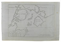
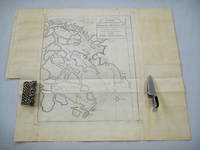
1749136826Paris. circa1749. Black and white engraved map on watermarked laid paper 20.9 x 32.7cm showing coastal area of Zhejiang Province Province de Che-kiang including Zhoushan Archipelago Isle de Chusan Zhoushan Bay Bay de Chusan and Xiangshan County Siang-chan-luen a walled city outside of upper border Ningbo Ning-po prefecture under Qing administration title cartouche lower left original folds. This map is No. 3 Vol. 6 from the impressive 15-volume "Histoire Generale des Voyages" compiled by Antoine François Prévost. Even browning mainly to the sheet edges in very good condition. . unknown
1749136795Paris. circa1749. Black and white engraved map of Quanzhou and Zhangzhou 21.1 x 30 cm here spelled Chin-chew and Chang-chew and both final words with added superscript "ou" on watermarked laid paper 25.6 x 38 cm original folds a few marginal spots simplified compass rose and a decorative fleur de lis bottom right in very good condition. Attractive map including the estuary of Quanzhou River Xiamen Emowi and Kinmen or Quemoy Quemowi island. The map was designed by the eminent French cartographer Jacques-Nicolas Bellin and here published as plate No. 22 in the impressive 15 volume compilation of voyages "Histoire Generale des Voyages" by Antoine François Prévost. . unknown
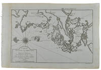
1749136781Paris. circa1749. Black and white engraved map on laid paper showing entrance to Pearl/Canton river Macao and the area which would become Hong Kong Sinn-gan-hien folded designed by the prominent French cartographer Jacques-Nicolas Bellin. This map is No. 16 Vol. 5 from the impressive 15-volume "Histoire Generale des Voyages" compiled by French novelist Antoine François Prévost. The walled city of Canton upper section is divided into areas of Tartar and Chinese. <br> <br>Some light even browning on paper added at margins good copy. Map measures 25.7 x 20.5. . unknown
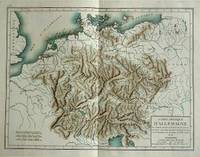
180057070c1800. Copper engraving with handcolouring map shows Germany and parts of France Italie Hongrie Pologne and Prusse sic. Minor hole upper border few closed tears and some browning edges otherwise a clean and bright image. Map measures approximately 34 x 46cm. . unknown
174217649Chez Charles-Nicolas Poirion. Good. 1742. Nouvelle Edition. Hardcover. Bound in brown calf with five bands and lightly faded gilt decoration & lettering. Marbled endpapers. Internal hinges intact. Text is tight bright & intact. Volume #1 has a fold-out 12 1/2" x 9 1/2" color map of Paris 2 fold-out map/plans 5 fold-outs of monuments/buildings & 2 single page engravings. xxiv 631pp 1 errata . Volume #2 has has 3 single page engravings/ plans 3 fold-out plans/maps & 11 fold-outs of monuments/buildings. 2 645pp 1errata . Both front covers & vol-1 rear cover cracked with covers firmly attached. Spine ends rubbed with some loss & bottom corners rubbed. 2 fold-outs have minor tape repair & 2 have small tear at site of attachment. France; 16mo 6" - 7" tall; 1276 pages . Chez Charles-Nicolas Poirion hardcover
1787j9931London: G Bigg / P Elmsley / T Cadell / J Sewell. VG : in very good condition without dust jacket. Modern binding with new endpapers.Occasional light spotting to page edges. 1787. Second Edition. Brown leather spine on decorative papered boards. 270mm x 220mm 11" x 9". xix 255pp. Grellman was one of the earliest writers to look specifically at Gypsy life in the late eighteenth century and from an analytical viewpoint for the first time. Publishing his Dissertation on the Gipsies in 1783 Grellman focused on the language origin image and work of the Gypsies being the first to link their origin to India based on linguistics which was met with much critical acclaim in Europe. . G Bigg / P Elmsley / T Cadell / J Sewell hardcover
178510735London. Very Good with no dust jacket. ca1785. Engraving. This superb engraving is in very good condition full borders as published plate marks well defined very fine detail an extremely scarce engraving. ; 16" x 12" . unknown
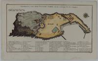
1748175859Leipzig.: Schwabe Johann Joachim. 1748. Engraved map on laid paper 20.5 x 36 cm plate -mark inc. captions 24 x 39 cm sheet size original fold later hand-colouring slight marginal spotting but in very good condition. Fine 18th century ground plan of Gorée Island off the coast of Senegal infamous for its association with slavery. The map shows encampments and forts with a detailed key. Originally published in Abbe Prevost's "Histoire générale des voyages." 1746 -1789 with maps and plans by the great cartographer Jacques-Nicolas Bellin this was prepared for volume two of the the German edition "Allgemeine Historie der Reisen." published in 1748. . (Schwabe, Johann Joachim) unknown
1773150519-M761London: W. Strahan and T. Cadell in the Strand 1773. Quarto with marbled boards Rebound Spine rebound in expertly tooled calfskin hinges reinforced Volume 2 1773 first edition previous owner's signaures from 1825 and 1839 Timothy W. Fiske U. S. Navy water damage to back pages many maps and engravings some foldouts Missing the Map of New Zealand. First Edition. Leather Binding. Very Good/No Dust Cover. Illus. by Bartollozi. W. Strahan, and T. Cadell in the Strand Hardcover
1735818Amsterdam: printed for the author 1735. Contemporary vellum with the manuscript title on the spine blue sprinkled edges. Small 8vo. With a woodcut vignette on the title-page 2 decorated woodcut initials and a woodcut tailpiece. Rare second edition of a popular travel account of a summer holiday trip through the Netherlands and Cleve. Travelling from the Hague they visited Utrecht Leiden Zeist Soestdijk Amersfoort Voorthuizen Deventer Doesburg Middachten Rozendaal Arnhem Elterberg Emmerik Kleef Nijmegen Grave Hees Den Bosch Tilburg Dongen Breda Waalwijk Gorcum Vianen Schoonhoven and various country estates along the way such as 't Loo Huis Heemstede and Huis te Voorst. The travelling was done by public means of transport by barge by coach and on foot. Other than the various day trips the work also includes the stories the travellers told each other en route of which many are somewhat erotic in nature.The author remained anonymous by his own request. He was persuaded by his friend and travel companion to publish the account of their travels but requested that the people and names mentioned would be erased for it was initially only written for himself and good friends but now "for the whole world to see". The first edition was published in 1734 by J. Loveringh. The present second edition however is rarer with only one institutional copy recorded in the Dutch Short Title Catalogue STCN.The work has been recased with new end papers the binding has been professionally restored at the upper corner of the front board and the head of the spine. A faint water stain in the outer margin of the first few leaves not affecting any text. Otherwise in good condition.l Scheepers II 248; STCN 240053419 1 copy; Waller 1911; cf. Buisman 2559 other ed.; Muller 885 other ed. printed for the author, hardcover
177248368Amsterdam: E. van Harrevelt & D.J. Changuion 1772. 4to. x 2 502 2 pp. Title in red & black. 14 maps 2 folding 2 engraved plates. Contemporary tree calf elaborately gilt decorated spine black tan & gilt morocco spine labels marbled endpapers minor shelfwear rubbing minor wear to corners still a VG fresh copy. Revised & expanded Dutch edition of this installment in the noted set originally compiled and begun by John Green in England further expanded and rewritten by Prevost with superior maps and illustrations and finally this Dutch addition with additional material. This volume opens with detailing the voyages of Bartholome de las Casas 1484-1566 to Venezuela and Guatemala; Jacques Cartier into Newfoundland and present-day Canada; as well as those of Pizarro Diego d’Almagro Vacca de Castro Blasco Nunez de Vela many illustrated and including detailed descriptions of Panama Peru Chili Panama Lima Paraguay the Amazon River and more. Of interest are the plates depicting in habitants of the Americas including domesticated Blacks Mulatto women in Lima and Peruvian Indians. E. van Harrevelt & D.J. Changuion, unknown
1749860361749. TRAVEL HISTOIRE GENERALE DES VOYAGES OU NOUVEAU COLLECTION DE TOUTES LES RELATIONS DE VOYAGES PAR MER ET PAR TERRE . TOME SECOND. Paris: Didot 1749. 450 5 folding maps. 12mo. mottled calf gilt spine raised bands. Spine chipped spine label slightly chipped joints cracked leather cracked. Marbled edges and endpapers small chip to front flyleaf small printed bookplate to front pastedown. A few maps with small closed tears but else in very good condition. Title page continued: "Qui ont ete publiees jusqua present dans les differentes Langues de toutes les Nations connues: contenant ce qu'il y a de plus remarquable de plus utile et de mieux avere' dans le pays ou les voyageurs ont penetre': avec les moeurs des habitans la religion les usages arts sciences commerce manufactures &c. pour former une systeme complet d'histoire & de geographie moderne qui represente l'etat actuel de toutes les nations; enrichi de cartes geographiques et de figures." Depuis le commencement du XV Siecle Premier Partie: Voayages au Sud-Est et aux Indes Orientales. As is. unknown
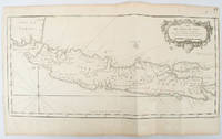
1750136782circa1750. Black and white copperplate engraving map of Java a little light even browning neat colour pencil highlighting of rivers and two settlements. Folded as issued. Good copy. 26 x 44cm. Issued in Prevost's Histoire Générale des Voyages ou nouvelle collection de toutes les relations de voyages par mer et par terre. . unknown
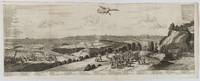
1720180201A Leide. Leiden.: Chez Pierre van der Aa. circa1720. Engraved panorama on watermarked laid paper 28.5 x 77.5 including captions; 31 x 79.5 cm sheet title cartouche engraved key in French and Dutch the upper margin trimmed to the platemark original folds edgewear and toning neat sealed tear to the outer edge barely visible 5mm intrusion to the image a very good dark impression. Finely composed and engraved panorama of Tokyo prepared for the monumental work "Galerie Agreable du Monde" by the master Dutch publisher Pieter Van de Aa 1659-1733. The detailed key in Dutch and French notes myriad buildings and temples on the horizon and in the foreground two processions converge: of nobles and their attendants dancers a trio of dogs and a priest or religious attending a suppliant. <br> <br>Pieter van der Aa 1659-1733 was born in Leiden Holland and started his own book publishing business when he was only twenty-three. His prolific output of highly decorated maps and atlases culminated in his magnum opus “Galerie Agreable du Monde” which illustrated the world known to Europeans in the early eighteenth century. Comprising 66 volumes it was the of plates published at that time it has been estimated that only 100 copies were published. . Chez Pierre van der Aa unknown
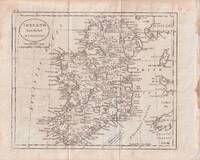
1796176602circa1796. Engraved map 18.3 x 22 cm 21.7 x 27 cm sheet original folds age toning and some offsetting inner edge darkened and discoloured but the map in good condition. Finely engraved map showing Ireland divided into counties lower coast of Scotland and Wales and the Isles of Man and Anglesea; also noting Nymph Bank 'discovered in 1735 by Capt. Doyle.' . unknown
179349099No stated publisher Paris 1793. Later Edition. Hardcover Full Leather. Good Condition. Size: 32mo <5 1/2". 202 / 200 / 184pp. 3-volume set complete. Hinges cracking/cracked but boards remain firmly affixed. Loss to title pieces vols 1 & 3. Spines worn with loss to ends. Foxing front/rear pages but body of book mostly clean and unfoxed. All edges gilt faded. Occasional creasing to page corners. Some damp staining vol 1. Covers worn. Corners bumped. This edition notable for being published in Paris during Year 1 or 2 of the French Republic. Quantity Available: 1. Shipped Weight: Under 500 grams. Category: Fiction; Spain; Travel & Places. Pictures of this item not already displayed here available upon request. Inventory No: 49099. . No stated publisher hardcover
1789184162Mostly at sea: 8 June 1786 - 31 March 1789. The last surviving crew member of Cook's Endeavour A window onto the later career of Isaac Manley 1755-1837 mourned on his death as the last remaining participant in Cook's historic first voyage. Manley joined Cook's crew aged only 13 and was promoted to midshipman on 5 February 1771 during the journey home. He rose to the rank of admiral of the red becoming one of the fifteen most senior officers in the Royal Navy. On the Endeavour Manley acted as servant to the master Robert Molineux. The ravages of disease in the later part of the voyage offered opportunities for advancement. Molineux died off Cape Town in April 1771 and Manley was promoted a day either side of the deaths of midshipmen John Bootie and Jonathan Monkhouse. "The Muster Rolls show Isaac being charged £3.13.2 for slops at this time and £15.18.6 for dead men's clothes presumably he was buying the dead middies' uniforms. And his tobacco charge which began at 19/- in September 1769 also increased to £1.8.6" Hill. Writing to the First Secretary of the Admiralty on his return to England Cook gave Manley his endorsement in typically reserved fashion: "Midshipmen Mr Isaac Smith and Mr Isaac Manly both too young for the preferment yet their behaviour merits the best recommendation" quoted by Hill. Manley signed up for Cook's second voyage but was discharged for still unknown reasons in April 1772 before the Resolution sailed. He was commissioned lieutenant in May 1777 serving with the Channel Fleet and in North America and the West Indies and fought in the Battle of the Saintes. In 1786 at the rank of commander he was appointed to HMS Fairy - the service covered by this log - and ended his active duties in 1790. While living the life of a landed gentleman he continued to earn promotion reaching flag rank in 1809. He was promoted to admiral of the red a few months before his death. The daily log commences on 8 June 1786: "Came on board and took the command of Her Majesty's Sloop Fairy by virtue of a commission dated the 17th May 1786." The ship is tasked with patrolling the Channel and cracking down on smugglers seizing spirits tobacco and other contraband. There are also references to punishing sailors for drunkenness and mutinous behaviour. In late 1787 Manley was also occupied with naval impressment and was ruthlessly effective recording ships stopped and men pressed-ganged. In 1788 the ship is ordered to Africa the log ending in media res on 31 March 1789 near the equator. a By family descent; b Sold at Sotheby's London "Atlases Maps Topographical Prints and Travel Books" 2 May 1985 Lot 220 buyer: Quaritch; c Sold by Quaritch c.1987 to Cecil George Whitmont 1912-1991 Australian collector with his bookplate and a selection of paperwork formerly in an improvised acetate rear pocket. Quarto 245 x 195 mm. With 182 leaves all but 3 pages filled in neat manuscript. Original quarter calf parchment sides. Housed in custom green cloth solander box green spine label. Wear from shipboard use contents clean: very good. Anthony Hill "Isaac Manley - Servant on Endeavour to Admiral" Captain Cook Society. hardcover
1714009329London: W. Taylor 1714. Book. Fair. Hardcover. 1st Edition. First edition W. Taylor 1714 although exterior of spine states 1715 London. Good hardocover. Original leather binding. Closed tear to spine. Frontispiece torn and tape repaired. Previous owner's handwritten notes to flyleaf. Browning to rear endpaper rear hinge cracked. Front endpaper bears the bookplate of English novelist Joseph Henry Shorthouse. . W. Taylor Hardcover
1799607082London: G. Nicol G. G. and J. Robinson J. Debrett 1799. Two volume set; two hardcovers no jackets - full leather. v.1: xxiii 414pp 2; v.2: xi 387pp 5; five fold-out plates one fold-out map and one fold-out table across both volumes. Gilt design on each board. Boards and spines are worn with age and rubbed at points with a few scuffs and scores and nicks at spine ends; two noticeable gouges on rear board of v.1 seemingly repaired by affixing the piece of cover back on. Speckled page blocks are slightly tanned and marked. Foxing and age-related marks in both volumes though nothing unexpected or severe; Occasional creasing to corners and very few pages; some faint pencilled crosses in margins of v.1. Overall a solid and well-maintained set for age. TS. Hardcover. Good. Used. G. Nicol, G. G. and J. Robinson, J. Debrett Hardcover
178120257London: Printed by J. Nichols 1781. First Edition. Cloth. Good. First Edition. Large 4to. iv ii-viii 1-468 469-470 471-472 471-477 blank 473-557 558 binder's directions and errata pages. Lacking the portrait of Mozart at age seven and map of the Ohthere's Voyage. The Map of the Northwest coast of America and portrait of Sir John Wynne Baronet are both present. Modern library buckram gilt; binding lightly scuffed; library stamp to top edge; personal bookplate Archie W Shiels and ex library institutional stamps to front pastedown; new endpapers; inserted modern frontispiece on coated photo paper; title page with handwritten annotations; "Contents" page marked with colored pencil; scattered foxing throughout; some pages brittle due to paper quality; library pockets and electronic tags at rear pastedown; an imperfect ex library copy. Properly de-accessioned. Cloth. This copy owned by Vincent Novello and presented by him to the Musical Antiquarian Society July 8 1845. "Novello was an original member of the Philharmonic Society of the Classical Harmonists and of the Choral Harmonists officiating frequently as conductor. In 1849 he went to live at Nice where he died. Many of his compositions were sacred music much of which was very popular. His great contribution however together with Christian Ignatius Latrobe lay in the introduction to England of unknown compositions by the great masters such as the Masses of Haydn and Mozart the works of Palestrina the treasures of the Fitzwilliam Museum and innumerable now well known great compositions." wikipedia<br /> <br /> Much on travel to the Northwest and polar regions natural history the Linnean system and other subjects including a report on Mozart a "very remarkable young musician." Among Americana collectors the book is notable for publishing the "journal of Maurelle pilot with the fleet commanded by Don Juan de la Bodega while exploring the coast northward of California in 1775; this portion was also issued in separate form." <br /> <br /> Streeter mentions the account to be the only contemporary source in English of this important voyage. <br /> <br /> See Howes B177 and Streeter Sale IV 2445. Also: Sabin 3628. Printed by J. Nichols unknown
1744007220London: T. Woodward 1744. Hardcover. Good. 2 volumes: vol. 1: 8 xvi 8 984 p. 16 leaves of plates; vol. 2: 10 1056 22 p. frontispiece and 21 leaves of plates: tables; 44 cm. Contemporary half calf with seven compartments between raised bands. Gilt-tooled title in second compartment of vol. 1: Harris's Voyages. Plain light grey paper over boards. Leaves are untrimmed. Title pages in red and black. Vol. 1 imprint: Printed for T. Woodward A. Ward S. Birt D. Browne T. Longman R. Hett C. Hitch H. Whitridge S. Austen J. Hodges J. Robinson B. Dod T. Harris J. Hinton and J. Rivington. Vol. 2 imprint the same except for omission of A. Ward. The dedication to George II with royal crest and signed by Carteret appears opposite the title page in vol. 1. A second dedication "To the merchants of Great-Britain" signed "The author" follows the title page. Index and "List of Charts Maps and Cutts in this Work" follow text in vol. 2. Woodcut head pieces tail-pieces and initial letters. Bookplate of the Museum Library of the University of Pennsylvania on each front fixed endpaper stamped " No longer the property of the University Museum Library." A heavy set; for international shipping they will have to be sent by priority international. Lacking maps except plans of Lima and Canton in v.1 and Peking in v.2 and some other leaves of plates 38 plates present of 61 called for; otherwise in Good Condition: front boards detached but present; lacking most of leather from vol. 2 spine; text blocks are solid; clean and bright. T. Woodward hardcover
179213545NY: Berry & Rogers. Good. 1792. First American Edition. Hardcover. Binding copy. Complete but the front cover is loose and the spine is covered with tape. Minimal marking in the book. I find one stamp on the title page. ; Ex-Library; 24mo 5" - 6" tall; 267ads pages . Berry & Rogers hardcover
172354819Rainer Ottens. 1723. A most attractive map with early outline hand colour vertical fold barely visible diagonal crease upper half of map few very pale small brown spots otherwise a clean and bright image. Numbering in red pencil few annotations in pencil and light number stamp on reverse however not at all visible from front of map or affecting image. Sheet measures 46.6 x 60.2cm. . Rainer Ottens. unknown
172435371A La Haye: Chez P. Husson; E. Johnson Printers 1724. Later printing. Leather bound. Fair. 12mos. Incomplete set. 4 volumes. Volumes 2456. Speckled brown calf leather bindings with raised bands on the spines. Gilt decorations on the spines. A few title labels remain. Bindings are sturdy. Illustrated. <br /> <br /> Condition of the leather varies with cracked joints damp staining and dryness. <br /> <br /> Volume II: 5 598 pages. Illustrated with 21 plates of which 4 are folding including 8" x 6.5" map of "Isle De La Guadeloupe". Leather is cracked on the joints and has some damp staining. Text block is uniform but cracked in the middle at page 265. Text and illustrations are in good condition with light toning to the contents. <br /> <br /> Volume IV: 5 539 pages 1 page blank 1. Illustrated with 13 plates of which 5 are folding including plans of "Isle De La Barbade" and "Plan du Port du Fort et du Bourg de la Grenade". Slight damp staining and warping of the boards. Text and illustrations in good condition. <br /> <br /> Volume V: 5 504 pages 1. Illustrated with 6 plates 2 folding including 10" x 6.5" "Carte De Lisle De Saint Christophle" and "L'Isle St. Domingue". Leather joints cracked with moderate damp staining on the rear board. Text and illustrations in good condition. <br /> <br /> Volume VI: 4 514 pages 1 58 pages 'Table Des Matieres Pour Les Six Volumes' 2. Illustrated with 6 plates of which 2 are folding including "Plan du Fort et d'une partie du Bourg de la Guadeloupe. Attiquee par les Anglais en 1703". Leather is damp stained and chipped. Joints cracked. Text block a bit warped. Some page corners creased. Text is clean and in good condition. Each volume has an armorial bookplate of "Elden Hall" on the front paste downs. <br /> <br /> Sabin 38411. Chez P. Husson; E. Johnson, Printers unknown
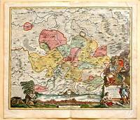
171761880Nuremberg.: Johann Baptist Homann. 1717. A beautifully engraved hand coloured map of North East Germany showing the area around Erfurt in detail. In the centre of the map is a small plan of Erfurt which is also shown as a panoramic view at the foot of the map and titled 'St. Petersburg'. An elaborate decorative title cartouche in the lower right corner depicts allegorical figures surrounded by the produce of the land including sheaves of wheat; a beehive; and a cornucopia of fruits. Cherubs holding a coat of arms float up from the scene on the right while on the lower left a centaur sits meditatively beneath a pine tree amongst slaughtered cattle. Physical features of the area are illustrated and farming areas shown by fields which criss-cross across the map. A clear dark impression the work of an outstanding German cartographer who in 1715 was appointed as imperial geographer by Emperor Charles VI. This map also includes "Schwan See" Swan Lake under a town of the same name which has since disappeared. Hand coloured two very minor splits at upper and lower edges on centre fold and not affecting engraved area a handsome map 54 x 61.5 cm. . [Johann Baptist Homann.] unknown