1 805 résultats
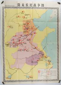
1980176714北京. Beijing.: 地图出版社.Di tu chu ban she. 1st Edition 1st Printing. 1980. Large Chinese education map folded with original envelope scale 1:1500000 legend left lower corner showing the military advance routes and battle grounds led by several leaders of the agrarian rebels including 王薄 Wang Bo 窦建德 Dou Jiande 杜伏威 Du Fuwei and 翟让 Zhai Rang. Very good copy. <br> <br>Text in Chinese. Sheet measures 106.8 x 76.52cm. . 地图出版社.[Di tu chu ban she]. unknown
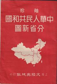
1952215851大陸輿地社. 1952. Charming pocket size atlas with double page coloured map showing China as a whole and the provinces with inset maps of special geographical features and a description of key information about each province vertical text. Text in traditional Chinese characters names on map read from right to left or vertically. Light wear little light browning but maps very clean and bright very good condition 14.5 x 9.8cm. . 大陸輿地社. unknown
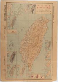
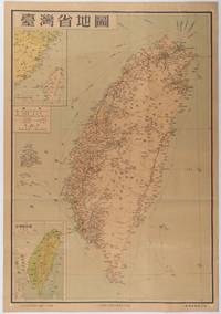
1945215871Taiwan.: 禹甸圖書局. Yudian tushuju. 1945. 1945 Ministry of Interior map of Taiwan published in the 34th year of the Republic of China with inset title and key top right. Romanised Japanese names for some areas and cities written in capital letters on main map which is surrounded by 15 small inset maps at edges each with its own scale. Paper browned wear at folds and edges repaired with archival washi on reverse some light stains and a few marks. 1 x 3cm chip bottom right corner. 77.4 x 54 cm. Text in traditional Chinese characters. Inset maps show clockwise from right edge; 1. Distribution of inhabitants according to ethnic background or minority group 2. Qing Dynasty prefectures and counties 3. Japanese administrative regions during the occupation 4. Strategic industrial and military places three city maps - 5.Chilung or Keelung port 6. Taipei city and 7. Tainan city 8. Geological formations 9. agricultural metallurgical and mineral products 10. Soil types 11. Topography of the island including sea currents and altitude diagram 12. Taiwan's position in relation to the mainland coast provinces of Fujian and Zhejiang as well as the Liuqiu Ryukyu Islands including Okinawa 13. Okinawa detail 14. Climate and rainfall in January 15. Climate and rainfall in July. . 禹甸圖書局. [Yudian tushuju]. unknown
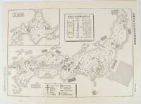
1955172396No publication details. Circa1955. Chinese black and white military map of Japan based on a map issued by 赤旗報 Shimbun Akahata on 24 June 1953. No scale given inset map of Hokkaido upper left corner legend lower section showing air and navy bases military exercise bases ammunition dump shooting ranges for the air force and navy headquarters of the coast guard etc. Text upper section provides details of the different types of US military bases and infrastructure. Text in traditional Chinese. 25.8 x 35.8cm. . No publication details. unknown
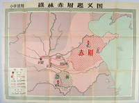
1958171563Beijing.: 地图出版社. Di tu chu ban she. 1st Edition 2nd Printing. 1958. Large Chinese coloured educational map folded. Scale 1:2000000 legend lower left corner showing the military advance of two peasant insurgent groups Lulin and Chimei's march towards the capital city Chang'an now Xi'an in 17 AD. In original worn paper wrapper map in very good condition. Text in traditional Chinese. Map measures 77 x 105.2cm. 王匡 Wang Kuang and 王凤 Wang Feng founded the Lulin Army in the region of modern Hubei Province. 樊崇 Fan Chong lead the Chimei also known as Red Eyebrows Army in the northern parts of modern Shandong Province. . 地图出版社. [Di tu chu ban she]. unknown
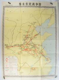
1981173280Beijing.: 地图出版社. Di tu chu ban she. 1st Edition 2nd Printing. 1981. Large Chinese coloured educational map folded scale 1:2000000. Legend lower left corner shows the routes of military advance led by peasant rebellion leaders' 陈胜Chen Sheng and 吴广Wu Guang in red and other military activities led by 项羽Xiang Yu and 刘邦Liu Bang in various colours. In original worn paper wrapper map in very good condition. Text in Chinese. Map measures 105.5 x 76.6cm. . 地图出版社. [Di tu chu ban she]. unknown
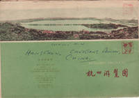
1962160933杭州.Hangzhou.: 浙江人民出版社.Zhejiang renmin chu ban she. 2nd Edition 3rd Printing. 1962. Folding colour tourist brochure for Hangzhou. One side shows large map of Hangzhou the other 5 more detailed maps chops and previous owner's annotations upper cover small hole at one fold some light wear and browning good. Text in both traditional and simplified Chinese. Sheet size 53.9 x 38.3cm folded size 13.5 x 19.2cm. <br> <br>One side includes a legend an inset showing tourist spots surrounding Hangzhou a table shows lists of Hangzhou's hospitality industry e.g. hotels cinemas swimming pools restaurants department stores etc. The other side includes five individual tourist maps: Viewing Fish at Flower Pond 花港觀魚 Lingyin Temple 靈隱 Hangzhou Bus Map 杭州市公交路线图 Lonely Mountain 孤山 Dreaming of the Tiger Spring 虎跑. . 浙江人民出版社.[Zhejiang renmin chu ban she]. unknown
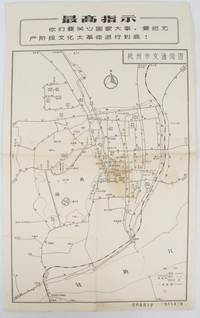
19671632381967. Vintage transportation black and white map of Hangzhou folded no scale a legend lower right corner shows bus/trolleybus routes and terminals. The map covers the old city of Hangzhou from the north side of the city 杭三中"Hangzhou No.3 High School" to the south side 钱江大桥 "Qiantang River Bridge". The West Lake is featured in the centre with its famous tourist spot 三潭映月 "Three Pools Mirroring the Moon" indicated. Bus/trolleybus routes connects schools hospitals municipal government departments cinemas department stores tourist spots around the West Lake etc are all shown on this map. <br> <br>Stained in the central section light wear along folds and edges otherwise good. Text in Chinese. Sheet measures 39.1 x 24.8cm The headline Chinese text in the box along the top of the map reproduces one of the highest directives from Mao's Quotations: "You must pay attention to state affairs and carry the great proletarian cultural revolution through to the end!" . unknown
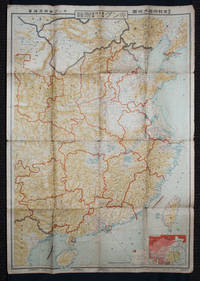
1938159295Tokyo: 大日本雄辯會講談社 Dainihon Yūbenkai Kōdansha. Shōwa 13. 1938. Two large detailed maps of China and on the reverse of the Soviet Union in Asia Manchuria and Mongolia printed double sided on a single large sheet. Issued as a supplement to Volume 14 Number 1 of the magazine Kingu on New Year's Day in 1938. <br> <br>Holes at a number of holes causing a small amount of loss some occasional browning some chipping on margins. The map has clearly been used but is still largely complete. The colourful map of China on a scale of 1:2600000 includes part of Manchukuo and Inner and Outer Mongolia on the north and part of French Indochina to the south-west. It shows East Hebei Autonomous Anti- Communist Council Jidong Fanggong Zizhi Zhengfu 冀東防共自治政府 south of Manchukuo which existed from late 1935 until February the 1st1938. The legend includes national and provincial borders cities roads railways sea and air routes and undersea cables. There is an inset map of East Asia titled "Present Situation of Far East" on the lower right corner which shows the areas under influence of Communism and those under influence of/controlled or colonised by the United Kingdom France Japan and China. <br> <br>The map on the reverse printed in blue and black shows the Asian section of the Soviet Union Manchuria and Mongolia on a scale of 1:3000000. There is an inset map of Asia titled "Asian Continent" at the upper left corner the area enclosed by a rectangle which indicates the area covered in this map. The legend includes cities railways roads national borders district borders province borders and air routes. . 大日本雄辯會講談社 [Dainihon Yūbenkai Kōdansha]. unknown
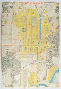
1922171899京都. Kyoto.: 山中書房. Yamanaka Shobō. 大正 11 1922. Attractive colour folding map of Kyoto with a quite detailed illustrated tourist guide printed in blue and white on the reverse some light browning holes at some folds good copy. 78.5 x 54cm This 1922 colour folding tourist map of Kyoto offers sightseeing information each panel showing a photographic monochrome image of the site discussed. <br> <br>The two inset maps on the Kyoto map show Otsu city on the shore of Lake Biwa and the Arashiyama area north of Kyoto. The main map highlights the major temples and famous sights in red geographic features such as rivers and hills are shown and an inset chart shows distances of sights from the nearby stations. The information on the reverse gives more detail on the famous sights a calendar of events seasonal highlights and details of the Imperial graves around Kyoto. . 山中書房. [Yamanaka Shobō]. unknown
1954215869地圖出版社. Reprint. 1954. Colour folding map of Taiwan showing all major cities towns and villages railways highways roads rivers and sea routes. Topographical inset map at lower left Taiwan Straits with mainland coast inset map at top left. Each map has its own scale. Text in traditional Chinese characters. Washi repairs along some folds on reverse pin marks at corners evenly browned and a little faded. A nice map of Taiwan in fair condition. 77 x 53.8cm. . 地圖出版社. unknown
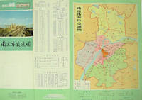
1977137003No place of publication.: 江苏人民出版社.Jiangsu ren min chu ban she. 1st Edition 2nd Printing. 1977. Colour Chinese transportation map featuring the city of Nanjing capital city of Jiangsu Province and its surrounding regions. Upper side: A transpiration map of Nanjing and neighbouring counties right section with a list of names of stations buses trains coaches ferries and their addresses lower right edge tourist guide including the addresses and phone numbers of major travel agents hospitals cinemas and more left section accompanied by two tables of bus routes. On reverse: a "Map of Nanjing Municipal Transpiration Map" scale not given a chart of terminus for bus and trolley bus lower right section. Some soiling on reverse stamp of a prior dealer in Guangzhou a handwritten date of "September 17th 1977" upper side light creases good copy. Text in Chinese. Sheet measures 37.8 x 52.3cm. . 江苏人民出版社.[Jiangsu ren min chu ban she]. unknown
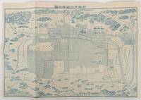
1907177995京都. Kyoto.: 旅館 亀屋. Ryokan Kameya. Meiji 40 1907. Small pictorial folding map 27 x 40cm folded into 14 x 10cm some small holes along folds now neatly secured with archival washi but a very good copy. This tourist map of Kyoto from 1907 was published by Kameya Ryokan as a complimentary map for its guests. The business was situated at a prominent location near Sanjo Bridge which is still a busy city centre in Kyoto. The map provides comprehensive information on tourist attractions in eastern and western Kyoto with their temples in illustrations and their distances as well as railway lines. . 旅館 亀屋. [Ryokan Kameya]. unknown
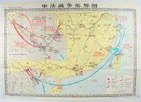
1978171343北京. Beijing.: 地图出版社.Di tu chu ban she. 1978. Large Chinese map in colour showing southern part of China and northern Vietnam folded in original envelope scale 1: 150000 inset map upper left corner scale 1:800000. Both maps show the battles between Qing court and French army between 23 Aug 1884 and 25 Mar 1885. Original paper envelope repaired with acidic free tape map in very good condition. Text in Chinese. Sheet measures 76.8 x 107.1cm. . 地图出版社.[Di tu chu ban she]. unknown
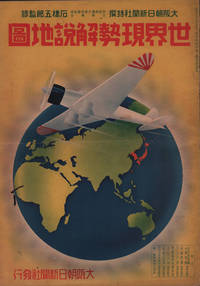
1937208633大阪朝日新聞社. Osaka Asahi Shinbunsha. Showa 12 1937. 10 colour maps not including insets or sketch maps in text on 12 pages. Handsome world map features as the centre fold colour pictorial paper wrappers. A little light soiling and horizontal crease wrappers. An attractive atlas. 38 x 26.7cm. A large format atlas with six pages of coloured maps showing the nations of the world and five pages of Japanese text. The publication seems to have been produced to celebrate the 1937 world record flight from Tokyo to London by Iinuma Masaaki and Tsugayoshi Kenji in their plane 'Kamikaze' which was sponsored by the Asahi Newspaper. The front cover depicts the plane soaring over a map of the world while the back cover also had a colour image of the 'Kamikaze' with an advertisement for the Oji Paper Company which we are told donated a hundred million yen to support the flight. The name 'Kamikaze" had at that stage not yet taken on the connotations which it acquired during the Pacific War. <br> <br>The maps inside the volume show political boundaries major cities and transport routes. The opening pages show the Japanese Empire including Japan proper Korea Karufuto and Manchukuo with small insets covering Taiwan the Chishima Archipelago and Japan's South Sea mandate. The accompanying text focuses on Japan's newly acquired client state of Manchukuo detailing its area population principle products etc while the map includes graphs illustrating Japan's trade with the world and with Manchukuo. China receives an entry of its own with a map of the Chinese Republic and information on the political situation population trade and infrastructure. The central pages of the volume are taken up with a double-spread map of the world including depictions of the flags of a selection of the world's nations. Other sections of the work cover Asia Europe America Africa and Oceania grouped together. The discussion of Oceania includes a section on Hawaii and some small and improbable depictions of Maori and Indigenous Australians. . 大阪朝日新聞社. [Osaka Asahi Shinbunsha]. unknown
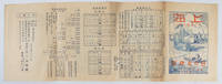
1935171622Shanghai.: 日の丸旅館. Hinomaru Ryokan. Circa1935. Black and white photographic illustrations 54 x 19.5cm. Single sheet printed double sided folded into 8 panels title image printed in blue and red shows a romantic scene across the river to the Bund with traditional Chinese craft and a modern ship in the foreground. Browning occasional light marks creasing and wear but overall a good copy of a scarce piece of Shanghai ephemera. Text in Japanese. Tourist brochure published by the Japanese inn Hinomaru Ryokan in Shanghai in the mid-1930s. The brochure is undated but it appears to have been published sometime after the First Shanghai Incident in 1932. Hinomaru Ryokan was named in honour of the Japanese national flag which was and is commonly called Hinomaru in Japanese. <br> <br>This interesting piece of Japanese Shanghai ephemera provides an outline of Shanghai and its Japanese community at a time when the Japanese residents numbered about 29000. The inn promotes its convenient location within the Japanese community and reassures visitors that the Hinomaru Ryokan is a safe place to stay given is close proximity to approximately 2000 Japanese troops stationed at the Marine's quarters at the ready to protect the residents. It also advertises the free tours of the area it runs and states it is a designated place of accommodation by the Japanese Consulate South Manchurian Railways Manchukuo embassy and the Japanese Tourist Bureau. Additionally the brochure lists the primary sights to be seen in Shanghai Suzhou and Hangzhou a 6-day sightseeing tour plan and train shipping and air schedules and prices. . 日の丸旅館. [Hinomaru Ryokan]. unknown
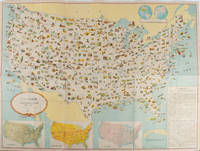
1955172003Washington D.C.: 国務省. Kokumishō. No date. circa1955. Large folding Japanese coloured map of the United States with 3 inset maps at foot of map showing main railways air and highway routes and hemispheres at the top right. Some browning mainly visible on reverse still a good copy. 66 x 81cm. An intricate and detailed pictorial map of the United States published in Japanese by the US State Department. The same type of map had been published since 1945 in English and subsequently in other languages. The Japanese language map is hard to find. The map is undated but was probably produced in the 1950's. The images include depictions of women board riders in two piece swimsuits of the sort popular in the 1950s but the inset text lists Alaska and Hawaii as external territories of the US indicating that the map was produced before they attained statehood in 1959. <br> <br>An inset panel provides information on the area and population of the US the population of major American cities mineral and other resources climate and topography. A note at the bottom right hand corner of the map states that copies of the map can be obtained free of charge from your nearest US Information Office. <br> <br>Every region of the country is decorated with an illustration of the natural resources industries or cultural or historical resources associated with that particular place. These include images of early colonial settlers the birthplaces of Mark Twain and Woodrow Wilson Booker T. Washington's house and Abraham Lincoln's grave; images of major dams oil fields coal mines cotton plantations etc. various animals and crops and images of ships cars and public buildings including the Statue of Liberty located rather oddly far out at sea. . 国務省. [Kokumishō]. unknown
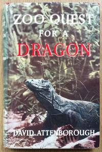
1957619633London: Lutterworth Press 1957. First edition hardcover signed and dedicated by David Attenborough in very good condition. Clipped dust jacket in good condition. Jacket is sunned at the spine. Edges are creased and nicked including small tears and chips. Board corners and spine ends are bumped. Spine is cocked. Page block and endpapers are lightly foxed. Binding is sound and pages are clear. LW. Signed and Dedicated By Author. First Edition. Hardcover. Very Good/Good. Used. Lutterworth Press Hardcover
1994614305London: CBC Publishing 1994. 'State Visit of President R.G. Mugabe United Kingdom 1994 With the Compliments of Lonrho'. Oversized hardcover with printed front board no dust jacket in very good condition. Board corners and spine ends are a little bumped and rubbed. Spine is slightly cocked. Previous owner's bookplate on front pastedown. Minimal ink marginalia on a couple of pages and page edges are lightly tanned. Boards are clean binding is sound pages are clear and colours vivid. LW. Hardcover. Very Good/No Dust Jacket. Used. CBC Publishing Hardcover
1959016941Beijing 1959 Book with dust jacket visible plastic in good conditions. The dustjacket has same traces of use tears / missing small pieces. Illustrated book of the 10th anniversary of the People's Republic of China. 544 pages. Page large photograghs illustrations in black and white and colour. The pictures show the life in China people art seasons industry history towns & villages nature army. Text in Chinese. Zhongguo hua ce bianji weiyuanhui Beijing 1959. Reading ribbon on the front cover there is in relfief "the National Emblem of the People's Republic of China". Table of contents. Included is a stapled booklet 8 pages in German text this is the German translation of the table of contents. "CHINA ein Bildband. Bildunterschriften. Zusammengestelt von der Kommission zur Herausgabe des Bildbandes CHINA. Peking 1959". Size: 39 x 32.5 x 5.5 centimeter. Weight: 6.6 kilogram. Price is including registered - insured - shipping. 1ste / 1st. cloth / linnen hardcover. good / goed/good / goed. A3 formaat gebonden. hardcover
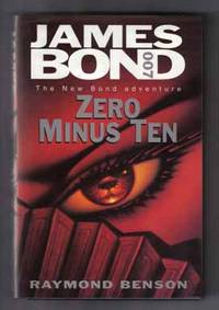
199712835London: Hodder & Stoughton. Fine in Fine dust jacket. 1997. First Edition; First Printing. Hardcover. 0340684488 . A very beautiful first edition/first printing in unread Very Fine condition in alike dust-jacket SIGNED by author Raymond Benson on the title page; Raymond Benson's first James Bond novel picking up where Ian Fleming and John Gardner left off. It is set mostly in Taiwan Hong Kong and China involving a wealthy British shipping magnate. Bond is first alerted to the case after a chain of events that are topped by a nuclear blast going off in the Australian outback. 007 is sent to Hong Kong to figure out the cause of these events; 8vo ; Signed by Author . Hodder & Stoughton hardcover
199713229London: Hodder & Stoughton. Fine in Fine dust jacket. 1997. First Edition; First Printing. Hardcover. 0340684488 . A very beautiful first edition/first printing in unread Fine condition in Fine dust-jacket signed by Raymond Benson on the title page; Raymond Benson's first James Bond novel picking up where Ian Fleming and John Gardner left off. It is set mostly in Taiwan Hong Kong and China involving a wealthy British shipping magnate. Bond is first alerted to the case after a chain of events that are topped by a nuclear blast going off in the Australian outback. 007 is sent to Hong Kong to figure out the cause of these events; 8vo ; Signed by Author . Hodder & Stoughton hardcover
1928012541Harper & Brothers 1928. Book. Very Good-. Soft cover. Signed by Authors. SIGNED BY ZANE GREY ON COVER in his traditional purple ink. First edition Harper & Brothers 1928. Very good minus softcover in yellow wrappers. Text clean and unmarked. Harper & Brothers Paperback
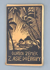
192658596Brno: Vydalo Druzstvo Moravsky Legionar 1926. Paperback. Very good. 155pp. Sextodecimo 17.5 cm Pictorial wraps with unstapled gatherings which was common for Czech paperbacks of the time. With 21 photographic illustrations and a map of Eurasia. With an expressionist cover illustrated by Helena Bochorakova-Dittrichova. <br /> <br /> Helena Bochorakova-Dittrichova 1894-1980 was the first female wordless novelist and the only woman to work in this medium during its heyday. She was born in the Moravian region of what is now the Czech Republic and spent most of her life in Brno the Moravian capital. She graduated from the Academy of Fine Arts in Prague and in 1923 received a government scholarship to study printmaking in Paris. Bochorakova-Dittrichova's unpublished wordless novel Malirka Na Cestach The Artist on Her Journey recounts this period in her life. In Paris she first encountered the wordless novels of Flemish artist Frans Masereel the originator of the form and was inspired to create her own. Over the course of her long career Bochorakova-Dittrichova published several wordless novels along with travelogues and historical works. She also worked as a printmaker and illustrator and was highly regarded in her native land though largely unknown elsewhere. This changed in 2014 when the National Museum of Women in the Arts held an exhibition of her work entitled "The First Woman Graphic Novelist: Helena Bochorakova-Dittrichova" and this important artist finally began to gain global recognition. Her work however is still not widely available. Vydalo Druzstvo Moravsky Legionar paperback
1909017646Cambridge at the University Press 1909. Illustrated with many photographic plates large octavo pp xii 431 slightly age-toned and with signs of use internally lacking the front endpaper front hinge a little weak with the very large folding map in the rear pocket but this is very worn and lacking two sections LACKING the tables of vocabularies original blue cloth a little worn the spine head slightly frayed. VERY SCARCE. The author educated at Eton where he was proficient in Oriental languages. Davies then joined the Army and was sent to British-controlled Burma in 1887 and to Siam in 1892. In 1893 he was attached to a survey unit which surveyed the passes between Burma and China which located the Crouching Tiger Pass the Heavenly Horse Pass and the Han Dragon Pass. On completion of the team's objectives Davies remained in China to explore the Yunnan area. On his return to England he was asked to survey a potential railway route from India to the Yangtze river via Yunnan and in 1898 returned to Burma. By mid-1899 his team had travelled nearly 2500 miles of the proposed route mapping the terrain in detail. First Edition. Cloth. Fair. Cambridge at the University Press Hardcover