2 135 résultats
1897256215Verlag von Georg Reimer Berlin 1897. Hardcover mit Lederrücken und -ecken Rundumfarbschnitt Lesebändchen ohne Schutzumschlag 3. Auflage / 3 Bände 18961897. Zustand: keine Beschädigungen keine Eintragungen. Rücken Ecken Kanten leicht bestoßen berieben und etwas abgeschabt. Titelblatt gering fleckig Buch ansonsten sauber und gepflegt mit festem Block. Mit Kennungen einer Klosterbibliothek. Verlag von Georg Reimer, Berlin, hardcover
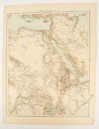
1895175108London.: Times Atlas of the World. 1895. Double-page folding map printed in colour 46.5 x 36.5 cm. edges gilt central fold with an inset map of Somaliland Somalia and the island of Sokotra key to European possessions outlined in colour small edge fold tears affecting the margin only and two other small edge tears slight toning at the edgaes but in very good condition. Attractive and detailed map prepared for the first edition of "The Times Atlas of the World". . (Times Atlas of the World). unknown
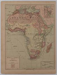
1877176015New York.: Harper & Brothers. circa1877. Chromolithographed map with outlne handcolour 27.1 x 21 cm major towns marked with a red cross relief by hachures ocean currents marked two inset maps of the Suez canal and Mascarene Island two very small marginal edge tears not affecting the map slight toning unrelated text on the verso prepared for "Harper's School Geography" in very good condition Interesting map of Africa before the escalation of the European race for colonial possessions from 1880. The map shows: the European possessions of the Cape Colony Transvaal Republic Orange River Republic and Natal; regions of the continent as fertile belts and desert belts; and indicates agricultural and other production such as palm oil ivory skins and cattle. Major cities are shown with important trade centers highlighted with a red cross. Prepared for US students in "Harper's School Geography" longitude is shown from the Greenwich prime meridian at the head of the map and from the Washington prime meridian at the foot. A small outline map of Ohio is included for relative scale. . Harper & Brothers. unknown
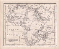
1830176607London.: Robert Jennings. 1830. Engraved map 11.5 x 14.3 cm showing route of European explorers faint added outline colour in an early hand and manuscript note to the verso in the same ink edges age-toned but in very good condition. Detailed pre-colonial map of Africa "Regions Unexplored" marked and "no fresh water to be found" on the west coast. An early manuscript inscription on the verso refers to Lander's ."wanderings of Clapperton" the Scottish naval officer and explorer. Richard Lander had returned with Hugh Clapperton's journal following his death and the account was published in the same year as Fenner's "Pocket Atlas of Modern & Ancient Geography" for which this map was prepared. . (Robert Jennings) unknown
189071668London: Royal Geographical Society 1890. 8vo pp. 331-346 i.e. 16 pages; folding color map; extracted from The Proceedings of The Royal Geographical Society and bound in modern blue wrappers printed paper label on upper cover; fine. On October 6 1889 Meyer attempting to summit Kilimanjaro for the third time finally achieved his goal with the Austrian mountaineer Ludwig Purtscheller. This account was read at the Evening Meeting of the RGS April 14 1890. Royal Geographical Society unknown
1869biblio499<p>This is the formal 1st edition of the groundbreaking work on African exploration by the famed explorer Sr. Samuel Baker and thus a very important book. Because of that fact alone is this "GOOD-only condition" book for sale by me. It is an excellent candidate for restoration because the actual printed matter is bound intact including all illustrations and maps.</p><p>Photo on request.</p> O.D. Case & Co hardcover
18900008050New York: Scribner's 1890. First edition. Hardcover. Very Good. 3 maps in pockets woodcuts. Octavos8vos; 547 540 pages green cloth all edges gilt front hinge v.1 repaired; short tears to margins of map 1 small puncture at top joint of vol. 2. Note: Protective Association stamp 65362. <br/><br/>Stanley who found Livingstone and traversed Lake Victoria Nyanza and relieved Emin Pasha was knighted by Queen Victoria. 3 maps in pockets 150 woodcuts Scribner's hardcover
1886103654Tours, Alfred Mame et fils 1886 In-4 27,5 x 17,5 cm. Cartonnage éditeur pleine percaline rouge, dos lisse et premier plat orné, tranches dorées, 358 pp., 45 gravures hors-texte, 1 carte, table des matières. Cartonnage poussiéreux.
1895142105Armand Colin et Cie 1895 In-8, demi-chagrin cerise, fers de prix sur le premier plat, 307 pp. Reliure fanée. Rousseurs éparses
189873016Librairie de Paris, Firmin-Didot et cie, éditeurs 1898 In-4. Reliure demi-percaline vert foncé, couverture conservée, dos lisse orné de filets dorés, VIII-330 pp., 150 illustrations d’après les photographies de l’auteur. Reliure légèrement frottée, couverture ternie, des rousseurs.
182830294Paris: Treuttel et Wuerz 1828. Gebunden. Treuttel et Wuerz unknown
181521179: 1815. Gebunden. ? unknown
1886BOOKS352091Harrisburg PA: E. K. Meyers State Printer. Good/NO DUSTJACKET. 1886. . Hardcover. Loose Volume . Sm 4to. 308 p.p. Shelf wear; head and tail of spine and corners bumped; tear at edges of head and tail of spine; cracked inner hinge; shelf lean; edges of cover; back cover pocket torn in side edge; shadowing on backs of some plates; edges of cover rubbed; pages clean and unmarked. . E. K. Meyers, State Printer hardcover
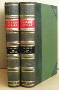
187716086London: Daldy Isbister 1877. Fourth edition. Hardcover. Very Good . Two volume set attractively rebound in green half leather over green cloth boards. Spine has raised bands and gilt lettering on red and black strips with 1877 at bottom. Fine color folded map in pocket at end of Vol. I. Some foxing on verso of frontis and the tissue in volume I. Many full plates & facsimiles and smaller woodcuts in both volumes however volume I has three of the small woodcuts cut out on pages 325 & 353-354. All other engravings and woodcuts are present. Green leather corners slightly rubbed. Author's own adventures the places and people and guide to future travelers and also discussion of Livingston's travels and death. Heavy set not available for shipping outside the U.S. <br/><br/> Daldy, Isbister hardcover
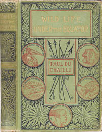
18674023NY: Harper & Brothers 1867. 1867. Hardcover. Fair. 292 pp ill. This edition published for teenagers. Stories of the author's explorations and hunting adventures with wild animals and two legged ones as well. Fair only condition. Rear endpaper torn out. However nicely inscribed and signed Paul once and Paul Du Chaillu again. Dated in the year of publication. Harper & Brothers hardcover
180853885Boston: Printed By J. T. Buckingham for Thomas & Andrews. Fair; Boards worn longitudinal crack down spine front outer joint split foxing bookplate scar on front pastedown endpaper pages toned. Maps toned Africa map tattered at edges but all three are intact and in Good condition. 1808. Second Edition. Leather. Original tree calf binding. Lacks leather lettering piece on spine. Three folding maps: Europe Africa Asia. A geographical survey of Europe Africa and Asia. Morse is best known as a minister and educator as well as the metaphorical father of American geography and biological father of Samuel F. B. Morse. ; 8vo 8" - 9" tall . Printed By J. T. Buckingham for Thomas & Andrews hardcover
185097819Rev. John Leighton Wilson 1850. Pamphlet. Used - Very Good. No imprint ca 1850. 11 pages. 9 x 5" stitched. Argues against proposed removal of squadron. Creased faintly foxed VG. Rev. John Leighton Wilson unknown
185831352Philadelphia PA: John E. Potter and Company 1858. Early reprint . Hardcover. Very Good. Originally published by G.G. Evans Philadelphia in 1858. 406 pages with 10 pages of ads in the rear. Bound in original brown cloth with lettering and border design stamped in black. Several book plates on front endpapers one with the name Warren Cheney with an Alaska moteef and a small date of 1905. Repaired tear to cloth at head of spine. A very good copy. <br/> <br/> John E. Potter and Company hardcover
1896biblio285box9<p>Light green covers with great illustration of Gordon on a Camel in gold red and brown on front and spine. No dustjacket. Covers are soiled and worn at the edges and corners. Interior clean with some browning.</p> E. P. Dutton and Co. hardcover
185840128Cincinnati: Moore Wilsatch Keys & Co. 1858. 1st Edition 1st Printing. Hardcover. Good. First edition no additional printings indicated. Recased small 8vo with original blind embossed cloth panels gilt illustrations and title. Good boards bowed; spine sunned; corners bumped and worn; gilt to spine has completely rubbed away; board edges rubbed and lightly worn; frontis page torn; 2"-tear to tipped-in map "repaired" with tape; chips to original rfep; internally clean. One additional illustration is affixed to the front pastedown. 456pp. <br/> <br/> Moore, Wilsatch, Keys, & Co. hardcover
188026087O. Ort, ohne Vlg. o. Jahr. ca. 1880. Mit 26 s/w Abb. m. Untertext in engl. Sprache. 24 S. unpag. Farb. illustr. OPappbd. m. Goldpräg. 21x15 cm. (Querformat). [4 Warenabbildungen]
1893683381 vol. in-4 cartonnage éditeur, plat sup. illustré, toutes tr. dorées, 169 gravures et 3 cartes, Administration de l'Univers illustré, Paris, s.d. (1893), 410 pp.
1853256378Selbstverlag München 1853. Hardcover mit Lederrücken und -ecken ohne Schutzumschlag Zustand: keine Eintragungen. Rücken Ecken Kanten leicht bestoßen und berieben. Der Vorsatz ist zur Bindung hin nicht intakt der Bund ist vorne offen der Buchblock hält aber zusammen. Seite 1/2 hat eine Fehlstelle gering in den Text reichend. Weitere Blätter haben Wasserränder jedoch ohne Wellung des Blocks. Dieser ist fleckig jedoch fest. Schiefstand. Selbstverlag, München, hardcover
18904893London: Murray 1890. Gebunden. Murray unknown
188334721Avec un plan de l'Ile de Gorée et la carte du professeur Lanet indiquant la marche invasive de la fièvre jaune vers l'Europe, 1 vol. in-8 br., Imprimerie Nouvelle A. Bellier et Cie, Bordeaux, 1883, 100 pp. avec 2 plans (dont 1 grande carte dépliante) et 1 graphique