Mount, William, Page, ThomasBiblio.com
88 résultats
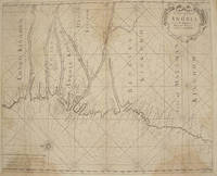
17611386<p>London: : From "The English Pilot: Part V" Sixth edition. Mount and Page 1761. 16-3/4" x 20-1/2"- 42.5 x 52 cm. Copper engraved map with hand colouring. Light overall browning with darker areas to corners generally good . An interesting coastal chart engraved by Francis Lamb showing rhumb lines from the Congo to Mount Negro in Mataman now Namibia.</p> From "The English Pilot: Part V" Sixth edition. Mount and Page,
1734164821London: W. Mears 1734. First Edition Thus . Hardcover. Very Good/No Jacket. 8vo - over 7¾" - 9¾" tall. Title continues: ". Containing a particular Account of all the Battles Sieges &c. Likewise a true Relation of the most secret Intrigues and Negotiations of the Courts of France Spain Germany and Savoy. Interpreted With Variety of entertaining Amours and original Letters of the several Princes concerned. Also The Political Intrigues of the late King of Sardinia containing an Account of the ill treatment of Mr. Phelippeaux the French Ambassador at the Court of Turin contrary to the Law of Nations. Translated from the Original French of Count Bonneval now in great Esteem at the Court of the Grand-Seignior By J. Sparrow Gent. With a correct Map explaining the Seat of the Last and Present War in Italy." 13 376pp; 1 folding map "Italy divided into Its Principal States" in excellent condition. Re-bound in modern brown Buckram with gilt dec. and spine titles. A very nice copy. <br/> <br/> W. Mears hardcover
1773797721773. unknown
171080848Crembs: Johann Jacob Kopitz 1710. kart. Johann Jacob Kopitz unknown
1783038539London: T. Cadell 1783. 1st Edition . No Binding. Very Good. A Fairly Detailed Map Of Africa The Surrounding Islands And The West Coast Of Arabia. 29 X 33 Cm. Folds; Some Light Browning. No Tears Or Chips. Removed From A Book. <br/> <br/> T. Cadell unknown
1773797731773. unknown
1773652791773. kart. unknown
1798274639Londres L. Duprat-Letellier et Compagnie Paris 1798. Softcover 2 Bände 17981805. Zustand: Keine Beschädigungen keine Eintragungen. Rücken Ecken Kanten bestoßen berieben randrissig. Bei erstem Band Einband lichtrandig und Rücken mit Abschabung. Die Druckbögen sind unbeschnitten. In allem original. Mit Rückenkennung einer Klosterbibliothek. Londres + L. Duprat-Letellier et Compagnie, Paris, paperback
1762301756Tobias Lobeck G. Eichler Johann Michael Wagner Augspurg 1762. Hardcover Leder Die Jahresangabe ist ungefähr. Farbig Querformat kein Falz in der Mitte der Karten 15x11cm. Planispheirum und Weltkarten sind keine enthalten. Zustand: keine Beschädigungen keine Eintragungen. Rücken Ecken Kanten gut. Sauber Fleckenfrei. Tobias Lobeck, G. Eichler, Johann Michael Wagner, Augspurg, hardcover
17723123Halae: Ioannis Ioach. Beyery 1772. Gebunden. Ioannis Ioach. Beyery unknown
17531942Stadler: 9x15 cm 1753. Gebunden. 9x15 cm unknown
179129554Frankfurt 1791. Gebunden. unknown
177521527Paris 1775. Very good condition. Detailed copper engraved map of the east coast of Africa from the Saudi Arabia coast and the Red Sea down to Zanzibar. Many coastal cities and rivers named; the countries and regions named include: Costes d'Hasbach Zeila Ajan Muji Munni and Zanjibar sic. From Prevost's "L'Histoire Generale des Voyages".<br /> <br /> Bellin 1703 - 1772 one of the most noted French mapmakers of the 18th century was named the hydrographer chief cartographer to the French Navy and later the Official Hydrographer to the French King.<br /> <br /> With compass rose. Folding 8 x 10 1/8" with ample margins. Strong impression very clean. unknown
177521526Paris 1775. Very good condition. Detailed copper engraved map of the west coast of Africa from Sierra Leone and the Gulf of Guinee or St. Thomas down to Angola. Many coastal cities and rivers named; the countries and regions named include: Coste de Grain Coste d'Ivoire Coste d'Or Coste des Esclaves Benin Biafara Maiumbo Loango Congo and Angola. From Prevost's "L'Histoire Generale des Voyages".<br /> <br /> Bellin 1703 - 1772 one of the most noted French mapmakers of the 18th century was named the hydrographer chief cartographer to the French Navy and later the Official Hydrographer to the French King. <br /> <br /> With compass rose. Folding 10 x 8 1/8" with ample margins. Strong impression very clean. unknown
177521531Paris 1775. Very good condition. Detailed copper engraved map of the west coast of Africa from Gabon "ou Pongo" down to Cap Negro in Benguela modern day Angola. Many coastal and interior cities and rivers named with various kingdoms marked. From Prevost's "L'Histoire Generale des Voyages".<br /> <br /> Bellin 1703 - 1772 one of the most noted French mapmakers of the 18th century was named the hydrographer chief cartographer to the French Navy and later the Official Hydrographer to the French King.<br /> <br /> Folding 12 1/4 x 10" with ample margins. Strong impression very clean. unknown
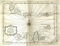
177521529Paris 1775. Very good condition. Detailed copper engraved map of the Cape Verde Islands off the west coast of Africa and the present day country of Senegal. Map extends from Isle de St. Antoine down to Isle de St. Yago sic. Additional islands named include St. Vincent Ste Lucie I. Branca Isle de S. Nicolas Isle de Sal Isle de Bonavista Isle de St. Philippe ou de Fuego Isle de St. Jean ou Brava and Isle de May. From Prevost's "L'Histoire Generale des Voyages".<br /> <br /> Bellin 1703 - 1772 one of the most noted French mapmakers of the 18th century was named the hydrographer chief cartographer to the French Navy and later the Official Hydrographer to the French King.<br /> <br /> Ornate compass rose at center of map with rhumb lines. 11 1/4 x 9" with ample margins. Strong impression very clean. unknown
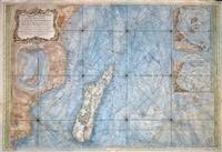
176777030Paris 1767. Originalt kobberstikk med ny hÃ¥ndkolorering. Størrelse : 86 cm X 59 cm.Original copper engraving with new hand-colouring. Size : 86 X 59 cm. Fransk. <br/><br/><em>Jacques-Nicolas Bellin 1703-1772 “Hydrographe du Roiâ€. Noe slitt ved ytterkantene og i plateranden. Et stort og dekorativt kart.Some wear at the outer edges and on the edge of the plate. A large and decorative map. </em> unknown
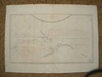
178438202London: G. Nicoll and T. Cadell 1784. Map. Near Fine. Plate 36 from the atlas volume of Cook James; A Voyage to the Pacific Ocean: Undertaken by the Command of His Majesty for Making Discoveries in the Northern Hemisphere published by G. Nicoll and T. Cadell; London 1784. Writing engraved by T. Harmer. Wagner; Cartography of the Northwest Coast of America 696. Map printed border to border measures 15.25 x 26.5 inches plate impression 16.75 x 27.25 inches sheet 21.5 x 30 inches. An exceptionally nice uncolored copy. Request a higher resolution photograph if required. <br/> <br/> G. Nicoll and T. Cadell unknown
175881348Barcelona: Jolis 1758. kart. Jolis unknown
175479689Parisiis: Garnier 1754. Gebunden Leder. Garnier unknown
177521525Paris 1775. Very good condition. Detailed hand colored copper engraved map of the west coast of Africa from Gibraltar and Tanger down to the Canary Islands and Cape Verde Islands and Gambia. Many coastal cities and rivers named. From Prevost's "L'Histoire Generale des Voyages".<br /> <br /> Bellin 1703 - 1772 one of the most noted French mapmakers of the 18th century was named the hydrographer chief cartographer to the French Navy and later the Official Hydrographer to the French King.<br /> <br /> With compass rose. Folding 8 1/4 x 10" with ample margins. Strong impression very clean. unknown
1799201023Johann Chistian Hermann Frankfurt am Main 1799. Hardcover zweite Auflage erster Band Erster Band vier Teile Bücher genannt. Mit Originalseiten. Umschlag ist liebevoll neu gefasst. Bindung tadellos. Kanten intakt Rücken intakt. Papier innen nachgedunkelt kaum bis keine Flecken. Alte Eintragungen im Vor- und Nachsatz sind erhalten. Johann Chistian Hermann, Frankfurt am Main, hardcover
175588960Paris: Jean Herissant 1755. kart. Jean Herissant unknown
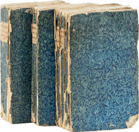
174361213Amsterdam: Jean Catuffe 1743. Third French edition. 12mo 18.5cm. Three volumes in blue pastepaper wraps with manuscript titles on plain paper spine labels; I: xxiv4282pp; II: xvi162pp; III: xx320pp; 5 folding maps and 25 line engravings one folding. Untrimmed and unbeaten. Cracks to paper over spine on vols II and III significant cracks to spine on vol. I wrappers lightly rubbed at edges with small abrasion on front wrapper of vol. I dampstaining to about 16 leaves in vol. III else clean: Very Good. <br /> <br /> Peter Kolbe 1675-1726 was an astronomer who traveled to the Cape of Good Hope in modern-day South Africa for astronomical research from 1704 to 1713. In 1719 he published this seminal work on natural history the Khoekhoen people and Dutch settlers in South Africa. The work became highly popular and was translated into multiple languages; this is the third edition in French. See MENDELSSOHN pp842-845 for the first edition and other translations. Jean Catuffe unknown
173479645criticum: chronologicum 1734. chronologicum unknown