WILSON, Edward LivingstoneBiblio.com
302 résultats
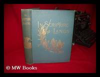
1891233015London : Religious Tract Society 1891. 1st edition. Hardcover. Scattered minor marginal foxing. Very good copy in the original gilt-blocked decorated cloth over beveled boards. Spine bands and panel edges somewhat rubbed and dust-toned as with age. Remains quite well-preserved overall; tight bright clean and strong. Subjects; Geography - Syria Lebanon Israel Jordan. Copiously illustrated; tissue-guarded frontis. London : Religious Tract Society hardcover
188033051London: John Murray 1880. Two Volumes with Portrait Maps And Illustrations. Foldout map at rear pcoket of Volume One present. Pocket frayed at lip. Lacking foldout map at end of Volume 2. Gilt at spine olive green cloth boards. Boards show modeate wear. a bit of fraying along top. Hinges tender slightly cracked but holdong nicely. Tops of pages dusted. Very occasional very light foxing. Page 315/316 has bottom 5/8" evenly removed during cutting and binding process not affecting the text. Hardcover. Very Good/No Jacket. John Murray Hardcover
187943050Couverture rigide. Reliure toile de l'éditeur. 192 pages. Rousseurs.
187980647Couverture rigide. Reliure toile de l'éditeur. 192 pages. Rousseurs. Couverture légèrement défraîchie.
1878005223Librairie Hachette et Cie., Paris 1878. 1. Französische Ausgabe, 1ère Edition Goldgeprägter Halblederband Sehr Ordentlich, Solide
18753147Hartford Conn: Columbian Book Co 1875. First Edition. Hard Cover. Near Fine. Thick Octavo. Title Cont. A narrative of the life travels adventures experiences and achievements of Dr. David Livingstone including his discovery by Henry M. Stanley and the subsequent wanderings and death of the renowned traveler. Together with a comprehensive history of African explorations the Livingstone relief expeditions and recent events. The whole abounding in picturesque descriptions of the country and people their traits customs and superstitions. Illustrated with over 100 engravings & maps 831pp. 1pp. ad at rear bound in green cloth upper board titled in gilt within decorative blindstamped border pictorial gilt spine; internally clean and fresh. A handsome copy of a very scarce work by the author who wrote Livingstone Lost and Found in 1873 the year of Livingstone's death. A near fine copy. <br/><br/> Columbian Book Co hardcover
1875001523Columbian Book Company Cincinnati OH 1875. Hardcover. Fair Condition/No Dust Jacket. Size: 8mo - over 7 3/4" - 9 3/4" tall. 831 pp. Pages are yellowed but are tight and clean. Spine is cracked but fully intact and tight. Moderate water damage to text covers unaffected. Heavy general shelfwear to cover. Quantity Available: 1. Shipped Weight: 3-5 pounds. Category: Exploration; Pictures of this item not already displayed here available upon request. Inventory No: 001523. . Additional shipping charges may apply. Columbian Book Company hardcover
18753147Hartford Conn: Columbian Book Co 1875. First Edition. Hard Cover. Near Fine. Thick Octavo. Title Cont. A narrative of the life travels adventures experiences and achievements of Dr. David Livingstone including his discovery by Henry M. Stanley and the subsequent wanderings and death of the renowned traveler. Together with a comprehensive history of African explorations the Livingstone relief expeditions and recent events. The whole abounding in picturesque descriptions of the country and people their traits customs and superstitions. Illustrated with over 100 engravings & maps 831pp. 1pp. ad at rear bound in green cloth upper board titled in gilt within decorative blindstamped border pictorial gilt spine; internally clean and fresh. A handsome copy of a very scarce work by the author who wrote Livingstone Lost and Found in 1873 the year of Livingstone's death. A near fine copy. <br/><br/> Columbian Book Co hardcover books
1874mon0001525703Caernarfon 1874T. unknown_binding. Good. . Cloth boards with leather spine and corners. Lavish colour illustrations throughout. Title page portrait detached but with book. Welsh language edition. Undated but with bookplate dated 1882. Caernarfon unknown
1899236647Boston: Brown and Company 144 Purchase Street 1899. First edition. Frontispiece. x 13-153 pp. 1 vols. 8vo. Crimson gilt stamped cloth t.e.g. In custom cloth dust jacket. laid into cloth chemise and slipcase. First edition. Frontispiece. x 13-153 pp. 1 vols. 8vo. With the first appearance of Wallace Stevens at page 28 "Vita Mea" which first appeared in the Harvard Advocate and here is its first and only book appearance. Edelstein B1Morse B1 Brown and Company 144 Purchase Street unknown books
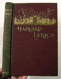
1899011704Boston: Brown and Company 1899. First edition 1899. Very well-kept copy of this hard-to-find collection of student poetry most notable by the inclusion of a very early work by noted American poet Wallace Stevens 1879-1955. This copy belonged to R. B. Dixon Professor of Anthropology at Harvard with his name neatly written at the head of the half-title. Maroon cloth lettered and with a pictorial design in gilt top edge gilt other edges uncut frontis illustration 153 pages including index of authors. Very light shelfwear mainly a bit of rubbing to the spine ends spine slightly faded very light surface soil. Good hinges sound text block very clean pages free from other names or markings. . First Edition. Hard Cover. Very Good/No. 12mo - over 6¾" - 7¾" tall. Brown and Company Hardcover
187433531Paris Hachette 1874 in-8° un frontispice ( portrait en pied de Stanley ) 4 cartes sur papier différent de l'ouvrage qui ont roussi, toutes tranches dorées gravures sur bois in et hors texte bon état général , deux coins inférieurs émoussés
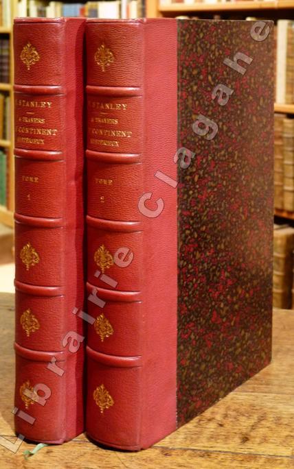
187912907Paris, Hachette, 1879 ; 2 tomes in-8 ; demi-chagrin rouge-cerise, fleurons décoratifs et titre dorés (reliure de l'époque) ; (12), IV, 496 ; (4), 544 pp., 2 frontispices, 9 cartes en couleurs dont 2 très grandes dépliantes en fin de chaque volume et 2 dépliantes, dont celle du fleuve Lingstone (Congo) et de ses chutes.
1890PHO-889Paris, Hachette, 1890 ; 2 volumes in-8 , 23x17 ,518 pp, 473 pp , relié demi-basane verte,dos à nerfs avec auteur titre et tomaison (Rel. de l'époque) , dos frottés et insolés , quelques rousseurs. 150 gravures d'après les dessins de A. Forestier, Sydney Hall, Montbard , Riou et 3 grandes cartes repliées en couleurs .P2-3A
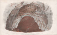
183924741839. Tinted lithograph. 220mm by 135mm sheet. From 'Three Expeditions into the Interior of Eastern Australia; With Descriptions Of the Recently Explored Region of Australia Felix and of the present colony of New South Wales' by Sir Thomas Livingstone Mitchell. Published by T and W Boone 1839. unknown
185720960London: John Murray 1857. Hardcover. Good overall. Annual volume of the RGS journal with content including Africa and Vancouver Island. 8vo cxcviii 398pp maps. Folding maps of David Livingstone in Africa Burma Vancouver Island Rewa River exploration in Fiji. Many plates on "strategic Movements between Tegea Caryae and Sparta." Original half brown calf & marbled board front board detached. Library slip on inside cover no other lib marks. Very good condition internally. John Murray hardcover
186115581London: John Murray 1861. First edition. Paperback. Important volume of the RGS journal with much Australian & British Columbian content & many folding maps in original blue paper wrappers. It contains John M'Douall Stuart's account of his last unsuccessful attempts to cross the continent; Stuart attempted 11 times to break through either to the Gulf of Carpentaria or to the Victoria River headwaters' Feeken Feeken and Spate. "The Discovery and Exploration of Australia". Other content includes Franklin in the Arctic Kashmir Peru the Andes. Articles include: M'Clintock Narrative of the Expedition in Search of Sir John Franklin; 4 articles on British Columbia by Mayne Palmer Begbie & Downie on British Columbia; Purdon On the Trigonometrical Survey of the Valley of Kashmir; Austen Notes on the Valley of Kashmir; Clerk Notes in Persia Khorassan and Afghanistan; John M'Douall Stuart Journal of Australian Exploration: 2nd 3rd & Last Expedition; Randell Voyage up the Darling and Barwon; Wheelwright Proposed Railway Route across the Andes; Spruce On the Mountains of Llanganati; Jameson; Journey from Quito to Cayambe; Markham The Province of Caravaya in Southern Peru. Orig. pale blue printed wrappers spine very lightly tanned with a couple of sml. ruffles front inner hinge strengthened o/w fine unopened condition. 8vo 12pp advertiserclxxxvi 386pp 16pp ads 12 folding partialy color maps and a folding facsimilie document of the Eribus and Terror. UNCUT and UNOPENED. John Murray paperback
188027304ALondon, Edinburgh & Dublin, A. Fullarton & Co., ohne Jahr (ca. 1880). Ca. 27 x 19,5 cm. Lithographiertes Titelblatt, XII Seiten, 754 Seiten; VI Seiten, 669 (1) Seiten. Mit insgesamt 28 farbig lithographierten Tafeln, einer gefalteten Karte und zahlreichen (teils ganzseitigen) Holzstich-Abbildungen. Grüne, gold- und blindgeprägte Original-Leinenbände. Two volumes in five original parts. 2 Bände in 5 Büchern.
188582556ABStuttgart, Gebrüder Kröner, 1885. Mit 1 Holzstichportr. Livingstones, 6 farb. lithogr. Tafeln, 43 Textillustr. u. 1 doppelblattgr. lithogr. farb. Karte. IV, 1, 270 S. OLwd. m. grosser Deckelillustr. - Gutes Bibl.-Ex. Etwas fleckig.
1881RO70051502MEGARD Bibliothèque Morale de la Jeunesse. 1881. In-8. Cartonnage d'éditeurs. Etat d'usage, Couv. légèrement passée, Mors fendus, Rousseurs. 224 pages. Frontispice illustré en noir et blanc (portrait de David Livingstone).. . . . Classification Dewey : 840-Littératures des langues romanes. Littérature française
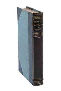
18485001112London: Longman Brown Green and Longmans 1848. Octavo frontispiece 11 lithograph plates and seven maps four folding a very good copy complete with 24 pp. publisher's advertisements neatly recased in the original red cloth spine gilt the cloth in bright condition. <p><p>First edition of Mitchell's account of his last expedition. In late 1845 with Edmund Kennedy as his second-in-command Mitchell set out from Sydney in search of an overland route to the Port Essington settlement. Although he did not find the hoped-for route over the next year he explored a vast area of unknown country in tropical Queensland returning to Sydney in December 1846. As with his earlier expeditions Mitchell showed contempt for official orders preferring instead to follow his instincts. In this instance he seemed more interested in discovering the fabled Kindur River one of his more enduring but erroneous beliefs. To justify his decision he here represented his discovery of the Victoria River which was in fact the Barcoo as the legendary great north-flowing source. Although Mitchell did not succeed in finding a northward route and - if anything - further confused the riddle of the inland rivers upon his return the expedition charted a vast area of previously unknown country without significant mishap or the loss of a single man.</p> <p>The fine tinted lithograph views in the books are all after Mitchell's own drawings. His work as a topographical artist has gained increasing respect in recent years and can be appreciated in the plates prepared for this book. It is characterised by a fine attention to detail and an accomplished use of tone and shading.</p> <p>An attractive copy in its original cloth binding.</p> </p> . Longman, Brown, Green and Longmans unknown
18485000630London: Longman Brown Green and Longmans 1848. Octavo frontispiece 11 lithograph plates and seven maps four folding; a fine copy unusually clean bound without the advertisements in later half blue morocco gilt top edges gilt. <p><p>An elegantly bound copy of the first edition.</p> <p>In late 1845 with Edmund Kennedy as his second-in-command Mitchell set out from Sydney in search of an overland route to the Port Essington settlement. Although he did not find the hoped-for route over the next year he explored a vast area of unknown country in tropical Queensland returning to Sydney in December 1846. As with his earlier expeditions Mitchell showed contempt for official orders preferring instead to follow his instincts. In this instance he seemed more interested in discovering the fabled Kindur River one of his more enduring but erroneous beliefs. To justify his decision he here represented his discovery of the Victoria River which was in fact the Barcoo as the legendary great north-flowing source. Although Mitchell did not succeed in finding a northward route and - if anything - further confused the riddle of the inland rivers upon his return the expedition charted a vast area of previously unknown country without significant mishap or the loss of a single man.</p> <p>The fine tinted lithograph views in the books are all after Mitchell's own drawings. His work as a topographical artist has gained increasing respect in recent years and can be appreciated in the plates prepared for this book. It is characterised by a fine attention to detail and an accomplished use of tone and shading.</p> </p> . Provenance: G.R. Nicolaus with pictorial bookoplate. Longman, Brown, Green, and Longmans unknown
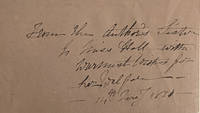
184810244London: John Murray 1848<br>. First edition. Frontispiece 10 tinted lithographs & 7 maps 4 folding. Pp. xiv 438 2pp publisher’s advertisements. 8vo. original red cloth blindstamped border gilt vignette to spine. Joints a little worn some rubbing and soiling to cloth.Booksellers label from Melbourne. <br>With a presentation inscription from Mitchell’s sister: ‘From the Author’s sister to Miss Hall with warmest wishes for her welfare’.<br>Between 1831 and 1848 Mitchell made four major expeditions into the Australian interior. Mitchell's final year long expedition sought to solve once and for all the question of the drainage of North-Eastern Australia. He set out in December 1845 with Edmund Kennedy as second in command and proceeded north into tropical Queensland. He had hoped the Barcoo River what he called the Victoria would lead all the way to the Gulf of Carpentaria and thereby provide an overland route between Sydney and Port Essington on the Gulf of Carpentaria. A very good copy with a lovely association.Ferguson 4828 Association copy belonging to the author’s sister and inscribed by her John Murray hardcover
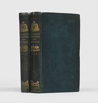
1838173536London: T. & W. Boone 1838. The deep tracks of his boat carriage quickly became their ribbon to follow to the south-west First edition of this illustrated account by the explorer who opened up the lush pastures of western Victoria to colonial settlement. His three daring expeditions added extensively to knowledge of Australia's inland waterways. This copy is from the collection of Jonathan Wantrup a leading bibliographer of Australiana with his book label on the front pastedowns. Appointed deputy surveyor-general of New South Wales in 1827 Mitchell 1792-1855 arrived in Sydney in September and began a six-year effort to produce a topographical map of the colony. His "Map of the Colony of New South Wales 1834 otherwise known as the 'map of the nineteen counties' has scarcely been equalled anywhere. It was perhaps Mitchell's greatest achievement. He determined too to extend his surveys outside the nineteen counties and though there are other reasons for his exploratory expeditions this was a major factor" ODNB. Mitchell's first expedition begun in late 1831 while his map was still in progress "explored between the Nammoi and the Gwydir and crossed the latter to strike the Barwon but there was no north-west river; all streams were clearly tributaries of the Darling. The murder by Aborigines of two of his party as they were bringing up provisions made a return to the settled colony imperative" ODNB and his party reached Sydney in February 1832. His second expedition undertaken three years later charted the course of the Darling to the point where it turned south establishing the likely region where it met the Murray. "Mitchell's third and most significant journey was undertaken ostensibly to connect the Murray with the Darling but also to explore the Murray and perhaps the country south of it. The expedition left Sydney in March 1836 and moved down the Lachlan. It was impossible to cross to the Darling so Mitchell proceeded to the Murrumbidgee and into the Murray following it down to what was thought to be the Darling junction. He traced the Darling upstream only sufficiently far to satisfy himself that it was in fact that river. Some 30 miles below the Goulburn river junction he turned off south-west. The region he then opened up he named Australia Felix now the western district of Victoria which certainly forms one of the richest tracts in Australia. At the Murray he found the country on the eve of being taken up by graziers and the deep tracks of his boat carriage quickly became their ribbon to follow to the south-west. This journey which lasted over seven months thus added greatly to the knowledge of a very fertile region of Australia" ODNB. Copies in the original cloth are nearly always found either rebacked or recased and this is a better example than most. 2 vols octavo. Frontispieces Vol. I hand-coloured 44 plates 3 hand-coloured 1 folding 5 maps and plans 3 hand-coloured 2 folding large folding map at rear with hand colouring vignette title pages illustrations and tables in text; 16 pages of publisher's advertisements at end of Vol. II. Original green vertically combed cloth recased spines lettered in gilt with gilt vignettes of kangaroos emus and aboriginal weapons boards decoratively blocked in blind yellow coated endpapers edges untrimmed binder's ticket of Remnant & Edmonds on front pastedown of Vol. I. Cloth clean light cockling and creasing small split at head of spine of Vol. II some plates foxed as usual large folding map with small splits at folds and stub rear repaired on verso: a very good set. Ferguson 2553; Hill 1165; Wantrup 124a. hardcover
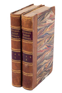
18394505219London: T. & W. Boone 1839. A little rubbed with map at end of volume 2 in poor condition and with obtrusive tape repairs. Two volumes octavo with lithographed title-pages large folding map repaired and 51 lithographed plates a few folding or coloured and small text illustrations; contemporary half calf with marbled boards. <p><p>Thomas Livingstone Mitchell was appointed to succeed Oxley as Surveyor General of New South Wales in 1828. The first expedition described here was undertaken to establish the veracity of a story spread about the colony by escaped convict George Clarke "The Barber" who claimed to have discovered a large river flowing to the north of Australia known by the Aboriginal name of Kindur. This expedition investigated the Namoi Gwydir and Barwon rivers but failed to prove or disprove the existence of the Kindur.</p> <p>The second and third expeditions were both aimed at fully determining the course of the Darling River extending on Sturt's earlier discoveries. Despite meeting hostilities with local Aboriginal tribes resulting in a retreat to Sydney and dismissing Burke's specific instructions regarding the Darling Mitchell went on to make a discovery of the greatest importance: the rich lands of western Victoria which he named Australia Felix in 1836.</p> <p>As well as being a fine surveyor Mitchell was an accomplished draughtsman and the plates in the book are all after his own drawings.</p> <p>This is the second edition revised and extended from the first publication the previous year. Despite the huge European interest in Australian exploration reflected in the number of titles published in London mid-century only Mitchell's and Sturt's journals would run into second editions.</p> </p> . Provenance: Lionel Gilbert historian with bookplate. T. & W. Boone unknown