2 375 résultats
xiv + 604pp.+ 5 folding maps loosely inserted, text in French, publisher's hardcover (green cloth with gilt lettering), dustwrapper, 25cm., in the series "Orientalia Lovaniensia Analecta" volume 72, fine condition, C88948
Very Good Turkish, Ottoman (1500-1928) Original color map. Folded. Oblong atlas folio. (50 x 60 cm). In Ottoman script. [MAP of EAST ANATOLIA] Malatya - Divrigi, Mancinik, Adiyaman, Harput. Shows Malatya, Adiyaman and Kharpout region; Firat River (Euphrates), Yazi Düzü, Erguvan etc. Scale: 1/200.000. This is one the serie of the Bonn projection maps which are the first map series in modern techniques in Turkey and the Ottoman Empire. In order to produce these maps covering Turkish territory, Reconnaissance Branch was incorporated into The Mapping Commission. The maps were produced in the datum based on the latitude and longitude of Ayasofya Mosque in equal area Bonn Projection. The field works for the 123 sheets covering the country were conducted by 76 staff. The production was completed in 18 years starting from east west. Field works continued without stopping except in years 1914 and 1920. This map series called also reconnaissance maps contributed a lot to producing 1:25.000 scale maps. Hegira: 1332 = Gregorian: 1916. Not description on map-maker. According to Türkezer & Çobanoglu: History of Mapping in Turkey-1:200.000 Scale Maps, cartographer of this map is Kambay, Cemal.
New English Original bdg. HC. Folio. (33 x 24 cm). In English and Turkish. 232 p., b/w and color ills. Black pearl, white tulip: A history of Ottoman Africa.= Siyah inci, beyaz lale: Afrika'da Osmanli asirlari. "In the year 1517, the Ottoman s under Sultan Selim I eradicated the Mamluk Sultanate from political landscape, and in its stead, took chances to interact with nations, peoples, and customs in Africaand the Middle East. Ottoman imperial authority rapidly expanded from North Africa and the Red Sea down to the continent's south. The Ottoman rule in Africa until the early 20th century has drawn scholarly analysis so narrow in scope. This edited volume, Black Pearl and White Tulip, brings together works of an international scholarship examining the administrative, commercial, cultural, and diplomatic implications of the Ottoman involvement in Africa...".
Very Good Turkish, Ottoman (1500-1928) Original color map. Folded. Oblong atlas folio. (50 x 60 cm). In Ottoman script. Shows Eastern and Southeastern parts of Anatolia; Maras, Elbistan, Birecik and Kilis areas. Hegira: 1333 = Gregorian: 1917. Not description on map-maker.
Very Good Turkish, Ottoman (1500-1928) Original color map. Folded. Oblong atlas folio. (50 x 60 cm). In Ottoman script. [MAP of EAST ANATOLIA and ARTVIN] Oltu, Artvin, Ispir, Hasankale. Shows Artvin, Ispir, Hasankale and Kars city. Scale: 1/200.000. This is one the serie of the Bonn projection maps which are the first map series in modern techniques in Turkey and the Ottoman Empire. In order to produce these maps covering Turkish territory, Reconnaissance Branch was incorporated into The Mapping Commission. The maps were produced in the datum based on the latitude and longitude of Ayasofya Mosque in equal area Bonn Projection. The field works for the 123 sheets covering the country were conducted by 76 staff. The production was completed in 18 years starting from east west. Field works continued without stopping except in years 1914 and 1920. This map series called also reconnaissance maps contributed a lot to producing 1:25.000 scale maps. Hegira: 1332 = Gregorian: 1916. Not description on map-maker.
Very Good Turkish, Ottoman (1500-1928) Original color map. Folded. Oblong atlas folio. (50 x 60 cm). In Ottoman script. [MAP of EAST ANATOLIA] Hozat, Dersim. Shows Eastern parts of Anatolia; Dersim-Horat and border of Erzincan city; Divrigi; Harput (Kharpout); Kilis; and Munzur Mountains, et alli. Scale: 1/200.000. Hegira: 1330 = Gregorian: 1914. Not description on map-maker.
Very Good Turkish, Ottoman (1500-1928) Original color map. Folded. Oblong atlas folio. (50 x 60 cm). In Ottoman script. [MAP of EAST BLACK SEA] Trabzon, Giresun, Erzincan, Ispir. Shows Trebizond, Cerasonte, Erzingan (Eriza), Suspiritis (Sper) of Erzurum (Erzeron city); mostly Black Sea shores of Trabzon and Giresun. . Scale: 1/200.000. This is one the serie of the Bonn projection maps which are the first map series in modern techniques in Turkey and the Ottoman Empire. In order to produce these maps covering Turkish territory, Reconnaissance Branch was incorporated into The Mapping Commission. The maps were produced in the datum based on the latitude and longitude of Ayasofya Mosque in equal area Bonn Projection. The field works for the 123 sheets covering the country were conducted by 76 staff. The production was completed in 18 years starting from east west. Field works continued without stopping except in years 1914 and 1920. This map series called also reconnaissance maps contributed a lot to producing 1:25.000 scale maps. Hegira: 1336 = Gregorian: 1920. Not description on map-maker. Extremely rare.
Very Good Turkish, Ottoman (1500-1928) Original color map on cloth. Folded. Oblong atlas folio. (50 x 60 cm). In Ottoman script. Shows Konya city and around, Alaiye at south. Not description on map-maker. Scale: 1: 200.000. This is one the serie of the Bonn projection maps which are the first map series in modern techniques in Turkey and the Ottoman Empire. In order to produce these maps covering Turkish territory, Reconnaissance Branch was incorporated into The Mapping Commission. The maps were produced in the datum based on the latitude and longitude of Ayasofya Mosque in equal area Bonn Projection. The field works for the 123 sheets covering the country were conducted by 76 staff. The production was completed in 18 years starting from east west. Field works continued without stopping except in years 1914 and 1920. This map series called also reconnaissance maps contributed a lot to producing 1:25.000 scale maps. Rare.
Very Good Turkish, Ottoman (1500-1928) Original color map on cloth. Folded. Oblong atlas folio. (50 x 60 cm). In Ottoman script. [MAP of MAGNESIA - AEGEAN REGION] Manisa - Soma, Izmir, Aydin cities (Magnesia, Smyrna and Tralleis) in Aegean region. It shows villages and settlements in Tayakadin of Iskenderiye. Scale: 1/25.000. Hegira: 1328 = Gregorian: 1912. This is one the serie of the Bonn projection maps which are the first map series in modern techniques in Turkey and the Ottoman Empire. In order to produce these maps covering Turkish territory, Reconnaissance Branch was incorporated into The Mapping Commission. The maps were produced in the datum based on the latitude and longitude of Ayasofya Mosque in equal area Bonn Projection. The field works for the 123 sheets covering the country were conducted by 76 staff. The production was completed in 18 years starting from east west. Field works continued without stopping except in years 1914 and 1920. This map series called also reconnaissance maps contributed a lot to producing 1:25.000 scale maps. Not description on map-maker. A very detailed map showing lakes, rivers and mountains. Extremely rare.
Very Good Turkish, Ottoman (1500-1928) Original color map. Folded. Oblong atlas folio. (50 x 60 cm). In Ottoman script. Shows Eastern parts of Anatolia; Siverek, Urfa city and border of Diyarbakir and Adiyaman cities; Siverek; Harput (Kharpout); et alli. Scale: 1/200.000. Hegira: 1333 = Gregorian: 1917. Not description on map-maker. This is one the serie of the Bonn projection maps which are the first map series in modern techniques in Turkey and the Ottoman Empire. This is one the serie of the Bonn projection maps which are the first map series in modern techniques in Turkey and the Ottoman Empire. In order to produce these maps covering Turkish territory, Reconnaissance Branch was incorporated into The Mapping Commission. The maps were produced in the datum based on the latitude and longitude of Ayasofya Mosque in equal area Bonn Projection. The field works for the 123 sheets covering the country were conducted by 76 staff. The production was completed in 18 years starting from east west. Field works continued without stopping except in years 1914 and 1920. This map series called also reconnaissance maps contributed a lot to producing 1:25.000 scale maps. Subasi is cartographer of this map according to Türkezer - Cobanoglu: History of Mapping in Turkey-1:200.000 Scale Maps.
Very Good Turkish, Ottoman (1500-1928) Original color postcard shows Tripoli War in 1911 and Arabic / Libyan tribes organized by Ottoman Turks and Italian soldiers. Can be seen Turkish / Ottoman flags. 9x14 cm. In Ottoman script and French on verso. Some traces of folding. Otherwise a good copy. [OTTOMAN PROPAGANDA / TRIPOLI / POSTCARD] Osmanlilar ile Italyanlar Trabluss muharebesinde. [i.e. Tripoli War with the Ottoman Turks and Italians]. La guerre Turco-Italienne - La bataille de Taraboulous.
1911136216Tours, Mame (1911) 1911 In-4, toile bradel éditeur, dos lisse et premier plat décoré bleu, noir et or, avec une grande vignette collée, tranches dorées, 398 pp. 18 illustrations hors texte sous serpente, dont 2 planches couleurs avec 4 clichés autochromes de G. Courtellemont & 82 figures dans le texte. Bon exemplaire.
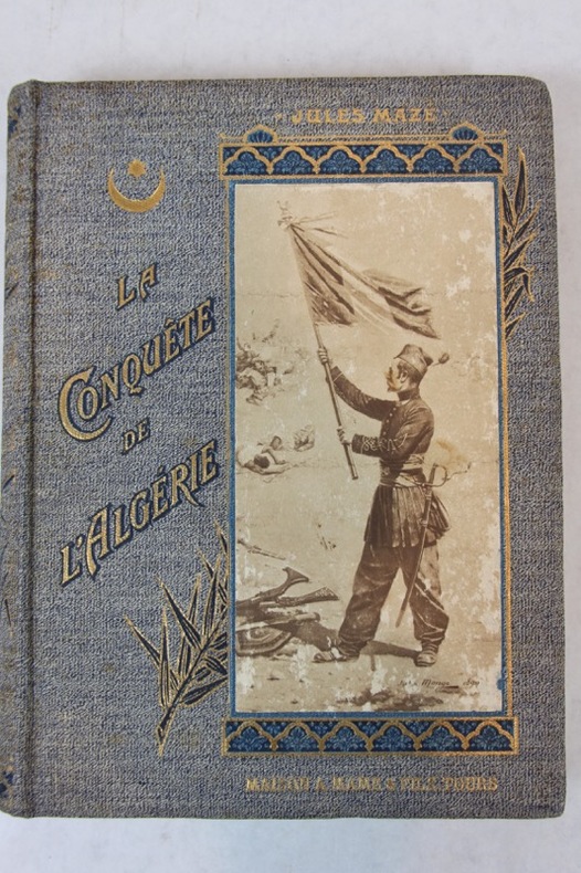
13054Les prisonniers du Gassi Touil, Campagne au Tassili, La guelta, Ouargla..... P. Berger-Levrault 1937. Petit in-4, 222 pages. Demi chagrin havane, dos à nerfs, couverture illustrée conservée.
603575Rabat, Editions Techniques Nord-Africaines, 1966-1969. 4 volumes en 7 fasc. in-8 br., figures in-texte, qq. illustr. h.-texte.
51896Paris Librairie Plon, E. Plon, Nourrit et Cie, Imprimeurs-Editeurs 1897 in 12 (18x11,5) 1 volume reliure demi veau havane de l'époque, dos à nerfs orné de fleurons dorés, pièce de titre de maroquin rouge, XII et 267 pages. Très bel exemplaire, finement relié ( Photographies sur demande / We can send pictures of this book on simple request )
19211Paris Librairie Armand Colin 1913 in 12 (19x12) 1 volume broché, XII et 500 pages, avec 3 cartes en couleurs hors-texte. Nouvelle édition. Bel exemplaire ( Photographies sur demande / We can send pictures of this book on simple request )
44293Alger Imprimerie E. Imbert 1957 in 8 (24,5x16) 1 volume reliure demi chagrin havane à coins, dos à nerfs, couvertures conservées, 315 pages (pagination continue), avec de nombreuses illustrations en noir et blanc, cartes et photographies. Tome VIII, année 1957. Renferme les bulletins: N°25, 26, 27 et 28. Bon exemplaire ( Photographies sur demande / We can send pictures of this book on simple request )
44294Alger Imprimerie E. Imbert 1958 in 8 (24,5x16) 1 volume reliure demi chagrin havane à coins, dos à nerfs, couvertures conservées, 395 pages (pagination continue), avec de nombreuses illustrations en noir et blanc, cartes et photographies. Tome IX, année 1958. Renferme les bulletins: N°29, 30, 31 et 32. Bon exemplaire ( Photographies sur demande / We can send pictures of this book on simple request )
44295Alger Imp. La Typo-Litho et J. Carbonel 1959 in 8 (24,5x16) 1 volume reliure demi chagrin havane à coins, dos à nerfs, couvertures conservées, 366 pages [1] (pagination continue), avec de nombreuses illustrations en noir et blanc, cartes et photographies. Tome X, année 1959. Renferme les bulletins: N°33, 34, 35 et 36. Bon exemplaire ( Photographies sur demande / We can send pictures of this book on simple request )
44296Alger Imp. La Typo-Litho et J. Carbonel 1960 in 8 (24,5x16) 1 volume reliure demi chagrin havane à coins, dos à nerfs, couvertures conservées, 370 pages 1 (pagination continue), avec de nombreuses illustrations en noir et blanc, cartes et photographies. Tome XI, année 1960. Renferme les bulletins: N°37, 38, 39 et 40. Relié à la suite: Table méthodique des matières du Bulletin de Liaison Saharienne, du tome I au tome XI inclus (23 pages). Bon exemplaire ( Photographies sur demande / We can send pictures of this book on simple request )
44297Alger Imp. La Typo-Litho et J. Carbonel 1961 in 8 (24,5x16) 1 volume reliure demi chagrin havane à coins, dos à nerfs, couvertures conservées, 397 pages (pagination continue), avec de nombreuses illustrations en noir et blanc, cartes et photographies. Tome XII, année 1961. Renferme les bulletins: N°41, 42, 43 et 44. Bon exemplaire ( Photographies sur demande / We can send pictures of this book on simple request )
44292Alger Imprimerie E. Imbert 1956 in 8 (24,5x16) 1 volume reliure demi chagrin havane à coins, dos à nerfs, couvertures conservées, 202 pages (pagination continue), avec de nombreuses illustrations en noir et blanc, cartes et photographies. Tome VII, année 1956. Renferme les bulletins: N°22, 23 et 24. Relié à la suite: LES NOIRS DU SOÛF, par le capitaine Roger Leselle, Supplément au Bulletin de Liaison Saharienne (1957), 76 pages. Bon exemplaire ( Photographies sur demande / We can send pictures of this book on simple request )
44298Paris Editions du Centre National de la Recherche Scientifique 1969 in 4 (28x21,5) 1 fort volume reliure toilée bleue, dos lisse, pièce de titre de cuir noir, couverture illustrée conservée, 527 pages, avec 284 figures et tableaux dans le texte, 11 planches photographiques hors texte en noir et blanc, et 6 grandes cartes volantes dépliantes dont 5 en couleurs insérées dans une pochette en fin d'ouvrage. Centre de Recherches sur les Zones Arides, série: Géologie, N°10. Envoi autographe signé par l'auteur. Bon exemplaire ( Photographies sur demande / We can send pictures of this book on simple request )
44287Neuchatel A la Baconnière 1954 in 4 (27,5x22,5) 1 volume reliure demi chagrin rouge à coins, dos à nerfs, couverture illustrée conservée, non paginé, avec de nombreuses illustrations en noir et blanc dont nombreuses photographies tirées en héliogravure, trace claire d'humidité sur les pages de gardes. Edition originale. Bon exemplaire ( Photographies sur demande / We can send pictures of this book on simple request )
1908PHO-1423Paris, Baillière, 1908. in-8, (1)f., XVIIIpp., (1)f., 316pp., (2)ff. Et 30 planches , brochage éditeur