[NEW GUINEA] ERSKINE, Commodore James EBiblio.com
853 résultats
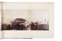
18854504633Sydney: Thomas Richards Government Printer 1885. Slight rubbing to binding in handsome & original condition; interior lightly foxed in places; map with repaired tear; images all bright and crisp. Large square folio with a folding map three coloured lithograph plates 33 original silver albumen photographs 283 x 212 mm mounted on card with printed captions and borders and two superb panoramas one of them double-page 240 x 553 mm and the other on four sheets 242 x 1053 mm; original dark blue grained morocco binding bevelled edges spine banded and sides with multiple borders in gilt front cover lettered in gilt all edges gilded. <p><p>This rare and sumptuous album published in very small numbers and illustrated with actual photographs has been called the first example of Australian photo-journalism: 'the most magnificent example of an Australian work in this genre the high point in relation to which all other examples can be considered' Holden. It is most impressive as an ethnographic album one of the first such produced in the South Pacific. A special copy was delivered to Her Majesty the Queen as "a keen supporter of photography." </p> <p>The photographs all date from the 1884 expedition when Commodore Erskine proclaimed a British protectorate over the south coast of New Guinea. Although unattributed at the time all images were made by the New South Wales Government Printing Office and were chiefly the work of Augustine Dyer 1873-1923. Principally intended as a visual record the album shows the importance of the Hood Lagoon area of Papua New Guinea in British and Australian ambitions with six depictions of the region effectively a sixth of the finished work.</p> <p>The superb series of ethnographic and exploration photographs commemorating the 1884 expedition was printed and the albums assembled in Sydney in a small edition for presentation. Sir James Erskine R.N. 1838-1911 in 1885 was Private Secretary to Lord Northbrook the first Lord of the Admiralty and became Commodore of the Australian Station in January 1882. Erskine leased "Carthona" the grand Gothic-revival house built on Darling Point in 1841 for the explorer Sir Thomas Mitchell. In the 1880s it was owned by the solicitor Arthur Mansfield Allen but he was offering it to be let fully furnished in June 1884 and Erskine is known to have been resident there soon after.</p> <p>It is a piece of photo-reportage unmatched by any other work of this time and place. Through the positioning of images of the official ceremonies alongside topographical views of the surrounding areas the photographs themselves become a true part of the narrative: the first photographic images of the meeting between Imperial forces and Hood Bay chiefs. One of the remarkable images is a scene on board HMS Nelson as Erskine addressed some of the assembled tribal elders 'Commodore addressing Chiefs on board HMS Nelson Hood Bay' one seen grasping an ebony staff. Erskine had handed out a number of the staffs to local chiefs as "an emblem of authority in the form of an ebony stick with a florin let in at the top the Queen's Head being uppermost and encircled by a band of silver" Lyne New Guinea pp. 13 114-118.</p> <p>The motivation for the Australian Squadron's to New Guinea expedition under Erskine's command was imperialistic: "The Imperial Government. decided to take steps to establish a Protectorate over that part of the southern shores of new Guinea to the east of the territory claimed by the Netherlands with the double object of preventing any foreign occupation of the country and of protecting the inhabitants from aggression.". This declaration of the expedition's objective belies the tone of much of Erskine's Narrative which reads more like a travelogue than an official account. "Picturesque" is the most often used descriptive term along with such passages as "the striking variety and beauty of the colour in the adjacent water were enchanting and struck the beholder with wonder and admiration." Similarly Erskine's own speech considered for many years as a "Declaration of Rights" for New Guinea contrasts strongly with the text of the Proclamation itself. The latter is couched in formal imperial language whereas the former looks ahead in more open terms to the real benefits that the tribesmen might expect and is very specific regarding the protection offered by Her Majesty Queen Victoria: "look upon white persons whom the Queen permits to reside amongst you as your friends .". </p> <p>A full list of the images can be seen at hordern.com.</p> <p>The photographs are: 1 "Port Moresby from the Mission Station." Four-sheet panorama. 2 "H.M.S. 'Nelson' at Port Moresby S.W." 3 "General View of Settlement at Port Moresby N.N.E." 4 "Commodore shaking hands with Native Chief 'OBE Vagi' on board H.M.S. 'Nelson' at Port Moresby." 5 "Native Village Port Moresby W." 6 "Ethel Island and landing-place at Native Village Port Moresby S.W." 7 "Native Houses Port Moresby." 8 "Native Village Port Moresby S." 9 "Native Village Port Moresby N.W." 10 "Hoisting Flag at Port Moresby N.W." 11 "Yule Island from Delena Hall Sound N.W." 12 "Landing-place at Delena Hall Sound N." 13 "Hoisting flag at Delena Hall Sound." 14 "Koloka the Queen of the Lolo Tribe at Delena." 15 "Landing at Motumotu." 16 "Landing at Motumotu." 17 "Firing the Feu de joie Motumotu." 18 "New Guinea Chief Motumotu." 19 "Native Village Kerepunu Hood Lagoon S.W." 20 "Commodore reading Proclamation at Kerepunu Hood Lagoon W." 21 "H.M.S. 'Espiegle' saluting Flag Hood Lagoon." 22 "Scene near Kerepunu Hood Lagoon N.E." 23 "A Chief's House Kerepunu Hood Lagoon S.W." 24 "Commodore addressing Chiefs on board H.M.S. 'Nelson' Hood Bay." 25 "Argyll Bay W.N.W." Two-sheet panorama. 26 "Commodore reading Proclamation at Argyll Bay N.W." 27 "H.M.S. 'Nelson' saluting Flag at Mission Station Suau Stacey Island South Cape." 28 "View from Stacey Island N." 29 "Native Village Suau S.W." 30 "Native House at Suau." 31 "View from Dinner Island China Strait - H.M. Ships 'Nelson' and 'Espiegle' at anchor N.W." 32 "View from Dinner Island S.W." 33 "Natives on board H.M.S. 'Nelson' at Dinner Island." 34 "View from Anchorage N. side of Teste Island W. by N." 35 "West end of Teste Island from Anchorage S.W."</p> </p> . Provenance: A Paré "Elgin" Durban Rd. Wynberg South Africa pencil inscription on front flyleaf. Thomas Richards, Government Printer unknown
est381T10Hand Colored 21 x 15.5 inches Typus orarum maritimarum Guineæ, Manicongo, & Angôlæ... - Delineatio orarum maritimarum, terræ vulgo indigetatæ Terra do Natal. [Amsterdam, 1596]. 2 feuilles, chacune de 390 x 530 mm. Superbe exemplaire de l'une des cartes les plus décoratives figurant la moitié sud du continent africain, gravée par van Langren pour l'Itinerario de Linschoten. Les deux feuilles sont ornées de magnifiques cartouches de titre style Renaissance. Les mers sont traversées de lignes de rhumbs, de roses des vents, de navires et de monstres marins, tandis que les terres sont décorées de petites vignettes figurant des éléphants, des lions, ainsi qu'une scène représentant l'empereur chrétien Prester John. La feuille figurant la partie ouest de l'Afrique est ornée de deux vues des possessions portugaises de Sainte-Hélène et de l'Ascension, et des armoiries du Portugal décorant le cartouche de titre en latin et hollandais. La feuille figurant la partie orientale de l'Afrique est l'une des premières à représenter cette partie de l'Afrique. Elle s'étend de Doara à R. do Infante, et montre l'ile de Madagascar. Très bel exemplaire aquarellé. Tooley, MCC n°29,
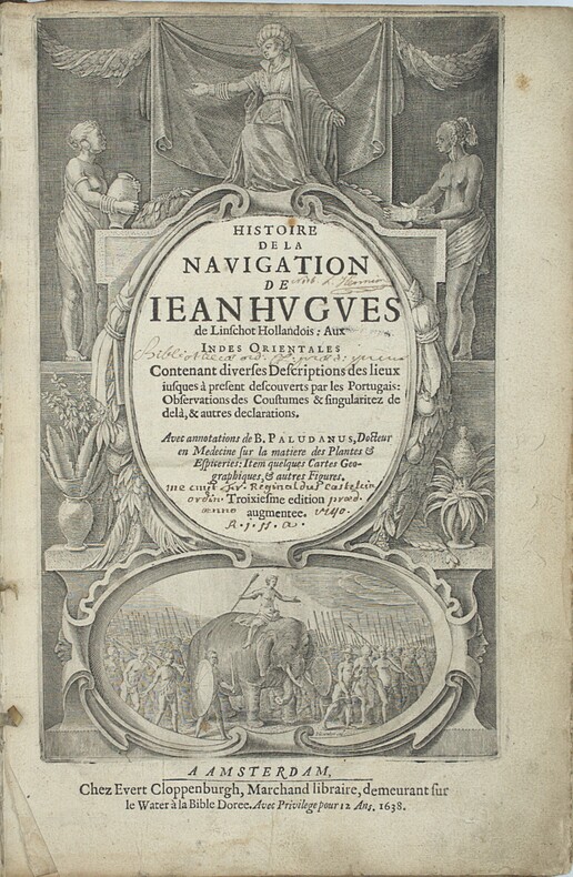
1638PHO-2460Amsterdam : J.E. Cloppenburch, 1638, in-folio, 315 x 220mm, 4pp. (titre, préface, indice des chapitres) 206pp., titre avec des figures allégoriques (Asie, Afrique Europe) et une scène d’un roi sur éléphant, illustré du portrait de l’auteur, 29 (sur 36 ) planches gravées dépliantes à double page et vues de Johann et Baptiste ven Doetecom d'aprés Linschoten , les cartes sont absentes. Titre empoussiéré, quelques taches et mouillures, le dernier feuillet détaché. Reliure en partie détachée du corps de l’ouvrage. Provenance - « Fr. Reginaldus Castelin (?) ordin. 1740 » (ex-libris manuscrit ancien). – L. Hennion (ex-libris manuscrit ancien sur une garde). Bibliographie Sabin, n°20128. Leclerc, n°363. Cordier Japonica, 222. Gay, 260
13972049Ansterdam: J. L. de Lorme, Libraire sur le Rockin à l'enseigne de la Liberté, 1698 1 volume in-12 (16,5 x 11 cm), frontispice sur cuivre gravé par B. Picart, page de titre, (8)-402 p. [la relation de voyage du sieur de Montauban occupe les p.360-402] , (2) p. (catalogue de livres nouveaux qui se trouvent chez J. L. De Lorme); page de titre (L'Art de Voyager Utilement), (2)-51 p. Reliure d'ép. dos à 4 nerfs orné, coiffe sup. et coins usés, rel. frottée, bon état. Sabin 11274.
19046480[Mali, Côte d'Ivoire, Guinée], 1904. 1904 1 vol in-8 oblong (210 x 265 mm) de : [24] ff. comportant chacun 4 photographies (95 x 65 mm) et 1 supplémentaire (110 x 65 mm) collée au dos sur dernier plat. Un total de 97 photographies. Pleine toile de percaline rouge à dos et à coin estampés à froid, titre orné Kodak Souvenirs sur le premier plat, dos muet.
210600Paris, Durand, Pissot, 1751 2 parties en un vol. in-12, x-258-[2]-314 pp., avec 5 planches zoologiques hors-texte, basane fauve marbrée, dos à nerfs orné de fleurons à froid, armes en pied, encadrement de simple filet à froid sur les plats, armes au centre, tranches mouchetées (reliure de l'époque). Coiffes et mors restaurés.
171411152A Paris, chez Arnoul Seneuze et chez Raoul Morel, 1714. In-12 de [12]-298 pages, pleine basane mouchetée, dos à 5 nerfs orné de fleurons, étoiles, roulettes, filets et titre dorés, étiquette de titre bordeaux, tranches mouchetées. Ex-libris Abraham Diodati au verso du titre. Mors fendus en tête et en queue, quelques rousseurs.
Incisione in rame (mm. 525x630), abilmente dipinta da mano coeva, verso velato da finissimo foglio di carta Giappone. Bella e rara carta nautica, tratta dal celebre atlante di De Witt ''Orbis Maritimus ofte Zee Atlas": la mappa si estende dal Senegal a nord fino all'Angola a sud, centrata sulla Baia di Guinea. Le indicazioni toponimiche e le caratteristiche geografiche sono strettamente limitate alle coste. Rosa dei venti, linee lossodromiche e splendido cartiglio, in alto, dove commercianti olandesi contrattano per gli schiavi ammanettati con i capi indigeni. Sullo sfondo si può vedere una fornace che fonde quello che presumibilmente è oro. L'abile rinforzo con carta Giappone evita il deperimento da acidità ai verdi e marroni; quindi l'esemplare si presenta in ottimo stato, anche grazie alla splendida coloritura del cartiglio. "Frederick de Wit deve essere considerato uno dei più importanti editori di mappe della seconda metà del XVII secolo. La maggior parte delle sue mappe sono di ottima qualità, sono caratterizzate da un'incisione chiara e bella, dall'attualità e ricchezza dell'immagine cartografica nonché dall'equilibrio delle decorazioni cartografiche". (Lexikon der Kartographie II, p. 899), Koeman M. Wit 1, 27. Koeman, Atlantes Neerlandici, IV, pp.191 e 518-519. Shirley 444. Putnam, Early sea charts, 75.. .
1802PHO-1460Paris, Henri Agasse, 1802 , TEXTE et ATLAS , texte : 2 vol. in-8 de LVI-359-[1]-383pp. ,relié demi cuir , dos lisse avec titre et tomaison, plats frottés , coins et coupes usés , manque la page de titre ,XXXI,XXXV à XLVIII , 334 à 337 au tome 1 et les page 245 à 252 au tome 2 et Un ATLAS in-4°, viii-[4]-67 pp.; 43 planches (44), relié demi veau , dos lisse , quelques défauts à la reliure , petites rousseurs à l’atlas et papier légèrement bruni.
13971466Wien: Seidel & Sohn, 1933 2 vol.in folio (33x26 cm), tome 1: xi-303 page, 12 planches hors texte en couleurs, 67 illustrations dans le texte; tome 2: 400 illustrations hors texte. Reliure toile éditeur, titre doré sur les dos et les premiers plats, infimes usures, légères taches au dos du 2 ème volume, autrement très bon exemplaire. Rare.
13969827Paris: chez Durand, chez Pissot, 1751 2 parties en 1 vol. in-12, x-258 et [2]-314 pages, 5 planches se dépliant, 6 planches ajoutées. Reliure plein veau brun d'époque, dos à 5 nerfs orné de caissons et de fleurons dorés, pièce de titre de maroquin rouge, tranches rouges, roulettes dorées sur les coupes, bel exemplaire. Edition originale de la traduction française. Ouvrage enrichi de la suite complète des planches dépliantes gravées sur cuivre par N. B. de Poilly, issue de Histoire de la Jamaïque, par Sloane, publiée la même année. L'auteur fut envoyé en 1726 par la Royal African Company pour lever les plans de ses forts sur la côte de Guinée. (Sabin, 84561).
161918935Frankfurt: Blaeu 1619. Scarce copper engraved map of the northwest coastline of New Guinea and Moluccas showing the track of the Dutch explorers Le Maire and Schouten in 1616 in the ships Eendracht and Hoorn. The two explorers made the third complete circumnavigation and were the first to round Cape Horn from the east a more efficient way to get to the East Indies and thus a significant threat to the monopoly held by the Dutch East India Company. The expedition was headed for Batavia which it reached in October of 1616. The Dutch governor there obliged them by confiscating their cargo and sending them back to Holland but Schouten published his journals and now the word on the Drake Passage was out. With title cartouche in Dutch Latin and French. With two compass rose and sailing ship. From Schouten's account of his and Le Maire's first rounding of Cape Horn. Slightly toned otherwise very good condition. Blaeu unknown
1837REIS0786Leipzig, im Industrie-Comptoir (Baumgärtner) 1835-1837. 2 Bde. 4°. IV, VIII S., 408 S., mit 2, davon e. dopplblattgr., gest., Karten, (Taf. 51 u. 72), 1 mehrf. gef., gest. Karte, mit 71 parallel gezählten (V, 1-50. 52-71), ganzseitig illustrierten Seiten mit je vier Motiven; 1 gest. Taf., IV S., 370 S., mit 1 Karte (Taf. 2), 1 mehrf. gef., gest. Karte, mit 69 parallel gezählten (1. 3-70) ganzseitig illustrierten Seiten mit je drei oder vier Motiven bzw. einer Karte, sowie einer Textillustration. Pappbände d. Zeit, mit Rückenbeschriftungen von alter Hand und goldgeprägten Rückenschildchen, Buchschnitte mit verblasster Marmorierung, Ecken bestoßen, berieben, entlang der Gelenke schadhaft, zweiter Band etwas fleckig. Seiten insgesamt wenig vergilbt, vereinzelt gebräunt u. mäßig fleckig, mit wenigen Blatteinrissen. Sabin V,574. Engelmann. Bibliotheca geographica 99 - zweibändige, reich illustrierte, deutsche Übersetzung der 'Voyage pittoresque autour du monde', einer Sammlung von Berichten über berühmte Entdeckungsfahrten und Forschungsreisen, herausgegeben von Jules Dumont d'Urville (1790-1842), französischem Seefahrer und Entdeckungsreisenden. Der Schriftsteller und Redakteur Johann August Diezmann (1805-1869) übersetzte zahlreiche Werke aus dem englischen und französischen und gab zwei Taschenwörterbücher und mehrere Zeitungen und Zeitschriften heraus. Die Landkarten des ersten Bandes zeigen Hawai, Taiti (Tahiti) und eine Weltkarte, die des zweiten die Tonga Inseln, Neuseeland und den Pazifik. [3 Warenabbildungen]
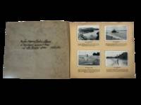
1936230101936. Neuendettelsau Mission publisher. Bilder aus der Neuguinea Mission late 1920s-mid 1930s documents German Protestant missionary activity and Indigenous life in New Guinea during the interwar period following the end of formal German colonial rule. Produced as a cigarette card album with printed German captions the work records village life subsistence practices missionary institutions and ceremonial activity situating Indigenous communities within a visual framework shaped by religious and colonial perspectives. The album supports research into Pacific history missionary networks and the role of photography in documenting and interpreting Indigenous societies under colonial influence.<br /> <br /> Oblong album containing a substantial series of mounted photographic cigarette cards on captioned leaves with printed German text throughout. The cover title reads "Bilder aus der Neuguinea-Mission" and includes a commemorative image captioned "Gedenkt des 50 jährigen Jubiläums der Neuendettelsauer Mission auf Neuguinea!" depicting three Indigenous men in traditional dress with spears. The album includes numerous images of daily life in coastal New Guinea including fishing hunting boat building village environments and ceremonial gatherings with captions such as "Mit Pfeil und Bogen" and "Mit dem Jagenetz" describing subsistence practices. Additional images depict mission infrastructure including churches schools workshops and settlements alongside scenes of education labor and communal activity. Photographs are systematically arranged and mounted presenting both ethnographic subjects and missionary-built environments within a unified visual sequence.<br /> <br /> The album was produced during a transitional period when German missionary societies continued operations in New Guinea under Australian administration after World War I maintaining institutional presence despite the loss of formal colonial control. The Neuendettelsau Mission founded in Bavaria in the nineteenth century had established networks of religious and educational institutions in the region contributing to broader systems of cultural transformation and documentation. The images reflect both local practices and the interpretive framework imposed by missionary observers revealing how photography functioned within colonial and religious contexts to classify record and disseminate knowledge about Indigenous populations. Mild toning foxing and edge wear to covers and pages; cards remain securely mounted with images largely clean and crisp; overall very good condition. This album provides sustained visual documentation of missionary activity and Indigenous life in New Guinea during the interwar period. unknown
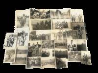
1940230081940. Photographs of Indigenous communities in New Guinea during World War II document direct encounters between local populations and United States military personnel as Allied forces established operational infrastructure across the island beginning in 1942. Taken in the early to mid 1940s these images record the presence of Indigenous men women and children alongside uniformed servicemen situating them within a major Pacific theater of war where military expansion reshaped local environments and social conditions. The archive supports research into Indigenous history wartime contact zones and the impact of global conflict on colonial territories.<br /> <br /> Archive consists of 26 original black and white photographic prints likely silver gelatin depicting group portraits staged encounters and environmental views in New Guinea. Multiple images show Indigenous individuals arranged in lines or clusters often positioned with U.S. servicemen standing behind or among them indicating organized or facilitated photographic documentation. Dress and adornment vary with women wearing traditional skirts and beadwork and men and children appearing in customary attire. Several photographs include visible military infrastructure including aircraft fuselages transport planes and trucks suggesting proximity to airstrips supply depots or forward bases. A group of images captures a ceremonial dance or ritual with participants wearing elaborate headdresses and woven garments photographed in mid action.<br /> <br /> These photographs were produced during a period when New Guinea became a strategic center of Allied military operations in the Pacific bringing new systems of transportation labor demands and administrative control into Indigenous regions. Wartime conditions altered patterns of daily life through the introduction of foreign personnel the construction of military facilities and the expansion of colonial oversight. Visual documentation of these encounters reflects both the logistical realities of military presence and the asymmetrical relationships between Indigenous communities and external authority. Minor handling wear and edge wear with occasional fading; overall very good condition. This archive provides primary visual documentation of wartime contact between Indigenous populations and Allied forces in New Guinea during World War II. unknown
2002Adhya-9781402002281Springer 2002. Paperback. New. Springer paperback
2002Adhya-9781402002281Springer 2002. Paperback. New. Springer paperback
1748SB-06113Leipzig, bey Arkstee und Merkus, 1748. Titelfortsetzung: ... in Ansehung ihrer verschiedenen Reiche und Länder; deren Lage, Größe, Gränzen, Eintheilungen, Himmelsgegenden, Erdreichs, Früchte, Thiere, Flüsse, Seen, Gebirge, großen und kleinen Städte, Häfen, Gebäude u. s. w. wie auch der Sitten und Gebräuche der Einwohner, ihrer Religion, Regierungsart, Künste und Wissenschaften, Handlung und Manufacturen, enthalten ist: Mit nöthigen Landkarten nach den neuesten und richtigten astronomischen Wahrnehmungen und mancherley Abbildungen der Städte, Küsten, Aussichten, Thiere, Gewächse, Kleidungen, und anderer dergleichen Merkwürdigkeiten versehen; Durch eine Gesellschaft gelehrter Männer im Englischen zusammen getragen und aus demselben ins Deutsche übersetzt. Deutsche Ausgabe, basierend auf der in vier Bänden herausgegebenen englischen Originalausgabe "New general collection of voyages and travels" (1745 - 1747) sowie der französischen "Historie generale des voyages", die zwischen 1746 und 1791 in insgesamt 20 Bänden erschien. Mit 35 ganzseitigen bzw. faltbaren Kupfertafeln und -karten (alle vorhanden). 12 Bl., 668 S., Geographisches Verzeichnis der in dem dritten Bande erwähnten Inseln, Länder, Städte und andern Oerter; (5 Bl.); Register der in diesem Bande vorkommenden Sachen ( (23 Bl.). Inhalt: Das VI: Buch: Reisen längst der westlichen Küste von Africa, von dem weißen Vorgebirge bis nach Sierra Leone; welche insbesondere eine Nachricht von der englischen Niederlassung, und ihrer Handlung an dem Flusse Gambra oder Gambia, nebst der Erdbeschreibung der natürlichen Historie der benachbarten Länder enthalten. Das VII. Buch: Reisen nach Guinea und Benin, welche die Küste von Sierra Leone bis zu dem Vorgebirge Lope Gonsalvo in sich fasse. Das VIII. Buch: Beschreibung von Guinea, nebst der Erdbeschreibung, der Natur- und politischen Geschichte. Original-Ganzlederband mit sechs echten Bünden, goldgeprägtem Rückentitel sowie aufwendiger ornamentaler Goldprägung. Großformat 25,5 x 20,5 cm. Marmorierter Buchschnitt. Der prächtige Band befindet sich in sehr schönem stabilen Zustand. Rücken mit kleinen Stoßspuren, ein Gelenk oben etwas eingekerbt, unteres Kapital mit leichtem Abrieb. Auch innen sehr gutes Exemplar, wenige Seiten etwas gebräunt oder geringfügig fleckig, die meisten Seiten fleckenfrei, sehr gute Papierqualität.
334 pages including index. "The thrust of this challenging book is that America is the first society to move beyond the industrial age into the new "technetronic" era, and that this transition affects directly both our international and our domestic problems. Part 1 describes the impact of the scientific revolution on world affairs in general and on the Third World in particular, and exposes the ambiguous position of its principal disseminators, the US. Part 2 examines how this has effected the content, style, and format of man's political outlook on his global reality. Part 3 assesses the contemporary relevance of communism to the problems of modernity. Part 4 focuses upon the US, a society that is both a social pioneer and a guinea pig for mankind, and examines the crisis of American institutions and values during the current transition - as well as the challenge posed by the New Left. Part 5 outlines in broad terms the general direction the US might take in order to make an effective response to its foreign and domestic dilemmas." - from dust jacket (not included). "This is one of the most original books on political and social thought to appear in recent years. The author projects the impact of technology and electronics on the political and social values of the United States, the Soviet Union and other 'post-industrial' states. As a study of global society in transition, this seminal work is bound to elicit major controversy and will be difficult to ignore." - Foreign Affairs. Bit of soiling to fore-edge else clean and unmarked with light wear. Light wear to dust jacket now preserved in archival-grade Brodart. A quality copy. Book
193057796Paris: Société d'Éditions Géographiques Maritimes et Coloniales 1930. First edition. Folding map. 114 pp plates 350 pp. 1 vols. 4to. Original wrappers. Bottom third of spine missing else Near Fine. First edition. Folding map. 114 pp plates 350 pp. 1 vols. 4to. Société d'Éditions Géographiques, Maritimes et Coloniales unknown
193057796Paris: Société d'Éditions Géographiques Maritimes et Coloniales 1930. First edition. Folding map. 114 pp plates 350 pp. 1 vols. 4to. Original wrappers. Bottom third of spine missing else Near Fine. First edition. Folding map. 114 pp plates 350 pp. 1 vols. 4to. Société d'Éditions Géographiques, Maritimes et Coloniales unknown books
170017369Amsterdam, de Wit, 1675 (recte um 1700). Ca. 49,5 cm x 57 cm. [4 Warenabbildungen]
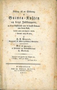
182256812Kbh. 1822. 8vo. Senere blått kartonasjebind. Ubeskåret. XXVIII 382 2 s. Trykt hos Andreas Seidelin. Dansk. <br/><br/><em>Materien noe gulplettet. </em> unknown
1960153973London: Contemporary Films 1960. Eight vintage double weight studio still photographs from the 1960s UK re-release of the 1934 French film. Manuscript ink annotations identifying scenes on the versos. <br /> <br /> From the archive of film historian and author Joel Finler. <br /> <br /> A classic of French cinema Jean Vigo's only theatrical feature a film that in the minds of many including Francois Truffaut predicted and even helped define the French New Wave that would come 20 years later. <br /> <br /> Shot on location in Paris Yvelines and Seine-Maritime France. <br /> <br /> 10 x 8 inches. Four Near Fine four Very Good plus with faint dampstains to the bottom edges.<br /> <br /> Ebert I. Rosenbaum 1000. Contemporary Films unknown