148 résultats
179232BBO.O., 1792. XVI, 456 Seiten, 1 mehrfach gefaltetes, gestochenes Frontispiece. Lederband der Zeit. Band 1 (von 2)
17657-3-380Lemgo, Meyerische BH, 1765. 8°, mit gest. Frontispiz (Grundriß des Escurials), 23 Bll., 766 S., 1 Bl., HLdr. d. Zt. mit Rvg
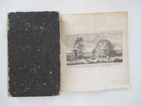
18001559AG1800 (ca.). altkolorierte Aquatinta, alt montiert. 17 x 23 (H), montiert. Blatt: 24 x 28 cm. gut erhalten. Auf Wunsch Digitalaufnahme in jpg-Format erhältlich- photo in jpg-format available. Je nach Versandart können die Portokosten bis zu 2 ? weniger als angegeben betragen.+
175411579ABGöttingen, Vandenhöck, 1754. 20,5 : 12,5 cm. 15 hojas, 340 páginas, 8 hojas Con láminas grabadas plegadas y un mapa grabado y plegado. Tapas de carton de época.
175411579AB1754. Göttingen Vandenhöck 1754. 205 : 125 cm. 15 hojas 340 páginas 8 hojas Con láminas grabadas plegadas y un mapa grabado y plegado. Tapas de carton de época. Primera edición en Aleman. - Armstrong describe la historia geografia y folkore Cleghorn describe la vegetación de la isla. - Sammlung neuer und merkwürdiger Reisen zu Wasser und zu Lande vol. 8. - El mapa con arrugas encuadernación rozada. - Palau 133052. unknown
170926835-zb3g15O.O.: o. Dr. 1709. 8 Blatt. Ohne Einband (am rechten unteren Rand ein durchgehender Tintenfleck, sonst gutes und sauberes Exemplar). 8°. broschiert/ Taschenbuch
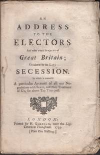
173932845London: Printed for H. Goreham 1739. Wraps. Very good. Stitched untrimmed wraps. 63 pages. iv 63 pages 1 page blank. The author defends the British policy against Spain to those who are sympathetic to Spain. Contents discusses interference with American trade and makes reference to the Negro population. <br /> <br /> Sabin 72044. Printed for H. Goreham unknown
170211998Utrecht Anthoni Schouten 1702. titelprent 2 96 774 46 p. Opnieuw gebonden Perkament 4° Titelprent en titelpagina aan de binnenzijde geplakt verder een goed exemplaar opnieuw gebonden in de originele band. Jean d'Espagne 1591-1659 was een Frans predikant o.a. in Den Haag en Londen. Utrecht, Anthoni Schouten unknown
176042872ABHalle, Johann Justin Gebauer, 1754-1760. 8 in 4 Bdn. 4°. Mit 1 Front., 8 gest. Titelvignetten u. 10 (davon 8 gef.) Karten. Leder. Rückenschild u. Rückenvergold. Stärker ber, best. u. abgeschabt, Kapit. m. Fehlst. u. gestaucht. Etw. gebr. u. tls. stockfl., 1 Bd. wasserrandig u. stockfl., insgesamt solider Zustand.
172515318BBAmsterdam, Reiner und Joshua Ottens, (ca. 1725). Plattengrösse: 51,8x60,3 cm. Blattgrösse: 55,3x64 cm. Kolor. gestoch. Karte, gefaltet.
1772N911London, Lockyer Davis, 1772. Dritte englischsprachige Ausgabe des bahnbrechenden Berichts über die Expedition zur Erforschung von Erdumfang und -krümmung in Südamerika. Verfasst vom spanischen Mathematiker Jorge Juan de Santacilia (1712-1774) und dem Admiral und Statistiker Antonio de Ulloa (1716-1795) gehört das im 1748 zuerst in spanischer Sprache erschienene Werk (erste englische Ausgabe 1758) zu den am besten und weitestgehend wissenschaftlich zuverlässig dokumentierten Forschungsberichten des 18. Jahrhunderts.?This voyage arose out of the desire of the French Government (through the Academy of Sciences at Paris) to send certain members of the Academy of Sciences to measure a degree of longitude in the equinoctial countries of Peru. This request was not only accorded in the most courteous manner, but the King of Spain conceived the idea of sharing the honor of a scheme devoted to the advancement of knowledge, and sent two of the most scientific officers of the Spanish navy to accompany the expedition. This party carried on a series of operations of unexampled difficulty and encountered hardships and sufferings which demanded the strength of the strongest constitutions and the energy of minds stimulated by a love of science. Much information was collected and published, which has been reproduced in other works on South America" (Cox). ?Leur mission était de déterminer la figure et la grandeur de la Terre. Ils choisirent le pays de Quito, situé sous la ligne équinoxiale, pour le théâtre de leurs observations. Ils débarquèrent en 1736, et commencèrent à mesurer les degrés terrestres près de l'équateur" (Hoefer). Die feingestochenen Tafeln zeigen Karten, Pläne und Einwohner von Porto Bello, City of Quito, Cartagena de los Indios, Lima, Callao etc., eine Tafeln mit einem atemberaubendem Vulkanausbruch, dem Transport eines Pferdes in einer Seilbahn über einen reißenden Fluss, idyllische Eingeborenenhütten und Kolonialarchitektur, Landschaftsansichten, Tierdarstellungen (Lamas), Instrumente zur Bearbeitung der Erde, von Eisen etc., Schiffe und vieles mehr. Die Karten sind sehr detailreich und fein gestochen. Nur leicht gebräunt, kaum fleckig, wenige unwesentliche Papierläsuren, insgesamt schönes Exemplar in sehr schönen, stilvollen Einbänden eines wahrhaften Meisterbuchbinders. Aus der Bibliothek von "Samuel Eliot Morison" mit dessen Exlibris. [2 Warenabbildungen]
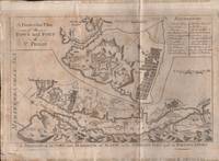
175634755Britain: n.p. 1756. Map. Fair. Approx. 11" x 8" map. Vertical crease. Light foning to the paper. Edges on the verso have a thin paper reinforcement. Bottom left corner tear. Fair condition. <br /> <br /> From the British Museum: Map of the town and harbour of Mahon with a larger scale plan of the town and fort of St. Philip inset above. Etching and engraving dated 1756. No publisher information. Subject term: Naval Engagements. Places include Europe Spain Balearic Islands Menorca Mahón. n.p. unknown
1720910204CGAugsburg:, Jeremias Wolff, 1720. Kupferstich Blattgröße 48,5 x 39 cm.
1720910205CGAugsburg:, Jeremias Wolff, 1720. Kupferstich Blattgröße 46,5 x 38,5 cm.
1720910203CGAugsburg:, Jeremias Wolff, 1720. Kupferstich Blattgröße 48 x 37 cm.
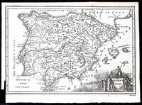
1748372040Printed for T. Osborne in Gray's Inn; A. Miller in the Strand; and J. Osborn in Paternoster Row London 1748. Unframed Print. Very Good Condition. This 1748 map provides a detailed representation of ancient Spain highlighting key regions cities and geographical features as understood in the 18th century. It was engraved by Isaac Basire a well-known cartographer and engraver of the time. The map was printed in London by T. Osborne A. Miller and J. Osborn.1 folding plate. Close cropped at the left margin. Size: 20 x 30 cms. Category: Universal History; PRINTS : Antiquarian Interest; Printed before 1800; Special Features. This item may require more postage than the rates shown for delivery outside the UK. If extra postage is required we will contact you before processing your order and you will be given the details and option to decline the extra cost. Printed for T. Osborne, in Gray's Inn; A. Miller, in the Strand; and J. Osborn, in Paternoster Row unknown
173018637(Augsburg), Seutter, um 1730. Ca. 50 cm x 58 cm. [2 Warenabbildungen]