Scotland, LochlomondBiblio.com
154 résultats
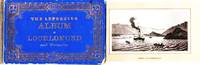
1880037828Glasgow: L&R / James Reid Bookseller 1880. First Edition. Decorated Boards. Very Good. 12 lithographed views from photographs printed on 12 panels accordion-fold leporello format. Brief captions. Views include: Lochlomond from Mount Misery; Ascent of Benlomond; Eilen's Isle Lake Katrina; Loch Achray and Ben Venue with the Trosachs Hotel; Brig o' Turk; Doune Castle; &c. Folds into cloth-backed blue boards decorated in gilt. 3.25" x 5" Not recorded by WorldCat. L&R / James Reid, Bookseller unknown
1892146437Edinburgh : Blackwood 1892. First Edition. Hardback. Fine copy in the original paper-labelled cloth. Slightest suggestion only of dust-dulling to the panel edges. Remains particularly well-preserved overall; tight bright clean and strong. ; 1 pages; Physical desc. : 261p. Subject: Municipal government -- Scotland. Great Britain. Laws statutes etc. 1837-1901 Victoria . Command paper. Edinburgh : Blackwood hardcover
1878260184Edinburgh : H. M. General Register House 1878. First Edition. Hardcover. Worn copy bound in half leather over marble boards with gilt-blocked label to the spine. Some minor wear and tear to the spine and boards along with some dust-toning. Remains well-preserved overall; bright clean and sharp-cornered. Physical description; cxxvi 697 p. ; 26 cm. Notes; Includes bibliographical references and index. Latin documents with English introduction and notes. Subjects; Scotland. Court of Exchequer — Public records. Finance Public — Scotland — History. Scotland — History — 1057-1603 — Sources. Edinburgh : H. M. General Register House hardcover
1884260188Edinburgh : H. M. General Register House 1884. First Edition. Softcover. Poor copy in the original stiff-card wrappers; wear and tear as with age. Text remains in fine condition and without blemish. Physical description; xviii 774 p. ; 26 cm. Notes; Includes bibliographical references and index. Latin documents with English introduction and notes. Subjects; Scotland. Court of Exchequer — Public records. Finance Public — Scotland — History. Scotland — History — 1057-1603 — Sources. Edinburgh : H. M. General Register House paperback
1877260181Edinburgh : H. M. General Register House 1877. First Edition. Hardcover. Worn copy bound in half leather over marble boards with gilt-blocked label to the spine. Some minor wear and tear to the spine and boards along with some dust-toning. Remains well-preserved overall; bright clean and sharp-cornered. Physical description; clxxxiv 720 p. 1 leaf of plates : facsim. ; 26 cm. Notes; Includes bibliographical references and index. Latin documents with English introduction and notes. Subjects; Scotland. Court of Exchequer — Public records. Finance Public — Scotland — History. Scotland — History — 1057-1603 — Sources. Edinburgh : H. M. General Register House hardcover
1880260176Edinburgh : H. M. General Register House 1880. First Edition. Hardcover. Worn copy bound in half leather over marble boards with gilt-blocked label to the spine. Some minor wear and tear to the spine and boards along with some dust-toning. Remains well-preserved overall; bright clean and sharp-cornered. Physical description; cvi 779 p. ; 26 cm. Notes; Includes bibliographical references and index. Latin documents with English introduction and notes. Subjects; Scotland. Court of Exchequer — Public records. Finance Public — Scotland — History. Scotland — History — 1057-1603 — Sources. Edinburgh : H. M. General Register House hardcover
1880260187Edinburgh : H. M. General Register House 1880. First Edition. Softcover. Poor copy in the original stiff-card wrappers; wear and tear as with age. Text remains in fine condition and without blemish. Provenance; from the library of the Lords Commissioners of Her Majesty's Treasury with its bookplate. Physical description; cvi 779 p. ; 26 cm. Notes; Includes bibliographical references and index. Latin documents with English introduction and notes. Subjects; Scotland. Court of Exchequer — Public records. Finance Public — Scotland — History. Scotland — History — 1057-1603 — Sources. Edinburgh : H. M. General Register House paperback
1878260185Edinburgh : H. M. General Register House 1878. First Edition. Hardcover. Worn copy bound in half leather over marble boards with gilt-blocked label to the spine. Some minor wear and tear to the spine and boards along with some dust-toning. Remains well-preserved overall; bright clean and sharp-cornered. Physical description; cxxvi 697 p. ; 26 cm. Notes; Includes bibliographical references and index. Latin documents with English introduction and notes. Subjects; Scotland. Court of Exchequer — Public records. Finance Public — Scotland — History. Scotland — History — 1057-1603 — Sources. Edinburgh : H. M. General Register House hardcover
1880260177Edinburgh : H. M. General Register House 1880. First Edition. Hardcover. Worn copy bound in half leather over marble boards with gilt-blocked label to the spine. Some minor wear and tear to the spine and boards along with some dust-toning. Remains well-preserved overall; bright clean and sharp-cornered. Physical description; ccxiv 781 p. 1 fold. leaf of plates : facsim. ; 26 cm. Notes; Includes bibliographical references and index. Latin documents with English introduction and notes. Subjects; Scotland. Court of Exchequer — Public records. Finance Public — Scotland — History. Scotland — History — 1057-1603 — Sources. Edinburgh : H. M. General Register House hardcover
1878260174Edinburgh : H. M. General Register House 1878. First Edition. Hardcover. Worn copy bound in half leather over marble boards with gilt-blocked label to the spine. Some minor wear and tear to the spine and boards along with some dust-toning. Remains well-preserved overall; bright clean and sharp-cornered. Physical description; cxxvi 697 p. ; 26 cm. Notes; Includes bibliographical references and index. Latin documents with English introduction and notes. Subjects; Scotland. Court of Exchequer — Public records. Finance Public — Scotland — History. Scotland — History — 1057-1603 — Sources. Edinburgh : H. M. General Register House hardcover
1880260189Edinburgh : H. M. General Register House 1880. First Edition. Softcover. Poor binding copy in the original stiff-card wrappers; wear and tear as with age. Text remains in fine condition and without blemish. Provenance; from the library of the Lords Commissioners of Her Majesty's Treasury with its bookplate. Physical description; ccxiv 781 p. 1 fold. leaf of plates : facsim. ; 26 cm. Notes; Includes bibliographical references and index. Latin documents with English introduction and notes. Subjects; Scotland. Court of Exchequer — Public records. Finance Public — Scotland — History. Scotland — History — 1057-1603 — Sources. Genre; Illustrated. Edinburgh : H. M. General Register House paperback
1851200139AG1851. London & New York John Tallis & Company 1851. Large Original steel engraving / Vintage map. Drawn and engraved by John Rapkin. Illustrated and Engraved by D. Pound. Plate Size: 51 cm x 36.5 cm. Sheet Size: 51.5 cm x 37.2 cm. Vintage 19th century map / city-plan in very good condition. This Map is beautifully framed. Price includes worldwide free shipping per UPS Courier Framed. Published in the Illustrated Atlas And Modern History Of The World Geographical Political Commercial & Statistical Edited By R. Montgomery Martin. Handsome town-plan of Edinburgh in Scotland. The The Water of Leith can be seen running through Scotland's capital city. Railways street and district areas of the city are also included. The Salisbury Crags Carlton Hill and the Castle Rock are all shown. Decorative scrolling and title cartouche around the edges of the map. One of the few double page plans published by Tallis. The project of 'The Illustrated Atlas' was designed to be finished just in time for the anxiously awaited "Great Exhibition of the Works of Industry of All Nations" or The Great Exhibition sometimes referred to as the Crystal Palace Exhibition in reference to the temporary structure in which it was held was an international exhibition that took place in Hyde Park London from 1 May to 11 October 1851. It was the first in a series of World's Fairs exhibitions of culture and industry that became popular in the 19th century and it was a much-anticipated event. The Great Exhibition was organized by Henry Cole and Prince Albert husband of the reigning monarch Queen Victoria. It was attended by numerous notable figures of the time including Charles Darwin Samuel Colt members of the Orléanist Royal Family and the writers Charlotte Brontë Charles Dickens Lewis Carroll George Eliot and Alfred Tennyson. Music for the opening was under the direction of Sir George Thomas Smart and the continuous music from the exhibited organs for the Queen's procession was "under the superintendence of William Sterndale Bennett". Wikipedia unknown
1851200138AG1851. London & New York John Tallis & Company 1851. Original steel engraving / Vintage map. Drawn and engraved by John Rapkin. Illustrated and Engraved by H. Winkles. Plate Size: 48 cm x 36 cm. Sheet Size: 52.5 cm x 37.2 cm. Vintage 19th century map / city-plan in very good condition. Published in the Illustrated Atlas And Modern History Of The World Geographical Political Commercial & Statistical Edited By R. Montgomery Martin. Handsome town-plan of Glasgow in the West Central Lowlands of Scotland. The River Clyde can be seen running through the industrial city being joined by the smaller River Kelvin in the lower left corner. Canals railways street and district areas of the city are also included. The coat of arms of the City of Glasgow is present on the map. Decorative scrolling and title cartouche around the edges of the map. One of the few double page plans published by Tallis. The project of 'The Illustrated Atlas' was designed to be finished just in time for the anxiously awaited "Great Exhibition of the Works of Industry of All Nations" or The Great Exhibition sometimes referred to as the Crystal Palace Exhibition in reference to the temporary structure in which it was held was an international exhibition that took place in Hyde Park London from 1 May to 11 October 1851. It was the first in a series of World's Fairs exhibitions of culture and industry that became popular in the 19th century and it was a much-anticipated event. The Great Exhibition was organized by Henry Cole and Prince Albert husband of the reigning monarch Queen Victoria. It was attended by numerous notable figures of the time including Charles Darwin Samuel Colt members of the Orléanist Royal Family and the writers Charlotte Brontë Charles Dickens Lewis Carroll George Eliot and Alfred Tennyson. Music for the opening was under the direction of Sir George Thomas Smart and the continuous music from the exhibited organs for the Queen's procession was "under the superintendence of William Sterndale Bennett". Wikipedia unknown
1851200128AG1851. London & New York John Tallis & Company 1851. Original steel engraving / Vintage map. Drawn and engraved by John Rapkin. Illustrated and Engraved by H. Winkles. Plate Size: 33 cm x 25 cm. Sheet Size: 37.5 cm x 27 cm. Vintage 19th century map in very good condition. Published in the Illustrated Atlas And Modern History Of The World Geographical Political Commercial & Statistical Edited By R. Montgomery Martin. Handsome town-plan of Perth in central Scotland bordered to the south by the River Tay. Railway street and district areas of the city are also included. Decorative scrolling and title cartouche around the edges of the image. The project of 'The Illustrated Atlas' was designed to be finished just in time for the anxiously awaited "Great Exhibition of the Works of Industry of All Nations" or The Great Exhibition sometimes referred to as the Crystal Palace Exhibition in reference to the temporary structure in which it was held was an international exhibition that took place in Hyde Park London from 1 May to 11 October 1851. It was the first in a series of World's Fairs exhibitions of culture and industry that became popular in the 19th century and it was a much-anticipated event. The Great Exhibition was organized by Henry Cole and Prince Albert husband of the reigning monarch Queen Victoria. It was attended by numerous notable figures of the time including Charles Darwin Samuel Colt members of the Orléanist Royal Family and the writers Charlotte Brontë Charles Dickens Lewis Carroll George Eliot and Alfred Tennyson. Music for the opening was under the direction of Sir George Thomas Smart and the continuous music from the exhibited organs for the Queen's procession was "under the superintendence of William Sterndale Bennett". Wikipedia unknown
1851200053AG1851. London Edinburgh & Dublin J & F. Tallis 1851. Original steel engraving / Vintage map. Drawn and engraved by John Rapkin. Partly hand-coloured. Vignettes by N. Whitlock and Engraved by J. Rogers. Plate Size: 25 cm x 35.5 cm. Sheet Size : 27.1 cm x 37.4 cm. Vintage 19th century map in very good condition. Published in the Illustrated Atlas And Modern History Of The World Geographical Political Commercial & Statistical Edited By R. Montgomery Martin. The last great illustrated map of Scotland in the manner of early tourism maps dedicated for the being a souvenir for visitors abroad Hunters etc. Beautiful and interesting map of Scotland including its islands- the Hebrides or Western Isles Orkney Isles and the more distant Shetland Islands pictured in inset box in the tope right corner. The northern part of Ireland England and the Isle of Man are also shown. Scotland's counties from Wigton in the south to Caithness in the north are delineated. Rivers and lakes are also shown and relief shown through hachuring. Bar- scale shown in lower right corner. Ornate bordering. John Tallis 7 November 1817 3 June 1876 was an English cartographic publisher. His company John Tallis and Company published views maps and atlases in London from roughly 1838 to 1851. Tallis set up as a publisher with Frederick Tallis in Cripplegate in 1842; the business moved to Smithfield in 1846 and was dissolved in 1849. From 1851 to 1854 Tallis operated as John Tallis and Company. He started The illustrated news of the world and national portrait gallery of eminent personages in 1858 selling it for £1370 in 1861; it folded in 1863. Wikipedia The most important project John Tallis undertook was the 'Illustrated Atlas' from 1851. The original map we offer here was part of this exceptional Atlas and all the maps it contained are still today considered as the last reminder of an era of lavish map production. Tallis worked the project together with John Rapkin 1815-1876 and it was Rapkin's style and talent that we have to thank for when we marvel at these maps today. What makes these maps so special is the detail of engraved vignettes that surround the map and often show indigenous scenes people in their environment and even more so historical buildings or historical views of towns and cities architecture and landscape. The project of 'The Illustrated Atlas' was designed to be finished just in time for the anxiously awaited "Great Exhibition of the Works of Industry of All Nations" or The Great Exhibition sometimes referred to as the Crystal Palace Exhibition in reference to the temporary structure in which it was held was an international exhibition that took place in Hyde Park London from 1 May to 11 October 1851. It was the first in a series of World's Fairs exhibitions of culture and industry that became popular in the 19th century and it was a much-anticipated event. The Great Exhibition was organized by Henry Cole and Prince Albert husband of the reigning monarch Queen Victoria. It was attended by numerous notable figures of the time including Charles Darwin Samuel Colt members of the Orléanist Royal Family and the writers Charlotte Brontë Charles Dickens Lewis Carroll George Eliot and Alfred Tennyson. Music for the opening was under the direction of Sir George Thomas Smart and the continuous music from the exhibited organs for the Queen's procession was "under the superintendence of William Sterndale Bennett". Wikipedia unknown
181881912Edinburgh: E. Monteith & Co Etc. 1818. New edition. . Half-Leather. Good/No Jacket as issued. Marbled boards and leather well rubbed; binding firm; contents vg; 428p folded map; map is repaired but complete. Size: 16mo - over 5¾" - 6¾" tall <br/> <br/> E. Monteith & Co, Etc. hardcover