Holland Ray P.ABAA

351 résultats
1944253391West Hartford VT: The Countryman Press 1944. Author and Artist's Autograph Edition No. 237 of 250 copies signed by the author and artist. With 9 reproductions of oil paintings Frontispiece is tipped-in and numerous line drawings by Lynn Bogue Hunt. xiv 213 pp. 1 vols. 4to. Original beige cloth gilt. fine in almost fine original pictorial slipcase minor soiling and rubbing to slipcase. Hunt Lun Bogue. Author and Artist's Autograph Edition No. 237 of 250 copies signed by the author and artist. With 9 reproductions of oil paintings Frontispiece is tipped-in and numerous line drawings by Lynn Bogue Hunt. xiv 213 pp. 1 vols. 4to. Limited Edition. The beautiful deluxe edition of a book that has attained classic status. Riling 2489; Biscotti p. 209; Heller 2:674 The Countryman Press unknown books
1949140939932New York: Longmans Green & Company 1949. First Edition. Near Fine/Very Good. First edition first printing. Signed by the author Catherine Cate Goblentz and illustrator Janice Holland on the half-title page in the year of publication. Bound in publisher's turquoise cloth stamped on dark blue. Near Fine with light shelf wear light toning to cloth at edges and toning to pages. Previous owner name on half-title page. In a Very Good unclipped dust jacket with wear at the extremities a short tear at the top of the front spine fold and a small patch of abrasion on the front panel taking out the "e" in the title. Winner of the Newbery Medal signed by both the author and the illustrator. Longmans, Green & Company unknown books
3762Large-size 4 1/2 x 6 inches original and unused bright orange bookplate for F. Holland Day designed by Day himself or Goodhue. There is also a small one in black or orange but this is the large one. Day used it n his books but didn't give them away so having an unused one is special. <br/><br/> unknown books
1807309846London: J. Hatchard 1807. First edition. xv i 346 2 ads pp. 8vo. Later blue cloth uncut. Spine browned. First edition. xv i 346 2 ads pp. 8vo. First edition of this English translation of 17th-century Spanish drama comprising The Fairy Lady La Dama Duende and Keep Your Own Secret Nadie Fie Su Secreto by Pedro Calderón de la Barca and One Fool Makes Many Un Bobo Hace Ciento by Antonio de Solis. J. Hatchard unknown books
19949006635Cambridge Massachusetts: University Harvard Press 1994. Facsimile Edition. Hardcover. Fine Condition. Published by the Department of Sanskrit and Indian Studies Harvard University. 667 pages. Bound in the publisher's original tan cloth with the spine stamped in grey. Text is written in Sanskrit with notes in English. Diskette not present. <br/><br/> University Harvard Press hardcover books
19949006634Cambridge Massachusetts: Harvard University Press 1994. 1st. Hardcover. Fine Condition. Published by the Department of Snaskrit and Indian Studies Harvard University. 667 pages. Bound in the publisher's original teal cloth with the spine stamped in gilt. Text in Sanskrit with notes in English. Diskette not present. <br/><br/> Harvard University Press hardcover books
189352242New York: The Century Company 1893. Large 8vo 41 issues in all original printed wrappers some slightly defective spines occasionally cracked and/or perished lacking a single rear wrapper and contained in six maroon cloth clamshell boxes. Among the articles are an 8-page prospectus for the Century Dictionary and much other material on the Century Dictionary which was published 1889-91; contributors include Mark Twain Walt Whitman Frank R. Stockton Henry James George W. Cable James Whitcomb Riley John Burroughs John Muir Ina Coolbrith Joachim Miller T. W. Higginson Thomas Bailey Aldrich Edward Everett Hale Margaret Deland John Hay Edward Bellamy Thomas Nelson Page S. Weir Mitchell Celia Thaxter Joel Chandler Harris Theodore Roosevelt Henry Cabot Lodge Abner Doubleday Sarah Orne Jewitt Theodore L. De Vinne John Kendrick Bangs W. Woodhill Rockhill Richard Harding Davis Frederick Schwatka William Tecumseh Sherman Horace Greeley Julian Hawthorne Rudyard Kipling and even poems by Herman Melville as intruduced by Arthur Stedman. Among the illustrators are Frederic Remington Joseph Pennell F. Hopkinson Smith A. B. Frost Frederick Church Charles Dana Gibson E. W. Kemble and George Wharton Edwards. Lacking 6 issues: vol. 38/6 42/6 43/1 43/6 44/3-4. The Century successor to the Scribner's Monthly Magazine ran from 1881 to 1930. <br/><br/> The Century Company hardcover books
194518149ENew York: Dutton 1945. First Edition. Near fine copy with a faint hint of edge wear in a very good lightly used and dust soiled dust jacket with some small chips and tears and a couple of small minor rubbed spots. The basis of the classic film noir motion picture directed by Otto Preminger starring Alice Faye Dana Andrews Linda Darnell Charles Bickford Anne Revere John Carradine and Bruce Cabot. The story of Eric Stanton Andrews who while down on his luck falls for a waitress named Stella Darnell but marries a wealthy woman named June Mills Faye in hopes that his riches will attract the woman he truly loves. Murder and mystery thicken the plot. Scarce. Dutton unknown books
1906316979Lonon: T. Fisher Unwin 1906. Second edition. Extra-Illustrated with hand-coloued frontispece of Napoleon and aprox 75 other portraits and plates. 2 vols. Bound in three quarter crimson morocco and cloth sides t.e.g. gilt spines by Ernest Hertzberg & Sons Chicago. Bookplates of Hannay Arthur and Foster. Second edition. Extra-Illustrated with hand-coloued frontispece of Napoleon and aprox 75 other portraits and plates. 2 vols. EXTRA-ILLUSTRATED. T. Fisher Unwin unknown books
194518148ENew York: Dutton 1945. First Edition. Fine copy in a very good lightly used and dust soiled dust jacket with some small chips and tears and slight rubbing to the spine folds. The basis of the classic film noir motion picture directed by Otto Preminger starring Alice Faye Dana Andrews Linda Darnell Charles Bickford Anne Revere John Carradine and Bruce Cabot. The story of Eric Stanton Andrews who while down on his luck falls for a waitress named Stella Darnell but marries a wealthy woman named June Mills Faye in hopes that his riches will attract the woman he truly loves. Murder and mystery thicken the plot. Scarce. Dutton unknown books
181737583London: Printed by Thomas Davison Whitefriars for Longman Hurst Rees Orme and Brown 1817. First thus. xv 261 1; vii i 232 pp. 2 vols. 8vo. Bound in full contemporary brown polished calf spines rubbed brown binder's ticket on front pastedowns "Bound by Smith 49 Long Acre" in each volume; front joint of vol. I starting fixing to preliminaries else very good. First thus. xv 261 1; vii i 232 pp. 2 vols. 8vo. Inscribed Twice. INSCRIBED on the first blank leaf of volume I "With the author's best regards March 1834 London" and on the title page of both volumes "To my dear Aunt Mrs. Moore E.V. Holland." Lady Holland's Aunt Mrs. Moore of NYC was Clement C. Moore's mother. <br/>The first volume containing the account of Lope de Vega's life and writings was first published in 1806; this is the first two volume edition and the first containing the treatment of Guillen de Castro. Printed by Thomas Davison, Whitefriars for Longman, Hurst, Rees, Orme and Brown unknown books
1966947041966. Sculptural bust of the wild-haired American author by Thomas Holland. Faux antique bronze mounted on a walnut base. Signed by the artist "T. Holland" on the rear of the bust. Best remembered as a sculptor and avid polo player California native Thomas Holland created a variety of bronze pieces primarily depicting equestrian themes and major literary figures. The entire piece measures 17 inches tall. In near fine condition. "To understand America read Mark Twain. No matter what new craziness pops up in America I find it described beforehand by him He was never innocent at home or abroad" Garry Wills. "High and fine literature is wine" Twain once wrote "and mine is only water; but everybody likes water." Raised in Hannibal Missouri which later provided the setting for Tom Sawyer and Huckleberry Finn Samuel Clemens of Mark Twain was lauded in his obituary as the "greatest humorist this country has produced." His 1885 novel The Adventures of Huckleberry Finn is often referred to as "The Great American Novel." unknown books
1961947051961. Sculptural bust of the greatest dramatist in literary history William Shakespeare. Faux antique bronze mounted on a walnut base. Signed by the artist "T. Holland" on the rear of the bust. Best remembered as a sculptor and avid polo player California native Thomas Holland created a variety of bronze pieces primarily depicting equestrian themes and major literary figures. The entire piece measures 15 inches tall. In near fine condition. A unique piece. English poet playwright and actor William Shakespeare is widely regarded as the greatest writer in the English language and the world's pre-eminent dramatist. His extant works consist of approximately 38 plays and 154 sonnets. His plays have been translated into every major living language and are performed more often than those of any other playwright to this day. Shakespeare's early plays were primarily comedies and histories and are regarded as some of the best work ever produced in these genres. He then wrote mainly tragedies including Hamlet Othello and Macbeth; and in his late phase wrote tragicomedies also known as romances. unknown books
190224798New York: Forbes & Co. Ltd. and sold exclusively in the United States by Jas. E. O'Neill 1902. Edition limited to 750 sets this being set no. 62 3 pictorial green cloth portfolios approx 17" x 13" containing a total of 196 gravure plates; 1 portfolio rebacked the other 2 with short tears at spine ends; plates are generally fine throughout. Forbes 1863-1927 was a wealthy balloonist who organized the Aero Club of Connecticut and wrote the basic draft for the first aeronautical law in the United States passed by the Connecticut Legislature and signed into law by Governor Simeon Baldwin on June 8 1911 and was appointed ConnecticutÃÂs first Commissioner of Aeronautics. <br/><br/> Forbes & Co., Ltd. [and] sold exclusively in the United States by Jas. E. O'Neill hardcover books
1815310751London: Longman Hurst Rees Orme and Brown 1815. First edition. Frontispiece map and 12 engraved plates. x ii 551 1 pp. 4to. Period-style half calf and marbled boards brown morocco spine label. Light foxing. First edition. Frontispiece map and 12 engraved plates. x ii 551 1 pp. 4to. Holland spent a year and a half traveling through Portugal Gibraltar Sardinia Sicily the Ionian Isles and Greece. This book provides an account of the eastern part of tour. Blackmer 825 Longman, Hurst, Rees, Orme, and Brown unknown books
1934WRCAM25237Probably San Francisco 1934. Oil on canvas 18 x 21 inches. Signed lower right: "John Holland." Very good. Framed. A brutal Depression painting a bum's-eye view of the hog carcasses live swine and the boots and slopbroom of a butcher seen in the alleyway behind a San Francisco butchershop. Painted in luminous sea greens and whites from the perspective of a laid- out drunk this intense examination of life among the lowly possesses an unlikely grandeur. Harder edged than Daumier's great and tragic pictures of the Parisian underbelly more desperate than any of Sloan's ashcan scenes down-and-out artist John Holland's "Butchershop Alley" is an uncensored depiction of what the promised land looked like to a man who was knocked out at the end of its road. <br> <br> According to an artist file at the San Francisco Museum of Art John Holland was born in Kilkenny Ireland in 1882. The date of his arrival in San Francisco is unknown. An informational form found in the file listed his full time occupation as perhaps sardonically "gallery attendant." His WPA work includes watercolor paintings for Bay region schools and Letterman Hospital the United States Army's first permanent general hospital founded in 1899 and completed in 1935. He died in Golden Gate Park circa 1935. The police identified Holland's body from a receipt found in his pocket for two paintings lent to a San Francisco Museum of Art exhibition. <br> <br> Provenance: Private Collection New Haven Ct. Artist Files. San Francisco Museum of Art. unknown books
1609WRCAM33906The Hague: Hillebrant Iacobz 1609. 11pp. Large vignette on titlepage. Modern marbled boards. Very good. The original edition of the official Dutch text of the "Twelve Years' Truce" between the United Provinces and Spain. There are thirty- eight articles of which nine deal with foreign trade. The present issue undoubtedly the first contains a few errors which were corrected in later issues. By this treaty the Dutch agreed to stay out of Spanish controlled possessions in the New World. However it conceded the right of the Dutch to trade in the East Indies and on the basis of this and the breathing room the treaty gave them they were able to rout the Spanish in the 1620s. Savelle calls the Twelve Years' Truce "a great international triumph for all the challengers of the Hispano-Portuguese monopoly" on New World colonization since it marked the first explicit recognition of the right of any non- Iberian people to sail to the Americas. Spain tacitly recognized the right of the Dutch to own colonies in the New World a right which the Dutch French and British vigorously pursued in the ensuing decades. An important treaty and quite scarce. OCLC locates three copies. Not in EUROPEAN AMERICANA. DAVENPORT 28. KNUTTEL 1589. SAVELLE THE ORIGINS OF AMERICAN DIPLOMACY pp.31-34. OCLC 8525118 17751928. Hillebrant Iacobz hardcover books
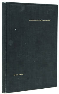
1913238650New York: Privately printed 1913. First edition #96 of 200 copies initialed and numbered on the half-title. With frontispiece 19 plates including 2 group portraits double map of Lake George around Bolton Landing at back. 65 pp. 1 vols. 8vo. Original green cloth titled in gilt on upper board. Bixby bookplate of Mohican Point house on front pastedown. Fine. First edition #96 of 200 copies initialed and numbered on the half-title. With frontispiece 19 plates including 2 group portraits double map of Lake George around Bolton Landing at back. 65 pp. 1 vols. 8vo. Inscribed on flyleaf "Mr. & Mrs. A.B. Payne names partly effaced with sincere regards of Mr. & Mrs. W.K. Bixby St. L. 5/18/14"<br/>"Includes 12 pages of text on fishing for smallmouth bass lake trout and land-locked salmon. one of the few early books to contain as much material on fishing in Lake George" Heller.<br/>An important and rare book. Plum Adirondack Bibliography 568; Bruns S27; Heller 1:716 Privately printed unknown books
1776WRCAM36226London: Printed for Robt. Sayer and John Bennett August 17 1776. Engraved map consisting of eight folio sheets backed on linen 54 1/2 x 21 3/4 inches with contemporary color outlining and shading of some boundaries and geographic features. Slightly soiled occasional minor stains a few old repairs no loss of text. In a brown cloth slipcase. A very good copy. This famous map is one of the best for the provinces of New York and New Jersey during the colonial period. It is the fourth state described by McCorkle following versions published circa 1768 in 1775 and earlier in 1776. "The map includes western Connecticut and Massachusetts and most of Vermont. In 1775 the title became 'The Provinces of New York and New Jersey; with part of Pensilvania and the Province of Quebec'.Three insets were added in this state: A chart of the mouth of the Hudson River; A plan of the City of New York; Plan of Amboy.The following year the date changed to 1776. Later in the same year the title was extended to include 'Corrected and improved from the original materials by Govern.r Pownall' and Holland's rank was given as Major" - McCorkle. The present copy is the final version described by McCorkle. <br> <br> THE PROVINCES OF NEW YORK AND NEW JERSEY is in effect a large-scale map of the Hudson River and its tributaries including the Mohawk and settlement in New York is almost entirely confined to the banks of the Hudson and Mohawk rivers. The unexplored Adirondack County is left almost entirely blank with a lengthy notation that begins "Beaver Hunting Country of the Confederated Indians." Pennsylvania extends north into western New York state almost as far as the Mohawk Vermont is shown attached to New York with each existing township identified and the map extends north into Quebec beyond Montreal. Interesting notations on the country are scattered across the face of the map. For instance in Pennsylvania an area with little detail is simply noted as "endless mountains." The map is beautifully decorated with a pastoral title cartouche suggestive of the Hudson Palisades in the lower right corner. <br> <br> The map was created by Samuel Holland Surveyor General for the Northern District of North America. As a result of the French and Indian War 1755-63 Great Britain had acquired a new American Empire for which there were few adequate maps. Two new offices of surveyor general for the American colonies were established in 1763-64. The colonies were divided at the Potomac River into a northern and southern district and the respective surveyors appointed were Samuel Holland and Gerard De Brahm. Holland conceived of a general survey of North America east of the Mississippi to be based upon geodetic principles on a scale of one inch to one mile but work was interrupted in 1775 by the outbreak of the American Revolution. <br> <br> A very good copy of Holland's large and important map which includes western New England and portions of Quebec. DEGREES OF LATITUDE fig. 21. PHILLIPS ATLASES 1166 number 17. McCORKLE 768.3 775.6 776.13. Printed for Robt. Sayer and John Bennett, August 17 hardcover books
29544 p.l. xix 164 pp. 8vo cont. mottled calf by John Brindley single gilt fillet round sides the four corners of each cover elaborately gilt with Brindley's characteristic dolphins surmounted by crowns within circular wreaths spine divided into six compartments five of which with the golden fleece device in gilt green morocco lettering piece in remaining compartment. London: J. Brindley 1728. First edition; an extraordinary "illuminated" copy with the title-page initials and section headings all heightened in gold and bound by John Brindley bookbinder to Frederick Prince of Wales and Queen Caroline. The initials along with the vignettes and typographical ornaments at the beginning and end of each chapter have also been skillfully decorated in blue red and yellow. This remarkable book with all the decorations contemporary comes from the library at Marble Hill House the Palladian villa constructed 1724-29 at Twickenham which was built by Henrietta Howard ca. 1688-1767 countess of Suffolk and mistress of George II. Pope helped design the gardens and he Gay and George Berkeley were frequent visitors. Henrietta Howard was an intimate of Queen Caroline who encouraged the countess in her sexual relationship with King George II. The present book is dedicated to Queen Caroline and clearly there is some connection because of its special illuminations and binding between the Queen and Henrietta Howard. Could this have been the Queen's copy or one specially prepared for her close and useful friend This book was printed by William Bowyer and his records show that 350 ordinary copies and 150 large-paper copies were printed. Richard Holland 1688-1730 was born in London and educated at St. Catharine's College Cambridge where he received his M.D. in 1723. He became a fellow of the College of Physicians in 1725 and was elected a fellow of the Royal Society in 1726. This is his only book which provides many case histories. A fine and special copy. With a contemporary inscription on the leaf facing the title "Removed from Marble Hill House." Later engraved bookplate of M. General Sir Charles Stewart. This copy was sold Sotheby's 20 July 1959 part of lot 749. ❧ ODNB for Holland and Howard. unknown books
177634405London: J. F. W. Des Barres 1776. Engraved with color wash and outline color. Sheet: 31 x 42 1/4 inches. Expert restoration primarily at the upper margin. Two sheets joined both watermarked "J.Bates" and countermarked "JB". Fourth state of five. Among the earliest charts published by Des Barres were those relevant to the crisis in New England as the War of Independence broke out.<br/> <br/>This chart depicts the coast of Massachusetts from Salem to Scituate Harbor and includes the complicated hydrography of Boston Harbor and the confluent rivers. A considerable amount of coastal topography is included obviously relevant to warships. Fundamentally a chart for navigators it includes soundings and shoals with particularly strong detail along the Charles and Mystic Rivers as well as in Salem and Marblehead. Samuel Holland was the lead surveyor. In 1764 he was named Surveyor General of both the Province of Quebec and the Northern District of North America. He had a considerable staff and the British Navy assisted in providing soundings. From 1770 to 1774 his squad worked exclusively on northeastern colonies that soon became part of the United States. The surveys that derived from the industry of their work were the most accurate ever made to that time. They were sent to London where Des Barres supervised the engraving and publication. The charts were very soon put to use. Des Barres of Swiss-Huguenot extraction studied under the great mathematician Daniel Bernoulli at the University of Basel before continuing on to the Royal Military College at Woolwich. Upon the outbreak of hostilities with France in 1756 he joined the British Royal American Regiment as a military engineer. He came to the attention of General James Wolfe who appointed him to join his personal detail. During this period he also worked with the future legendary explorer James Cook on a monumental chart of the St. Lawrence River. From 1762 Des Barres was enlisted to survey the coastlines of Nova Scotia Newfoundland and the Gulf of St. Lawrence while his colleague Samuel Holland charted the New England coast. He also managed to gain access to some surveys of the American South Cuba and Jamaica. In 1774 Des Barres returned to England where he began work on The Neptune. His dedication to the project was so strong that often at his own expense he continually updated and added new charts and views up until 1784. That year he returned to Canada where he remained for a further forty years becoming a senior political figure and a wealthy land owner and living to the advanced age of 103.<br/> <br/>Stevens Collection 94d ; cf. Hornsby Surveyors of Empire: Samuel Holland J.F.W. Des Barres and the Making of the Atlantic Neptune. 2011. J. F. W. Des Barres unknown books
177517671London: Published by J.F.W. Des Barres in 'The Atlantic Neptune' 1775. Copper-engraved and etched map with aquatint on two joined sheets. Printed on laid paper with `J Bates' watermark and `JB' countermark in excellent condition. Sheet size: 30 1/4 x 42 5/8 inches. With: The explanatory text leaf titled as above. 1p. folio 25 1/2 x 19 inches. The finest and most celebrated sea chart of Boston Harbor ever produced and a highly important Revolutionary War map depicting details relating to the Siege of Boston: with the very rare explanatory text leaf.<br/> <br/>This is one the most important maps contained in Des Barres' The Atlantic Neptune and one of the most significant large-scale maps of the Revolutionary War. It provides an invaluable record of Boston at the beginning of the war covering the area from the environs of the city out into the open waters of Massachusetts Bay. A particularly striking feature is the use of boldly etched and subtly aquatinted details to capture the diverse topography of the region including the numerous hills islands and river estuaries. It is important to remember that this was issued as a working sea-chart and as such the cartographer has naturally concentrated on features such as depth soundings indicated by detailed lines and based on surveys by Samuel Holland and George Callendar and the navigable channels between the harbor's numerous shoals which are delicately outlined in stipple-engraving. Holland's original manuscript map is today preserved in the British Hydrographic Library at Taunton Somerset. The present map shows the city of Boston with its streets carefully outlined occupying a pear-shaped peninsula a position that would soon prove precarious to its British defenders in the escalating conflict. This is the second state of five of Des Barres' chart and is identical to the Henry Stevens Collection variant 96D in the National Maritime Museum Greenwich. This state shows a number of notable changes when compared with the original and was evidently altered to take particular account of the Siege of Boston April 19 1775 to March 17 1776. Henry Stevens noted that this state depicted the addition of "Numerous Forts Batteries Redoubts &c. which have been inserted in many places notably on the Charles Town peninsula and on the mainland between 'Willis Creek' and 'Mystic River' also on the east and north side of 'Charles River' below 'Cambridge'.also to the south of 'Boston Neck' and 'Dorchester Neck'.This state is almost as rare as the first state. It is found in some copies of the earliest edition of the Neptune." The accuracy scope and artistic virtue of Des Barres's Chart of the Harbour of Boston was apparent to his contemporaries and it became the main source map of the area for decades to come. Joseph Frederick Wallet Des Barres was born in Switzerland where his Huguenot ancestors had fled following the repeal of the Edict of Nantes. He studied under the great mathematician Daniel Bernoulli at the University of Basel before immigrating to Britain where he trained at the Royal Military College Woolwich. Upon the outbreak of hostilities with France in 1756 he joined the British Royal American Regiment as a military engineer. He came to the attention of General James Wolfe who appointed him to join his personal detail. During this period he also worked with the legendary future explorer James Cook on a monumental chart of the St. Lawrence River. Upon the conclusion of the Seven Years War Britain's empire in North America was greatly expanded and this required the creation of a master atlas featuring new and accurate sea charts for use by the Royal Navy. Des Barres was enlisted to survey the coastlines of Nova Scotia Newfoundland and the Gulf of St. Lawrence. With these extremely accurate surveys in hand Des Barres returned to London in 1774 where the Royal Navy charged him with the Herculean task of producing the atlas. He was gradually forwarded the manuscripts of numerous advanced surveys conducted by British cartographers in the American Colonies Jamaica and Cuba of which the present map is based on the work of Samuel Holland conducted in the 1760s. The result was The Atlantic Neptune which became the most celebrated sea atlas of its era containing the first systematic survey of the east coast of North America. Des Barres's synergy of great empirical accuracy with the peerless artistic virtue of his aquatint views created a work that "has been described as the most splendid collection of charts plates and views ever published" National Maritime Museum Catalogue. The Neptune eventually consisted of four volumes and Des Barres's dedication to the project was so strong that often at his own expense he continually updated and added new charts and views to various editions up until 1784 producing over 250 charts and views many appearing in several variations. All of these charts were immensely detailed featuring both hydrographical and topographical information such that in many cases they remained the most authoritative maps of the regions covered for several decades. Following the completion of The Neptune Des Barres returned to Canada where he remained for a further forty years becoming a senior political figure and a wealthy land owner living to the advanced age of 103.<br/> <br/>Cf. GuthornBritish Maps of the American Revolution referring to Holland's original manuscript 59/3; Krieger & Cobb p.107 1781 issue; Lingel Atlantic Neptune N91.2; National Maritime Museum Henry Stevens Collection K0713 HNS 96D; National Maritime Museum Catalogue 78-83; Nebenzahl Bibliography 3; Stevens Bibliography of the Atlantic Neptune unpublished pp.211-216; Sellers & Van Ee 945. Published by J.F.W. Des Barres in 'The Atlantic Neptune' unknown books
16003113London:: Adam Islip 1600. FIRST EDITION IN ENGLISH and THE FIRST OF PHILEMON HOLLAND’S TRANSLATIONS of ANCIENT AUTHORS. Folio:. 32.7 x 21.7 cm. . 12 804 809-1351 1354-1403 43 pp. Collation: AⶠB-6Fâ¶. with blank A6 and without blank 6F6 This is a very fine copy in contemporary calfskin ruled in gold with decorative tools at the corners of the central compartment and a fine arabesque at the center of the boards gilt. Rebacked with original spine preserved small defects. A very fine copy with minor smudges or inkspots including a fingerprint on p. 655. Marginal tear on p. 623-4 no loss. A woodcut portrait of Queen Elizabeth is printed on the verso of the title page; a second portrait of Livy is printed on A4 verso. This is the first complete rendering into English of the most important Roman historian. The scholar-surgeon Philemon Holland is one of the great literary figures of the twilight years of the Elizabethan age. Like his contemporary John Florio who translated Montaigne’s “Essays†into English in 1599 Holland not only made the works that he translated accessible to English readers but also put his own stamp on those works creating something at once faithful and new. The translations provided a wealth of material for English writers; it is possible that Shakespeare himself read Holland’s “Livy†See Muir The sources of Shakespeare’s plays 1977 p. 238 “Holland's first book the first complete rendering of Livy into English was published in 1600 when he was nearly fifty. It was a work of great importance presented in a grand folio volume of 1458 pages and dedicated to the queen. The translation set out to be lucid and unpretentious and achieved its aim with marked success. It is accurate and often lively and although it does not attempt to imitate the terseness of Latin it avoids prolixity. As part of his book Holland translated two other substantial works—an ancient epitome of Roman history that provides an outline of the lost books of Livy and Bartolomeo Marliani's guide to the topography of Rome—as well as some smaller texts. These were taken from the edition of Livy published in Paris in 1573; by translating them Holland was making available in English a great learned compendium of historical knowledge not simply a single ancient author.â€ODNB Livy’s “History†"Livy's narrative began with the mythic origins of Rome that is with Aeneas' flight from Troy and came down to the death of Drusus Augustus' stepson in Germany in 9 BC. It is possible that Livy's plan interrupted by his death was to reach the death of Augustus in AD 14. "Several times both in the preface and elsewhere Livy refers to the fact that for him the narrating of Rome's glorious past is a refuge from the distress he feels when he comes to narrating more recent and contemporary events the civil war between Caesar and Pompey the subsequent war waged by Octavian soon to be the first Roman emperor Augustus against Marc Antony and Cleopatra. Although he recognizes that the crisis is epochal rather than episodic Livy refuses to focus on that alone; rather he strives to view it within the general context of Roman history. "When Livy turns his gaze to the more than seven centuries that have brought Rome a small city of Latium to mastery of the world he shows reverence almost dismay before such vast time and vast achievements. In evoking that immense journey he feels the pressure of history the weight of the influence that the images of the past exercise upon the consciousness of the present time. These images act as models of social and individual behavior positive and negative; they are invitations to virtue and warnings against wickedness. The mythology of the past in short not only has meaning for contemporary men but also gives meaning to their actions in that it can illustrate through examples their own ideological needs.â€Conte STC 16613; Pforzheimer 495; Luborsky & Ingram English illustrated books 1536-1603 16613 Adam Islip, unknown books
16013078London:: Impensis G. Bishop 1601. FIRST EDITION second issue with cancel title page. Folio:. 33 x 22 cm. Ï€6 par.4 a-b6 A8 B-3I6 3K4; A-3G6 3H4 3I-3O6 3P8 lacking blank leaves Ï€1 and 3P8 Complete in two parts; with a divisional title page to the second tome and the errata/colophon on leaf 3P7 Bound in contemporary English calfskin ruled in blind rebacked and recornered in morocco. An excellent crisp bright copy with very minor faults: repaired clean tear with no loss leaf P4. A few signatures with very light marginal dampstains. Occasional rust spots marginal tears or marginal natural paper flaws no loss whatsoever. Title pages to both volumes. The first with an elaborate architectural border with Solomonic columns. The second with a large woodcut device. An impressive book. “The ‘Natural History’ of Pliny the Elder is more than a natural history: it is an encyclopaedia of all the knowledge of the ancient world… It comprises 37 books with mathematics and physics geography and astronomy medicine and zoology anthropology and physiology philosophy and history agriculture and mineralogy the arts and letters… The ‘Historia’ soon became a standard book of reference; abstracts and abridgements appeared by the third century. Bede owned a copy Alcuin sent the early books to Charlemagne and Dicuil the Irish geographer quotes him in the ninth century. It was the basis of Isidore's Etymologiae and such medieval encyclopedias as the Speculum Majus of Vincent of Beauvais and the Catholicon of Balbus. One of the earliest books to be printed at Venice the centre from which so much of classical literature was first dispensed it was later translated into English by Philemon Holland in 1601 and twice reprinted a notable achievement for so vast a text… Over and over again it will be found that the source of some ancient piece of knowledge is Pliny.†PMM 5 “Holland's first book the first complete rendering of Livy into English was published in 1600 when he was nearly fifty. It was a work of great importance presented in a grand folio volume of 1458 pages and dedicated to the queen. … “The Livy was followed in the next year by an equally huge translation of the elder Pliny: The Historie of the World Commonly called the Naturall Historie. This encyclopaedia of ancient knowledge about the natural world had already had a great indirect influence in England as elsewhere in Europe but had not been translated into English before and would not be again for 250 years.â€ODNB Pforzheimer 496; STC 2nd ed. 20029 Impensis G. Bishop, unknown books
177933200London 1779. Engraved and aquatint map period hand colouring. 14 lettered references large inset with title as above. Rare revolutionary chart of the Hudson River showing the American defenses on the eve of the Battle of Fort Montgomery.<br/> <br/>On October 6 1777 a British force led by Lieutenant General Sir Henry Clinton attacked Forts Montgomery and Clinton from the landward side where the American defenses were only partially completed. Support from cannon fire from British ships on the Hudson River that had passed through the chevaux de frise on the lower river. By the end of the day both forts had fallen to the British who burned the forts and tore down the stonework buildings. However the battle was a pyrrhic victory for the British. The campaign against the forts caused delays in reinforcing General John Burgoyne at Saratoga where Americans forced the British surrender ten days later at the Battle of Saratoga before Clinton's forces could arrive. The present map which depicts the Forts and the River defenses prior to the battle is from The Atlantic Neptune the finest large scale sea atlas of the United States and Canadian Atlantic coastline ever produced. The maps in the atlas were produced over a seven-year period 1775-82 and are well known for their accurate portrayal of various sounds bays bars harbors as well as navigational hazards. This atlas was used extensively by the Royal Navy during the American Revolution. Des Barres studied under the great mathematician Daniel Bernoulli at the University of Basel before continuing on to the Royal Military College at Woolwich. On the outbreak of the Seven Years war in 1756 he joined the British Royal American Regiment as a military engineer. He came to the attention of General James Wolfe who appointed him to be his aide-de-camp. From 1762 Des Barres was enlisted to survey the coastlines of Nova Scotia Newfoundland and the Gulf of St.Lawrence while his colleague Samuel Holland charted the New England coast and further south. In 1774 Des Barres returned to England where he began work on the Neptune. His dedication to the project was so strong that often at his own expense he continually updated and added new charts and views up until 1784. That year he returned to Canada where he remained for a further forty years becoming a senior political figure and a wealthy land owner and living to the advanced age of 103. The Atlantic Neptune was the first British sea atlas of her North American colonies and one of the most important achievements of eighteenth century cartography. With an official commission from the Royal Navy Des Barres published the first volume in London in 1775 which was soon followed by further volumes. Des Barres' monumental endeavor eventually featured over two-hundred charts and aquatint views many being found in several states. All of the charts were immensely detailed featuring both hydrographical and topographical information. The Neptune met with the highest acclaim from the beginning and is today widely regarded as superior to all other atlases produced during its time. Henry Stevens identified only a single state of this chart issued coloured or uncoloured which appeared in some examples volume four part two of the Atlantic Nepture; the map however is not listed in the engraved list of maps for that section and given the rarity was likely not issued in all copies.<br/> <br/>National Maritime Museum: Henry Stevens Collection: HNS156; Cf. Phillips Atlases 1198; Hornsby Surveyors of Empire: Samuel Holland J.F.W. Des Barres and the Making of the Atlantic Neptune 2011. unknown books