Magris ClaudioMareMagnum

225 résultats
br. «Il viaggio è forse sempre un cammino verso quelle lontananze che splendono rosse e viola nel cielo della sera, oltre la linea del mare e dei monti, nei paesi sui quali sorge il sole che da noi tramonta.» Paesaggi, umori, incontri, riflessioni, racconti di un viaggiatore sterniano che scende con pietas e con humour lungo il vecchio fiume, dalle sorgenti al Mar Nero, ripercorrendo insieme la propria vita e le stagioni della cultura contemporanea, le sue fedi e le sue inquietudini. Un itinerario fra romanzo e saggio che racconta la cultura come esperienza esistenziale e ricostruisce a mosaico, attraverso i luoghi visitati e interrogati, le civiltà dell'Europa centrale - in tutta la complessa varietà dei suoi popoli e delle sue culture - rintracciandone il profilo nei segni della grande Storia e nelle effimere tracce della vita quotidiana. Viaggio esterno, dunque, e avventura interiore, minuziosa documentazione erudita che diventa materia di finzione e di digressione fantastica per un viandante curioso di luoghi, libri e persone che redige un piccolo Decamerone danubiano con storie e vicende, destini individuali e collettivi rimasti impigliati sulle rive del fiume e del tempo. "Il Danubio" diviene un labirintico percorso alla ricerca del senso della vita e della storia, sull'atlante della vecchia Europa e del nostro presente. Prefazione di Gian Luigi Beccaria.
Napoleone assiste al passaggio del Danubio da parte di una sua divisione di dragoni
Milano, 1920 gennaio 11, copertina illustrata a colori in fascicolo originale completo di pp. 12 de "La Domenica Illustrata"
1957GITg052Paris Presses Universitaires de France PUF 1957. In-8 broché 276pp. Orné de 2 plans et 3 cartes à pleine page. Bel exemplaire frais, bien complet du texte, des planches et des cartes.
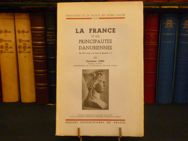
54577Presses Universitaires De France Paris 1955 In-8 ( 160 X 250 mm ) de 463 pages, broché sous couverture illustrée d'une vignette. 1 carte dépliante, sources et bibliographie, index. Collection: "Publications de la Faculté des Lettres d' Alger - XXVII". Bel exemplaire.
2001145448Herausgeber: Stadt Lauingen (Donau) 2001. 213 Seiten. Mit zahlreichen teils farbigen u. teils faks. Abbildungen. Farbig illustrierte Okart.-Einband. Querformat 22x30 cm
4727Gustav Weise Verlag, "Das Meister Werk", Berlin, s.d. In-12, broché sous couverture illustrée en couleur, 10 pp. - pl.
Very Good German Original color map on cloth. Oblong atlas folio. (46 x 52 cm). Toponyms in German. [MAP of BALKANS] J.10. Glina and around. North Bosnia and Herzegovina sheet. A sheet of the collection of 'The general map of Central Europe'. appeared in the years between 1873-1876 with the work of Joseph Ritter von Scheda, (1815-1888) who was a general, geographer and cartographer.
Very Good German Original color map on cloth. Chipped on folded places. Otherwise a clean copy. Oblong atlas folio. (46 x 52 cm). Scale: 1/300.000. Toponyms in German. Shows Saraybosna (Sarajevo), and its around, Travnik, Kladanj, G. Yakuf, Konjiva, Gorazda, Mostar et alli. A sheet of the collection of 'The general map of Central Europe'. appeared in the years between 1873-1876 with the work of Joseph Ritter von Scheda, (1815-1888) who was a general, geographer and cartographer.
Very Good German Original color map on cloth. Folded. A good copy. Oblong folio. (45 x 51 cm). In German. [MAP of BULGARIA]. Rusçuk. [Ruse]. Donau River, Plevna, Nikoli. A sheet of the collection of 'The general map of Central Europe'. appeared in the years between 1873-1876 with the work of Joseph Ritter von Scheda, (1815-1888) who was a general, geographer and cartographer.
Very Good German Original color map on cloth. Chipped on folded places. It needs repair. Oblong atlas folio. (46 x 52 cm). Toponyms in German. Shows Durach (Durazzo) and its around, Musakija at south, western shores of Albania, Elbasan, and three bays (Drin Golf etc). A sheet of the collection of 'The general map of Central Europe'. appeared in the years between 1873-1876 with the work of Joseph Ritter von Scheda, (1815-1888) who was a general, geographer and cartographer.
Very Good German Original color map on cloth. Chipped on folded places. Otherwise a clean copy. Oblong atlas folio. (46 x 52 cm). Toponyms in German. Shows Brood area and its around, Djakovo, Tuzla etc. A sheet of the collection of 'The general map of Central Europe'. appeared in the years between 1873-1876 with the work of Joseph Ritter von Scheda, (1815-1888) who was a general, geographer and cartographer.
Very Good German Original color map on cloth. Chipped on folded places. Otherwise a clean copy. Oblong atlas folio. (46 x 52 cm). Scale: 1/300.000. Toponyms in German. Shows Gallipoli [and the Hellespont, Edremid Gulf, Imbros, Tenedos, Lesbos (Midilli), Aivali (Ayvalik) and North Aegean shores of Anatolia]. A sheet of the collection of 'The general map of Central Europe'. appeared in the years between 1873-1876 with the work of Joseph Ritter von Scheda, (1815-1888) who was a general, geographer and cartographer.
Very Good German Original color map on cloth. Oblong atlas folio. (46 x 52 cm). Toponyms in German. [MAP of OTTOMAN BALKANS] L.14. Berat. Shows South Albanian shores, Corfu, Berat et alli. Lithography. (Argyrokastro). A sheet of the collection of 'The general map of Central Europe'. appeared in the years between 1873-1876 with the work of Joseph Ritter von Scheda, (1815-1888) who was a general, geographer and cartographer.
Very Good German Original color map on cloth. Chipped on folded places. Otherwise a clean copy. Oblong atlas folio. (46 x 52 cm). Toponyms in German. Shows Krusevac and its around in Serbia. A sheet of the collection of 'The general map of Central Europe'. appeared in the years between 1873-1876 with the work of Joseph Ritter von Scheda, (1815-1888) who was a general, geographer and cartographer.
Very Good German Original color map on cloth. Chipped on folded places. Oblong atlas folio. (46 x 52 cm). Toponyms in German. [MAP of WEST WALLACHIA - CRAIOVA] N.10. Kraiova. A sheet of the collection of 'The general map of Central Europe'. appeared in the years between 1873-1876 with the work of Joseph Ritter von Scheda, (1815-1888) who was a general, geographer and cartographer.
Very Good German Original color map on cloth. Chipped on folded places. It needs repair. Oblong atlas folio. (46 x 52 cm). Toponyms in German. Shows Kastoria area in Greece. A sheet of the collection of 'The general map of Central Europe'. appeared in the years between 1873-1876 with the work of Joseph Ritter von Scheda, (1815-1888) who was a general, geographer and cartographer.
Very Good German Original color map on cloth. Chipped on folded places. Oblong atlas folio. (46 x 52 cm). Toponyms in German. A sheet of the collection of 'The general map of Central Europe'. appeared in the years between 1873-1876 with the work of Joseph Ritter von Scheda, (1815-1888) who was a general, geographer and cartographer.
Very Good German Original color map on cloth. A little foxing on cloth. Very good. Folded. Folio. (57 x 43 cm). Toponyms in German. [MAP of BALKANS] 40-44 Zajecar. [Macedonia, Donau -Danube- River, Hungary and Bulgaria border, East Serbia].
1799GITf725(A Paris chez Charles An VIII 1799). In-8 IV 204pp 1 feuillet non chiffré errata. Cartonnage de papier bleu de l'époque, dos lisse, pièce de titre brun clair. Orné d'un beau portrait de Jourdan hors texte. Usure et petits manques en bordure du cartonnage et de la pièce de titre, sans les pages de faux-titre et de titre.
46 pages. Abundantly illustrated with colour and black and white archival photos. Features: Bill Maximick - Profile of a Western Artist - one of British Columbia's most respected marine artists; When Whales Were Fair Game - Between 1910 and 1943 Rose Harbour and other whaling stations whaled the Pacific; Amur, Danube & Tees - Three Pioneer West Coast Steamers that carried gold-seekers to the Klondike; Blue-Coated Mounties - The Alberta Provincial Police; Klondike Joe Boyle. Clean, bright and unmarked with very light wear. An excellent copy. Book
44037Lausanne : Société de Belles-Lettres, 2016. Directrice : Marion Graf. Un volume broché (16,5x23,5 cm), 280 pages. Textes de : Istvan Kemeny, Ana Blandiana, Vincent Yersin, Reiner Kunze, Amelia Litcheva, Angela Marinescu, Gyorgy Petri, Sibila Petlevski, Virgil Mazilescu, Grigore Chiper, Blaga Dimitrova, etc. Une géographie poétique le long du Danube. Un envoi de l'ancien propriétaire en page de garde, bon état.
Fine English Paperback. Pbo. Cr. 8vo. (20 x 14 cm). In Turkish. 176, [6] p. B/w ills. Ottoman civilization in Balkans. Balkanlardan Tuna Boylarina. Bulgaristan'da Osmanli medeniyeti.
Very Good English Paperback. Pbo. Demy 8vo. (22 x 15 cm). In Turkish. 256, [1] p., many full page b/w plates. First Edition. Tunadan batiya. Tunadan önce - Tuna yolunda - Tunadan sonra - Dönüs.
028256604X.Gpaperback. Good. Access codes and supplements are not guaranteed with used items. May be an ex-library book. paperback