133 résultats
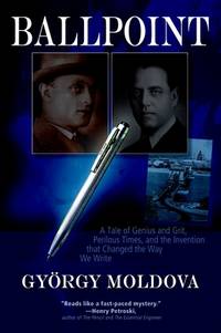
2012Q-0982578113New Europe Books 2012-08-07. Paperback. New. In shrink wrap. Looks like an interesting title! New Europe Books paperback
1901K-172Wien, Milit?rgeographisches Institut, [1901]. Formatangabe ca 50 x 37 cm, in 8 Segmenten gefaltet, Ausgabe: Einfarbig ; Zustand: diesmal etwas knapper beschnitten, sonst guter Zustand
1901K-1075Wien, Milit?rgeographisches Institut, ca. 1901. Formatangabe ca 50 x 37 cm, gefaltet zu 8 Segmenten, Ausgabe: einf?rbig ; Zustand: gut
2007S97047s.l., Editura Accent Print 2007 447pp. with numerous colour illustrations, bilingual: English-Romanian, 32cm., publisher's hardcover, illustrated dustwrapper, in the series "Research, Conservation and Restoration Centre-Collection" volume 2, very good condition, ISBN 978-973-1772-12-7, weight: 2.7kg., S97047
447pp. with numerous colour illustrations, bilingual: English-Romanian, 32cm., publisher's hardcover, illustrated dustwrapper, in the series "Research, Conservation and Restoration Centre-Collection" volume 2, very good condition, ISBN 978-973-1772-12-7, weight: 2.7kg., S97047
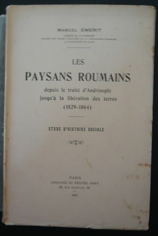
193731371937. Paris Librairie du Recueil Sirey 1937 - Broché 17 cm x 25 cm 577 pages - Texte de Marcel Emerit - Non coupé - Bon état
8vo., First Edition, with maps in the text; black cloth, gilt back, a near fine copy in price-clipped dustwrapper. EXTREMELY SCARCE, ESPECIALLY IN THIS CONDITION.
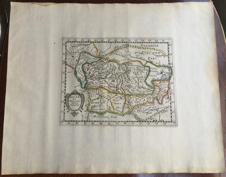
1653UUI-10048Carte géographique de format 28,5/34,5 cm (pour la planche), 15/19,5 cm (pour la carte). Issue du rare atlas de Briet : "Theatrum geographique Europae veteris", Pierre Mariette, 1653. Papier légèrement jauni, petite mouillure sur le rebord supérieur de la planche, à gauche, bon état général, bel exemplaire. Carte de la Dacie, recouvrant donc à peu près la Transylvanie, la Moldavie, la Bessarabie... Frais d'envoi 7 euros sur la France, 15,05 UE et Suisse, entre 19,60 et 26,70 euros pour le reste du monde, à spécifier selon zone. Possibilité de remise en mains propres sur Paris, n'hésitez pas à me contacter avant de passer commande. Twitter : @Pontneuf06.
182611272Wien, Kunike, 1826. Ca. 26 cm x 35 cm.
182611273Wien, Kunike, 1826. Ca. 26 cm x 35 cm.
ria9789362249036_inpHardcover. New. New Book; Fast Shipping from UK; Not signed; Not First Edition; This book ""Nutritional Biochemistry"" aims to elucidate the complex relationships between nutrition biochemical processes and health outcomes. It provides a comprehensive exploration of how nutrients affect body functions at the mole hardcover
ria9789362241993_inpHardcover. New. New Book; Fast Shipping from UK; Not signed; Not First Edition; The book "Nutrition Therapy" is a comprehensive guide structured into nine chapters each addressing different facets of nutrition and its application in therapeutic settings."Nutrition Therapy" serves as an essential resource guiding hardcover
1900K-1445Wien, Kaiserlich-K?nigliches Milit?r-Geographisches Institut, [um 1900]. Hochformat, ca. 38 x 55 cm, gefaltet zu 8 Hauptsegmenten, Ausgabe: mehrf?rbig; Zustand: Grenzmarkierungen mit blauen Buntstift, Markierungen mt rotem Buntstift, drei kleine L?cher, sonst gut
feb59343Used. For more details please contact me unknown
1900K-1459Wien, Kaiserlich-K?nigliches Milit?r-Geographisches Institut, [um 1900]. Hochformat, ca. 38 x 55 cm, gefaltet zu 8 Hauptsegmenten, Ausgabe: mehrf?rbig; Zustand: Einzeichnungen mit blauem und rotem Buntstift, Titel und Ma?stab fehlen, sonst gut
1916A141-1282Wien, Kaiserlich-K?nigliches Milit?r-Geographisches Institut, 1916. Hochformat, ca. 38 x 55 cm, gefaltet zu 8 Segmenten, Ausgabe: mehrf?rbig; Zustand: gut +
1900A141-1170Wien, Kaiserlich-K?nigliches Milit?r-Geographisches Institut, [um 1900]. Hochformat, ca. 38 x 55 cm, gefaltet zu 4 Segmenten, Ausgabe: mehrf?rbig; Zustand: gut +
1914A141-1171Wien, Kaiserlich-K?nigliches Milit?r-Geographisches Institut, um 1914. bis April 1914 berichtigtes Blatt f?r Kriegsgebrauch, Hochformat, ca. 38 x 55 cm, gefaltet zu 4 Segmenten, Ausgabe: mehrf?rbig; Zustand: gut +
1890A141-1253Wien, Kaiserlich-K?nigliches Milit?r-Geographisches Institut, 1890. Hochformat, ca. 38 x 55 cm, gefaltet zu 20 Segmenten, Ausgabe: mehrf?rbig; Zustand: Blatt mit Fehlstellen und L?chern, Kartenbild dennoch nicht sehr stark beeinflusst, sonst gut
1900K-1444Wien, Milit?rgeographisches Institut, [um 1900]. Hochformat, ca. 38 x 55 cm, gefaltet zu 8 Segmenten, Ausgabe: mehrf?rbig; Zustand: Markierungen mit rotem Buntstift, Karte bis zum Rand beschnitten, sonst gut +
1899A141-1255Wien, Kaiserlich-K?nigliches Milit?r-Geographisches Institut, 1899. Hochformat, ca. 38 x 55 cm, gefaltet zu 12 Segmenten, Ausgabe: mehrf?rbig; Zustand: gut +
1900A141-1254Wien, Kaiserlich-K?nigliches Milit?r-Geographisches Institut, [ca. 1900]. Hochformat, ca. 38 x 55 cm, gefaltet zu 4 Segmenten, Ausgabe: mehrf?rbig; Zustand: gut +
1914A111-191Wien, Kaiserlich-K?nigliches Milit?r-Geographisches Institut, 1914. Hochformat, ca. 38 x 55 cm, Ausgabe: mehrf?rbig; Zustand: gut +
1914A111-171Wien, Kaiserlich-K?nigliches Milit?r-Geographisches Institut, 1914. Hochformat, ca. 38 x 55 cm, Ausgabe: mehrf?rbig; Zustand: gut
1915A111-185Wien, Kaiserlich-K?nigliches Milit?r-Geographisches Institut, 1915. Hochformat, ca. 38 x 55 cm, Ausgabe: mehrf?rbig; Zustand: gut +