195 résultats
193943653Paris: Desclée de Brouwer & cie 1939. First edition. Paper wrappers. A very good copy tears to spine ends lightly soiled wrappers. XV 522 pp. The coat of arms of Venezuela in colors on verso of half-title. Folio. Facsimile reproduction of the periodical Correo del Orinoco in commemoration of the fiftieth anniversary of the National Academy of History including all 128 issues and which actually ran until March 23 1822. The Correo del Orinoco was an influential periodical not only in Venezuela but in all the Americas and Spain serving as a propaganda source for the revolutionary forces. Desclée, de Brouwer & cie unknown
1988mon0003012302Fundacion La Salle 1988. Hardcover. Very Good. . Cover has shelf and edge wear. Pages are tanned but clean. Fundacion La Salle hardcover
1997077496Banco Central de Venezuela 1997. Soft cover. Fine/Fine. SPANISH-LANGUAGE large hardcover and dust jacket in excellent unmarked next-to-pristine condition slightest hint of handling. The DJ is protected by a new clear removeable cover. 332 pages with color illustrations throughout. 4.4 lbs <br/> <br/> Banco Central de Venezuela paperback
1396299157.Ghardcover. Good. Access codes and supplements are not guaranteed with used items. May be an ex-library book. hardcover
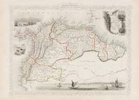
18512008AG1851. London & New York J & F. Tallis 1851. Original steel engraving / Vintage map. Drawn and engraved by John Rapkin. Partly hand-coloured. Plate Size: 32.7 cm x 24.9 cm. Sheet Size: 37.4 cm x 27.3 cm. Vintage 19th century map in very good condition. John Tallis 7 November 1817 3 June 1876 was an English cartographic publisher. His company John Tallis and Company published views maps and atlases in London from roughly 1838 to 1851. Tallis set up as a publisher with Frederick Tallis in Cripplegate in 1842; the business moved to Smithfield in 1846 and was dissolved in 1849. From 1851 to 1854 Tallis operated as John Tallis and Company. He started The illustrated news of the world and national portrait gallery of eminent personages in 1858 selling it for £1370 in 1861; it folded in 1863. Wikipedia The most important project John Tallis undertook was the 'Illustrated Atlas' from 1851. The original map we offer here was part of this exceptional Atlas and all the maps it contained are still today considered as the last reminder of an era of lavish map production. Tallis worked the project together with John Rapkin 1815-1876 and it was Rapkin's style and talent that we have to thank for when we marvel at these maps today. What makes these maps so special is the detail of engraved vignettes that surround the map and often show indigenous scenes people in their environment and even more so historical buildings or historical views of towns and cities architecture and landscape. The project of 'The Illustrated Atlas' was designed to be finished just in time for the anxiously awaited "Great Exhibition of the Works of Industry of All Nations" or The Great Exhibition sometimes referred to as the Crystal Palace Exhibition in reference to the temporary structure in which it was held was an international exhibition that took place in Hyde Park London from 1 May to 11 October 1851. It was the first in a series of World's Fairs exhibitions of culture and industry that became popular in the 19th century and it was a much anticipated event. The Great Exhibition was organized by Henry Cole and Prince Albert husband of the reigning monarch Queen Victoria. It was attended by numerous notable figures of the time including Charles Darwin Samuel Colt members of the Orléanist Royal Family and the writers Charlotte Brontë Charles Dickens Lewis Carroll George Eliot and Alfred Tennyson. Music for the opening was under the direction of Sir George Thomas Smart and the continuous music from the exhibited organs for the Queen's procession was "under the superintendence of William Sterndale Bennett". Wikipedia unknown
19621771Caracas: Guadarrama 1962. Softcover — Tapa blanda. 235x170mm. 9¼x6¾". Caracas Guadarrama 1962. 5 volúmenes. En 4º 235 x 170mm. -I: 415 pp. 8 h. -II: 441 pp. 6 h. -III: 380 pp. 8 h. -IV: 402 pp. 8 h. -V: 430 pp. 6 h. Rústica. Primera edición completa de sus cinco volúmenes. En junio de 1961 se celebró en Caracas un Congreso sobre "El Pensamiento Constitucional de Latinoamérica 1810-1830" al que concurrió especialmente invitado el profesor de Derecho Constitucional de la Facultad Dr. Héctor Gros Espiell. Guadarrama paperback
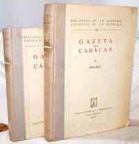
19601511040057Caracas : Academia Nacional de la Historia 1/1/1960. Hardcover. Good. 2 volume set. Biblioteca de la Academia Nacional de la Historia 21-22. 32-39 cm. "Es una coleccion mucho mas completa que la publicada por la Academia en 1939"--V. 2 p. 37. Caracas : Academia Nacional de la Historia hardcover
0365538116.Gpaperback. Good. Access codes and supplements are not guaranteed with used items. May be an ex-library book. paperback
0365538183.Ghardcover. Good. Access codes and supplements are not guaranteed with used items. May be an ex-library book. hardcover
036639536X.Ghardcover. Good. Access codes and supplements are not guaranteed with used items. May be an ex-library book. hardcover
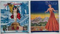
193712416Caracas; N. Y.: The National Tourist Sevice; Venezuelan Tourist Commissioner. Fine. c. 1937. Ephemera. Come to Venuzuela brochure with normal fold line down the middle throughout. ; Stapled illustrated wrappers; black & white photographs throughout both booklets; maps including folding map charts & tables in Tourists' Venezuela. Tourists Venezuela has a double page section of tables for Great Venezuelan Railroad and Pan American Airways that is dated "Caracas December 15 1937 The Board." Come to Venezuela inside rear cover "Facts in Brief" base on an 'Official Estimate' 1933. The brochure was likely produced sometime later in the decade. ; Square 8vo 8" to 9" tall; 36; 20 pages . The National Tourist Sevice; Venezuelan Tourist Commissioner unknown
196145624Caracas: Corpa Corporación Publicitaria Nacional 1961. First edition. Full pebbled cloth with leather title label on front board. Near fine small bookplate on front paste=down. 23 40 pp. 8 illustrations. 4to. Introduction. Estudio preliminar por Pedro Grases. Provenance: Ex-libris of Hans Neumann 1921-2001 holocaust survivor later one of Venezuela's greatest industrialists and the object of his daughter's 2020 work When Time Stopped. OCLC shows only seven U.S. libraries. Corpa, Corporación Publicitaria Nacional hardcover
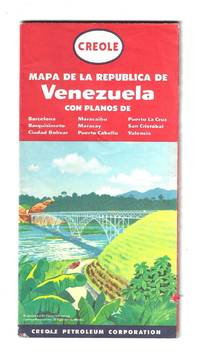
195680035General Drafting Company cartographer for the Creole Petroleum Corporation 1956. Text in Spanish. Full color one sheet map measures 65 x 108 cm folding to 22 x 11 cm. Light wear. Includes various indexes distance chart explanation of signs and index to points of interest in Caracas. Also includes highlighted zones of oil exploration.<br /> <br /> Venezuela became an oil economy after the discovery of crude oil around 1913. During the 1920s oil production was mostly done through concessions to foreign companies. The largest of those was the Creole Petroleum Corporation an American oil company and a division of Standard Oil of New Jersey. Once the second largest oil producer in the world the company was dissolved when Venezuelan nationalized its assets along with those of other foreign oil firms on January 1 1976.<br /> <br /> At the time this map was published the U.S. introduced oil import restrictions starting with voluntary controls in 1957 and escalating to President Eisenhower's Mandatory Oil Import Program MOIP in 1959 driven by concerns that cheap foreign oil threatened U.S. national security and domestic producers. From 1962 the maximum level of imports was set at 12.2% of domestic production. The import quota was lifted in 1973 by President Richard Nixon. General Drafting Company, cartographer, for the Creole Petroleum Corporation unknown
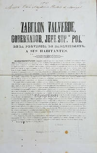
185528454Barquisimeto: Oficina de Joaquin Pérez 1855. Broadside. Broadside issued by Zabulon Valverde Governor of the Province of Barquisimeto on August 2 1855 in which he addresses his fellow citizens and explains his political agenda. It begins: "Zabulon Valverde Gobernador Jefe Sup.r Pol.co de la Provincia de Barquisimeto a sus habitantes. Barquisimetanos. Llamado desde el lugar de mi nacimiento por el voto expontáneo del Presidente del Estado á regir los destinos de esta hermosa y fértil provincia; yo me hallo ya entre vosotros. Animado como lo estoy del mejor desco de hacer el bien y felicidad de esta importante pocion de la Républica yo espero que vosotros me ayudeis con decision y noble patriotismo á conseguir tan laudables fines. " Measures 27 x 42.5 cm. There is a name or signature in ink on the top edge which reads Señora Doña Magdalena Hurtado de Monagas. Doña Magdalena 1799- was the wife of Comandante Antonio Gerardo Monagas Burgos 1798-1859. A few tiny holes two small stains numbers in pencil on the lower edge. Very good. Oficina de Joaquin Pérez unknown
194962107New York: Duell Sloan and Pearce 1949. 8vo. xii 379 1 pp Numerous photo illust. map. Blue-green publisher’s cloth gilt lettering front cover & spine w/ d.j. jungle cover art by Laura Schlageter minor shelfwear slight scuffing still NF/VG copy inscribed by the author on ffep. to Cecil A. Stanfield. Second printing inscribed of the author’s natural history excursions to Venezuela and the Andes during his five years of expeditions including 1945-1948. Beebe 1877-1962 was a noted naturalist oceanographer and executive with the New York Zoological Society. Tee-Van 1897-1967 was a noted ichthyologist and zoologist who began with the Bronx Zoo and later became director of the New York Aquarium in 1956. Duell, Sloan and Pearce, hardcover
1893000012739Paris: J. Montorier 1893. First edition. Hardcover. Near Fine. 12mo. 5 8-132 6 pp. Polished contemporary brown sheep with the spine in five compartments gilt lettering on the spine; top edge gilt. Marbled endpapers and pastedowns. Bound by Françoise Le Boulenger. Bound without the half-title. Illustrated with a frontispiece portrait of Marcano. NeglectedScience.com "Vicente Marcano". Marcano was an accomplished chemist. This biography was done by his brother a physician. Marcano researched agriculture elements and minerals in Venezuela. Minor sunning to the spine a few subtle pencil marginalia. J. Montorier hardcover
a75120Caracas 1972. Octavo 368pp. many photo portraits of prominent businessmen; extensive alphabetical listing of companies many advertisements color wraps. VG light wear. . paperback
194874534Los Angeles: The Author 1948. Original typescript. Probably one of two copies. Quarto. 21 5 bibliography leaves rectos only plus two folding maps "Map of Venezuelan Guayana" and "Mapa-Croquis Geologico de la Gran Sabana". Original full black morocco with gilt cover lettering black endpapers. Spine rubbed and with one-inch pieces missing from top and bottom. Very clean copy in a tight if a bit abraded original binding.Although we never learn who commissioned Rene Engel to conduct this survey we can admire it's professionalism. Engel gives in depth information about the geography geology and mining history of then Venezuelan Guayana. Gauyana achieved statehood in 1966. The area has a long history of gold and diamond mining with the biggest gold mines being near the Calloa lode which he considered a bit played out for methods of the time. Indeed the first map in this book actually a photograph of a map has marked on it the various diamond and gold mines and prospects marked on the map. His conclusion is as follows "After summing up the evidence in an objective way the writer of of the opinion that the project as outline above is fully justified by the probable returns which would accrue from the expansion of the Eastern Venezuelan Guayana mining region into its unknown West." Rene Engel a French national received his master of science degree at the University of Paris in 1912. He sserved with distinction in the French Army during WWI and in 1920 emigrated to the U.S. and by 1925 was enrolled as a graduate student at Stanford. Due to his connections he finished his PhD at the California Institute of Technology in 1935. He served his new hoe in WWII in the Philippines and was captured and imprisoned at the infamous Santo Tomas camp. In the late 50s he was employed at the Naval Ordnance Test Station at China Like in California's Mojave Desert. He became interest in small submersibles. He was instrumental in bringing Picard’s deep-diving vehicle Trieste to this country and in bringing Jacques Cousteau’s diving saucer to San Clemente Island and participated personally in several dives. (The Author) unknown
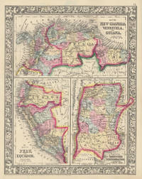
186046866New York: S. Augustus Mitchell Jr. 1860. Folio 12¼" X 15¼" image area 10½" X 13½". Hand colored. Near fine. Quite faint age toning. Bold bright and lovely map of these half dozen South American countries from the 1864 edition of "Mitchell's New General Atlas Containing Maps of the Various Countries of the World Plans of Cities Etc." Upper third contains "Map of New Granada Venezuela and Guiana" lower left third contains "Map of Peru and Equador" and lower right third contains "Map of the Argentine Confederation." Today "New Granada" consists of Colombia and Panama. Wonderfully delicately colored with fine decorative border. S. Augustus Mitchell, Jr. unknown
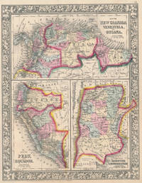
186046956New York: S. Augustus Mitchell Jr. 1860. Folio 12¼" X 15¼" image area 10½" X 13½". Hand colored. Very good. Mild age toning and bit of faint soiling. Quite nice map of these half dozen South American countries from the 1864 edition of "Mitchell's New General Atlas Containing Maps of the Various Countries of the World Plans of Cities Etc." Upper third contains "Map of New Granada Venezuela and Guiana" lower left third contains "Map of Peru and Equador" and lower right third contains "Map of the Argentine Confederation." Today "New Granada" consists of Colombia and Panama. Wonderfully delicately colored with fine decorative border. S. Augustus Mitchell, Jr. unknown