Antiquariat.de

92 résultats
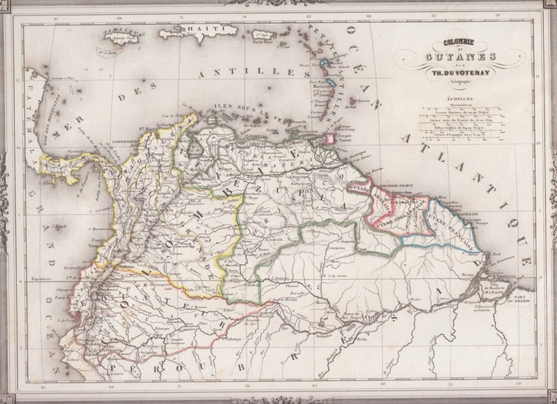
185422984Hildburghausen, Bibliogr. Institut, um 1854. Ca. 38 cm x 30 cm.
1885WRCAM31214Georgetown Dem.: R.P. Kaps 1885. Small postcard 5 1/2 x 3 1/2 inches. Standard postcard text on verso. Minor chip in lower right corner. Very good. A postcard from Demerara featuring a photograph of St. Georges Cathedral taken by R.P. Kaps. R.P. Kaps unknown books
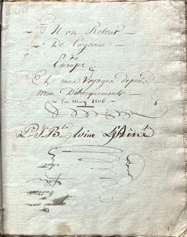
18061866, , 1806-1831. Manuscrit in-8 carré de (49) pp., texte copié à l'encre brune, sur papier bleuté et blanc, écriture cursive bien lisible jusqu'en janvier 1818 mais plus difficile à déchiffrer les dernières pp. 47-49, titre et signature inscrits à l'encre sur la première page, deux cahiers cousus, sous couverture d'attente muette, documents conservés dans un emboîtage demi-chagrin bleu moderne. Couverture salie, quelques mouillures.
188643203Paris, Librairie polytechnique Baudry et Cie, 1886. In-8 de (4)-147 pp., figures dans le texte.LAUR (P.). Du gisement et de l'exploitation de l'or en Californie. Paris, Dunod, 1863. In-8 de (4)-89 pp., 6 planches repliées hors texte.Les deux pièces reliées en 1 vol. in-8, demi-chagrin vert, dos orné à nerfs (reliure de l'époque).
1898179471898. Paris Librairie Nilsson s.d. (1898) - Broché 12 5 cm x 19 cm 252 pages photos et ills noir & blanc in et hors-texte - Texte photos et ills de Jean Hess - Dos restauré état d'usage
184139808Paris, Clarey, 1841. In-8 de (4)-III-259 pp. maroquin vert, dos orné à nerfs, triple filet doré d’encadrement sur les plats, dentelle intérieure dorée, tranches dorées sur marbrure, non rogné (Brany).
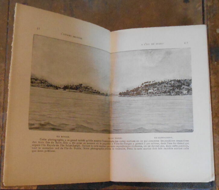
188326282Paris Librairie Octave Doin 1883 In-8 traces d'humidité - dos passé- 480 pp - Contient : une carte de l'île de Saint-Martin, Notes sur l'île de Saint Martin - la maladie de Ballingall - carte de la guyane Française en Couleurs Plan d'ensemble en Couleurs de la Colonie Française du Maroni - La colonisation de la Guyane par la transportation, etc
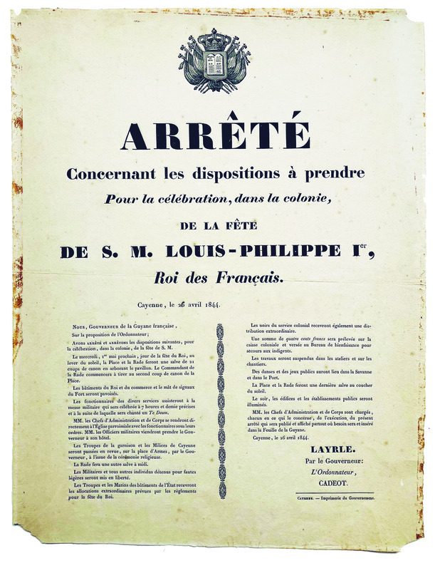
1844LBW-7759Cayenne, Imprimerie du Gouvernement, 1844. Affiche originale imprimée (40 x 30 cm).
182454352Amsterdam, Gerard Hulst van Keulen, 1824. Contemp. hcloth. Stamp on title-page. IV,25,(1) pp. A few scattered brownspots.
182454352Amsterdam Gerard Hulst van Keulen 1824. Contemp. hcloth. Stamp on title-page. IV251 pp. A few scattered brownspots. hardcover
187515604Paris, J. Rotschild, 1875 ; in-8 ; demi-basane marron, dos à nerfs, titre et auteur dorés (reliure de l'époque) ; VIII, 552 pp., 6 figures hors-texte (5 à double page et 1 dépliante).
1838185461- Famin, Cäsar (César). Columbien und Guayana. 2 Teile. in 1 Band. Aus dem Französischen übersetzt von C. A. Merbold. Stuttgart, Schweizerbart, 1838. Mit 2 mehrfach gefalteten, gestochenen Karten u. 100 (92 Brasilien; 8 Kolumbien) Stahlstichtafeln. Titel, 406 S., Zwischentitel, 40 S. Hellbrauner Halblederband der Zeit mit 2 farbigen Rückenschildern u. Marmorpapierbzügen; berieben, Rücken etwas aufgehellt u. fleckig. (Welt-Gemälde-Gallerie oder Geschichte und Beschreibung aller Länder und Völker. Abt. Amerika, Bd. 1).
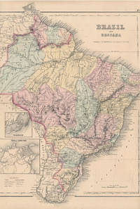
185528012New York: J.H. Colton & Co 1855. 13 3/4" X 16½" image 13¼" X 16¼". Hand colored. Near fine. Faint age toning. A beauty clean margined and striking. Small insets at lower left showing "Pernambuco" and "Rio de Janeiro." Full text "The Republic of Chili" on verso. J.H. Colton & Co unknown
190085406- Une feuille 25 x 34 cm.
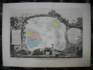
1869261511869 Pelissier, Paris, 1869. 1 carte géographique gravée ancienne de l'ILE SAINT MARTIN, DE LA GUYANE FRANÇAISE, DE L'ILE DE TERRE NEUVE, DES ILES SAINT PIERRE ET MIQUELON, COLONIES FRANÇAISES (en Amérique), imprimée sur papier fort et coloriée à l'époque, de format : 36,5 x 51,5 cm.
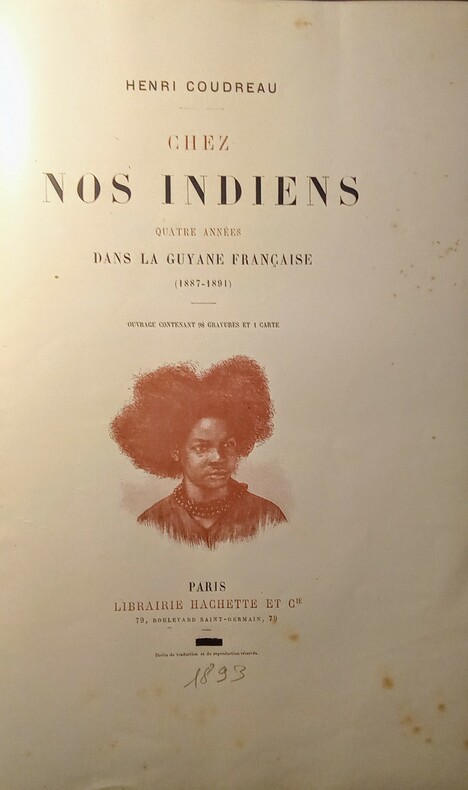
1893WOC-2285Ouvrage contenant 98 gravures in et hors texte sur bois et 1 carte grande carte dépliante en couleurs repliée(petite restauration sur la carte)la Guyane française d'après les plus récentes Explorations dessinée par J. Hansen, publiée par la Société de Géographie. Paris 1892. Paris, Librairie Hachette & Cie, 1893. In-4 (30x4,5x20cm)relié demi chagrin rouge à coins, dos à nerfs un peu passé avec 5 fleurons dorés et nom et titre dorés, tête dorée. III,614pp.
189320267Paris, Hachette et Cie, 1893. Grand in-4 de [8]-614-[2] pages, demi-chagrin rouge à coins, dos à nerfs orné de fleurons dorés, tête dorée.
1892GIT00d60Paris Librairie Hachette et Cie 1892. In-8 broché XVI 352pp. Non coupé. Petit manque angulaire sur le 1er plat.
1843262551843 Maison Basset, Paris, 1843. hand-coloured map, by George and Smith, BARBIE DU BOCAGE, , image size approximately 22,5 x 30 cm old original print / originale Druckgrafik
189772563Paris Hotel des sociétés savantes 1897 1 vol. broché in-4, broché, 58 pp. Bordures de couvertures un peu brunies. Légers accrocs en bordure de la 4e de couv. Sinon bon état.
189772563Paris Hotel des sociétés savantes 1897 1 vol. broché in-4, broché, 58 pp. Bordures de couvertures un peu brunies. Légers accrocs en bordure de la 4e de couv. Sinon bon état.
1898413022Leipzig, H. W. Theodor Dieter, 1898. 8°. Halbleinenband der Zeit ohne Einbandtitel, leicht berieben und bestoßen. 116 Seiten mit vielen Illustrationen und Fotos. Nach Seite 18 ist der Buchblock leicht gelockert. Innen sauber. Insgesamt gut erhalten. [3 Warenabbildungen]
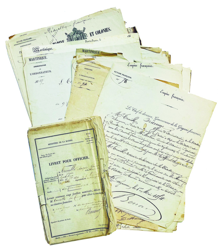
1853LBW-7989Fort-de-France, Cayenne, Saint-Louis (pour la plupart), 1853-1874. 37 pp. petit in-folio (env. 30 x 22 cm) ; en feuilles. On joint un livret de solde au nom d’Adolphe Treuille, dérelié, bords déchirés et froissés.
190018460Paris ALCAN- LEVY 1900 1 in-8 demi-basane un volume, reliure demi-basane (half binding sheepskin) marron foncé in-octavo, dos long (spine without raised band), décoré or (gilt decoration) et filets à froid (blind-stamping decoration line), titre et Auteur frappés or, entre nerfs à fleurons "or", papier marbré aux plats (cover with marbled paper), toutes tranches lisses (all smooth edges), orné de 17 illustrations photographiques in et hors texte en noir et un plan dépliant de la Guyane française in-fine, 5ff (titre et 3 portraits en noir) + iv + 244 pages, 1900 Paris Imprimerie ALCAN- LEVY Editeur,
182418496French Guiana 1824. Together 12 manuscript maps and views plus one engraved map. Provenance: Baron Pierre-Bernard Milius 1773-1829. A fine manuscript cartographic record of Baron Milius's scheme to establish a settlement near the mouth of the river Mana on the far west coast of French Guiana including survey work by Auguste Vaillant.<br/> <br/>"Milius first went to sea in 1786 on his father's merchant ships. He joined the navy in 1793 and in 1800 as 'lieutenant de vaisseau' lieutenant commander was appointed to the Australian Expedition of Nicolas Thomas Baudin. He served as Jacques Hamelin's second-in-command on the Naturaliste and at Timor in 1801 was promoted 'capitaine de frigate' commander" Howgego M44. The importance of the Baudin Expedition cannot be overstated. The 1800-1803 French expedition was the first to survey the western coast and much of the southern coast of Australia. The Expedition harbored at Sydney from the end of April to mid-November 1802. On the return Baudin died of illness and command passed to Milius who successfully brought the expedition back to France. Milius subsequently served as director of the port of Venice returning to France in 1814; "after the restoration of the monarchy in 1815 he was appointed director of the port of Brest. He subsequently served as governor of Reunion 1818-21 and Guiana 1823-25 and in 1827 commanded the Scipion at the Battle of Navarino" Howgego. Milius's service as governor of French Guiana was of particular importance. Originally settled by France in the 17th century the South American tropical region had been seized by Portugal in 1809. After its restoration to France a renewed movement began to colonize the area. Milius himself would be influential in seeking to create a penal colony at Mana and to oversee numerous surveys of the region to determine the feasibility and best places for colonization. The present archive from the collection of Baron Milius dates from his time as the colonial governor of French Guiana and includes several magnificent large-scale maps and views including a masterful manuscript plan of Cayenne as well as important manuscript maps of Mana and the Maroni River by Auguste Nicolas Vaillant 1793-1837. Together this collection represents a stunning visual record of the culmination of Milius's storied career. Original primary source manuscript material from Grand Voyage expeditions is of the utmost rarity and almost exclusively exists in French institutions. Such material that does appear on the market is seldom able to leave France. These newly-discovered drawings from a critical period of French exploration are of great historical value. The collection is comprised of: 1 Auguste Nicolas VAILLANT 1793-1837. Pen ink and wash original manuscript map titled 'Plan de la Partie du Maroni Comprise Entre Son Embouchure Et le Parallêle Situé par 5 degrees 7'.46". de latde. N. Dressé par Augte. Niclo. Vaillant Ensgne. de Vau. pendant Son Voyage dant Ce Fleuve pour le Service de la Commission Explorative de la Guyanne Française'. French Guiana: 1824. Pen and black ink with grey watercolor wash on early 19th-century laid paper 'M' in a shield watermark with 'M' countermark. Sheet size: 39 1/4 x 25 1/2 inches. An attractive record of an important early survey of the border between French Guiana and Surinam. Auguste Vaillant served as 'aide de camp' to Baron Milius and would subsequently command a voyage of circumnavigation aboard the corvette Bonite. He produced this detailed record of soundings and observations about habitation and natural features and hazards on the Rio Maroni: the importance of the work was recognised and he produced a 'memoir' describing the exploration. The Maroni which up until this survey was virtually unknown served then and now as French Guiana's border with Surinam on the west bank. The area surveyed includes a 'Grand village Parêtlaii' on the approximate site of present-day Saint-Laurent du Maroni. As the title makes clear this map was one of the results of an extensive survey carried out for the commission commanded by Baron Milius to explore French Guiana. 2 Auguste Nicolas VAILLANT 1793-1837. An original manuscript map titled 'Croquis du cours de l' Acarouani en de ses Affluence par Augte. Vaillant Ensgne. de Vau. Aide de Camp de Mr. le Bon. Milius'. French Guiana: 17 Juillet 1824. Pen and ink on laid French Grand-Aigle paper watermark: a crowned eagle. Sheet size 25 3/4 x 17 3/4 inches. A detailed chart of the course of the Acarouani River from its headwaters to its confluence with the Mana just upstream from the town from where the town of Mana is now situated. 3 H. PARENT. An original manuscript map titled 'Plan de l'ancienne et nouvelle ville de Cayenne.' French Guiana: 1821. Pencil pen-and-ink and watercolour on laid French Grand-Aigle paper watermark of a crowned eagle watermark with indistinct countermark. Sheet size: 24 1/8 x 35 1/16 inches. A beautifully-finished plan showing the proposed new layout for the capital apparently following the plans drawn up by the surveyor Sirdey the 'arpenteur royal.' This plan marks the moment when Cayenne became a modern colonial capital and is a fascinating and important document in the history of the development of Cayenne. The proposed expansion was only possible because of the amount of land that had been reclaimed by the engineering works which began in 1777. Using convict labour the draining of the marshy land around the old town and the resulting Canal Laussat shown on this plan was also finished in 1821. The Old Town "Ancienne Ville" lies at left; the New Town "Nouveau Ville" at right. It is interesting to note how much of the lay out suggested here is still in existence although very few of the streets have retained their names - the 'Rue de Choiseuil' is now the 'Avenue du général de Gaulle' for instance. 4 Captain BONNE. An original manuscript engineering drawing titled 'Plan d'un Débarcadour en charpente projeté pour le Port de Cayenne. Executé sous l'administration de Mr. le Baron Milius'. French Guiana: March 1823. Pen-and-ink and watercolour wash on laid paper watermark of an 'M' in a shield 'M' countermark. Sheet size: 26 3/8 x 40 inches. Further inscribed "Vue et Approuvé" by Baron Milius with his signature and the date '27 Mars 1823' and also signed by Bonne 'Le capn. au corps Royal du genie militaire.' Four engineering drawings on one large sheet of a proposed boat dock in Cayenne: top elevation side elevation and two details. 5 Captain BONNE. An original manuscript engineering drawing titled 'Plan d'un Débarcadour en charpente projeté pour le Port de Cayenne. French Guiana : circa 1823. Pen ink and watercolour wash on laid French Grand-Aigle paper watermark of a crowned eagle clutching thunderbolts in each foot 'Montgolfier / Annonay' countermark. Sheet size: 26 1/4 x 38 ½ inches. A more finished version of the previous drawing. 6 Captain BONNE. An original manuscript engineering drawing titled 'Projet d'un Pont de débarquement en charpente à construire vis-à -vis le Bureau du Port à Cayenne'. French Guiana 1823. Pen ink and watercolour wash on laid French Grand-Aigle paper watermark of a crowned eagle clutching thunderbolts in each foot 'Montgolfier / Annonay' countermark. Signed by Bonne. Sheet size: 25 x 19 1/8 inches. Detailed engineering plan of a bridge from a disembarking point to the mainland near the 'Bureau du Port' in Cayenne. 7 Captain BONNE. An original manuscript architectural drawing titled 'Plan de l'Hôpital militaire projeté à Cayenne'. French Guiana circa 1823. Pen ink and watercolour wash on laid paper watermark of an 'M' in a shield 'M' countermark. Sheet size: 24 3/4 x 38 5/8 inches. Signed by Bonne 'Le capn. du genie.' A fine architectural drawing of the new wing of the military hospital in Cayenne. 5 parts on one sheet as follows: Floor plan of the new and existing wings; elevation of the new and existing wings which shows the changes to the latter; two cross sections and an elevation of the existing wing before modification. 8 Captain BONNE An original manuscript architectural drawing titled 'Caserne pour 6 compagnies d'infanterie projetée a Cayenne'. French Guiana circa 1823. Pen ink and watercolour wash on 19th century wove paper. Sheet size: 20 3/8 x 26 1/4 inches. Expertly drawn architectural plan for a barracks for "six companies of infantry" at Cayenne. Consists of elevations of three facades a cross section and a plan of the main floor. 9 E. BODIN. An original drawing titled in a cartouche 'Vue du Port de la Nouvelle Angoulême'. French Guiana: July 1824. Pencil and brown wash panorama with black ink ruled border on two joined sheets of laid Dutch Royal paper 'Vande Ley' watermark with countermark of the figure of Fortune on a globe with 'VDL' monogram beneath signed 'E. Bodin del.' in black ink in lower right corner. Sheet size: 16 inches x 46 3/4 inches. A beautifully observed and executed view of this newly-established experimental colonial settlement. The village is shown from the opposite bank of the Mana River from approximately eye-level. Shown within a tropical landscape are eight buildings five of which appear to be private dwellings two public buildings and one at far left a store or warehouse. The next plan by Bodin see below includes the information that he was an 'Ingénieur Géographe de Militaire'. 10 Captaine BRACHE. An original pen ink and watercolour map titled 'Crique Portal depuis son embouchure jusqu'a 40 lieues. Exploration de Mr. le Capne. Brache en Juillet en Aout 1824. d'apres les ordres de Mr. le Baron Milius commandt. et administratr. de la Guyane Fe. pour le Roi.' French Guiana: 1824. Pen and ink map of the course of the river with large watercolour vignette of the rapids of St. Bernard within a black wash border on laid French Grand-Aigle paper watermark of a crowned eagle clutching thunderbolts in each foot with 'Montgolfier / Annonay' countermark. Sheet size 25 1/4 x 35 inches. Shows the course of the 'Crique Portal' a tributary of the Rio Maroni that runs roughly from southwest to northeast specifically designed to show in large inset a series of rapids Saul St. Bernard that obstruct navigation on the river. 11 E. BODIN & Mr. LAINÉ. An original chart titled in a cartouche 'Plan de l'embouchure de la Mana levé et dressé par ordre de Monsieur le Baron Milius commandant a la Guyane pour le Roi par les Officiers de la Goelette de sa Majesté l'Artésienne sous la direction de Mr. Lainé commandant la station de Cayenne conjointement avec Mr. Bodin ingénieur géographe militaire'. French Guiana: July 1824. Pen ink and watercolour chart with soundings marked in black and red title cartouche and explanatory index on a trompe-l'oeil 'sheet' of paper all within black ink ruled border on two joined sheets of laid paper watermark: an 'M' in a shield with an 'M' countermark. Sheet size: 24 5/8 x 46 1/8 inches. A finely-presented manuscript nautical chart of an area of the utmost importance to the settlers on the banks of the Mana in the far north west of French Guiana. Numerous soundings are given and the title cartouche is enriched by the inclusion of two 'cornucopias' overflowing with pineapples mangos paw-paw avocado banana and tropical flowers. A preparatory drawing for the following: 12 E. BODIN & Mr. LAINÉ. An original chart titled in a cartouche 'Plan de l'embouchure de la Mana levé et dressé par ordre de Monsieur le Baron Milius commandant a la Guyane pour le Roi par les Officiers de la Goelette de sa Majesté l'Artésienne sous la direction de Mr. Lainé Commandant la Station de Cayenne conjointement avec Mr. Bodin Ingénieur Géographe de Militaire'. French Guiana: July 1824. Pen ink and watercolour chart with soundings marked in black and red title cartouche and explanatory index on a trompe-l'oeil 'sheet' of paper all within black ink ruled border on two joined sheets of laid French Grand-Aigle paper signed 'E. Bodin Direxit.' in red ink in lower right corner crowned eagle with indistinct countermark. Sheet size: 24 1/8 x 44 3/4 inches. A more highly finished variant to the above with additions and corrections and signed by Bodin. 13 GRESSIER. Plan de l'Embouchure de la Rivière de Cayenne et des Mouillages Extérieurs Levé en Mars 1820 dans la Campagne de la Corvette la Bayadère et du Brick Le Favori par M. M. Gressier Ingénieur Hydrographe de la Marine . Sous les Ordres et la Direction de M. le Baron Roussin . Chef de l'Expédition. Paris: Dépòt-général de la Marine 1822. Black and white copper-engraving. Sheet size: 27 1/2 x 40 1/8 inches. A fine engraved marine chart almost contemporary with the manuscript plans and drawings above. It shows Cayenne and its vicinity in detail and includes an inset of the Iles du Salut including the infamous Devil's Island.<br/> <br/>Howgego M44 & V1. unknown books