Alpine Club of Canada 1913Biblio.com
Alpine Club of Canada (Hrsg.)Antiquariat.de
Alpine Huts & Mountain Adventures.
200735666Canmore AB Canada, ACC, 2007. zahlr. farb. Abb., o.Pag Gr.-8° (23 x 10 cm), OBr.

Alpen-Antiquariat · DE - München5,00 €
20 958 résultats
1913105283Banff Alberta: Alpine Club of Canada 1913. Softcover. fine. 1st Edition. viii137pp. 5pp. adspp. Octavo bound in original green wrappers with plates from photos etc. And 2 maps 1 folding. Minor fading on spine but pages are clean. fine Includes articles on "The Mountains of Lake Chilko' Strathcona Park the Vermillion Pass Camp of 1912 and 'Camps in the Altai' by N. Hollister. 1913 Alpine Club of Canada paperback
1912104973Banff Alberta: Alpine Club of Canada 1912. Softcover. fine. 1st Edition. vi151pp. 4pp ads;iv97pp. Two volumes Octavo in original brown wrappers with plates some folding from photos maps etc and 2 folding maps at end of each volume fine Includes account of the Club's expedition to Jasper Park Yellowhead Pass and Mount Robson Region 1911 by Arthur O. Wheeler; 'A Mountaineering Experience Near Arolla' by J. W. A. Hickson; and 'First Ascents in the Southern Selkirks' by Edward W. Harnden. 1912 Alpine Club of Canada paperback
1938104993Banff Alberta: Alpine Club of Canada 1938. Softcover. very good. 1st Edition. viii164pp. 6pp adspp. Octavo in original green wrappers with plates from photos maps etc and illustrations in text including maps. Slight wear and fading to wrapper. very good Contents include the Harry Snyder Canadian Expedition Nahanni 1937; Canadian Climbs 1937 by Kate Gardiner; Bella Coola Mountains by W. A. Don Munday; Climbs within the Arctic Circle; Following the Footsteps of the Fur Traders by Cyril G. Wates; the Forbidden Plateau Vancouver Island; and winter mountaineering and ski section. 1938 Alpine Club of Canada paperback
1924105288Banff Alberta: Alpine Club of Canada 1924. Softcover. fine. 1st Edition. vi159pp. 5pp adspp. Octavo in original greenish/grey wrappers with plates from photos and 2 folding maps. fine Contents include articles about a trip around Bow Pass the Saskatchewan River and Cathedral Crags the Columbia Icefield by William S. Ladd and J. Monroe Thorington ascents of Mt. Neptuak and the west face of Sir Donald first ascents of Mt. Barbican Mt Geike and by Lady Members Mt. Robson. Contributors also include J. N. Collie on the Canadian Rocky Mountains a Quarter Century Ago James White on Cheadle's "Journal Across the Mountains.1863 and Tom Wilson on "Memories of Golden Days". 1924 Alpine Club of Canada paperback
1934104991Banff Alberta: Alpine Club of Canada 1934. Softcover. very good. 1st Edition. viii236pp. 4pp adspp. Octavo in original green wrappers with plates one folding from photos maps etc illustartions in text and folding map. very good Contents include "High Peaks of the Coast Range" and Mt. Waddington 1934 by W. A. Munday; first ascents of Needle Peak and Molar Tower; climbs in the Rockies and Selkirks during the summer of 1933 by Kate Gardiner; the summer of 1894 around Lake Louise by Yandell Henderson; records of glacial observations in the canadian Cordillera 1933 and 1934 by A. O. Wheeler; and winter mountaineering and ski section. 1934 Alpine Club of Canada paperback
1913126436Banff Alberta: Alpine Club of Canada 1913. Hardcover. very good. 1st Edition. viii137pp. 5pp. adspp. Octavo in original green cloth with plates from photos and 2 maps 1 folding. Minor wear to cover but pages are clean in fine condition. very good Includes articles on "The Mountains of Lake Chilko' Strathcona Park the Vermillion Pass Camp of 1912 and 'Camps in the Altai' by N. Hollister. 1913 Alpine Club of Canada hardcover
200735666Canmore AB Canada, ACC, 2007. zahlr. farb. Abb., o.Pag Gr.-8° (23 x 10 cm), OBr.
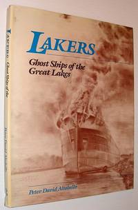
1988855c6104Canada: Eden Press 1988. Book. Illus. by Altobello Peter David. Very Good. Hardcover. First Edition. Folio - over 12" - 15" tall. 128 pages. "Bears witness to a bygone era when the ships of the Great Lakes were built according to a single premise the need to transport steel iron ore grain and cargo from port to port. Yet the exteriors of these extraordinary ships belie the interiors which were constructed with a less utilitarian purpose in mind. Fine woodwork was applied to crew cabins; dining rooms and staterooms were finished with white oak mahogany walnut and brass. This elegant beauty suggested a state of mind dedicated to exquisite craftsmanship which like the ships themselves is gone forever. Here are 64 of the author's stunning illustrations capturing the mood and atmosphere he felt lingering in each ship. The S.S. Birchglen and other ships are preserved in the rich full textures of these sketches." - from dust jacket. Book clean tight and unmarked with light wear. Average wear to price-clipped dust jacket. A sound copy. Eden Press Hardcover
1944008395Montreal / Toronto: Aluminum Company of Canada 1944. 2nd Edition 1st Printing. Hardcover. Very Good. 4to - over 9¾ - 12" tall. Alcan Technical Books - Second Edition - 1947. Blue boards with illustration on face internal spiral binding. xiii 128 pages with B&W photos / tables. Minor rubbing to boards with slight bump to top corner. Internals clean & tight <br/> <br/> Aluminum Company of Canada hardcover
1950008394Montreal / Toronto: Aluminum Company of Canada 1950. 1st Edition 1st Printing. Hardcover. Near Fine. 4to - over 9¾ - 12" tall. Alcan Technical Books - D. I . 201-37/50 Black illustrated boards with internal spiral binding.ix 66 pages with B&W photos / illustrations glossary & index. <br/> <br/> Aluminum Company of Canada hardcover
0666700753.Ghardcover. Good. Access codes and supplements are not guaranteed with used items. May be an ex-library book. hardcover
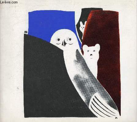
197029992Montréal / Toronto Musée des beaux arts de Montréal / Art Gallery of Ontario 1970
R320162797Ministère des Affaires Extérieures du Canada. non daté. In-8. Broché. Bon état, Couv. convenable, Dos satisfaisant, Intérieur frais. Environ 22 pages agrafées - catalogue en français et en anglais - nombreuses illustrations en noir et blanc hors texte.. . . . Classification Dewey : 708-Galeries, musées, collections d'art
Un volume broché de format in 8° de 140 pp.; couverture illustrée. Bon état. Voir photo. Peu courant.
18689A La Haye, aux dépens de la Compagnie, 1755. xvi, 246 pp. 12mo. Contemporary marbled calf, spine gilt in compartments, red label with gilt lettering, red edges. Kress 5420; Higgs 1029; cf.: INED 884; not in Goldsmiths; not in Einaudi; not in Conlon; Sabin 9602; Howes B.1049; cf.: Leclerc 241; Echeverria & Wilkie 755/5. Edition published in the same year as the first edition. Butel-Dumont argues that Great-Britain owes her power and wealth to the colonies. He analyses the commerce and trade as well as the population of the British colonies at the time of the Guerre du Canada. With the outbreak of the Seven Years War, many of whose battles were to be fought in the New World, considerable curiosity about the British colonies was excited. This was one of the books profiting from this curiosity. It emphasized the phenomenal growth and prosperity of the colonies. 'This is the first extensive French text on the British North American colonies and was occasioned by the heightened tensions preceding the Seven Years War. It gives accounts of the geography, history, religion, government, economics, trade, and products of the several colonies' (Echeverria & Wilkie). According to INED this work was also attributed to Véron de Forbonnais.
27162De l'Imprimerie de Crapelet. A Paris, Chez Maradan, An IX - 1801. Frontispiece, two plates, one folding plate, one folding map (vol. 1); four folding maps (vol. 2); four folding tables, two folding maps (vol. 3). Three volumes. xxi, [1, errata], 427, [1] pp.; xiii, [1, errata], 434 pp.; xii, 409, [1, errata] pp. 8vo. Contemporary mottled calf, spines richly gilt in compartments, green morocco labels with gilt lettering, a very attractive copy. Echeverria & Wilkie, 801/22; Fay, p. 40; Monaghan 503; Sabin 17501. The scarce first edition of this little-known work by Crèvecoeur, which was not translated into English until the 1960s. It is of course not a translation but an original work by Crèvecoeur. Crèvecoeur was of noble birth and first came to America in 1754. He served in Canada during the Seven Years' War, travelled widely throughout the Great Lakes and Ohio regions and American colonies, and finally settled on a farm near the frontier in Orange County, NY. He became an American citizen in 1764, and he served as French consul in New York from 1783 to 1790. His "letters of an American Farmer," published in English in 1782, made him an instant celebrity in Europe and the book was the first best-seller by an American author in Europe."Crèvecoeur spent nearly a quarter of a century in America, saw Washington, in 1774, come to the first Congress fresh from his farm, witnessed his extraordinary career, and, in 1797, saw him retire to the private life of an agriculturist. His experience, therefore, enables him to give much information and personal gossip not readily found elsewhere. (.....) This work is distinguished by its details on the aboriginal tribes, and their gradual disappearance. No other writer has so well described the Indian great councils, or assemblies, where they deliberate on their public interests" (Monthly Review, quoted in Sabin).The work furthermore provides information on central New York, Niagra Falls, deals with (new settlements in) Kentucky, Tennessee, Virginia, the two Carolina's and some discussion on Canada, there are observations on the flora and fauna, political history, the city of New York, the whole constituting a rich source on the 18th-century history of America.The frontispiecce is a portrait of George Washington, further portraits are of Kesketomah, an Ondondaga sachem, Koohassen, an Oneida warrior, a map entitled "Carte de la Partie Septentrionale des Etats-Unis", a map entitled "Plan de la Cataracte de Niagara et de l'Isthme qui separe les lacs Erie et Ontario", and a map entitled "Carte de la Partie Meridionale des Etats-Unis", a plate "Fortification des Anciens Indigenes" and a plate "Plan d'un Ancien Camp Retranché", two folding views of Niagara Falls, plus some tables both in- and outside text. - A very nice copy of a scarce and interesting work.
18775A Colle, et se trouve à Paris, Chez Froullé, 1788. 4 volumes. (4), xvi, 383, (1) pp.; (4), 259 pp.; (4), 292 pp.; (4), 366 pp. 8vo. Contemporary catspaw calf, gilt triple fillets on sides, spines richly gilt in compartments, a very nice copy. Sabin 47206; Leclerc 957; Howes M.456; Monaghan 1052; Muller 1612; Fay 24; Echeverria & Wilkie 788/65; Echeverria, p. 124; Einaudi 3807; not in Kress; not in Goldsmiths; not in JFBL. First edition. 'This work was conceived as a corrective reply to Raynal's Histoire Philosophique et Politique and Mably's Observations. It was suggested by William Short, Jefferson's secretary, and was written with Jefferson's assistance and approval.' Contains among others: Reflexions rédigées à l'occasion du Mémoire sur la manière dont la France & l'Espagne doivent envisager les suites de la querelle entre la Grande-Bretagne & ses Colonies (volume 3, pages 217-282), by A.R.J. Turgot, dated April 6, 1776 and published here for the first time, concerning a memoir by Vergennes written at the request of Louis XVI to assist the Conseil d'État in formulating a policy for France and Spain in regard to the American Revolution. Turgot explored the various possible outcomes with their probable consequences for France and predicted that the eventual independence of the U.S. would lead to the independence of other European colonies in America. He recommended arms sales to the U.S. but favored continued official neutrality and opposed direct military intervention' (Echeverria & Wilkie). Mazzei was an Italian physician who practised medicine in Smyrna and later, from 1755 to 1773, engaged in commerce in London. With several other Italians he came to the United States in December, 1773, to introduce the cultivation of the grape and the olive. He became a neighbor and friend of Thomas Jefferson. He actively supported the movement for independence and from 1779 to 1783 he was an agent for Virginia to obtain supplies in Italy. His Memorie della vita (Lugano, 2 volumes, 1845-1846) contains a lengthy account of his activities in Italy on behalf of Virginia (Monaghan, op.cit.) In the above work he was assisted by Condorcet who is the 'Bourgeois de New-Haven.' 'Compilation très exacte, qui réfute les théories de Mably et de Raynal et constitute un répertoire précieux de renseignements de tous ordres sur les États-Unis' (Fay). - Very good and attractive copy.
18722Paris, Chez L'Huilier, Delaunay, 1819. With engraved map. (4), xvi, 156 pp. 8vo. Modern boards, label with gilt lettering. Sabin 5568; Howes B.467; not in Streeter sale; not in Muller; not in Leclerc. The only French version. The name of the author is misspelled as Birkbecks on the title. Birckbeck purchased 6.000 acres of land on English Prairie, Illinois, in 1816, founding thereon the city of New Albion. The author did much to inspire and direct British emigrants into that area. The French translator considers the wealth of information supplied also of great interest for French people who might wish to emigrate to the United States. The work includes a wealth of information on economic and social conditions in that part of the United States. - One leaf (pp. 63/64) neatly repaired, without loss of text, and some small loss of paper in outer blank margin of half-title and title.
18779A Paris, Chez Favre, an IX (1801). (8), viii, 458, (2) pp. 8vo. Contemporary boards, spine gilt in compartments, red label with gilt lettering. Sabin 12166; Leclerc 845; Fay 40; Echeverria & Wilkie 801/4. First edition. This publication is one in a group which was typical of revived French-American fraternity in the early 19th century, dwelling on the similarities between the American and the French revolution, comparing Napoleon with Washington, and the struggle against the English. The work was therefore dedicated to Napoleon while the authors were careful to explain that American Liberty meant respect for the law, not license, and that the doctrine of the social contract and the principle of equality were not to be misinterpreted as signifying pure democracy or an unrestricted franchise (see at length: Echeverria, Mirage in the West, p. 255). Only after 1804 and the coronation of the Emperor, parallels between Washington and Napoleon were no longer politically desirable.
18765A Londres et se trouve à Paris, Chez Buisson, juin 1789. 2 works bound in 1 volume. xxiv, xlviii, 344 pp.; (4), 69, (1), (8), 151 pp. 8vo. Contemporary half calf, spine gilt in compartments, gilt lettering, green paper covered boards, a bit shaved. First work: Sabin 13516; Fay 23; JFBL B542 (under Brissot); Echeverria & Wilkie 787/3; Monaghan, 303; not in Muller; not in Leclerc; Kress B.1169; Goldsmiths 13307; Einaudi 1121; INED 809 & 1123. First edition, quite scarce. Probably printed in Paris. In January 1787 Brissot, St. Jean de Crèvecoeur, Clavière and Bergasse founded in Paris the Société Gallo-Américaine with the purpose of advancing mutual understanding and trade between France and the U.S. This survey of the actual situation in the United States deals with: De la guerre contre les sauvages. - Des troubles de l'État de Massasuchets. - etc. At the end: 'pièces justificatives'.'Économique et démographique. Principes généraux qui doivent diriger le commerce extérieur des nations, et des rapports commerciaux pouvant unir la France et les États-Unis .... (INED).Dedicated to the American Congress, this work is a systematical treatise on the mutual advantages that the new American republic and France will gain from their commercial relations. It further contains an argument in favour of the American political system where there is anarchy nor slavery.Second work: Stourm 183; Kress B.1564; Goldsmiths 13874; Einaudi 1119; INED 1126.In this work Clavière refutes the opinions of the day concerning the French finances and suggests measures to improve the situation. The first 69 pages contain 'réflexions préliminaires'.
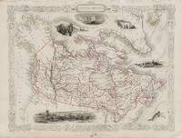
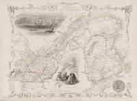
18512018AG1851. London & New York J & F. Tallis 1851. Original steel engraving / Vintage map. Drawn and engraved by John Rapkin. Partly hand-coloured. Plate Size: 33 cm x 24.6 cm. Sheet Size: 37.4 cm x 27.4 cm. Some fraying to the upper margins. Otherwise in very good condition with a small inkstain to the Montreal image. Beautifully Mounted ! John Tallis 7 November 1817 3 June 1876 was an English cartographic publisher. His company John Tallis and Company published views maps and atlases in London from roughly 1838 to 1851. Tallis set up as a publisher with Frederick Tallis in Cripplegate in 1842; the business moved to Smithfield in 1846 and was dissolved in 1849. From 1851 to 1854 Tallis operated as John Tallis and Company. He started The illustrated news of the world and national portrait gallery of eminent personages in 1858 selling it for £1370 in 1861; it folded in 1863. Wikipedia The most important project John Tallis undertook was the 'Illustrated Atlas' from 1851. The original map we offer here was part of this exceptional Atlas and all the maps it contained are still today considered as the last reminder of an era of lavish map production. Tallis worked the project together with John Rapkin 1815-1876 and it was Rapkin's style and talent that we have to thank for when we marvel at these maps today. What makes these maps so special is the detail of engraved vignettes that surround the map and often show indigenous scenes people in their environment and even more so historical buildings or historical views of towns and cities architecture and landscape. The project of 'The Illustrated Atlas' was designed to be finished just in time for the anxiously awaited "Great Exhibition of the Works of Industry of All Nations" or The Great Exhibition sometimes referred to as the Crystal Palace Exhibition in reference to the temporary structure in which it was held was an international exhibition that took place in Hyde Park London from 1 May to 11 October 1851. It was the first in a series of World's Fairs exhibitions of culture and industry that became popular in the 19th century and it was a much anticipated event. The Great Exhibition was organized by Henry Cole and Prince Albert husband of the reigning monarch Queen Victoria. It was attended by numerous notable figures of the time including Charles Darwin Samuel Colt members of the Orléanist Royal Family and the writers Charlotte Brontë Charles Dickens Lewis Carroll George Eliot and Alfred Tennyson. Music for the opening was under the direction of Sir George Thomas Smart and the continuous music from the exhibited organs for the Queen's procession was "under the superintendence of William Sterndale Bennett". Wikipedia unknown
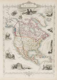
18512014AG1851. London & New York J & F. Tallis 1851. Original steel engraving / Vintage map. Drawn and engraved by John Rapkin. Partly hand-coloured. Plate Size: 33.3 cm x 25.5 cm. Sheet Size: 37.5 cm x 27.2 cm. Vintage 19th century map in very good condition. John Tallis 7 November 1817 3 June 1876 was an English cartographic publisher. His company John Tallis and Company published views maps and atlases in London from roughly 1838 to 1851. Tallis set up as a publisher with Frederick Tallis in Cripplegate in 1842; the business moved to Smithfield in 1846 and was dissolved in 1849. From 1851 to 1854 Tallis operated as John Tallis and Company. He started The illustrated news of the world and national portrait gallery of eminent personages in 1858 selling it for £1370 in 1861; it folded in 1863. Wikipedia The most important project John Tallis undertook was the 'Illustrated Atlas' from 1851. The original map we offer here was part of this exceptional Atlas and all the maps it contained are still today considered as the last reminder of an era of lavish map production. Tallis worked the project together with John Rapkin 1815-1876 and it was Rapkin's style and talent that we have to thank for when we marvel at these maps today. What makes these maps so special is the detail of engraved vignettes that surround the map and often show indigenous scenes people in their environment and even more so historical buildings or historical views of towns and cities architecture and landscape. The project of 'The Illustrated Atlas' was designed to be finished just in time for the anxiously awaited "Great Exhibition of the Works of Industry of All Nations" or The Great Exhibition sometimes referred to as the Crystal Palace Exhibition in reference to the temporary structure in which it was held was an international exhibition that took place in Hyde Park London from 1 May to 11 October 1851. It was the first in a series of World's Fairs exhibitions of culture and industry that became popular in the 19th century and it was a much anticipated event. The Great Exhibition was organized by Henry Cole and Prince Albert husband of the reigning monarch Queen Victoria. It was attended by numerous notable figures of the time including Charles Darwin Samuel Colt members of the Orléanist Royal Family and the writers Charlotte Brontë Charles Dickens Lewis Carroll George Eliot and Alfred Tennyson. Music for the opening was under the direction of Sir George Thomas Smart and the continuous music from the exhibited organs for the Queen's procession was "under the superintendence of William Sterndale Bennett". Wikipedia unknown
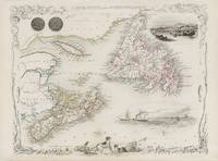
18512020AG1851. London & New York J & F. Tallis 1851. Original steel engraving / Vintage map. Drawn and engraved by John Rapkin. Partly hand-coloured. Plate Size: 24.2 cm x 35.4 cm. Sheet Size: 27.4 cm x 37.5 cm. Vintage 19th century map in very good condition. John Tallis 7 November 1817 3 June 1876 was an English cartographic publisher. His company John Tallis and Company published views maps and atlases in London from roughly 1838 to 1851. Tallis set up as a publisher with Frederick Tallis in Cripplegate in 1842; the business moved to Smithfield in 1846 and was dissolved in 1849. From 1851 to 1854 Tallis operated as John Tallis and Company. He started The illustrated news of the world and national portrait gallery of eminent personages in 1858 selling it for £1370 in 1861; it folded in 1863. Wikipedia The most important project John Tallis undertook was the 'Illustrated Atlas' from 1851. The original map we offer here was part of this exceptional Atlas and all the maps it contained are still today considered as the last reminder of an era of lavish map production. Tallis worked the project together with John Rapkin 1815-1876 and it was Rapkin's style and talent that we have to thank for when we marvel at these maps today. What makes these maps so special is the detail of engraved vignettes that surround the map and often show indigenous scenes people in their environment and even more so historical buildings or historical views of towns and cities architecture and landscape. The project of 'The Illustrated Atlas' was designed to be finished just in time for the anxiously awaited "Great Exhibition of the Works of Industry of All Nations" or The Great Exhibition sometimes referred to as the Crystal Palace Exhibition in reference to the temporary structure in which it was held was an international exhibition that took place in Hyde Park London from 1 May to 11 October 1851. It was the first in a series of World's Fairs exhibitions of culture and industry that became popular in the 19th century and it was a much anticipated event. The Great Exhibition was organized by Henry Cole and Prince Albert husband of the reigning monarch Queen Victoria. It was attended by numerous notable figures of the time including Charles Darwin Samuel Colt members of the Orléanist Royal Family and the writers Charlotte Brontë Charles Dickens Lewis Carroll George Eliot and Alfred Tennyson. Music for the opening was under the direction of Sir George Thomas Smart and the continuous music from the exhibited organs for the Queen's procession was "under the superintendence of William Sterndale Bennett". Wikipedia unknown
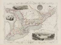
18512013AG1851. London & New York J & F. Tallis 1851. Original steel engraving / Vintage map. Drawn and engraved by John Rapkin. Partly hand-coloured. Plate Size: 25 cm x 32.5 cm. Sheet Size: 37.5 cm x 27.2 cm. Vintage 19th century map in very good condition. John Tallis 7 November 1817 3 June 1876 was an English cartographic publisher. His company John Tallis and Company published views maps and atlases in London from roughly 1838 to 1851. Tallis set up as a publisher with Frederick Tallis in Cripplegate in 1842; the business moved to Smithfield in 1846 and was dissolved in 1849. From 1851 to 1854 Tallis operated as John Tallis and Company. He started The illustrated news of the world and national portrait gallery of eminent personages in 1858 selling it for £1370 in 1861; it folded in 1863. Wikipedia The most important project John Tallis undertook was the 'Illustrated Atlas' from 1851. The original map we offer here was part of this exceptional Atlas and all the maps it contained are still today considered as the last reminder of an era of lavish map production. Tallis worked the project together with John Rapkin 1815-1876 and it was Rapkin's style and talent that we have to thank for when we marvel at these maps today. What makes these maps so special is the detail of engraved vignettes that surround the map and often show indigenous scenes people in their environment and even more so historical buildings or historical views of towns and cities architecture and landscape. The project of 'The Illustrated Atlas' was designed to be finished just in time for the anxiously awaited "Great Exhibition of the Works of Industry of All Nations" or The Great Exhibition sometimes referred to as the Crystal Palace Exhibition in reference to the temporary structure in which it was held was an international exhibition that took place in Hyde Park London from 1 May to 11 October 1851. It was the first in a series of World's Fairs exhibitions of culture and industry that became popular in the 19th century and it was a much anticipated event. The Great Exhibition was organized by Henry Cole and Prince Albert husband of the reigning monarch Queen Victoria. It was attended by numerous notable figures of the time including Charles Darwin Samuel Colt members of the Orléanist Royal Family and the writers Charlotte Brontë Charles Dickens Lewis Carroll George Eliot and Alfred Tennyson. Music for the opening was under the direction of Sir George Thomas Smart and the continuous music from the exhibited organs for the Queen's procession was "under the superintendence of William Sterndale Bennett". Wikipedia unknown
18512015AG1851. London & New York J & F. Tallis 1851. Original steel engraving / Vintage map. Drawn and engraved by John Rapkin. Partly hand-coloured. Plate Size: 32.2 cm x 25 cm. Sheet Size: 37.7 cm x 27.2 cm. Vintage 19th century map in very good condition. John Tallis 7 November 1817 3 June 1876 was an English cartographic publisher. His company John Tallis and Company published views maps and atlases in London from roughly 1838 to 1851. Tallis set up as a publisher with Frederick Tallis in Cripplegate in 1842; the business moved to Smithfield in 1846 and was dissolved in 1849. From 1851 to 1854 Tallis operated as John Tallis and Company. He started The illustrated news of the world and national portrait gallery of eminent personages in 1858 selling it for £1370 in 1861; it folded in 1863. Wikipedia The most important project John Tallis undertook was the 'Illustrated Atlas' from 1851. The original map we offer here was part of this exceptional Atlas and all the maps it contained are still today considered as the last reminder of an era of lavish map production. Tallis worked the project together with John Rapkin 1815-1876 and it was Rapkin's style and talent that we have to thank for when we marvel at these maps today. What makes these maps so special is the detail of engraved vignettes that surround the map and often show indigenous scenes people in their environment and even more so historical buildings or historical views of towns and cities architecture and landscape. The project of 'The Illustrated Atlas' was designed to be finished just in time for the anxiously awaited "Great Exhibition of the Works of Industry of All Nations" or The Great Exhibition sometimes referred to as the Crystal Palace Exhibition in reference to the temporary structure in which it was held was an international exhibition that took place in Hyde Park London from 1 May to 11 October 1851. It was the first in a series of World's Fairs exhibitions of culture and industry that became popular in the 19th century and it was a much anticipated event. The Great Exhibition was organized by Henry Cole and Prince Albert husband of the reigning monarch Queen Victoria. It was attended by numerous notable figures of the time including Charles Darwin Samuel Colt members of the Orléanist Royal Family and the writers Charlotte Brontë Charles Dickens Lewis Carroll George Eliot and Alfred Tennyson. Music for the opening was under the direction of Sir George Thomas Smart and the continuous music from the exhibited organs for the Queen's procession was "under the superintendence of William Sterndale Bennett". Wikipedia unknown