602 résultats
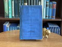
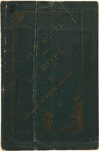
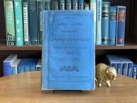
1886065220Ottawa: Canada Department des Affaires des Sauvages / Imprimerie Maclean Roger et Cie 1886. Paperback. pp. lxiv 232 235. 8vo. Original blue wrappers showing professional restoration mostly over spine small chips at edges some loss to bottom corner of last few pages a bit dogeared rubber stamp to two pages Société Historique de Montreal otherwise contents remain clean and unmarked binding sound. In French. A detailed snapshot of the Indigenous peoples at a pivotal time in history with extensive statistical tables. John A. MacDonald's introduction summarizes the events of the year notably including the 1885 uprising. Following are detailed yearly statements by Superintendents and Agents organized by area and including a census of each band; and detailed Financial Statement. Canada Department des Affaires des Sauvages / Imprimerie Maclean, Roger et Cie paperback
1883065223Ottawa: Canada Department des Affaires des Sauvages / Imprimerie Maclean Roger et Cie 1883. Paperback. pp. lxv 275 212. 8vo. Original blue wrappers showing professional restoration mostly over spine splitting at front joint small chips at edges crease to first several pages rubber stamp to two pages Société Historique de Montreal otherwise contents remain clean and unmarked binding sound. Fold-out chart present and unmarred. In French. A detailed snapshot of the Indigenous peoples at a pivotal time in history with extensive statistical tables. Then-Superintendent General of Indian Affairs John A. MacDonald's introduction summarizes the events of the year followed by a report by John J. McGee regarding the co-operation of the Canadian and US governments on related matters. Following thereafter are detailed yearly statements by Superintendents and Agents organized by area and including a census; and detailed Financial Statements. Canada Department des Affaires des Sauvages / Imprimerie Maclean, Roger et Cie paperback
1880108582Liverpool: Turner and Dunnett Printers Liverpool 1880. Softcover. good to very good. 2nd And Complete edition. 173pp. 1 leaf list of agentspp. Octavo. Folding colour "Map of Canada and part of the United States." at front. Text in double columns tables. Original printed pale blue wrappers; slightly soiled and chipped; reinforced with gray cloth tape spine. Contemporary name and date top of title page; repaginated in ink top right hand corners. Uncommon. good to very good Peel 3rd Edition # 911. 1880 Turner and Dunnett, Printers, Liverpool paperback
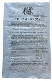
184344013Toronto 5th of June: Canada Company Office Frederick Street 1843. folio. 31cm 4 pages folded on light weir tinted blue paper in mint condition very rare. mint. Being Twenty-One numerated questions with detailed paragraph answers concerning emigration. Subjects include costs wages crops climate society etc. taxes transportation . T.P.L. 2571 "The memorandum describes the land of the district facilities for settlement and cultivations also costs". In 1843 the Canada Company led by commissioner Frederick Widder issued publications to address numerous inquiries from British North America and the United States regarding settlement in Canada West formerly Upper Canada. These documents often featuring memos from local agents provided information on land in the Huron Tract and assisted in advising prospective emigrants on farming opportunities. Key details about the Canada Company around 1843: Active Promotion: The company was actively answering questions to boost immigration to the Huron District which contained about one million acres of land. Frederick Widder was a key figure having been appointed co-commissioner in 1839 leading to improved efficiency in the company's operations. By 1843 the company was operating more effectively following the Act of Union 1841 and was in the process of paying off its debt to the British. Various documents from 1843 and 1845 were published to promote the thriving towns such as Guelph and the surrounding Wellington District. Canada Company Office, Frederick Street unknown
188147946Toronto: Hunter Rose & Co 1881. First edition. 128 pp. 1 vols. 8vo. Original brick cloth. Bookplate of Henry Cabot Lodge. Very Good. First edition. 128 pp. 1 vols. 8vo. INSCRIBED. Inscribed: "To the author of that extremely interesting work 'The English Colonies in America' / Jno Geo Bourinot / Ottawa House of Commons 21st Oct. 1881.". Hunter, Rose & Co unknown books
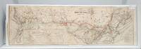
1900159192Montreal 1900. Very good. 26 x 84 cm. B&w with CPR tracks shown in red. Left edge has small tears and chips. 6 vertical folds. Inset shows worldwide routes. Table of comparative distances. <br/><br/>From 1897 until 1923 Canadian Bank Note C. was a unit of the New Yorkbased American Bank Note Company. It became a privately-held company when it was acquired by Ottawa businessman Charles Worthen. It's obviously best known for holding the contract with the Bank of Canada to supply it with Canada's banknotes. Beginning in 1976 Douglas Arends slowly acquired control of the company and it's now based in Ottawa. unknown
188135023Ottawa: Printed by MacLean Roger & Co. 1881. Original printed salmon wrappers stitched. 2 10 large folding map short closed tear 20 11 3 2 2 pp as issued. Vertical fold light edgewear. Very Good.<br/> offered with Booth C.J. President: THE CANADA ATLANTIC RAILWAY CO'Y. PROSPECTUS. Ottawa: 1889. 4 pp printed on rectos only. Caption title as issued. Pinned at upper blank corner and docketed in ink on final blank "Canada Atlantic RR Prospectus January 1889." Fine.<br/><br/> The map in excellent condition is titled "Canada Atlantic Railway Map December 1881" accomplished by "Geo. Bishop & Co. Lith. Montreal." It measures 18" x 35" with the route of the railway; extensions and other railways also notes; other boundaries in green. All the documents creating the Company set forth in the title of the pamphlet are printed each individually numbered. The Railway as the Prospectus states "extends from Ottawa in a south easterly direction a distance of 142 miles and connects with the Central Vermont Railroad at the village of Alburgh Springs Vt. U.S.A."<br/> "The Canada Atlantic Railway CAR was a small regional railway created in 1880 by lumber baron John Rodolphus Booth. Initially planned as part of the transportation network for his vast lumber holdings the railway quickly grew into a general-purpose railway serving passengers and communities along the route. Booth's first target was to gain access to Vermont in order to connect with the Central Vermont Railway CV and further exploit the US markets" "Canada Atlantic Railway" Ontario Railways accessed at Canada-Rail website May 2018.<br/> As of May 2018 we do not locate either of these documents-- or the map-- on OCLC. Printed by MacLean, Roger & Co. unknown books
188135023Ottawa: Printed by MacLean Roger & Co. 1881. Original printed salmon wrappers stitched. 2 10 large folding map short closed tear 20 11 3 2 2 pp as issued. Vertical fold light edgewear. Very Good.<br /> offered with Booth C.J. President: THE CANADA ATLANTIC RAILWAY CO'Y. PROSPECTUS. Ottawa: 1889. 4 pp printed on rectos only. Caption title as issued. Pinned at upper blank corner and docketed in ink on final blank "Canada Atlantic RR Prospectus January 1889." Fine.<br /> <br /> The map in excellent condition is titled "Canada Atlantic Railway Map December 1881" accomplished by "Geo. Bishop & Co. Lith. Montreal." It measures 18" x 35" with the route of the railway; extensions and other railways also noted; other boundaries in green. All the documents creating the Company set forth in the title of the pamphlet are printed each individually numbered. The Railway as the Prospectus states "extends from Ottawa in a south easterly direction a distance of 142 miles and connects with the Central Vermont Railroad at the village of Alburgh Springs Vt. U.S.A."<br /> "The Canada Atlantic Railway CAR was a small regional railway created in 1880 by lumber baron John Rodolphus Booth. Initially planned as part of the transportation network for his vast lumber holdings the railway quickly grew into a general-purpose railway serving passengers and communities along the route. Booth's first target was to gain access to Vermont in order to connect with the Central Vermont Railway CV and further exploit the US markets" "Canada Atlantic Railway" Ontario Railways accessed at Canada-Rail website May 2018.<br /> As of January 2026 2026 we do not locate either of these documents-- or the map-- on OCLC. Printed by MacLean, Roger & Co. unknown
188727518Ottawa. Queen's Printer. 1887 1887. Soft cover. tall8vo 24cm cccxcviii 85-564p. folding colour map in half black calf gilt decorated raised bands crimson morocco label gilt titles marbled boards oval library stamp on the titles some slight wear at the edges else very good to fine n1 Much of the Report lists the contents of the papers and correspondence of Sir Frederick Haldimand Governor of Quebec from 1778 to 1786. Also includes: correspondence relating to the capture of Fort McKay Prairie du Chien in 1814; the Journal of Mr. C.F. Hanington from Quesnelle through the Rocky Mountains during the winter of 1874-75 with map; letter from M. Tremblay to the Directors of the Seminary of Quebec 1695 French and English. Ottawa. [Queen's Printer]. 1887 unknown
1864WRCAM47423London 1864. 162pp. Folio. String-tied as issued. A bit tanned some small chips at the edges. Very good. The Thomas W. Streeter copy with his pencil notes on the titlepage. This House of Commons working paper is a continuation of their return dated July 10 1863 on the subject of constructing a telegraph line to British Columbia and the Pacific. The Hudson's Bay Company unsurprisingly was intimately involved in the machinations for the building of the line. They had made an agreement with the Canadian government to build the telegraph line from the Red River to the Pacific themselves but when they failed to do so a group of English bankers proposed to step in and do the job. The papers included herein provide much information on the qualities of the land between Lake Superior and British Columbia and the need for swift communication throughout and across the vast region. Also included is a memorial from the people of the Red River Settlement discussing their urgent need for the telegraph. <br> <br> The Streeter copy sold to Nebenzahl for $30 in 1969 and was still in his stock when the Reese Company bought the last of it in 2013; here it is. STREETER SALE 3436 this copy. SOLIDAY I:1207. LOWTHER 228. unknown books
1838101145Toronto Canada 1838. Ephemera. Good. No Binding. Toronto: Printed at the Patriot Office 1838. pp. 133-160 2 161-167 1. Collation: 34-422. It's possible that this pamphlet was part of a larger work. Sewn gatherings the thread now gone no wrapper. Wove paper small pieces missing from the top right of the preliminary leaves and the last 2 leaves. Addressed to His Excellency Sir Francis Bond Head Lieutenant Governor of Upper Canada the report was submitted by the Office of the Commissioners at Cornwall on 1 January 1838 by Jonas Jones the President of the Board. The report consists of the minutes of the Saint Lawrence Commission in 1837 with letters from engineers and contractors statement of expenditures 1834-7 and estimates of expenses for the completing the work on the Saint Lawrence Canals. Not recorded by Fleming's Upper Canadian Imprints 1801-1841. The only other copy of this imprint is located at the Thomas Fisher Rare Book Library University of Toronto. unknown
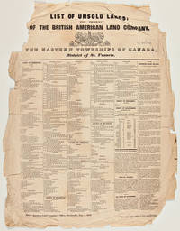
1842WRCAM39134Montreal: Printed by John C. Becket 1842. Broadside 22 1/2 x 17 3/4 inches. Printed in six columns. Small tears and creasing at all margins affecting a few words of text; significant loss at upper corners not affecting text. Good. A Canadian broadside advertising lands available in the Eastern Townships printed at the beginning of the region's transformation into a French-speaking area. In the early 1800s the Eastern Townships were an almost exclusively Anglophone region of Quebec. The American Revolution precipitated the flight of over 40000 Loyalists to Canada in the 1780s including a small handful to the largely unsettled region of Quebec between the St. Lawrence River and the U.S. border known as the Eastern Townships. The Loyalists cleared much of the rich land for farming which attracted a large number of immigrants from New England in the first decades of the 19th century. In the 1840s a rapid shift occurred in the region as French- speaking Quebecois from poorer areas began pouring in and the English speakers began emigrating to the U.S. and other parts of Canada. Francophones became a majority in the 1870s and today constitute over 85% of the population. <br> <br> The present broadside printed in English lists hundreds of lots for sale by the British American Land Company and includes over a column's worth of detailed descriptions of lands open for purchase. The following towns and areas are represented: Ascot Auckland Brompton Compton Clifton Clinton Ditton Dudswell Eaton Hereford Melbourne Newport Orford Shipton Stoke Weedon Westbury and Windsor in the County of Sherbrooke; Barford Barnston Bolton Hatley Potton and Stanstead in the County of Stanstead; Brome Ely Farnham Granby Milton Roxton Shefford and Stukeley in the County of Shefford; Acton Aston Chester Durhan Grantham Ham Kingsley Simpson Tingwock Warwick Wendover and Wickham in the County of Drummond; Sutton in the County of Missisquoi; Hemmingford in the County of Beauharnois; and improved farms in the district of St. Francis Territory Port St. Francis and the town of Sherbrooke. Not listed on OCLC and apparently unrecorded. Very rare. Printed by John C. Becket unknown books
1881WRCAM30264AMontreal: John Lovell & Son 1881. 219pp. plus large folding color map. Original printed wrappers. Minor wear to wrappers three-inch closed tear in map. Contemporary stamp of the U.S. Geological Survey Library on titlepage. Internally clean. Very good. Issued by the Nelsen Valley Railway Transportation Company this pamphlet and map advertise a new route to the middle of North America. The route marked by a heavy red line takes potential passengers through Hudson's Strait to Churchill Harbor Canada then south by train to the United States border in northern Minnesota. PEEL 448. John Lovell & Son unknown books
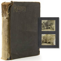
1890319445Newfoundland and Labrador 1890. 91 photographs. Most photos measure 4 x 5 inches. A few captioned in manuscript on verso. Black cloth spine perished. 91 photographs. Most photos measure 4 x 5 inches. A few captioned in manuscript on verso. The images include several aboard ship and arriving at the dock as well as images along the river and campsite including scenic views as well as images of the unidentified travellers. Other Humber River images depict villages salmon fishing with women participating including one holding a rifle. A number of photos depict indigenous peoples possibly Inuit Innu Mi'kng or So. Innit of Nu nath Kavut. The travellers must have taken another passage north with images of Labrador cliffs and even an iceberg. unknown books
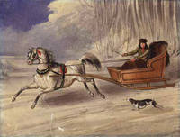
1840WRCAM19322N.p. 1840. Watercolor on stiff paper. 27.2 x 20.8 cm. With a rather unobtrusive 7 cm. tear through the lower left quadrant. Contemporary manuscript title on verso "An American Cutter." Overall a fine image. A handsome unsigned watercolor depicting a single-horse sleigh pulling a clever-looking American trapper with hunting dog barely keeping up. A lively image probably a Canadian scene very displayable. unknown books
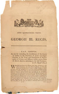
1803WRCAM31186London: Printed by George Eyre and Andrew Strahan 1803. 3pp. Two folio leaves. Split at fold chipped around edges dampstain on lower edge tape- repair on center fold. Good only. This act of Parliament addresses the issue of crimes committed in the British-controlled Pacific Northwest and specifically in Indian Territories. It provides that those who commit offenses in Indian Territories should be tried in the same manner as if the crimes occurred in the provinces of Lower or Upper Canada. The act also allows the governor of Lower Canada to empower Justices for the Indian Territories. Printed by George Eyre and Andrew Strahan unknown books
1864WRCAM51979London: Religious Tract Society 1864. viii370pp. plus two maps one folding and six pages of advertisements. Original green publisher's cloth stamped in blind and gilt. Front hinge cracked boards slightly rubbed. Binder's ticket on rear pastedown. Light tanning and dustsoiling at text block edges. Very good plus. A scarce mid-19th century description and guide to Canada with several chapters on the colonial history of the country its commercial attractions and its native inhabitants. TPL 9165. LOWTHER 225. SABIN 8114. Religious Tract Society hardcover books
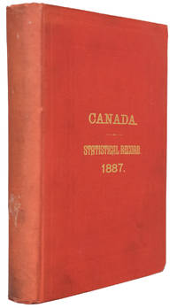
188827266Ottawa. Department of Agriculture. 1888 1888. Hardcover. 8vo 20.5cm 517p. folding statistical chart tables appendix index original red cloth gilt titles on front a fine copy cnds. - The third issue with a new chapter on Mineral Statistics. The book also includes the full text of the Fishery Treaty signed in Washington in 1887. An appendix consists of an extensive list of goods subject to duties. Ottawa. Department of Agriculture. 1888 hardcover
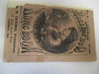
188021147Irving Publisher 35 King Street West 1880. 1 title page 1 blank vii-99 1 blank pp. Original printed wrappers light chipping minor foxing faded numerical stamp on front wrap disbound loosened. A few minor spots of foxing else clean. Good. OCLC notes publishing date as 1880 and shows pages as beginning at vii as does this copy. OCLC 20727258 1 Brown University. unknown
188021147Irving Publisher 35 King Street West 1880. 1 title page 1 blank vii-99 1 blank pp. Original printed wrappers light chipping minor foxing faded numerical stamp on front wrap disbound loosened. A few minor spots of foxing else clean. Good. OCLC notes publishing date as 1880 and shows pages as beginning at vii as does this copy. OCLC 20727258 1 Brown University. unknown books
1900598851900. CANADA. CANADIAN YEAR BOOK FOR 1900. All About Canada. Toronto: Alfred Hewett 1900. 8vo. paper wrappers. Some edgewear and soil to wraps; three leaves lightly chipped. Very good wraps a little fragile. unknown books
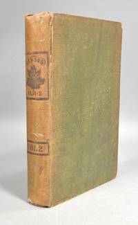
1855649201855. CANADA. CENSUS OF THE CANADAS. 1851-2. Agricultural Produce Mills Manufactories Houses Schools Public Buildings Places of Worship &c. Vol. II only. Quebec: Printed by Lovell and Lamoureux at their steam-printing establishment Mountain Street. 1855. Volume two only. First edition of the second volume of the first national Canadian census. 8vo.: iv474 pp. 1 errata. Original green cloth title and maple leaf printed to spine within a single-rule. Ex library; without any external marks and having only a bookplate and two discreet embossed stamps within. Text leaves are clean; although a few leaves near the end have shallow creasing at the fore-edge. Cloth is sunned particularly at spine showing moderate soiling and staining overall with wear at corners and to a couple of spots on spine. The upper joint is starting and there is a horizontal closed tear at spine. A good working copy. unknown books
1881B7060Toronto: Dudley & Burns. 1881. A very good example. Interior clean and crisp. Extremities lightly rubbed. Lower hinge split. Binding: Full blind-stamped brown cloth boards diced. Spine lettered in gilt. Yellow pasted and free endpapers. Notes: Small 8vo. 190 x 130 mm. Size: Small 8vo. Pages: 128 pp. Category: Book Canada; Dudley & Burns. hardcover
1863B337Ottawa: Authority of Parliament. c.1863-1904. Binding: some contemporary yellow cloth over board and some contemporary light green paper wrappers title in black ink on flat spine. Notes: Vol vi 1892-1893 Vol vii 1894 Vol viii 1895 Vol ix 1896 Vol x 1897 Vol xi 1898 Vol xii 1899 Vol xiv 1901 Vol xv 1902-1903 Vol xvi 1904 index 1863-1884 index 1885-1906. Some volumes have the map set of their own for example: map set to accompany vol vii 1894 map set to accompany vol xii 1899 map set to accompany vol xiv 1901 map set to accompany vol xv 1902-03 map set to accompany vol xvi 1904 map set of 1895 to accompany report on the Cascade Cola Basin Alberta map set of British Columbia Cariboo Mining district 1895. Also many individual volumes are illustrated with many maps within. Size: Large 8vo. Illustration: Illustrated with many maps. Volume: 12 volumes plus 9 map ca Category: Book Atlas & Cartography Authority of Parliament. hardcover
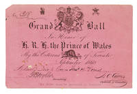
1860263494Toronto 1860. Invitation printed on a pink card addressed in manuscript to Mr. & Mrs. Thomas H. Pond and signed by the Secretary of the Committee. 4 x 6 inches. Remnants of prior mounting on verso. Invitation printed on a pink card addressed in manuscript to Mr. & Mrs. Thomas H. Pond and signed by the Secretary of the Committee. 4 x 6 inches. A scarce piece of ephemera relating to the Prince of Wales's 1860 visit to Canada to mark the opening of the Victoria Bridge. unknown books