428 résultats
187551587Montreal Toronto & London: George N. Tackabury Printed by the Burland-Desbarats Lithographic Co. 1875. Folio. 14.25 x 17.75 in. 251 1 pp. Colour lithograph illustrated title page showing the Parliament Building in Ottawa Canada from photograph by W. Notman 53 colour lithograph maps many double-page many tables. Publisher’s plum-coloured embossed cloth gilt decorative lettering on front cover marbled endpapers nicely rebacked in simulated black calf corners renewed some wear & rubbing to corners 1 leaf w/ repairs to creases minor tidemark to upper right corner not affecting maps still G copy. First edition of this fine atlas of Victorian-era Canada including maps of climatology possessions provinces prior to Alberta Saskatchewan & Newfoundland becoming provinces plat maps of counties Railways as well as maps of the United States and Europe. Of particular interest are the city maps of Quebec Ottawa London Hamilton Kingston Toronto and Montreal. This excellent reference work also provides a comprehensive list of railways in Canada steamships in use lists post offices railway stations cities and populations as well as business cards located by city and town. George N. Tackabury, [Printed by the Burland-Desbarats Lithographic Co.], hardcover
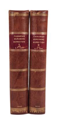
186022667London: Longman Greene Longman and Roberts 1860. First Edition. Two volumes pp. xx 494 publisher's ads; xvi 472 with seven maps two folding and one folding profile -- all with hand coloring; 20 chromoxylographic plates; and many additional illustrations in the text. Later full leather with red spine labels marbled endpapers. Scuffing to extremities old restorations to half-title and title pages one map with some foxing and splits at folds some penciled annotations in the margins. Bindings sound plates clean and bright. Hind's exploration of the country between Lake Superior and the Rocky Mountains was prompted by the need for a land access to the gold fields of British Columbia as well as the possible establishment of a railway route to the Pacific Coast. His narrative provides a wealth of information about customs beliefs and condition of the native peoples. Sabin 31934 notes that he "lived almost constantly among the Crees and Chippeways whose habits and peculiarities he was most eager to study and prompt to record." Graff 1892; Streeter Sale 3730; TPL 3820; Wagner-Camp 360. Longman, Greene, Longman and Roberts unknown
1809elala1145York: 1809. 1809. folio broadside 32.5 x 19.6 cm. Fleming 53. [York: 1809]. unknown
1838elala1149Toronto: R.Stanton 1838. 1838. 8vo. pp. 91 60. old half chagrin spine & extremities worn retaining original printed wrs. wrs. soiled. imprint date found on fr. wr. The report dated Feb. 13 1838 is largely concerned with the Rebellion: "It cannot but be felt that this traitorous insurrection of a portion of the inhabitants of Upper Canada is an event much to be regretted It has entailed upon the public a very formidable expense the sufferings occasioned by an enterprise of so criminal and desperate a nature to the guilty actors can hardly fail to excite compassion." p. 9 Appended are numerous related documents including proclamations and handbills from William Lyon Mackenzie and from R.J.Sutherland of the Patriot Army the Militia General Order of Dec. 4 1837 official acts resolutions despatches and petitions communications from the American government regarding the capture of the steam-boat Caroline &c. Fleming 1271. TPL 2231. Casey I 1656. Gagnon I 2994. Lande 869. [Toronto]: R.Stanton, 1838. unknown
188135023Ottawa: Printed by MacLean Roger & Co. 1881. Original printed salmon wrappers stitched. 2 10 large folding map short closed tear 20 11 3 2 2 pp as issued. Vertical fold light edgewear. Very Good.<br /> offered with Booth C.J. President: THE CANADA ATLANTIC RAILWAY CO'Y. PROSPECTUS. Ottawa: 1889. 4 pp printed on rectos only. Caption title as issued. Pinned at upper blank corner and docketed in ink on final blank "Canada Atlantic RR Prospectus January 1889." Fine.<br /> <br /> The map in excellent condition is titled "Canada Atlantic Railway Map December 1881" accomplished by "Geo. Bishop & Co. Lith. Montreal." It measures 18" x 35" with the route of the railway; extensions and other railways also noted; other boundaries in green. All the documents creating the Company set forth in the title of the pamphlet are printed each individually numbered. The Railway as the Prospectus states "extends from Ottawa in a south easterly direction a distance of 142 miles and connects with the Central Vermont Railroad at the village of Alburgh Springs Vt. U.S.A."<br /> "The Canada Atlantic Railway CAR was a small regional railway created in 1880 by lumber baron John Rodolphus Booth. Initially planned as part of the transportation network for his vast lumber holdings the railway quickly grew into a general-purpose railway serving passengers and communities along the route. Booth's first target was to gain access to Vermont in order to connect with the Central Vermont Railway CV and further exploit the US markets" "Canada Atlantic Railway" Ontario Railways accessed at Canada-Rail website May 2018.<br /> As of January 2026 2026 we do not locate either of these documents-- or the map-- on OCLC. Printed by MacLean, Roger & Co. unknown
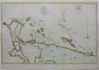
1864M5918Toronto c. 1864. Very Good. Notes: General survey of the North part of Lake Huron including Thunder Bay. Size : 380x592 mm 15x23.25 Inches Coloring: Hand Colored Category: Maps Canada Ontario North; unknown
1831elala1146York: James Baxter Printer 1831. 1831. 8vo. pp. 5. text in double columns. modern cloth-backed bds. foxing to title. Rare. Concerning the establishment of a school fund from the sale of Crown lands set aside for the purpose. The committee was chaired by William Morris 1786-1858 who by the late 1820s "had become a recognized authority on the distressing state of schooling in Upper Canada. " DCB VIII p. 640 Fleming 583 Public Archives copy only. Casey I 1334. Not in TPL. Hardcover. York: James Baxter, Printer, 1831. Hardcover
1839elala1150Toronto: Printed At The Patriot Office 1839. 1839. 8vo. pp. 87. old half sheep binding worn spine damaged foxing to outer leaves margins closely trimmed. The first half of the report dated April 30 1839 is concerned with the American involvement in the Rebellion: the raids conducted by sympathizers in the northern states including extensive discussion of the seizure and burning of the steamer Sir Robert Peel. The second half constitutes a commentary on Lord Durhams report. The last four pages contain the draft of an address to the Queen requesting continued support and protection. Fleming 1373. TPL 2334. Casey I 1727. Lande S2250. Toronto: Printed At The Patriot Office, 1839. unknown
18860101767Ottawa: l'Imrimeur de la Reine 1886. Hardcover. pp. 213. Royal 8vo. 20th century rebind: leather spine lettered in gilt over marbled boards with original front cover bound-in. Pages brittle with some chipping to edges and pulling at staples; contents unmarked new binding sound. Peel 1532. l'Imrimeur de la Reine hardcover
184311018BBParis, Didot Freres, 1843; 1849; 1837; ohne Jahr / sans date. 525 (3) S.; 384, 32 S.; 160, 164, 158, 108 S.; 213 Stahlstichtafeln und 6 gefaltete Karten (in 1 Band). Grüne Halblederbände der Zeit mit Rückentitelvergoldung., univers amerique 4 Bände
183222939Montreal. A la Librairie de E.R. Fabre & Cie. Juin 1832 1832. Hardcover. 24mo 13cm 16p. in the original plain boards fine n12 A book of prayers in response to a cholera epidemic outbreak in Lower Canada in 1832 which was brought by immigrants from Britain. At the time it was not understood how the disease spread nor how to treat it. Six thousand people were believed to have died. Montreal. A la Librairie de E.R. Fabre, & Cie. Juin 1832 hardcover
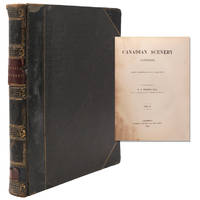
1842248173London: Goerge Vertue 1842. First edition. Engraved vignette title-page to each volume portrait frontispiece to first engraved map and 116 engraved plates after drawings by Bartlett. 128; 166 pp. 2 vols. 4to. Full contemporary black calf gilt spine plain endpapers. A little rubbing at extremities labels chipped both vignette titles and title pages quite severely stained and inner margins of most plates in Vol. One. Bartlett W.H. First edition. Engraved vignette title-page to each volume portrait frontispiece to first engraved map and 116 engraved plates after drawings by Bartlett. 128; 166 pp. 2 vols. 4to. Sabin 3786; Lande 2310; Alston 7673; TPL 2424Mill/15/2 Goerge Vertue unknown
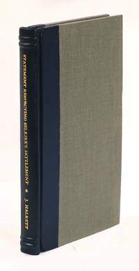
181722895London: J. Brettell 1817. First Edition. True first edition issued prior to the John Murray trade edition and distributed only to Selkirk’s and Halkett’s close associates and certain highly-placed officials in the British Foreign Office. 8vo pp. 125 lxxxix with folding map by A. Arrowsmith titled "Sketch of a Part of the Hudson's Bay Company Territory" in a modern quarter-leather binding. Map has some offsetting and an old repair on the verso; binding sound text very clean. The Red River Settlement was an agricultural colony located in present-day Manitoba North Dakota and Minnesota established in 1811 by Thomas Douglas Fifth Earl of Selkirk on about 120000 square miles of land granted to him by the Hudson's Bay Company. Selkirk had become interested in settling the area after reading Alexander Mackenzie's 1801 book on his travels in the region. Poverty was on the rise in Scotland and Selkirk believed he could give settlers a chance at a better life in the new colony he called "Assiniboia." His chief opponents in this plan were the partisans of the Northwest Company who had long traded without interference in the territories now claimed by Selkirk and the Hudson's Bay Company. Although the colony was not very successful agriculturally the lure of free land added new settlers every year and scarce resources and disputes over land rights led to conflict with trappers and traders from the North West Company. This work written by Lord Selkirk’s brother-in-law defends Selkirk’s actions in response to aggressions instigated by the North West Company that ultimately culminated in the 1816 “Massacre at Seven Oaks†and the death of the colony’s governor Robert Semple. The Appendix contains legal documents in support of Selkirk’s case. Streeter 3672 opines that "The tone of the Statement is arrogant and was certainly poor 'public relations' as far as the Canadian public was concerned." TPL 1092; Sabin 20703. [J. Brettell] unknown
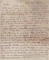
1847List2609Quebec City and Brockton Canada 1847. Four letters approximately sixteen total pages: four 8 x 12.5 inches twelve 8 x 10 inches and smaller. Two letters dated 1846 one 1847 missing final pages and one without date missing initial and final pages. Very good. Edmund John Senkler 1802–1872 was born in Norfolk England educated at Cambridge and in 1827 ordained as an Anglican minister. Senkler his wife Eleanor and their children immigrated to Canada in 1843 to live in Quebec City Canada East now the province of Quebec. They then moved to Sorel also known as William Henry and finally to Brockville near Kingston Canada West now Ontario.<br /> <br /> Offered here is a set of four letters from Senkler to his friend G. W. Chad back in Norfolk describing the activities of Senkler and his family as they settle into life in Canada. The Senklers had first moved to Quebec City but did not enjoy their time “in that pestiferous cloaca . over which the destroying angel seems evermore to hover with his drawn sword in his hand†May 8 1846. On planning to leave the Bishop of Montreal offers Senkler an unpaid position in “Coteau du Lac a lonely place 40 or 50 miles above Montreal†whose previous missionary had “been enjoying for many years a handsome salary†and was now “on his return to England.†Senkler turns down this meager offer and takes his family to Sorel.<br /> <br /> The move is providential as “Not fewer than 27 persons with whom we had some acquaintance have died there Quebec City since we left†September 10 1846. The family’s acquaintances apparently died in a theater fire in Quebec City—probably the St. Louise Theater—which seemed to have turned into a crowd crush:<br /> <br /> “I knew some of the sufferers: some were very pious people . What shocked the feelings of all who witnessed the scene with some of whom I have conversed was that the misery was so easily approachable and yet so utterly beyond relief. . In the case of poor Mr. Scott mentioned in all the papers particularly the Illustrated London News of July 18 where there is a view of the place his brother could not only see him but talk with him – caress him petting his face weeping over him while the poor suffering man commended his wife family to his care; and yet no force could drag out his limbs from the entangled mass of human beings. They did pull at him until they pulled the ball of his shoulder out of the socket and he begged to be allowed to die.â€<br /> <br /> By 1847 the family had sold their property in Sorel and moved west to Brockville in what is now Ontario. The family are noticing the effects of England’s Panic of 1847:<br /> <br /> “The great scarcity of money now felt in England will very shortly be felt here. The produce sent from hence home has not been paid for. Consequently our merchants must pay for the manufactures c. sent out by bills of exchange which must be in so much greater demand therefore fetch a higher premium.†December 8 1847<br /> <br /> And around the same time an epidemic of typhus breaks out in Canada from Irish immigrants fleeing the famine:<br /> <br /> “Probably you have learned from the papers what misery the unfortunate Irish emigrants have brought and are likely yet to bring to this country. They have spread a pestilence through the city of Montreal. Grosse Isle the quarantine station below Quebec has been crowded with fever patients to an alarming extent. . The emigrants as they recover are forwarded by the steam-boats from Grosse Isle to Montreal without touching at Quebec where they are received in miserable wooden sheds. Many suffer a relapse; others first shew symptoms of fever when there; and spread the infection though the town by begging. You can imagine what hotbeds of infection those steam-boats must be. Last week 3 passed Sorel without touching at the port one had 1000 emigrants on board the other two about 800 500 respectively. . These unhappy people are forwarded to their destination in the Western Country. For many of them doubtless that destination will be an untimely grave in a strange place.†No Date.<br /> <br /> Nonetheless the Senkler family happily settles in the town of Brockville with “an orchard garden with plenty of pasture for a couple of cows and horses with ground for growing all the vegetables required for the family†December 8 1847. The land is rapidly developing with land prices increasing and a telegraph line from Toronto to Quebec running through it – which to Senkler is “surprising in a country in which 60 years ago there was only an Indian’s hunting track for hundreds of miles.â€<br /> <br /> Overall the letters provide an intimate look at life for settlers in Canada in the middle period of its rule by the British. unknown
1851195036Edinburgh: Adam and Charles Black 1851. Second. Hardcover. Good/No Dustjacket. 8vo. original cloth laid onto new boards Second and best edition. Corrected Throughout and Greatly Enlarged. 8vo. orig. green blindstamped cloth spine lettered in gilt xxxii 468pp. With a large folding map at the front Adam and Charles Black hardcover
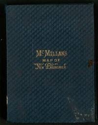
18781125564St. John New Brunswick: J. & A. McMillan 1878. Map. Very Good. No Binding. First Edition. 35 3/4 x 39 3/4" 90.7 x 101 cm. A large colored detailed map of New Brunswick showing parts of Maine Nova Scotia and Prince Edward Island. Fredericton and the City of St. John are shown in insets. The map was originally issued in 1867 by Charles Gregory. Corrected by Henry F. Perley 1831-1897. Civil Engineer. No printer or publisher's attribution. Mounted on linen; 87 x 97 cm. Scale ca. 1:506880 Encased in original cloth boards with gilt title "McMillans Map of New Brunswick." case is dull corners worn wear along spine when folded in case fore edges are spotted map is very good bright no separation at folds. J. & A. McMillan, hardcover
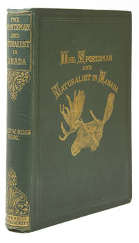
1866256569London: Hurst and Blackett Publishers 13 Great Marlborough Streeet 1866. First edition with tipped in errata slip. 6 chromolithographs and numerous text illustrations. xv 3 334 pp. Savill and Edwards Printer Chandos St. 1 vols. 8vo 26.5 x 18 cm. Original green cloth with gilt moose on upper cover. Fine. Signed "J.C. Cutting 1869. First edition with tipped in errata slip. 6 chromolithographs and numerous text illustrations. xv 3 334 pp. Savill and Edwards Printer Chandos St. 1 vols. 8vo 26.5 x 18 cm. A detailed and useful guide to Canadian sport. Four of the 12 chapters are devoted to fishing: "The Fisheries of Canada" concerning salmon rivers lakes and lesser waters; "The Salmon" its location size etc. includes data on trout and white fish; "The Canadian Shad" habitat etc. including other fish; and "The Tom Cod" annual arrival etc. including discussion of bass sturgeon and others. Rare in this condition. Bruns K-49; Gee p. 61; Lande 1886; Sabin 37857; TPL 6220 Hurst and Blackett, Publishers, 13, Great Marlborough Streeet unknown